

Mile Hill
Good walks are even better shared.
Overview
Mile Hill - An Overview
Mile Hill, standing at 285 meters, is a charming Marilyn nestled within the stunning Lake District. Its modest height
belies the magnificent views it offers hikers. The hill is a part of a well-trodden hiking circuit that attracts locals and
visitors alike. For those who take a jaunt up this hill, some stunning sights await.
Geology
The underlying geology of Mile Hill features resilient Lake District granite, providing a robust foundation that has withstood the test of time. The rocks here tell tales of the earth's fiery past, with remnants of volcanic activity subtly woven into the landscape, inviting interested geologists to ponder the story behind every boulder.
Routes
The Mile Hill Circuit is the most popular hiking route, stretching around 5 km. It offers a delightful mix of terrain and is described
as moderate in difficulty. This makes it an excellent option for family outings or those simply looking for an afternoon adventure. Just remember to pack your snacks; there's a lovely stone cairn waiting for you at the summit!
Summit Features
At the summit, you will find a proudly standing cairn and a small wooden marker, not only serving as a navigation guide but also as a perfect backdrop for photographs.
Terrain
The terrain is primarily grassy with occasional rocky outcrops. Be wary of slippery trails in wet weather—nothing ruins a good hike quite like a muddy backside!
Views
The views from Mile Hill are nothing short of breathtaking. On clear days, you'll be rewarded with views of the iconic Helvellyn and Skiddaw, making every step worth it. Spring and autumn are particularly delightful times to visit, as the seasonal changes add vibrant hues to the already stunning scenery.
Hazards
While Mile Hill is generally accessible, do keep an eye out for the typical Lake District hazards, such as muddy paths and unexpected changes in weather. Good walking shoes are a must!
Access
Getting to Mile Hill is relatively straightforward. The nearest parking is at Whinlatter Forest Park, about 5 km away,
so plan to tie your walking boots when you arrive. For those relying on public transport, buses to Braithwaite provide decent connectivity. Keswick, the nearest town, is packed with facilities from eateries to shops.
Facilities
After a long day on the hill, you can head to the bustling town of Keswick for a well-deserved pint or a cup of tea. Plenty of cafés, shops, and toilets make this a hiker-friendly spot.
History
Mile Hill's name is thought to derive from its function as a distance marker on an old coaching route. This fact adds an intriguing layer of history for those who enjoy pondering the stories behind the landscapes they explore.
In summary, Mile Hill may not be the highest of peaks, but it promises an enriching experience, offering both nature and fun in equal measure. Happy hiking!
Explore routes near Mile Hill
Public walks starting within 80 km of this hill. Nearby does not mean a route reaches the summit; check its map and access before setting out.
Club outing: Auchnafree Hill (shared-car departure)
View route
Club outing: Lomond Hills (shared-car departure)
View route
Club outing: Carn a’ Gheoidh (shared-car departure)
View route
Club outing: Ben Lawers (shared-car departure)
View route
Route planning notes
These notes describe possible approaches, not verified navigable routes or permission to cross land. Check current paths, local access rules and conditions before setting out.
Mile Hill Circuit
A scenic loop that offers a mix of gentle inclines and a few steeper sections, perfect for both novice and experienced hikers.
Make a day of it, together
Find someone to share the walk with, or organise a day out along a route you like.
Photo Gallery
View all Photo could not load
NO3157 : Mile Hill
Richard Webb
 Photo could not load
NO3157 : Mile Hill
Richard Webb
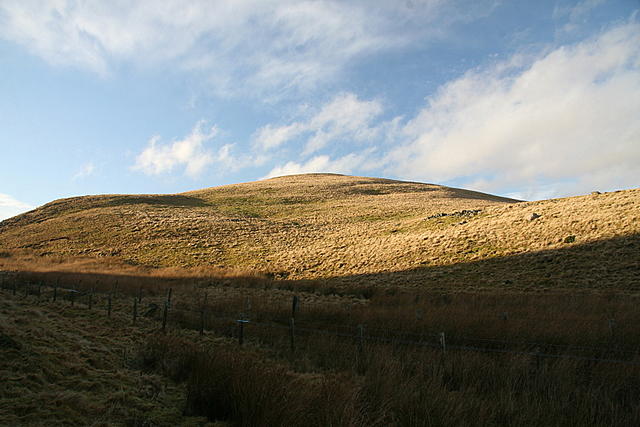 Photo could not load
NO3157 : Mile Hill
Dan
 Photo could not load
NO3157 : Mile Hill
Richard Webb
Hill facts and local notes
Classifications
Elevation
410m
1,345 ft
Prominence
185m
Coordinates
56.7009, -3.1262
NO311571
OS Map
53
Explorer: 381
At the Summit
The summit features a large stone cairn and a small wooden marker, offering a perfect spot for a snack break or to take in the views.
Terrain & Geology
Mile Hill is primarily composed of Lake District granite, known for its distinctive features and resilience against erosion. The remnants of ancient volcanic activity are evident in the surrounding area, providing a glimpse into the Earth's tumultuous geological past.
Views & Scenery
From the summit, hikers can enjoy panoramic views of the surrounding fells, including the impressive peaks of Helvellyn and Skiddaw.
History & Heritage
Name Origin
The name 'Mile Hill' is thought to derive from its former use as a marker for distances on the old coaching routes.
Historical Significance
Historically, it served as a landmark for local traders and travellers, providing a sense of direction in a rather wild landscape.
Getting There & Facilities
Check current local access restrictions, parking rules and transport timetables before travelling. These notes do not confirm public access to the summit.
Parking
The nearest parking is available at the Whinlatter Forest Park car park, located approximately 5 km away. Parking fees apply.
Public Transport
The nearest bus service runs to Braithwaite, with connections to Keswick and Penrith. The service frequency varies.
Nearby Facilities
Facilities are located in Keswick, which offers numerous cafes, shops, and toilet facilities.
Safety Information
Known Hazards
- Wet and slippery trails can occur, particularly after rain; proper footwear is a must.
General Safety Tips
- Check weather conditions before setting out
- Carry appropriate clothing and equipment
- Let someone know your planned route
- Take a map, compass, and GPS device
- Carry emergency supplies: food, water, first aid kit, torch
Hills
Some common questions about the hills answered
Are there group walks up Mile Hill?
Many walkers use Walkmates to join or organise walks with others. You can check for group walks around Mile Hill through the maps
Are there other walkers around Mile Hill?
Activity varies by location and time, but Walkmates lets you see whether others have shared walks or shown interest in this area. Find other people through the walking friends search walking friends for Mile Hill search or of course create your own walk for Mile Hill
Can I organise a walk to Mile Hill?
Yes. If there aren’t any walks listed already, you can create a walk and make it available for others to join.
If you're signed up to Walkmates, you can create a walk to Mile Hill.
How do I find a walk up this hill?
There are often multiple ways to walk this hill, depending on experience and route preference. Walkmates helps you explore walks and routes that others have shared.
Can I suggest a new route up Mile Hill?
Yes. You can suggest or create routes to share with others. Walkmates focuses on the social side of walking, so routes are used to help people organise walks and explore areas together, rather than as detailed navigation tools or route libraries.
Other uses really appreciate knowledgeable walkers sharing their routes. Share your favourite route to Mile Hill here
The is an error or something incorrect about this hill. How do I let you know?
We always strive to keep the information on Walkmates as accurate as possible. If you find an error, please let us know through the contact form and we'll aim to correct it as quickly as possible
Community Discussion
Comments
Location
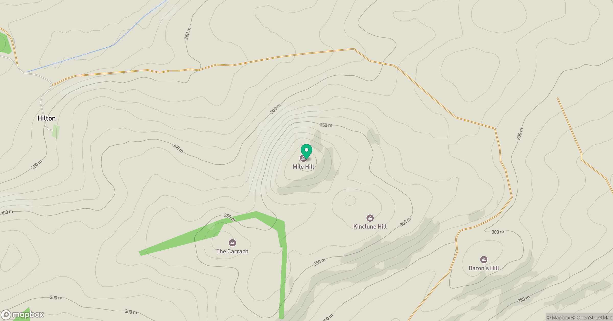
Grid reference: NO311571
View on OpenStreetMapOpens a map in a new tab, centred on the hill.
Hills within 30 km
Straight-line distance, not a walking route or confirmation of access.
No comments yet. Be the first.