

Hare Cairn
Good walks are even better shared.
Overview
Hare Cairn
Hare Cairn, standing at an elevation of 441 meters, is nestled within the stunning Southern Uplands of Scotland. This Corbett offers a delightful mix of challenging ascents and rewarding views, making it a perfect destination for hikers looking to escape the hustle and bustle of everyday life.
Geology
The mountain is predominantly made up of Silurian sedimentary rocks, which provide a varied landscape full of interesting rock formations. Nature has certainly outdone itself in crafting these geological wonders.
Route Description
The most popular route begins on the B719 where you'll find a lay-by suitable for parking a few cars. The path is well-defined and leads through heather and gorse, with the occasional rocky patch to keep you on your toes. The round trip covers about 8 km and typically takes around 3.5 hours.
Terrain
Expect a terrain of grassy slopes interspersed with rocky outcrops. Be cautious of some boggy areas near the base, particularly in wet conditions. It’s advisable to wear sturdy boots and perhaps bring an extra pair of socks, just in case!
Summit Features
At the summit, hikers are greeted by a small stone cairn, which also doubles as an excellent spot to catch your breath while soaking in the breathtaking views. It's the perfect place to ponder the mysteries of life or simply enjoy a snack.
Views
The views from Hare Cairn are nothing short of spectacular. On a clear day, you'll be treated to sights of the rolling hills of the Southern Uplands, with the Firth of Clyde gracing the horizon. Ideal times to capture these stunning vistas are during the spring and autumn when clarity and colours are at their best.
Hazards
Hiking on Hare Cairn is generally safe, but remember that the weather can change rapidly in the hills. Be wary of slippery conditions during and after wet weather. It's wise to check the forecast before setting out.
Nearby summits
For those looking to extend their adventure, nearby summits like Tinto Hill (707 meters) and Green Hill (588 meters) promise even more stunning scenery and opportunities for exploration.
Access
As for access, the nearest parking lies on the B719. Public transport options are limited, so plan accordingly - the closest bus stop is found in the village of Biggar, about 9 km away. Biggar serves as the nearest town with access to cafes, shops, and essential facilities that ensure you are well-equipped before and after facing the hills.
History
Interestingly, the name 'Hare Cairn' seems to suggest a nod to the local wildlife, specifically the plentiful hares that thrive in this region. Historically, this area resonates with folklore surrounding ancient clans, adding a rich layer of cultural significance to your hiking experience.
In sum, a trek up Hare Cairn represents a delightful balance of natural beauty, physical challenge, and a dash of historical intrigue. So grab your boots and… let’s hop to it!
Explore routes near Hare Cairn
Public walks starting within 80 km of this hill. Nearby does not mean a route reaches the summit; check its map and access before setting out.
Unled club outing: Glenesk (coach departure)
View route
Unled club outing: Xmas Walk - Bankfoot - Dunkeld (coach departure)
View route
Unled club outing: Angus coastal walk (coach departure)
View route
Unled club outing: Glen Moy/Glenogil (shared-car departure)
View route
Route planning notes
These notes describe possible approaches, not verified navigable routes or permission to cross land. Check current paths, local access rules and conditions before setting out.
B719 to Hare Cairn
A well-defined trail starting from the road, leading through heather and gorse with occasional rocky patches.
Make a day of it, together
Find someone to share the walk with, or organise a day out along a route you like.
Photo Gallery
View all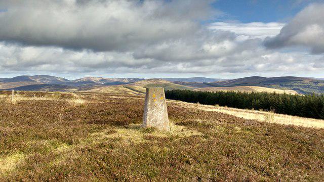 Photo could not load
NO2462 : Cairn of Hare Cairn
Aleks Scholz
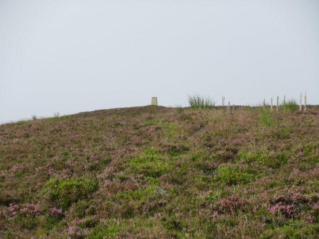 Photo could not load
NO2462 : Hare Cairn trig pillar from the north
Scott Cormie
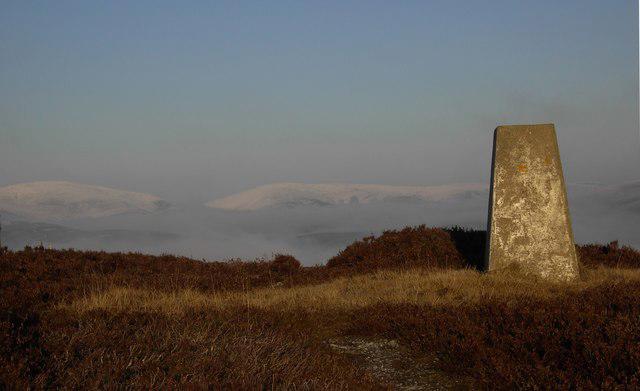 Photo could not load
NO2462 : Hare Cairn Trig
Colin Kinnear
Hill facts and local notes
Classifications
Elevation
516m
1,693 ft
Prominence
180m
Coordinates
56.7466, -3.2408
NO242623
OS Map
44
Explorer: OL53S 388S
At the Summit
The summit is marked by a small stone cairn, offering panoramic views and a perfect spot for a well-earned rest after the ascent.
Terrain & Geology
Hare Cairn is predominantly composed of Silurian sedimentary rocks, providing a rugged landscape peppered with interesting rock formations.
Views & Scenery
From the summit, you can see the rolling hills of the Southern Uplands and, on a clear day, distant views towards the Firth of Clyde.
History & Heritage
Name Origin
The name 'Hare Cairn' likely references the wildlife in the area, specifically hares which are quite prevalent in the region.
Historical Significance
The area is of geological interest and has historical significance in local folklore concerning the times of ancient clans.
Getting There & Facilities
Check current local access restrictions, parking rules and transport timetables before travelling. These notes do not confirm public access to the summit.
Parking
There is a small lay-by on the B719 just south of the mountain, suitable for a few cars.
Public Transport
Public transport is limited; the nearest bus stop is in the village of Biggar, approximately 9 km away.
Nearby Facilities
While there are no facilities directly at Hare Cairn, Biggar offers cafes, shops, and toilets for pre- and post-hike needs.
Safety Information
Known Hazards
- Care should be taken during wet conditions as some areas can become very slippery. Additionally, the weather can change rapidly in the hills.
General Safety Tips
- Check weather conditions before setting out
- Carry appropriate clothing and equipment
- Let someone know your planned route
- Take a map, compass, and GPS device
- Carry emergency supplies: food, water, first aid kit, torch
Hills
Some common questions about the hills answered
Are there group walks up Hare Cairn?
Many walkers use Walkmates to join or organise walks with others. You can check for group walks around Hare Cairn through the maps
Are there other walkers around Hare Cairn?
Activity varies by location and time, but Walkmates lets you see whether others have shared walks or shown interest in this area. Find other people through the walking friends search walking friends for Hare Cairn search or of course create your own walk for Hare Cairn
Can I organise a walk to Hare Cairn?
Yes. If there aren’t any walks listed already, you can create a walk and make it available for others to join.
If you're signed up to Walkmates, you can create a walk to Hare Cairn.
How do I find a walk up this hill?
There are often multiple ways to walk this hill, depending on experience and route preference. Walkmates helps you explore walks and routes that others have shared.
Can I suggest a new route up Hare Cairn?
Yes. You can suggest or create routes to share with others. Walkmates focuses on the social side of walking, so routes are used to help people organise walks and explore areas together, rather than as detailed navigation tools or route libraries.
Other uses really appreciate knowledgeable walkers sharing their routes. Share your favourite route to Hare Cairn here
The is an error or something incorrect about this hill. How do I let you know?
We always strive to keep the information on Walkmates as accurate as possible. If you find an error, please let us know through the contact form and we'll aim to correct it as quickly as possible
Community Discussion
Comments
Location
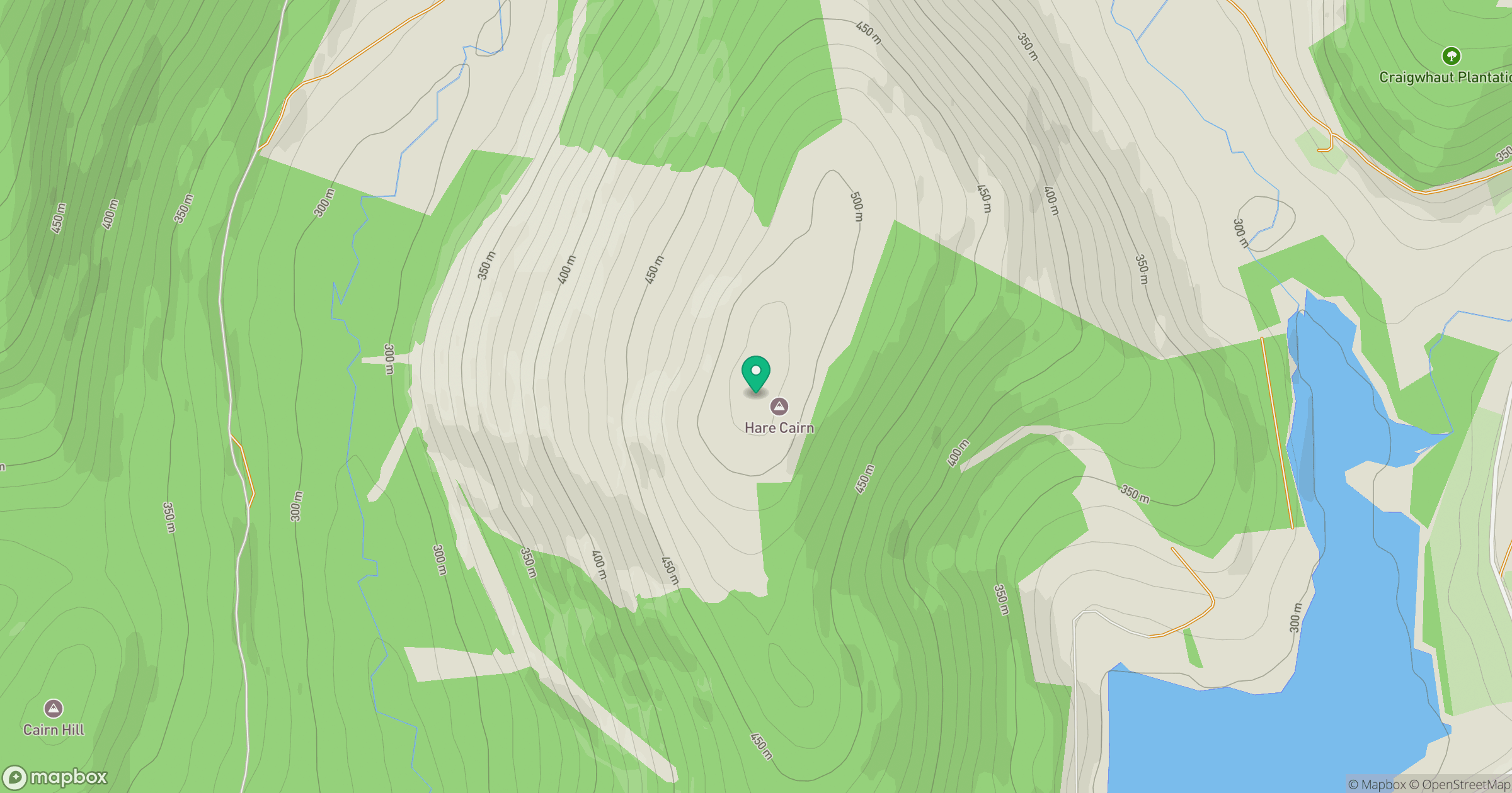
Grid reference: NO242623
View on OpenStreetMapOpens a map in a new tab, centred on the hill.
Hills within 30 km
Straight-line distance, not a walking route or confirmation of access.
Driesh
948m
Lochnagar - Cac Carn Beag
1,156m
Beinn a' Ghlo - Carn nan Gabhar
1,122m
Crock
554m
Creigh Hill
498m
No comments yet. Be the first.