

Hill of Strone
Good walks are even better shared.
Overview
Hill of Strone
Hill of Strone, nestled in the heart of the Scottish Highlands, stands at 316 meters. A Marilyn in classification, it offers a rewarding trek for all types of walkers.
Geology
With a rich geological history, this hill is primarily composed of basalt and limestone. The rugged landscape showcases features formed over millions of years, making it a fascinating study for geology enthusiasts...
Getting There
For access, a small car park is available at the starting point near Strone. If you're relying on public transport, don't fret; regular buses from Dunoon will drop you off not too far from the adventure.
Route Details
The Strone Hill Circular Route spans approximately 8.5 km, taking about 3.5 hours to complete. Expect a moderate challenge, complete with grassy slopes, rocky outcrops, and possibly some squelchy sections. Bring your wellies just in case!
Summit Experience
Upon reaching the summit, climbers are greeted by a wooden cross and breathtaking panoramic views! Notable sights include the shimmering waters of Loch Long and the impressive Arrochar Alps. Best to visit during late spring or autumn for that perfect view!
Hazards
Exercise caution: The weather can shift unexpectedly in these parts, so it's wise to pack an extra layer. And watch your step on those muddy bits—no one enjoys a wet sock!
Nearby Attractions
For those wanting more adventure, consider tackling Ben Donich or Beinn Bhreac, both nearby and equally inviting.
In conclusion, Hill of Strone is a gem for hikers, offering not just physical exertion but also ample rewards in terms of natural beauty and tranquility. As always, remember the Scottish saying, 'If you don't like the weather, just wait five minutes!' Happy hiking!
Explore routes near Hill of Strone
Public walks starting within 80 km of this hill. Nearby does not mean a route reaches the summit; check its map and access before setting out.
Loch Muick full circuit from Spittal of Glen Muick
View route
Cairngorms night walk and stargazing (event meeting)
View route
Cairngorms night walk and stargazing (event meeting)
View route
Cairngorms night walk and stargazing (event meeting)
View route
Route planning notes
These notes describe possible approaches, not verified navigable routes or permission to cross land. Check current paths, local access rules and conditions before setting out.
Strone Hill Circular Route
A delightful circular route offering stunning views and a varied terrain that’s suitable for most walkers.
Make a day of it, together
Find someone to share the walk with, or organise a day out along a route you like.
Photo Gallery
View all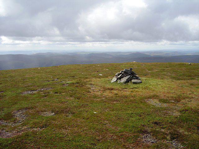 Photo could not load
NO2872 : Hill of Strone
Richard Webb
Hill facts and local notes
Classifications
Elevation
848m
2,781 ft
Prominence
142m
Coordinates
56.8422, -3.1690
NO287729
OS Map
44
Explorer: OL53S 388S
At the Summit
The summit is marked by a prominent wooden cross and offers a fantastic 360-degree view of the surrounding hills and lochs.
Terrain & Geology
Primarily composed of basalt and limestone, Hill of Strone forms part of an ancient volcanic landscape, offering fascinating rock features that are over 350 million years old!
Views & Scenery
From the summit, you can see Loch Long, the majestic Arrochar Alps, and on a clear day, even the peaks of Ben Arthur (The Cobbler) and beyond.
History & Heritage
Name Origin
The name 'Strone' is believed to derive from the Gaelic word 'Stroine', meaning 'a small stream'.
Historical Significance
Historically, this area was significant for its strategic position, offering views that allowed for monitoring of the lands and routes.
Getting There & Facilities
Check current local access restrictions, parking rules and transport timetables before travelling. These notes do not confirm public access to the summit.
Parking
There is a small car park located at the starting point near the village of Strone; be mindful as spaces can fill up quickly.
Public Transport
Regular bus services run from Dunoon and Gourock, with a short walk to the trailhead.
Nearby Facilities
While there are no facilities on the hill itself, Dunoon offers cafes, shops, and public toilets. A coffee post-hike is always a good idea!
Safety Information
Known Hazards
- Beware of changing weather conditions; it can turn from sunny to wet quicker than you can say 'Scottish weather'. Also, sections of the route can be muddy.
General Safety Tips
- Check weather conditions before setting out
- Carry appropriate clothing and equipment
- Let someone know your planned route
- Take a map, compass, and GPS device
- Carry emergency supplies: food, water, first aid kit, torch
Hills
Some common questions about the hills answered
Are there group walks up Hill of Strone?
Many walkers use Walkmates to join or organise walks with others. You can check for group walks around Hill of Strone through the maps
Are there other walkers around Hill of Strone?
Activity varies by location and time, but Walkmates lets you see whether others have shared walks or shown interest in this area. Find other people through the walking friends search walking friends for Hill of Strone search or of course create your own walk for Hill of Strone
Can I organise a walk to Hill of Strone?
Yes. If there aren’t any walks listed already, you can create a walk and make it available for others to join.
If you're signed up to Walkmates, you can create a walk to Hill of Strone.
How do I find a walk up this hill?
There are often multiple ways to walk this hill, depending on experience and route preference. Walkmates helps you explore walks and routes that others have shared.
Can I suggest a new route up Hill of Strone?
Yes. You can suggest or create routes to share with others. Walkmates focuses on the social side of walking, so routes are used to help people organise walks and explore areas together, rather than as detailed navigation tools or route libraries.
Other uses really appreciate knowledgeable walkers sharing their routes. Share your favourite route to Hill of Strone here
The is an error or something incorrect about this hill. How do I let you know?
We always strive to keep the information on Walkmates as accurate as possible. If you find an error, please let us know through the contact form and we'll aim to correct it as quickly as possible
Community Discussion
Comments
Location
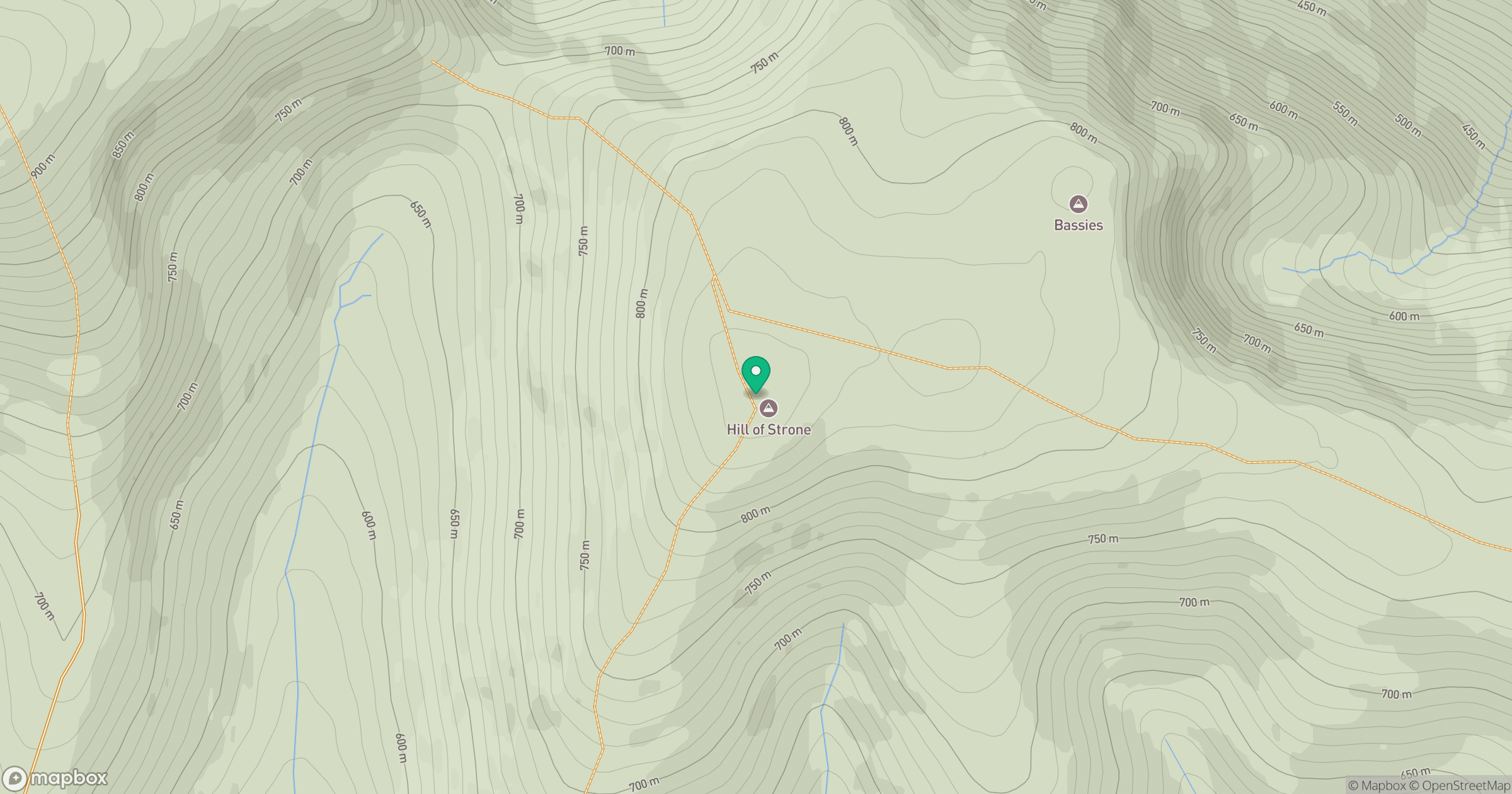
Grid reference: NO287729
View on OpenStreetMapOpens a map in a new tab, centred on the hill.
Hills within 30 km
Straight-line distance, not a walking route or confirmation of access.
No comments yet. Be the first.