

Middle Dodd
Good walks are even better shared.
NY3909 : Middle Dodd
David Purchase Photo source
Overview
Overview
Middle Dodd stands proudly at 601 metres, a quintessential example of the majestic hills that adorn the Lake District. With a prominence of 145 metres and a diverse landscape, it beckons hikers of all levels.
Geology
The mountain is predominantly volcanic in origin, showcasing remnants of ancient lava flows. Its unique geology offers intriguing insights into the area's turbulent geological past.
Routes
One of the most popular routes starts from Glenridding, winding through lush forests and providing a manageable ascent. The views grow more captivating as you gain elevation, making it a delightful trek for families and seasoned hikers alike.
- Key Route: The Dodd to Grisedale Valley Route
- Distance: 7.5 km, Approx. 3.5 hours, Moderate difficulty.
Summit Features
At the summit, you'll find a robust rocky outcrop crowned with a modest cairn. There’s no better place to take a breather and enjoy a sandwich amidst nature’s splendour!
Terrain
Expect a tapestry of grassy slopes, interspersed with rocky sections and the odd boggy patch (bring boots, not flip-flops!). The path is generally well-marked and family-friendly, but watch your step on those slippery stones near the top.
Views
The panorama from Middle Dodd is nothing short of spectacular, with Helvellyn and the blue glints of Ullswater providing a breathtaking backdrop. The scenery is particularly grand in late spring and early autumn when the colours of nature are at their finest.
Hazards
While hiking Middle Dodd, be wary of sudden weather changes and slippery rocks at the summit. Always check the forecast before heading out, and remember: there’s no bad weather, just inappropriate clothing!
Nearby Summits
Feeling energetic? Consider pairing your Middle Dodd hike with ascents of nearby peaks like Dodd or St. Sunday Crag for a bit of variety in your Lake District trek.
Access
Glenridding serves as the gateway to Middle Dodd, with ample parking available and regular bus services from Penrith. It’s a handy spot for those wanting to make a day of it.
Facilities
The charming village of Glenridding has quaint cafes and shops, ensuring you can fuel up after your hike. Public toilets are also available, so you can comfortably plan your breaks.
Conclusion
Middle Dodd is more than just another peak in the Lake District; it’s a delightful hiking experience that combines stunning scenery with enjoyable terrain. Perfect for family outings or solo rambles, Middle Dodd is a gem worth exploring. Remember your camera though – the views will give your Instagram a run for its money!
Explore routes near Middle Dodd
Walks starting near this hill. Open a route to check its map, distance and full itinerary.
Striding Edge, Helvellyn and Catstye Cam
View route
Helvellyn via Striding Edge
View route
Bow Fell from Langdale
View route
Tarn Hows Fast Route
View route
Route planning notes
These notes describe possible approaches. Check a route's map and access information when planning your walk.
The Dodd to Grisedale Valley Route
A well-trodden path that offers stunning views and a gentle ascent through forests and open grasslands.
Make a day of it, together
Find someone to share the walk with, or organise a day out along a route you like.
Photo Gallery
View all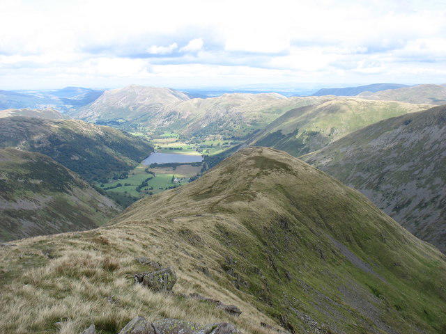 Photo could not load
NY3909 : Middle Dodd
David Purchase
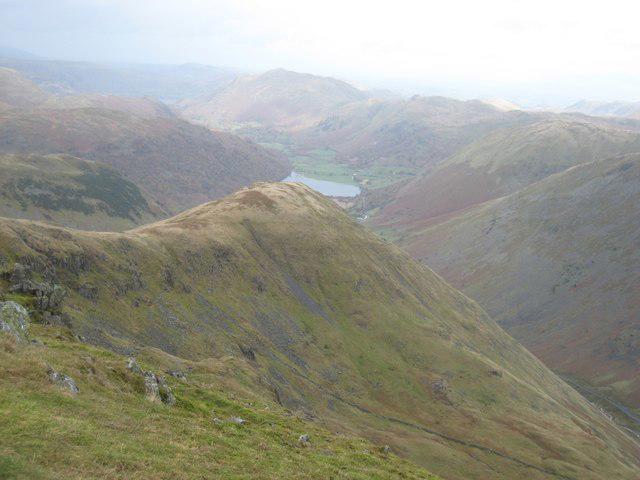 Photo could not load
NY3909 : Middle Dodd seen from the summit of Red Screes
Graham Robson
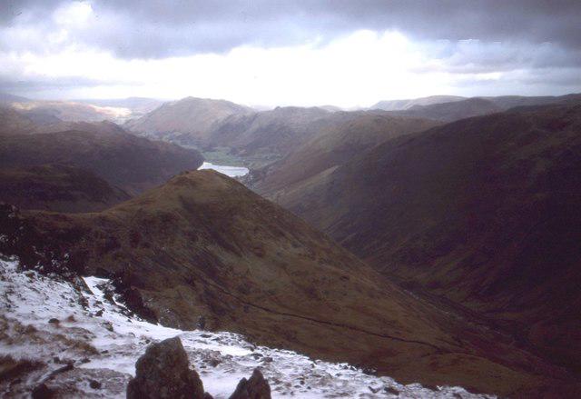 Photo could not load
NY3909 : Middle Dod and Brothers Water
Richard Webb
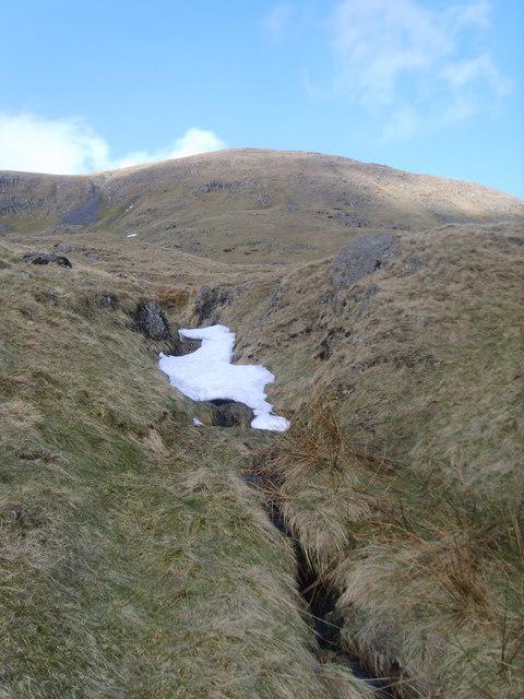 Photo could not load
NY3909 : Middle Dodd
Michael Graham
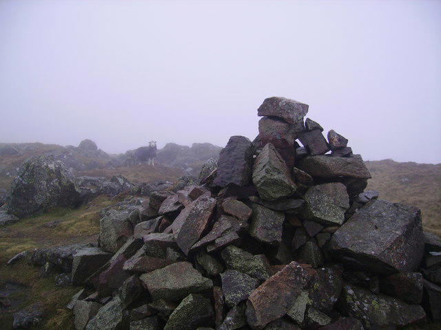 Photo could not load
NY3909 : Cairn and Herdwick
Michael Graham
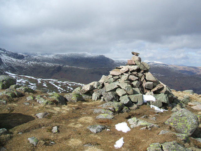 Photo could not load
NY3909 : Middle Dodd
David Brown
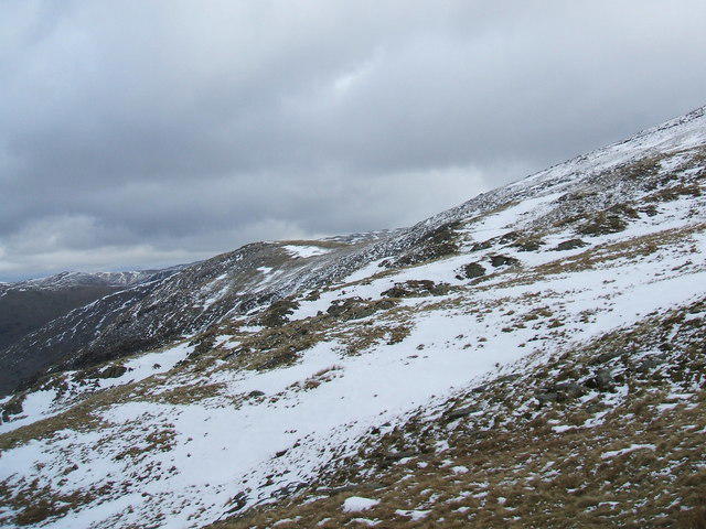 Photo could not load
NY3909 : Middle Dodd
David Brown
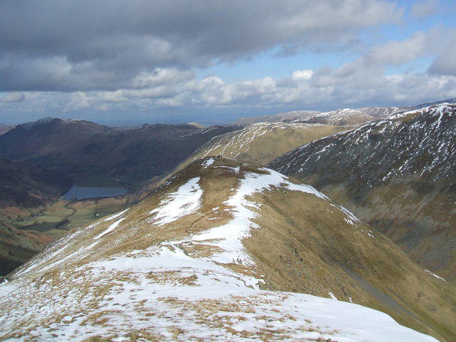 Photo could not load
NY3909 : Middle Dodd
David Brown
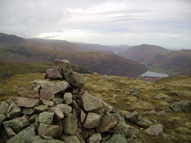 Photo could not load
NY3909 : Summit Cairn, Middle Dodd
Michael Graham
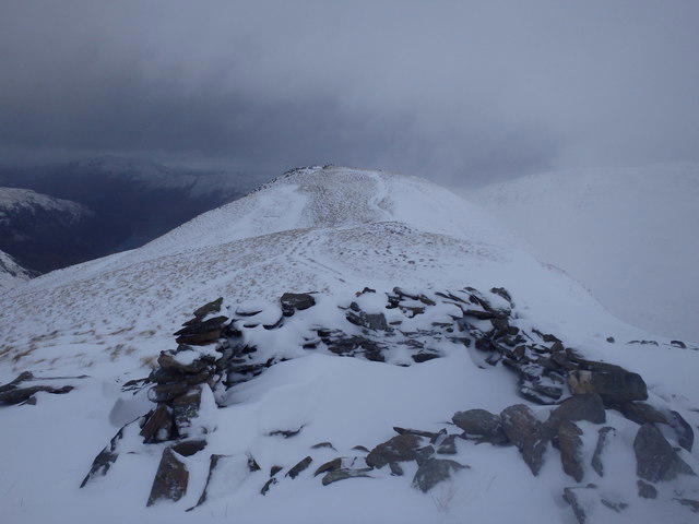
NY3909 : Approaching Middle Dodd
Michael Graham
Hill facts and local notes
Classifications
Elevation
654m
2,146 ft
Prominence
10m
Coordinates
54.4779, -2.9316
NY397095
OS Map
90
Explorer: OL5S OL7N
At the Summit
The summit features a rocky outcrop adorned with a small cairn, which can be a good spot for rest – and perhaps a cheeky snack.
Terrain & Geology
Middle Dodd is primarily composed of volcanic rock with notable features such as andesitic lava flows, remnants of the area's dramatic geological history.
Views & Scenery
From the summit, you can spot Helvellyn to the east, as well as the serene waters of Ullswater framed by the surrounding hills.
History & Heritage
Name Origin
The name 'Dodd' is derived from Old Norse, meaning 'hill' or 'small hill', a fitting title for this lovely peak.
Historical Significance
Middle Dodd has been a favoured route for walkers seeking stunning views without the extreme elevation gain typical of some of its taller neighbours.
Getting There & Facilities
Parking
The nearest parking is at the Glenridding Village car park, which is a short drive from the trailhead.
Public Transport
Regular bus services run from Penrith, making Glenridding easily accessible for hikers.
Nearby Facilities
Glenridding offers a few local cafes and shops for refreshments, as well as public restrooms, so you won't be left in a pickle post-hike.
Safety Information
Known Hazards
- Watch out for slippery rocks near the summit, as well as the potential for sudden changes in weather; the Lake District is known for its unpredictability!
General Safety Tips
- Check weather conditions before setting out
- Carry appropriate clothing and equipment
- Let someone know your planned route
- Take a map, compass, and GPS device
- Carry emergency supplies: food, water, first aid kit, torch
Hills
Some common questions about the hills answered
Are there group walks up Middle Dodd?
Many walkers use Walkmates to join or organise walks with others. You can check for group walks around Middle Dodd through the maps
Are there other walkers around Middle Dodd?
Activity varies by location and time, but Walkmates lets you see whether others have shared walks or shown interest in this area. Find other people through the walking friends search walking friends for Middle Dodd search or of course create your own walk for Middle Dodd
Can I organise a walk to Middle Dodd?
Yes. If there aren’t any walks listed already, you can create a walk and make it available for others to join.
If you're signed up to Walkmates, you can create a walk to Middle Dodd.
How do I find a walk up this hill?
There are often multiple ways to walk this hill, depending on experience and route preference. Walkmates helps you explore walks and routes that others have shared.
Can I suggest a new route up Middle Dodd?
Yes. You can suggest or create routes to share with others. Walkmates focuses on the social side of walking, so routes are used to help people organise walks and explore areas together, rather than as detailed navigation tools or route libraries.
Other uses really appreciate knowledgeable walkers sharing their routes. Share your favourite route to Middle Dodd here
The is an error or something incorrect about this hill. How do I let you know?
We always strive to keep the information on Walkmates as accurate as possible. If you find an error, please let us know through the contact form and we'll aim to correct it as quickly as possible
Community Discussion
Comments
Location
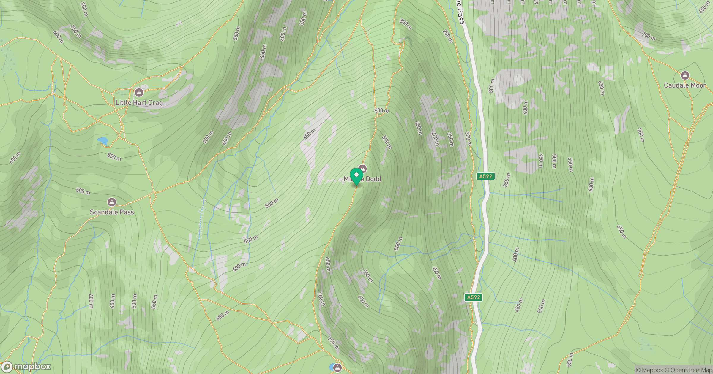
Grid reference: NY397095
View on OpenStreetMapOpens a map in a new tab, centred on the hill.

No comments yet. Be the first.