

Meall an Ceirileach
Good walks are even better shared.
Overview
Meall an Ceirileach
Nestled within the picturesque Scottish Highlands, Meall an Ceirileach stands proudly at an elevation of 733 meters. Recognised as a Marilyn, this charming peak is a favourite among local hikers looking for a moderately challenging climb with rewarding views.
Geology
The rugged yet enchanting terrain of Meall an Ceirileach is primarily composed of schist and gneiss. These resilient rocks offer a glimpse into the area’s geological history, showcasing the immense forces that have shaped the landscape over millennia. It’s a wondrous reminder of the power of nature, akin to pondering how that perfect cup of tea was made.
Route Information
A popular route to the summit is the Inveran to Meall an Ceirileach Path. This 6.5 km trek begins at the quaint hamlet of Inveran, weaving through heather-dappled terrain. Expect to take about 3.5 hours to reach the summit—allowing for no shortage of photo stops, of course! The route’s moderate difficulty is suitable for seasoned walkers and even those feeling rather brave on a sunny day.
Summit Features
Once you reach the summit, you'll be greeted by a humble cairn—a perfect spot to rest your weary legs and take in your glorious surroundings. And trust me, the views are worth every step! This is a prime location for a well-deserved snack, with your packed lunch seeming that much tastier in the great outdoors.
Terrain and Hazards
The terrain varies from grassy slopes to rocky outcrops, with some challenging patches that can catch even the most prepared hiker off-guard—especially after wet weather, when muddy patches can play tricks on the unwary. Be sure to wear robust footwear and keep an eye out for any sudden weather changes, which can sweep in quicker than you can say 'Scottish drizzle.'
Scenic Views
From the summit, breathtaking vistas of Loch Naver, the Flow Country, and expansive moorlands await. For the best views, aim to visit during the spring or autumn months. You’ll be treated to a stunning display of colours, transforming the landscape into a painter’s palette.
Nearby Summits
For those craving a bit more adventure, nearby summits such as Meall na Aighean and Cnoc na h-Urcha offer additional challenges and spectacular views.
Access and Facilities
Access is straightforward, with a small parking area located in Inveran. Bus services can get you from Lairg to the village, so there’s no excuse for missing out on this Highland gem! For facilities, Lairg provides various shops and cafes to replenish your energy levels.
Historical Significance
The name Meall an Ceirileach, meaning 'hill of the crooked', reflects the whimsical nature of our beautiful Highlands. Over the years, this peak has woven itself into local folklore, inviting stories that add depth to its already stunning physical beauty.
Conclusion
Whether you’re an experienced mountaineer or a curious newbie, Meall an Ceirileach provides a vibrant connection to nature and the rich history of the Scottish Highlands. So pack your rucksack, lace up your boots, and prepare for an unforgettable adventure in one of the UK’s most captivating landscapes.
Happy hiking!
Explore routes near Meall an Ceirileach
Public walks starting within 80 km of this hill. Nearby does not mean a route reaches the summit; check its map and access before setting out.
Ben Klibreck
View route
Loch Migdale from Torroy: Spinningdale pinewood and loch shore walk
View route
Route planning notes
These notes describe possible approaches, not verified navigable routes or permission to cross land. Check current paths, local access rules and conditions before setting out.
Inveran to Meall an Ceirileach Path
A scenic route starting from the small hamlet of Inveran, this path weaves through heather-clad hills and offers stunning views of the surrounding countryside as it ascends steadily to the summit.
Make a day of it, together
Find someone to share the walk with, or organise a day out along a route you like.
Photo Gallery
View all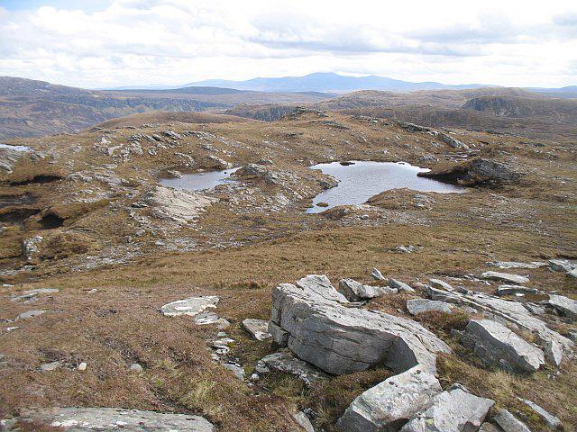 Photo could not load
NC4150 : Pools on Meall an Ceirileach
Richard Webb
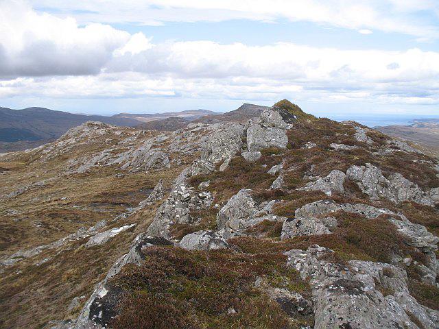 Photo could not load
NC4150 : Meall an Ceirileach
Richard Webb
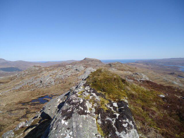 Photo could not load
NC4150 : The summit of Meall an Ceirileach, 502m
Michael Earnshaw
Hill facts and local notes
Classifications
Elevation
502m
1,647 ft
Prominence
121m
Coordinates
58.4104, -4.7076
NC419500
OS Map
9
Explorer: 447S
At the Summit
The summit boasts a modest cairn, providing not only a sense of achievement but also a perfect perch for a well-deserved snack. The panoramic views from here are simply breathtaking.
Terrain & Geology
Meall an Ceirileach is predominantly composed of schist and gneiss, which are indicative of the geological processes that shaped the region over millions of years. These rocks can tell tales of mountain-building events and the relentless forces of nature.
Views & Scenery
From the summit, you can enjoy views of Loch Naver, the dramatic peaks of the Flow Country and the vast stretches of moorland that characterise this unique landscape.
History & Heritage
Name Origin
The name 'Meall an Ceirileach' translates from Gaelic as 'hill of the crooked' - probably a testament to its winding trails or perhaps a comment on the state of your legs after tackling the ascent!
Historical Significance
The mountain has been a silent witness to the cultural tapestry of the Highlands, associated with local myths and stories passed down through generations.
Getting There & Facilities
Check current local access restrictions, parking rules and transport timetables before travelling. These notes do not confirm public access to the summit.
Parking
There is a small parking area available at Inveran where you can leave your vehicle. Arrive early to secure a spot, especially on sunny weekends.
Public Transport
The nearest public transport is available from Lairg, with limited bus services that can get you to Inveran. Check local schedules for the latest offerings.
Nearby Facilities
A few miles from the mountain, Lairg has various facilities, including cafes, small shops, and public toilets, enabling hikers to fuel up before or after their trek.
Safety Information
Known Hazards
- Be wary of sudden changes in weather, which can transform the landscape in moments. Also, the terrain can be uneven and slippery, especially after rain.
General Safety Tips
- Check weather conditions before setting out
- Carry appropriate clothing and equipment
- Let someone know your planned route
- Take a map, compass, and GPS device
- Carry emergency supplies: food, water, first aid kit, torch
Hills
Some common questions about the hills answered
Are there group walks up Meall an Ceirileach?
Many walkers use Walkmates to join or organise walks with others. You can check for group walks around Meall an Ceirileach through the maps
Are there other walkers around Meall an Ceirileach?
Activity varies by location and time, but Walkmates lets you see whether others have shared walks or shown interest in this area. Find other people through the walking friends search walking friends for Meall an Ceirileach search or of course create your own walk for Meall an Ceirileach
Can I organise a walk to Meall an Ceirileach?
Yes. If there aren’t any walks listed already, you can create a walk and make it available for others to join.
If you're signed up to Walkmates, you can create a walk to Meall an Ceirileach.
How do I find a walk up this hill?
There are often multiple ways to walk this hill, depending on experience and route preference. Walkmates helps you explore walks and routes that others have shared.
Can I suggest a new route up Meall an Ceirileach?
Yes. You can suggest or create routes to share with others. Walkmates focuses on the social side of walking, so routes are used to help people organise walks and explore areas together, rather than as detailed navigation tools or route libraries.
Other uses really appreciate knowledgeable walkers sharing their routes. Share your favourite route to Meall an Ceirileach here
The is an error or something incorrect about this hill. How do I let you know?
We always strive to keep the information on Walkmates as accurate as possible. If you find an error, please let us know through the contact form and we'll aim to correct it as quickly as possible
Community Discussion
Comments
Location
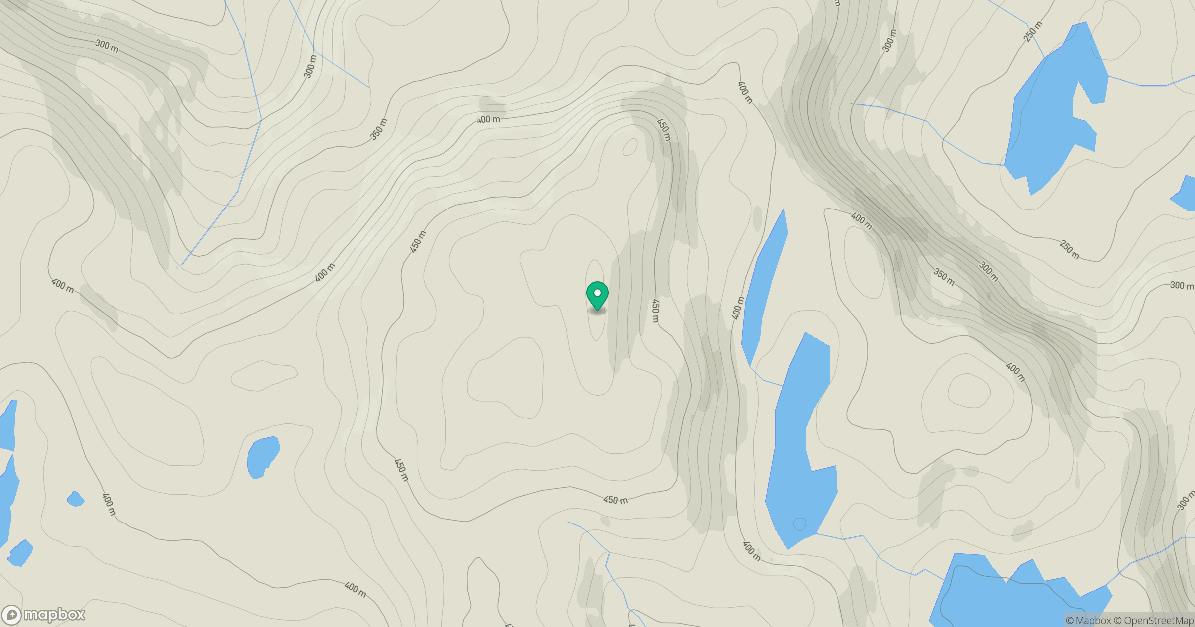
Grid reference: NC419500
View on OpenStreetMapOpens a map in a new tab, centred on the hill.
Hills within 30 km
Straight-line distance, not a walking route or confirmation of access.
Ben Hope
927m
Ben Stack
721m
Ben Loyal - An Caisteal
764m
Quinag - Sail Gharbh
809m
Quinag - Sail Ghorm [Sail Gorm]
776m
No comments yet. Be the first.