

Lord Arthur's Hill
Good walks are even better shared.
Overview
Lord Arthur's Hill: A Hidden Gem in Snowdonia
Nestled within the breathtaking confines of Snowdonia National Park, Lord Arthur's Hill is a Marilyn that manages to fly under the radar compared to its more famous neighbours. Standing at an elevation of 441 meters, it may not be the tallest peak, but it offers a splendid hike that rewards adventurers with stunning vistas and rich geology.
Geology
The hill is predominantly composed of volcanic rocks, presenting hikers with rocky outcrops and interesting formations. This unique geology stems from the volcanic activities that shaped this region millions of years ago. Whether you're a geology buff or just someone who enjoys a good rock, there's plenty to admire here.
Routes
The Llyn Idwal Circular Route is a favourite among hikers. Spanning approximately 6.5 km, this moderate loop winds around. Expect to spend around 3.5 hours enjoying the sights along the way. This route not only showcases the beauty of Llyn Idwal, but also offers a facing challenge as you ascend towards Lord Arthur’s Hill, providing a full experience of the area’s natural wonder.
Summit Features
When you reach the summit, be sure to scout out the small cairn that marks the top. It's a great place to pause, enjoy the panoramic views, and perhaps even snap a few photos for Instagram – you might just get your 'likes' to rise faster than your elevation!
Terrain
The terrain is a delightful mix of rocky and grassy areas. With some steeper sections, this hike keeps you engaged and, dare we say, 'on your toes!' It's ideal for those who relish a bit of challenge while soaking in the great outdoors.
Views
Once on top, you are greeted with sweeping views of Snowdonia’s array of peaks, including Tryfan and Pen yr Ole Wen. The best bits are, of course, the moments when you can spot some sheep grazing amidst the valleys. Now that’s a truly Welsh experience! The views are most spectacular in spring and summer, but autumn’s hues can be equally dazzling.
Hazards
Keep your wits about you! The terrain can be tricky with loose rocks, and that infamous Welsh weather can make a sudden entrance. Layers are your friend, as you might be drenched one moment and basking in the sun the next.
Nearby Summits
Extend your adventure by tackling nearby peaks like Tryfan (918 m) and Pen yr Ole Wen (978 m), which provide additional challenges and rewarding views.
Access
Nearest Parking
Ogwen Cottage car park is your best bet for parking. It fills quickly, especially in summer, so arrive early to claim a spot!
Public Transport
Public transport options exist but can be limited. Buses from Bangor and surrounding towns are your best option, so plan accordingly.
Nearest Town
Bethesda is approximately 15 minutes away and offers the basic amenities you might need.
Facilities
You’ll find public toilets near Ogwen Cottage and possibly a café for a well-deserved cuppa and some cake. After all, what’s hiking without a nice slice of something sweet?
History
The hill carries a name steeped in local folklore. While the exact origin of 'Lord Arthur' remains a bit elusive, it’s a nod to the rich history of the area.
In summary, whether you’re a seasoned hiker or a casual walker looking for a delightful day out, Lord Arthur's Hill is sure to please. Pack your boots, bring your snacks, and embark on an adventure filled with breathtaking views and a bit of Welsh charm.
Happy hiking!
Explore routes near Lord Arthur's Hill
Public walks starting within 80 km of this hill. Nearby does not mean a route reaches the summit; check its map and access before setting out.
Pitfichie: Cairn William Trail
View route
Loch Kinord: Muir of Dinnet Woodland Circuit
View route
Potarch to Shooting Greens: Deeside Way return
View route
Cairngorms night walk and stargazing (event meeting)
View route
Route planning notes
These notes describe possible approaches, not verified navigable routes or permission to cross land. Check current paths, local access rules and conditions before setting out.
Llyn Idwal Circular Route
A picturesque circular route around Llyn Idwal leading up to Lord Arthur's Hill, featuring scenic views and diverse landscapes.
Make a day of it, together
Find someone to share the walk with, or organise a day out along a route you like.
Photo Gallery
View all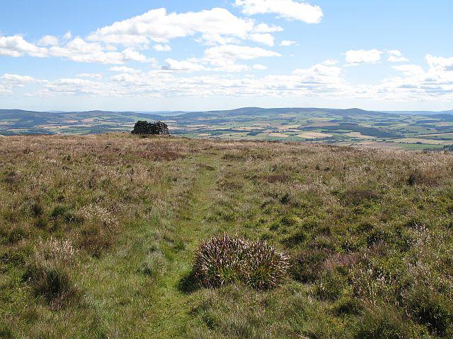 Photo could not load
NJ5119 : Lord Arthur's Cairn
Richard Webb
 Photo could not load
NJ5119 : Thin soils on Lord Arthur's Hill
Richard Webb
 Photo could not load
NJ5119 : Lord Arthur's Cairn
Richard Webb
Hill facts and local notes
Classifications
Elevation
518m
1,699 ft
Prominence
265m
Coordinates
57.2663, -2.8084
NJ513198
OS Map
37
Explorer: OL62E 420E
At the Summit
The summit boasts a modest rocky outcrop and a small cairn, providing a perfect spot to catch your breath and take in the views.
Terrain & Geology
Lord Arthur's Hill is primarily composed of volcanic rocks, including rhyolite and tuffs, which are remnants of the volcanic activity that shaped the region millions of years ago. This gives the hill a unique and rugged appearance, ideal for rock enthusiasts.
Views & Scenery
From the summit, you can enjoy breathtaking views of the surrounding Snowdonia peaks, including the famous Tryfan and the serene Llyn Ogwen below.
History & Heritage
Name Origin
The name 'Lord Arthur's Hill' likely reflects local folklore or historical ownership, although the exact origin remains a bit of a mystery.
Historical Significance
This hill is part of a larger geological and historical tapestry that attracts hikers and geologists alike, symbolising the rugged beauty of North Wales.
Getting There & Facilities
Check current local access restrictions, parking rules and transport timetables before travelling. These notes do not confirm public access to the summit.
Parking
There is a car park at Ogwen Cottage, which is the main access point for the Llyn Idwal Circular Route. It's advisable to arrive early during peak season as it can fill up quickly.
Public Transport
Buses run from Bangor and other nearby towns to the Ogwen area, but check schedules as they can be infrequent, especially on weekends.
Nearby Facilities
Near the Ogwen Cottage car park, there are public toilets available. For refreshments, a café can usually be found in the cottage or nearby villages.
Safety Information
Known Hazards
- Be wary of loose rocks on steeper sections and typical Welsh weather that can change without a moment's notice.
General Safety Tips
- Check weather conditions before setting out
- Carry appropriate clothing and equipment
- Let someone know your planned route
- Take a map, compass, and GPS device
- Carry emergency supplies: food, water, first aid kit, torch
Hills
Some common questions about the hills answered
Are there group walks up Lord Arthur's Hill?
Many walkers use Walkmates to join or organise walks with others. You can check for group walks around Lord Arthur's Hill through the maps
Are there other walkers around Lord Arthur's Hill?
Activity varies by location and time, but Walkmates lets you see whether others have shared walks or shown interest in this area. Find other people through the walking friends search walking friends for Lord Arthur's Hill search or of course create your own walk for Lord Arthur's Hill
Can I organise a walk to Lord Arthur's Hill?
Yes. If there aren’t any walks listed already, you can create a walk and make it available for others to join.
If you're signed up to Walkmates, you can create a walk to Lord Arthur's Hill.
How do I find a walk up this hill?
There are often multiple ways to walk this hill, depending on experience and route preference. Walkmates helps you explore walks and routes that others have shared.
Can I suggest a new route up Lord Arthur's Hill?
Yes. You can suggest or create routes to share with others. Walkmates focuses on the social side of walking, so routes are used to help people organise walks and explore areas together, rather than as detailed navigation tools or route libraries.
Other uses really appreciate knowledgeable walkers sharing their routes. Share your favourite route to Lord Arthur's Hill here
The is an error or something incorrect about this hill. How do I let you know?
We always strive to keep the information on Walkmates as accurate as possible. If you find an error, please let us know through the contact form and we'll aim to correct it as quickly as possible
Community Discussion
Comments
Location
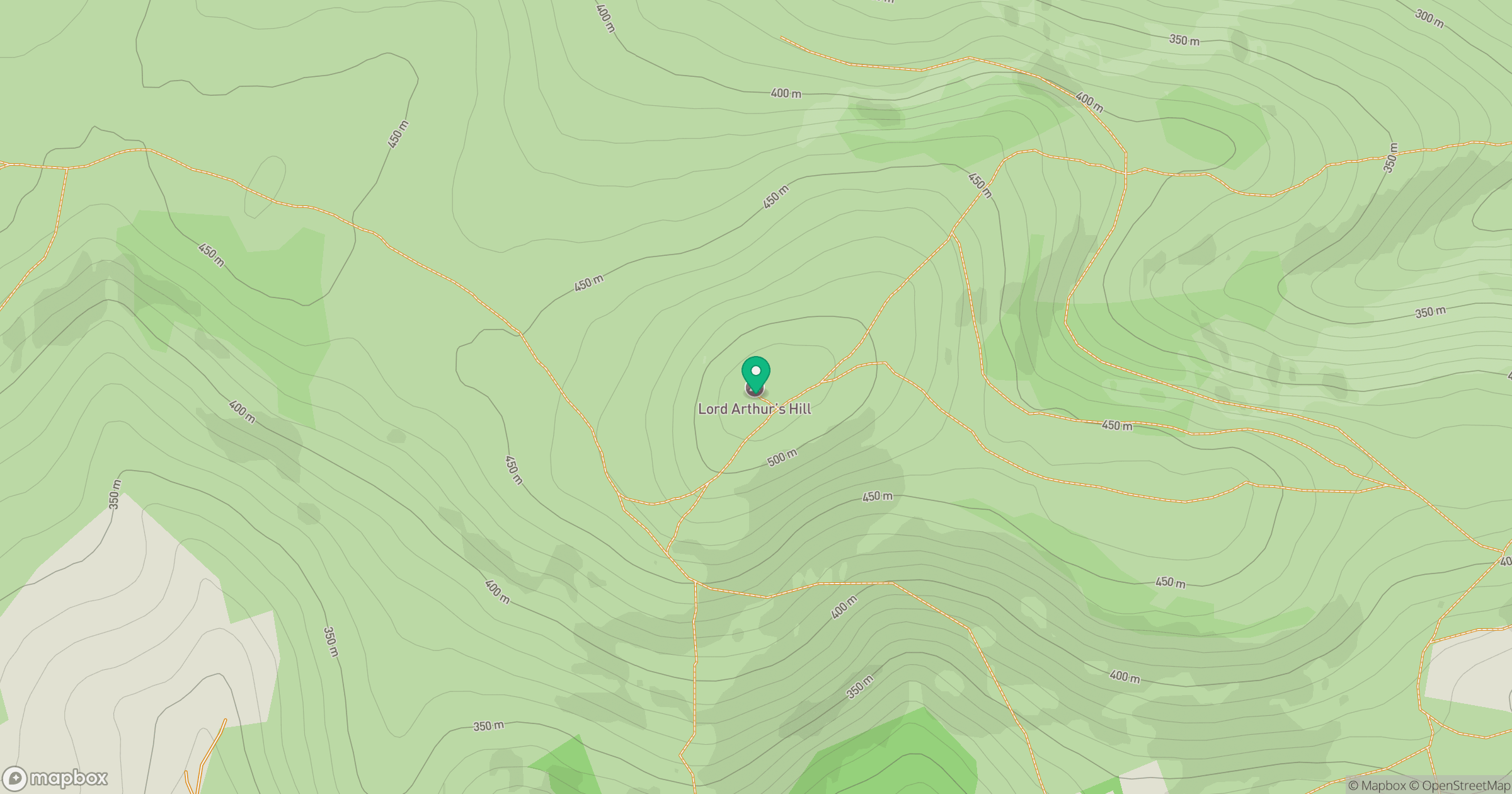
Grid reference: NJ513198
View on OpenStreetMapOpens a map in a new tab, centred on the hill.
Hills within 30 km
Straight-line distance, not a walking route or confirmation of access.
Bennachie - Oxen Craig
529m
Coiliochbhar Hill
533m
Tap o' Noth
563m
Pressendye
619m
Knockandy Hill
434m
No comments yet. Be the first.