

Loft Crag
Good walks are even better shared.
NY2707 : Into The Mist
Michael Graham Photo source
Overview
Loft Crag
Loft Crag, standing tall at 744 meters, offers a wonderful adventure for walkers and climbers alike. Nestled in the heart of the Lake District, this crag has become a beloved destination for both seasoned hikers and those looking to dip their toes into the world of British mountains.
Geology
Composed mainly of sandstone and slate, Loft Crag's impressive geological features are a result of intense glacial activity that has scoured the land over thousands of years. The rugged landscape is crisscrossed with rocky outcrops and lush greenery, providing a fantastic backdrop for your trek.
Routes
- Rosset Gill Approach: This moderate 8km route sets off from Great Langdale and follows the scenic Rosset Gill, making it accessible for a variety of skill levels.
- Bowfell Traverse: For those seeking more of a challenge, tackle this 12km route that links Loft Crag with the majestic Bowfell, making it ideal for a full day of adventure.
Summit Features
Upon reaching the summit, you'll be greeted by a stunning view, perfect for snapping a photo or two – don't forget to strike a pose! While there's no trig point to mark your achievement, the summit's rocky outcrop serves as a splendid vantage point to take in the rolling hills and valleys below.
Terrain
Expect to encounter rocky, uneven ground coupled with stretches of grassy paths. There are some steep sections, so sturdy footwear is recommended – unless you fancy a game of slip-and-slide!
Views
The vistas from Loft Crag are nothing short of breathtaking. To the south, you can see the iconic Langdale Pikes, whilst to the west, the expansive Morecambe Bay glistens in the distance. To catch these views in stunning light, plan your hike for the late spring or autumn, ideally at sunrise. Nothing quite soothes the soul like the sound of birds chirping and the sun peeking over the horizon.
Hazards
Be cautious of loose stones on steep paths and keep an eye on changing weather conditions. Like anyone trying to sneak an unscheduled break, Mother Nature can be unpredictable!
Access
Parking can be easily found at the National Trust car park in Great Langdale. For public transport enthusiasts, buses run from Windermere, but do check schedules to avoid long waits.
Facilities
After your hike, refuel at a local café in Chapel Stile, where you can indulge in a well-deserved cup of tea and a slice of cake. Public toilets are also available nearby, ensuring you can freshen up after your adventure.
History
Loft Crag’s name originates from Old Norse, meaning heights, a fitting tribute to its elevated status in the landscape. Historically, it has attracted climbers and outdoor enthusiasts, becoming a prominent feature in the local folklore.
In conclusion, Loft Crag is an inviting challenge beckoning those eager to explore the wonders of the Lake District. So gather your gear, lace up your boots, and answer the call of the hills!
Explore routes near Loft Crag
Walks starting near this hill. Open a route to check its map, distance and full itinerary.
Bow Fell from Langdale
View route
Great Carrs Halifax Wreckage from Wrynose Pass
View route
Scafell Pike from Seathwaite via the Corridor Route
View route
Tarn Hows Fast Route
View route
Route planning notes
These notes describe possible approaches. Check a route's map and access information when planning your walk.
Rosset Gill Approach
This route starts from the picturesque village of Langdale and follows the Rosset Gill to ascend Loft Crag, offering fantastic views along the way.
Bowfell Traverse
A more challenging route that continues from Bowfell along the ridge before descending towards Loft Crag.
Make a day of it, together
Find someone to share the walk with, or organise a day out along a route you like.
Photo Gallery
View all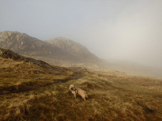 Photo could not load
NY2707 : Into The Mist
Michael Graham
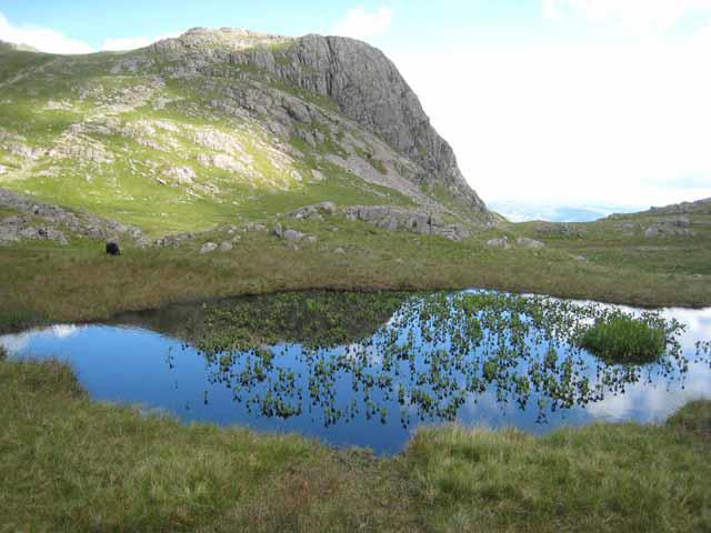 Photo could not load
NY2707 : Tarn at the head of Dungeon Ghyll
Oliver Dixon
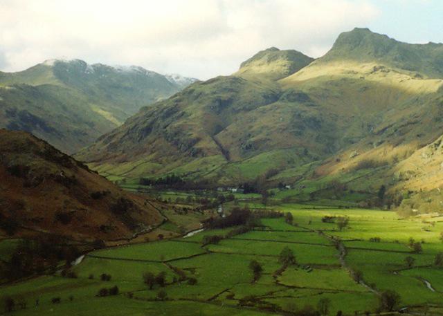 Photo could not load
NY2707 : Langdale Pikes
Chris Tomlinson
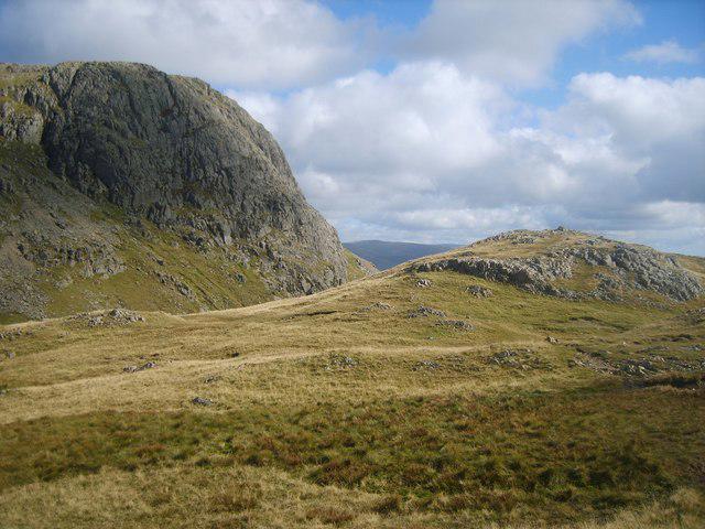 Photo could not load
NY2707 : Thorn Crag
Michael Graham
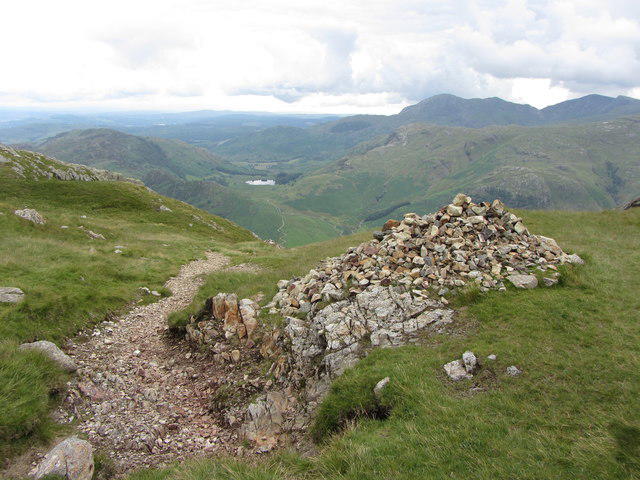 Photo could not load
NY2707 : Path and cairn on Langdale Pikes
Gareth James
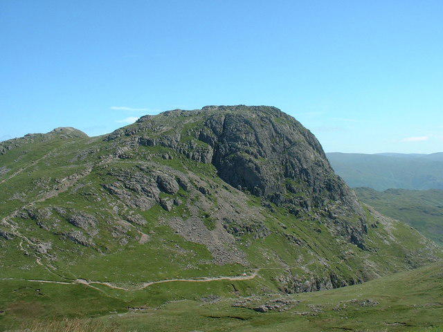 Photo could not load
NY2707 : Harrison Stickle from Loft Crag
Michael Graham
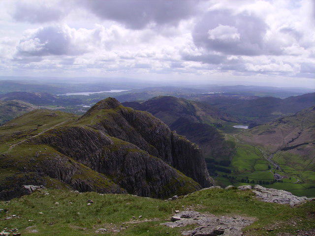 Photo could not load
NY2707 : Loft Crag
Michael Graham
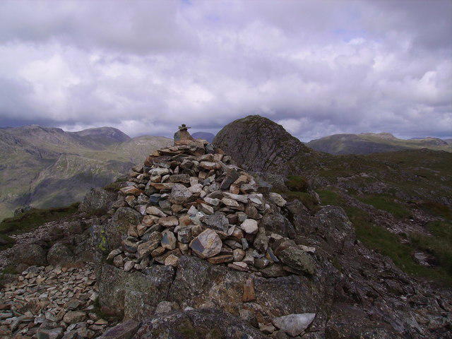 Photo could not load
NY2707 : Summit Cairn, Loft Crag
Michael Graham
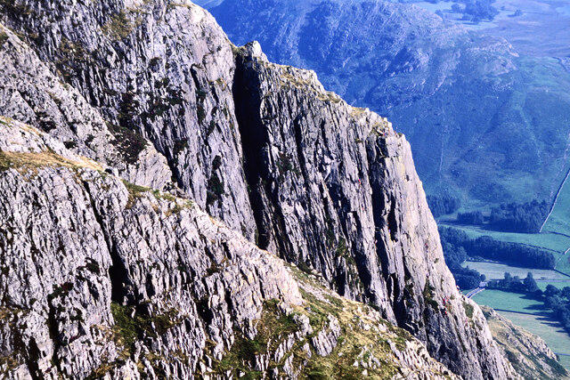 Photo could not load
NY2707 : Gimmer Crag
Trevor Littlewood
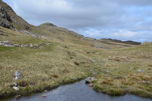
NY2707 : Harrison Combe
Jim Barton
Hill facts and local notes
Classifications
Elevation
682m
2,237 ft
Prominence
24m
Coordinates
54.4544, -3.1160
NY277071
OS Map
89 90
Explorer: OL6N
At the Summit
The summit features a distinctive rocky outcrop, offering hikers a perfect spot for a well-deserved breather. There's no trig point here, but the panoramic views make up for it!
Terrain & Geology
Loft Crag is primarily composed of sedimentary rocks, particularly sandstone and slate, which have been shaped over millennia by glacial activity, resulting in the dramatic crags we see today.
Views & Scenery
From the summit, unforgettable views of the Langdale Pikes and the surrounding valleys stretch out, along with a glimpse of the distant Morecambe Bay.
History & Heritage
Name Origin
The name 'Loft' may derive from the Old Norse word 'lopt', meaning 'air' or 'heights', which is fitting given its lofty perch.
Historical Significance
Loft Crag has been a popular spot for climbers and hikers for centuries, offering routes and views that have inspired local folklore.
Getting There & Facilities
Parking
The nearest parking can be found at the National Trust car park in Great Langdale, which is a short walk to the trailhead.
Public Transport
Regular buses run from Windermere to Langdale, although they may be infrequent, so it's wise to check the timetable.
Nearby Facilities
There are basic facilities in the nearby village of Chapel Stile, including a café and public toilets.
Safety Information
Known Hazards
- Loose stones on steep pathways, sudden changes in weather, and the potential for slippery conditions when wet.
General Safety Tips
- Check weather conditions before setting out
- Carry appropriate clothing and equipment
- Let someone know your planned route
- Take a map, compass, and GPS device
- Carry emergency supplies: food, water, first aid kit, torch
Hills
Some common questions about the hills answered
Are there group walks up Loft Crag?
Many walkers use Walkmates to join or organise walks with others. You can check for group walks around Loft Crag through the maps
Are there other walkers around Loft Crag?
Activity varies by location and time, but Walkmates lets you see whether others have shared walks or shown interest in this area. Find other people through the walking friends search walking friends for Loft Crag search or of course create your own walk for Loft Crag
Can I organise a walk to Loft Crag?
Yes. If there aren’t any walks listed already, you can create a walk and make it available for others to join.
If you're signed up to Walkmates, you can create a walk to Loft Crag.
How do I find a walk up this hill?
There are often multiple ways to walk this hill, depending on experience and route preference. Walkmates helps you explore walks and routes that others have shared.
Can I suggest a new route up Loft Crag?
Yes. You can suggest or create routes to share with others. Walkmates focuses on the social side of walking, so routes are used to help people organise walks and explore areas together, rather than as detailed navigation tools or route libraries.
Other uses really appreciate knowledgeable walkers sharing their routes. Share your favourite route to Loft Crag here
The is an error or something incorrect about this hill. How do I let you know?
We always strive to keep the information on Walkmates as accurate as possible. If you find an error, please let us know through the contact form and we'll aim to correct it as quickly as possible
Community Discussion
Comments
Location
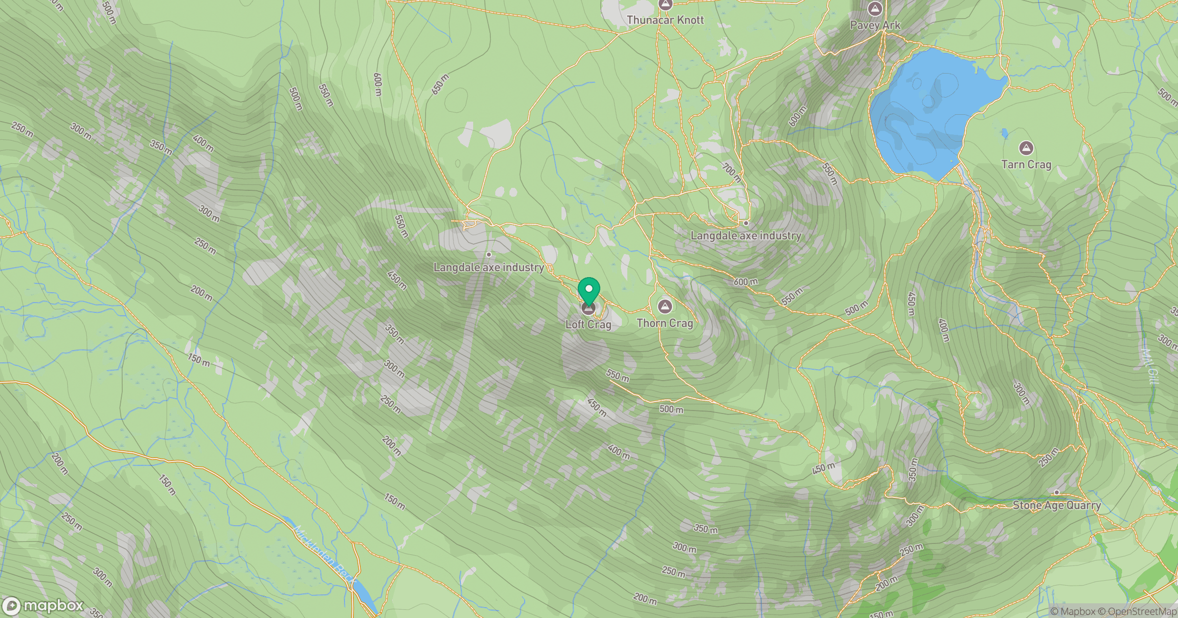
Grid reference: NY277071
View on OpenStreetMapOpens a map in a new tab, centred on the hill.
No comments yet. Be the first.