

Liddington Castle
Good walks are even better shared.
SU2079 : Liddington Castle
Vieve Forward Photo source
Overview
Liddington Castle
Overview
Liddington Castle, perched at a regal 211 meters, offers breathtaking views and a tantalising glimpse into the past. This ancient hillfort not only delivers an enjoyable hike but also serves up a generous dollop of history!
Geology
This charming peak is composed mainly of chalk and flint, giving it distinct characteristics that shape both its landscape and ecology. The chalk offers excellent drainage, which means lush habitats flourish along its slopes. It's a grand old geological structure that has weathered the ages, much like your trusty hiking boots.
Routes
- Liddington Hill Circular Route: This moderate route of about 4.5 km gives you a lovely loop, offering both the challenge of a hill climb as well as the pleasures of the picturesque English countryside. Pack your best tea and a good book for a picnic on top, and you’ll feel like you’ve struck gold.
- Castle Path: If you're short on time but long on ambition, this easy 1.2 km path directly leads you to the summit, ensuring you bag another peak in your list!
Summit Features
The summit is steeped in history, featuring remnants of the ancient hillfort. The earthworks are a testament to the ingenuity of past civilisations. You'll find a viewpoint that's perfect for a quick selfie or a romantic picnic. But let’s face it, who doesn’t love a bit of ancient history mixed with beautiful views?
Terrain Type
Expect a grassy trail with some rocky patches; essentially, your ideal mix of rugged and charming—just like an English gentleman. It’s mostly well-maintained but watch your footing, especially after rain!
Views
The summit offers awe-inspiring views of Swindon and the idyllic Vale of White Horse. On particularly clear days, you might even spot the Cotswolds like an old friend waving back at you. The best time to soak up these views? Late spring to summer when the flora bursts into life!
Hazards
Like any good adventure, there's a twist. After a rain shower, specific paths may get slippery, so keep your wits about you when descending. It’s all part of the thrill, right?
Nearby Summits
- Barbury Castle: A mere stone's throw away, this nearby summit also boasts historical significance.
- White Horse Hill: A higher elevation that challenges your legs and rewards your spirit!
Access
Parking is available at a quaint little car park on the B4192, making access easy as pie. For public transport lovers, Swindon station has you covered, with local bus services taking you straight to Liddington.
Facilities
While you won't find facilities on the hill itself, Liddington and nearby Swindon are brimming with lovely pubs and cafes where you can replenish yourself after a day’s adventuring.
History
The name 'Liddington' is steeped in Old English charm, linked to a woman named Lydda. Historically, this place has been a vantage point since the Iron Age, chronicling stories of those who tread its grounds before us.
Whether you’re drawing in breaths of fresh air or snapping photos for social media, Liddington Castle is a delightful trek that promises both history and breathtaking views. So lace up those boots and hit the trails!
Conclusion
Liddington Castle stands as a testament to the natural world and human history, beckoning hikers, history buffs, and nature lovers alike. Make your way up and immerse yourself in the stories that unfold as you gaze over the land.
Explore routes near Liddington Castle
Walks starting near this hill. Open a route to check its map, distance and full itinerary.
Chiseldon to Barbury Shooting School Circular Walk
View route
Donkey Walk
View route
Devizes Wharf and Caen Hill Lock Flight Towpath Walk
View route
Newbury to Donnington Castle: Lambourn Valley Way via Speen and Bagnor
View route
Route planning notes
These notes describe possible approaches. Check a route's map and access information when planning your walk.
Liddington Hill Circular Route
A circular route starting from Liddington village, passing through scenic countryside and ascending to the hillfort.
Castle Path
A more direct path leading straight to the summit from the nearby car park.
Make a day of it, together
Find someone to share the walk with, or organise a day out along a route you like.
Photo Gallery
View all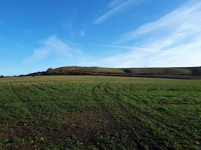 Photo could not load
SU2079 : Liddington Castle
Vieve Forward
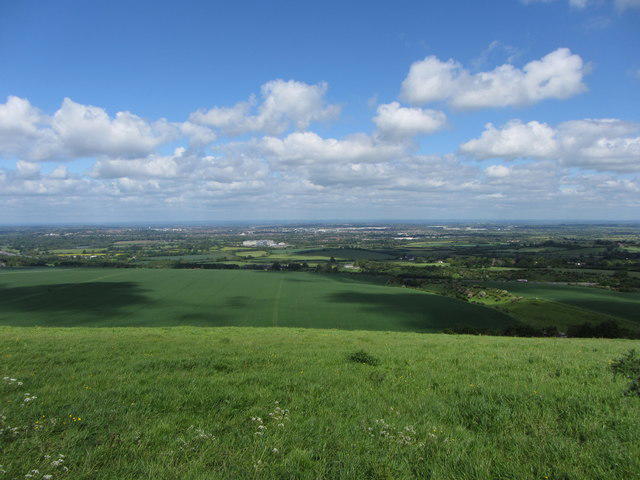 Photo could not load
SU2179 : View towards Swindon from Liddington Hill
Gareth James
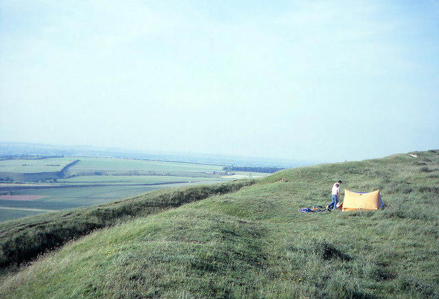 Photo could not load
SU2079 : Liddington Castle
Jeff Buck
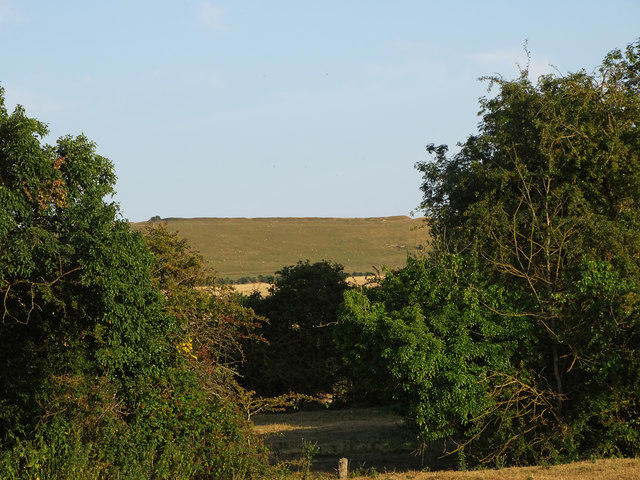 Photo could not load
SU2079 : Liddington Castle hill fort, Liddington, Swindon
Brian Robert Marshall
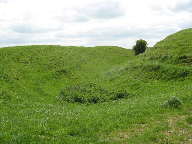 Photo could not load
SU2079 : Ditch, Liddington Hill
Dr Duncan Pepper
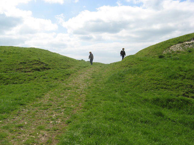 Photo could not load
SU2079 : Liddington Hill
Dr Duncan Pepper
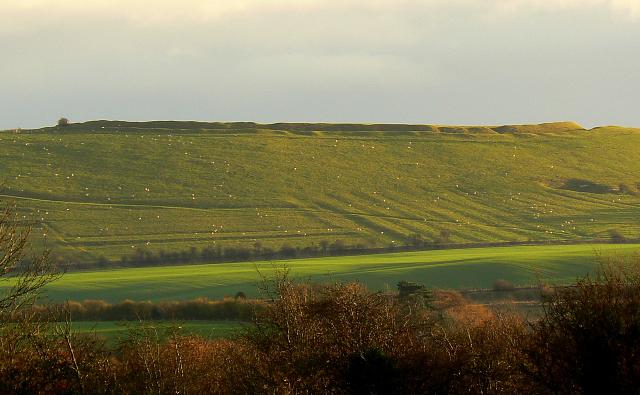 Photo could not load
SU2079 : Liddington Castle (complete), Liddington, Swindon
Brian Robert Marshall
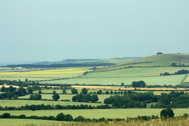 Photo could not load
SU2079 : Liddington Castle from Barbury Country Park
Katy Walters
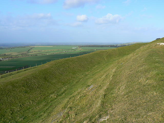 Photo could not load
SU2079 : Liddington Castle, Liddington
Brian Robert Marshall
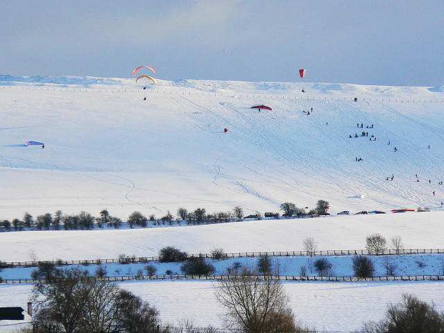
SU2079 : Liddington Castle in the snow, Liddington
Brian Robert Marshall
Hill facts and local notes
Classifications
Elevation
275m
902 ft
Prominence
1m
Coordinates
51.5158, -1.6988
SU209797
OS Map
174
Explorer: 157
At the Summit
The summit features the remnants of an ancient hillfort, with earthworks still visible. There’s a lovely viewpoint overlooking the surrounding countryside.
Terrain & Geology
Liddington Castle is primarily composed of chalk and flint, typical of the North Wessex Downs. The chalk uplands provide excellent drainage, allowing for rich flora and fauna.
Views & Scenery
From the summit, you can enjoy views of Swindon, the Vale of White Horse, and on a clear day, even the Cotswolds in the distance.
History & Heritage
Name Origin
'Liddington' derives from the Old English 'Lydding', meaning the hill associated with a woman named Lydda. It has been a strategic lookout point since prehistoric times.
Historical Significance
The site has been used since the Iron Age, and the remains of its hillfort illustrate the long-standing human occupation of the area.
Getting There & Facilities
Parking
There is a small car park at the base of Liddington Hill, just off the B4192.
Public Transport
Swindon is the nearest major train station, with local bus services to Liddington.
Nearby Facilities
No facilities directly on the hill, but several pubs and cafes can be found in Liddington and nearby Swindon.
Safety Information
Known Hazards
- Some areas can be slippery after rain; watch your step on descent.
General Safety Tips
- Check weather conditions before setting out
- Carry appropriate clothing and equipment
- Let someone know your planned route
- Take a map, compass, and GPS device
- Carry emergency supplies: food, water, first aid kit, torch
Hills
Some common questions about the hills answered
Are there group walks up Liddington Castle?
Many walkers use Walkmates to join or organise walks with others. You can check for group walks around Liddington Castle through the maps
Are there other walkers around Liddington Castle?
Activity varies by location and time, but Walkmates lets you see whether others have shared walks or shown interest in this area. Find other people through the walking friends search walking friends for Liddington Castle search or of course create your own walk for Liddington Castle
Can I organise a walk to Liddington Castle?
Yes. If there aren’t any walks listed already, you can create a walk and make it available for others to join.
If you're signed up to Walkmates, you can create a walk to Liddington Castle.
How do I find a walk up this hill?
There are often multiple ways to walk this hill, depending on experience and route preference. Walkmates helps you explore walks and routes that others have shared.
Can I suggest a new route up Liddington Castle?
Yes. You can suggest or create routes to share with others. Walkmates focuses on the social side of walking, so routes are used to help people organise walks and explore areas together, rather than as detailed navigation tools or route libraries.
Other uses really appreciate knowledgeable walkers sharing their routes. Share your favourite route to Liddington Castle here
The is an error or something incorrect about this hill. How do I let you know?
We always strive to keep the information on Walkmates as accurate as possible. If you find an error, please let us know through the contact form and we'll aim to correct it as quickly as possible
Community Discussion
Comments
Location
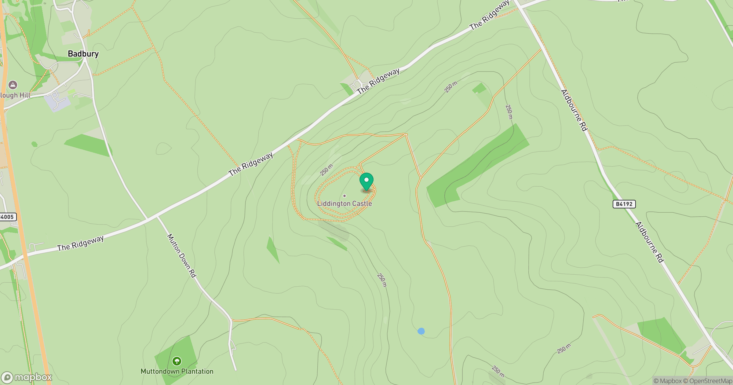
Grid reference: SU209797
View on OpenStreetMapOpens a map in a new tab, centred on the hill.
Nearby Hills
Worcestershire Beacon
425m
Glastonbury Tor
158m
Titterstone Clee Hill
533m
Leith Hill
294m

The Wrekin
407m
No comments yet. Be the first.