
Inchanadreen
Good walks are even better shared.
Overview
Inchanadreen: A Hidden Gem in the Scottish Highlands
Nestled within the stunning Scottish Highlands, Inchanadreen stands tall at 612 meters, offering hikers a moderately challenging ascent with breathtaking views as a reward.
Geology
Inchanadreen's rugged landscape is primarily composed of schist, a metamorphosed rock that showcases its ancient origins. Glacial features litter the valley floor, remnants of a time when the ice dominated this serene area. As you trek, be sure to admire the geological formations that seem to whisper secrets of the earth’s history.
Route Details
The most popular route to Inchanadreen is the North East Ridge. At roughly 6 kilometers in length, this path typically takes about 3.5 hours to complete. Hikers can expect a mix of rocky outcrops, heather-clad slopes, and the occasional boggy bit that reminds you of the unpredictability of Highland terrain. All in all, it’s a decent workout, worth every bead of sweat!
Summit Features
Upon reaching the summit, you'll be greeted by a substantial stone cairn, a classic sight for seasoned hikers. The panoramic views from this elevated perch include the majestic Ben More and the stunning Loch Awe. On days of perfect clarity, you might even catch a glimpse of the distant Isle of Mull. Snap a photo or two — they’ll make your friends green with envy!
Terrain Type
Be prepared for rocky stretches interspersed with grassy knolls and the occasional bog to keep things interesting. Suitable footwear is highly recommended to ensure you don't end up with muddy socks.
Views
The highlight of your hike will undoubtedly be the views from the summit. Late spring and early autumn present the most spectacular sights, as vibrant heather blooms and golden sunlight paint the landscape.
Hazards
Despite its charm, Inchanadreen does not come without its hazards. Be wary of the changeable Scottish weather — sunshine can swiftly turn to a downpour! Pay attention to the rocky terrain and watch your step, as slips can easily occur in wet conditions.
Nearby Summits
Inchanadreen is surrounded by impressive peaks, including:
- Ben More (966 meters) - a formidable challenge for more experienced hikers.
- Meall nan Sleac (670 meters) - a lovely addition to your hiking itinerary.
Access
Parking
There’s a small parking area near the trailhead, accommodating around ten cars. It’s best to arrive early to ensure a space.
Public Transport
The nearest bus stop is in Crianlarich, about 10 km away. From there, you’ll find that a taxi or a lengthy walk may be your only options.
Town Amenities
Crianlarich offers basic facilities including a small shop for refreshments and public toilets.
History
The name Inchanadreen, meaning 'hill of the heather', reflects the picturesque flora that blankets the area. This mountain holds significant sentimental value for local hikers and serves as a serene escape steeped in the rich cultural heritage of the Scottish Highlands.
Inchanadreen is a delightful adventure set within dramatic scenery. So lace up those boots, pack a sandwich, and get ready for a memorable day out in the hills!
Explore routes near Inchanadreen
Public walks starting within 80 km of this hill. Nearby does not mean a route reaches the summit; check its map and access before setting out.
No public routes are currently listed within 80 km of Inchanadreen on Walkmates. This does not mean there are no paths here. Explore the map and check local access information before planning a walk.
Route planning notes
These notes describe possible approaches, not verified navigable routes or permission to cross land. Check current paths, local access rules and conditions before setting out.
North East Ridge
A popular ascent path that features a mix of rocky outcrops and heather-clad slopes.
Make a day of it, together
Find someone to share the walk with, or organise a day out along a route you like.
Hill facts and local notes
Classifications
Elevation
310m
1,017 ft
Prominence
124m
Coordinates
51.7286, -9.1716
W191535
OS Map
85
At the Summit
The summit is marked by a substantial stone cairn and offers a breathtaking panorama of the surrounding peaks.
Terrain & Geology
Inchanadreen is primarily composed of schist, a metamorphic rock that provides a stunning backdrop against the rugged terrain, coupled with plentiful glacial features that tell tales of ancient ice ages.
Views & Scenery
From the summit, one can enjoy sweeping views of the nearby Ben More and the stunning Loch Awe. On a clear day, one can even see as far as the Isle of Mull.
History & Heritage
Name Origin
The name 'Inchanadreen' is believed to be derived from Gaelic, meaning 'hill of the heather'.
Historical Significance
This mountain is a favourite among local hikers and has served as a peaceful retreat for generations, reflecting the rich cultural tapestry of the Scottish Highlands.
Getting There & Facilities
Check current local access restrictions, parking rules and transport timetables before travelling. These notes do not confirm public access to the summit.
Parking
There is a small parking area at the start of the North East Ridge route, accommodating about 10 vehicles. Arrive early to secure a spot.
Public Transport
The closest bus stop is located in the village of Crianlarich, approximately 10 km away. From there, a taxi or a long walk is usually required.
Nearby Facilities
Crianlarich offers basic amenities including a small shop for snacks and drinks, as well as public toilets.
Safety Information
Known Hazards
- Variable weather conditions can lead to sudden changes; be prepared for rain and high winds. Watch your step on rocky terrain to avoid slips and falls.
General Safety Tips
- Check weather conditions before setting out
- Carry appropriate clothing and equipment
- Let someone know your planned route
- Take a map, compass, and GPS device
- Carry emergency supplies: food, water, first aid kit, torch
Hills
Some common questions about the hills answered
Are there group walks up Inchanadreen?
Many walkers use Walkmates to join or organise walks with others. You can check for group walks around Inchanadreen through the maps
Are there other walkers around Inchanadreen?
Activity varies by location and time, but Walkmates lets you see whether others have shared walks or shown interest in this area. Find other people through the walking friends search walking friends for Inchanadreen search or of course create your own walk for Inchanadreen
Can I organise a walk to Inchanadreen?
Yes. If there aren’t any walks listed already, you can create a walk and make it available for others to join.
If you're signed up to Walkmates, you can create a walk to Inchanadreen.
How do I find a walk up this hill?
There are often multiple ways to walk this hill, depending on experience and route preference. Walkmates helps you explore walks and routes that others have shared.
Can I suggest a new route up Inchanadreen?
Yes. You can suggest or create routes to share with others. Walkmates focuses on the social side of walking, so routes are used to help people organise walks and explore areas together, rather than as detailed navigation tools or route libraries.
Other uses really appreciate knowledgeable walkers sharing their routes. Share your favourite route to Inchanadreen here
The is an error or something incorrect about this hill. How do I let you know?
We always strive to keep the information on Walkmates as accurate as possible. If you find an error, please let us know through the contact form and we'll aim to correct it as quickly as possible
Community Discussion
Comments
Location
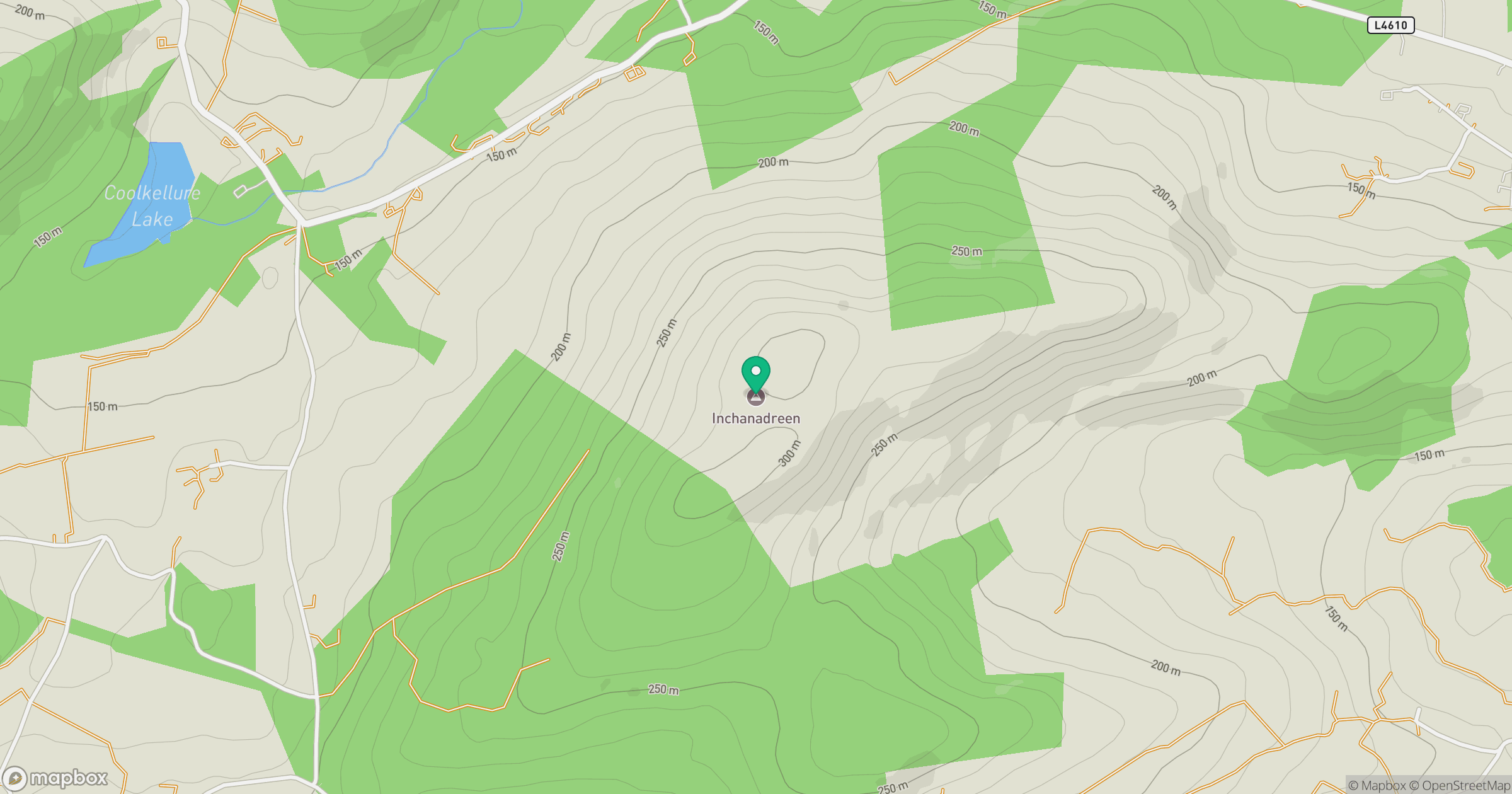
Grid reference: W191535
View on OpenStreetMapOpens a map in a new tab, centred on the hill.
Hills within 30 km
Straight-line distance, not a walking route or confirmation of access.
Coolsnaghtig [Carrigaphuca]
296m
Nowen Hill [Cnoc na nAbhann]
535m
Shehy More [Carrigmount] [An tSeithe Mhor]
546m
Carrigfadda [An Charraig Fhada]
312m
Douce Mountain [Damhais]
476m
No comments yet. Be the first.