

Holme Fell
Good walks are even better shared.
NY3100 : A cairn on Holme Fell
David Brown Photo source
Overview
Holme Fell
Holme Fell is a charming Marilyn peak nestled in the scenic Lake District, with an elevation of 487 meters. Known for its striking views and varied terrain, it's a gem of a hike that's just waiting for boots to tread its paths.
Geology
Situated in the Borrowdale Volcanic Group, Holme Fell is primarily composed of ancient volcanic rock. Evidence of glaciation can be seen in its beautifully shaped valleys and rugged outcrops, making it a fascinating study for geology enthusiasts—or just a good excuse to take a breather while you admire the scenery!
Recommended Route
One of the most popular routes starts from the Old Dungeon Ghyll. This scenic trail is approximately 6.4 kilometers long and takes about 2.5 hours to complete. The path is well-marked, making it an ideal choice for both seasoned hikers and those a little less experienced. Just remember to keep your eye out for the gorgeous views of the surrounding peaks!
Summit Features
Upon reaching the summit, hikers are greeted by a prominent cairn. It’s the perfect spot to relax and refuel with a snack, taking in the breathtaking 360-degree views that stretch across the region.
Terrain Type
The terrain is a delightful mix of grassy fields and rocky patches, providing a diverse hiking experience that keeps you on your toes (and not just because of the occasional bog!).
Views
From the summit, you'll be treated to magnificent views of the Langdale Pikes and Coniston Old Man, especially stunning in spring and autumn when the skies are clear and the landscapes are alive with colour.
Hazards
As always, hikers should be mindful of slip hazards on wet rocks, especially after a good rain. The weather can change rather quickly in this region, so pack a waterproof just in case you encounter a bit of Lake District drizzle!
Access
The nearest parking is at the Old Dungeon Ghyll car park, which also offers some light refreshment options for when you’re in need of a pick-me-up. A reliable bus service operates from Ambleside, making this trek accessible for those on foot or without wheels.
Facilities
If you fancy a nice cuppa after your walk, the nearby café serves up some delightful treats. Toilets are also available at the car park, which is always a bonus!
History
The name 'Holme' derives from Old Norse, reflecting the region’s rich heritage. Historically, this mountain has lured generations of hikers and artists, drawn to its stunning landscapes and the tranquility of nature.
So whether you’re a seasoned hillwalker or just looking for a pleasant day out, Holme Fell is sure to deliver a delightful experience.
Happy hiking!
Explore routes near Holme Fell
Walks starting near this hill. Open a route to check its map, distance and full itinerary.
Tarn Hows Fast Route
View route
Coniston to Tarn Hows: Monk Coniston Gardens and Woodland Circuit
View route
Great Carrs Halifax Wreckage from Wrynose Pass
View route
Bow Fell from Langdale
View route
Route planning notes
These notes describe possible approaches. Check a route's map and access information when planning your walk.
Old Dungeon Ghyll to Holme Fell
A scenic route featuring picturesque views and a well-defined path, ideal for a day hike.
Make a day of it, together
Find someone to share the walk with, or organise a day out along a route you like.
Photo Gallery
View all Photo could not load
NY3100 : A cairn on Holme Fell
David Brown
 Photo could not load
NY3100 : Cairn on Holme Fell
Rob Noble
 Photo could not load
NY3100 : Holme Fell
Rick Hole
 Photo could not load
NY3100 : Cairn on Ivy Crag
Bill Boaden
 Photo could not load
NY3100 : Harrison Stickle centre skyline
John Fielding
 Photo could not load
NY3100 : Cairn on Ivy Crag
Peter S
 Photo could not load
NY3100 : Cairn on Ivy crag.
steven ruffles
 Photo could not load
NY3100 : Grassy col on Holme Fell
Peter S
 Photo could not load
NY3100 : Holme Fell
Shaun Ferguson

NY3100 : Holme Fell Summit
Michael Graham
Hill facts and local notes
Classifications
Elevation
316m
1,036 ft
Prominence
165m
Coordinates
54.3963, -3.0565
NY315006
OS Map
90
Explorer: OL7N
At the Summit
The summit features a prominent cairn and a delightful rocky outcrop, perfect for a well-earned snack break and some photos.
Terrain & Geology
Primarily composed of volcanic rock from the Borrowdale Volcanic Group, with some evidence of ancient glaciation.
Views & Scenery
Breathtaking views of the surrounding fells, including the Langdale Pikes and Coniston Old Man.
History & Heritage
Name Origin
The name 'Holme' is derived from Old Norse, meaning 'island' or 'hollow', likely referring to its position amidst the fells.
Historical Significance
Holme Fell has been a popular hiking destination since the Victorian era, attracting nature lovers and artists alike.
Getting There & Facilities
Parking
Parking is available at the Old Dungeon Ghyll car park, which is a 20-minute walk from the trailhead.
Public Transport
Buses operate from Ambleside to the Old Dungeon Ghyll, making it accessible for those using public transport.
Nearby Facilities
There is a café nearby for refreshments, as well as public toilets at the Old Dungeon Ghyll car park.
Safety Information
Known Hazards
- Slippery rocks after rain and sudden changes in weather conditions.
General Safety Tips
- Check weather conditions before setting out
- Carry appropriate clothing and equipment
- Let someone know your planned route
- Take a map, compass, and GPS device
- Carry emergency supplies: food, water, first aid kit, torch
Hills
Some common questions about the hills answered
Are there group walks up Holme Fell?
Many walkers use Walkmates to join or organise walks with others. You can check for group walks around Holme Fell through the maps
Are there other walkers around Holme Fell?
Activity varies by location and time, but Walkmates lets you see whether others have shared walks or shown interest in this area. Find other people through the walking friends search walking friends for Holme Fell search or of course create your own walk for Holme Fell
Can I organise a walk to Holme Fell?
Yes. If there aren’t any walks listed already, you can create a walk and make it available for others to join.
If you're signed up to Walkmates, you can create a walk to Holme Fell.
How do I find a walk up this hill?
There are often multiple ways to walk this hill, depending on experience and route preference. Walkmates helps you explore walks and routes that others have shared.
Can I suggest a new route up Holme Fell?
Yes. You can suggest or create routes to share with others. Walkmates focuses on the social side of walking, so routes are used to help people organise walks and explore areas together, rather than as detailed navigation tools or route libraries.
Other uses really appreciate knowledgeable walkers sharing their routes. Share your favourite route to Holme Fell here
The is an error or something incorrect about this hill. How do I let you know?
We always strive to keep the information on Walkmates as accurate as possible. If you find an error, please let us know through the contact form and we'll aim to correct it as quickly as possible
Community Discussion
Comments
Location
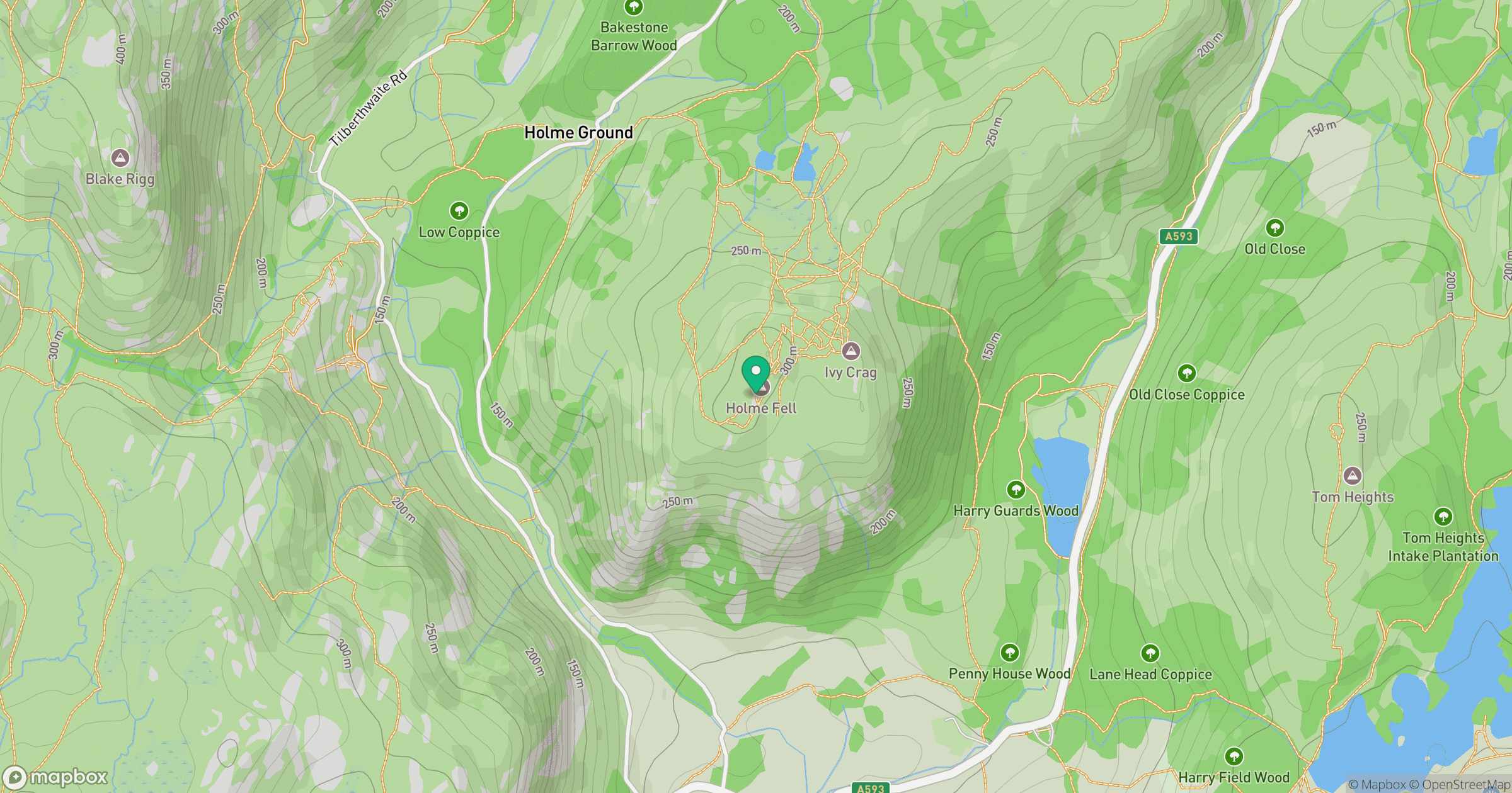
Grid reference: NY315006
View on OpenStreetMapOpens a map in a new tab, centred on the hill.

No comments yet. Be the first.