
Deuchar Hill
Good walks are even better shared.
Overview
Deuchar Hill: A Hidden Gem in the Scottish Highlands
Nestled in the heart of the Scottish Highlands, Deuchar Hill effortlessly combines hiking adventure with spectacular landscapes. With an elevation of 518 meters, it may not be the tallest hill, but it offers a rewarding experience for all who venture its path.
Geology
Deuchar Hill is predominantly made of ancient volcanic rock, a time capsule that tells the story of massive geological changes over the ages. The dramatic, rugged terrain has been sculpted by the merciless forces of glacial activity, giving hikers a chance to witness nature's artistry first-hand. Just don’t forget to look down at your shoes – no one wants to explain why they have mud-filled boots at the pub!
Routes
One of the most recommended routes is the journey from Carron Valley, which leads you through picturesque forest trails. With a distance of approximately 6 km, this moderate hike takes around 2.5 hours to complete, ensuring you have ample time to soak in the stunning scenery (and maybe tackle the odd snack break or two).
Summit Features
As you approach the summit, you'll be greeted by a quaint cairn that begs for a photo-op. The trig point here signals the highest point of your adventure, and it makes for the ideal spot to snap that coveted summit selfie while you revel in your achievements.
Terrain Type
The terrain on Deuchar Hill is a blend of grassy slopes interspersed with rocky outcrops, taking you on a delightful rollercoaster ride as you ascend. Just a gentle reminder though: some sections can be a tad boggy, so your boots may encounter some uninvited water features!
Views
From the summit, don’t miss the epic views of the rolling hills and valleys surrounding you. Look to the horizon and you might just catch a glimpse of the well-known peaks of the Scottish Highlands — a truly exasperatingly beautiful sight, especially when you realise they’re a bit taller than our star of the day!
Hazards
It’s important to stay safe on your adventure. Watch out for slippery rocks, particularly after rain, and approach boggy areas with care — it could be a surprise splash zone! Sturdy footwear is highly encouraged.
Nearby Summits
If you fancy a doubleheader, consider exploring nearby peaks like Ben Venue and Ben Lomond. These summits offer additional challenges and unparalleled views that are well worth the effort.
Access
Getting to Deuchar Hill is relatively straightforward. The nearest parking area is located at Carron Valley Forest Car Park, ensuring you’re never too far from the trailhead. Public transport links can be sparse, so a quick taxi ride from Denny (the nearest town, about 12 km away) could be a wise choice.
Facilities
While Deuchar Hill does not host any facilities on-site, make your way to Denny for amenities. Enjoy a comforting cup of coffee or stock up on some well-earned treats post-hike to help celebrate your adventure.
History
The name 'Deuchar' stems from the Gaelic 'deoch', meaning 'drink', possibly relating to the nearby water reservoirs. This hill has become a cherished spot for local hikers, truly standing as a testament to the natural beauty and recreational opportunities Scotland has to offer.
So, lace up those hiking boots, pack a trusty snack, and pay a visit to Deuchar Hill – you never know what adventures await you just around the next bend!
Happy hiking!
Explore routes near Deuchar Hill
Public walks starting within 80 km of this hill. Nearby does not mean a route reaches the summit; check its map and access before setting out.
Forfar to Lunanhead: East Road and the Ditches Walk
View route
Club outing: Auchnafree Hill (shared-car departure)
View route
Club outing: Lomond Hills (shared-car departure)
View route
Club outing: Carn a’ Gheoidh (shared-car departure)
View route
Route planning notes
These notes describe possible approaches, not verified navigable routes or permission to cross land. Check current paths, local access rules and conditions before setting out.
Carron Valley to Deuchar Hill
A scenic route starting from Carron Valley, weaving through forest paths before ascending to the summit.
Make a day of it, together
Find someone to share the walk with, or organise a day out along a route you like.
Hill facts and local notes
Classifications
Elevation
297m
976 ft
Prominence
101m
Coordinates
56.7527, -2.8767
NO464626
OS Map
44
Explorer: 389
At the Summit
The summit features a modest cairn which offers a great resting spot. The trig point provides the perfect opportunity for a classic hiking selfie!
Terrain & Geology
Deuchar Hill is primarily composed of ancient volcanic rock, which has been shaped by glacial activity over millennia. The rugged terrain provides a glimpse into Scotland's geological past, showcasing unique features formed by erosion.
Views & Scenery
From the summit, hikers can enjoy breathtaking views over the surrounding valleys, and on a clear day, the distant peaks of the Scottish Highlands are a sight to behold. Look out for the enchanting Carron Valley Reservoir below, glittering in the sun.
History & Heritage
Name Origin
The name 'Deuchar' is believed to derive from the Gaelic word 'deoch', meaning 'drink', possibly referring to the refreshing waters of the nearby reservoirs.
Historical Significance
Deuchar Hill has been a favourite spot for local hikers and nature lovers, often enjoyed for its tranquil setting and stunning landscapes.
Getting There & Facilities
Check current local access restrictions, parking rules and transport timetables before travelling. These notes do not confirm public access to the summit.
Parking
The nearest parking area is at Carron Valley Forest Car Park, which accommodates several vehicles and has access to the trails leading up to Deuchar Hill.
Public Transport
Public transport options are limited; however, local buses run services to nearby towns like Denny. A short taxi ride can also take you to the Carron Valley area.
Nearby Facilities
There are no facilities directly on Deuchar Hill, but Denny offers a range of cafes and shops where you can stock up on essentials before your hike.
Safety Information
Known Hazards
- Watch out for slippery rocks, especially after rain. The boggy sections can be deceptive, so sturdy footwear is highly recommended!
General Safety Tips
- Check weather conditions before setting out
- Carry appropriate clothing and equipment
- Let someone know your planned route
- Take a map, compass, and GPS device
- Carry emergency supplies: food, water, first aid kit, torch
Hills
Some common questions about the hills answered
Are there group walks up Deuchar Hill?
Many walkers use Walkmates to join or organise walks with others. You can check for group walks around Deuchar Hill through the maps
Are there other walkers around Deuchar Hill?
Activity varies by location and time, but Walkmates lets you see whether others have shared walks or shown interest in this area. Find other people through the walking friends search walking friends for Deuchar Hill search or of course create your own walk for Deuchar Hill
Can I organise a walk to Deuchar Hill?
Yes. If there aren’t any walks listed already, you can create a walk and make it available for others to join.
If you're signed up to Walkmates, you can create a walk to Deuchar Hill.
How do I find a walk up this hill?
There are often multiple ways to walk this hill, depending on experience and route preference. Walkmates helps you explore walks and routes that others have shared.
Can I suggest a new route up Deuchar Hill?
Yes. You can suggest or create routes to share with others. Walkmates focuses on the social side of walking, so routes are used to help people organise walks and explore areas together, rather than as detailed navigation tools or route libraries.
Other uses really appreciate knowledgeable walkers sharing their routes. Share your favourite route to Deuchar Hill here
The is an error or something incorrect about this hill. How do I let you know?
We always strive to keep the information on Walkmates as accurate as possible. If you find an error, please let us know through the contact form and we'll aim to correct it as quickly as possible
Community Discussion
Comments
Location
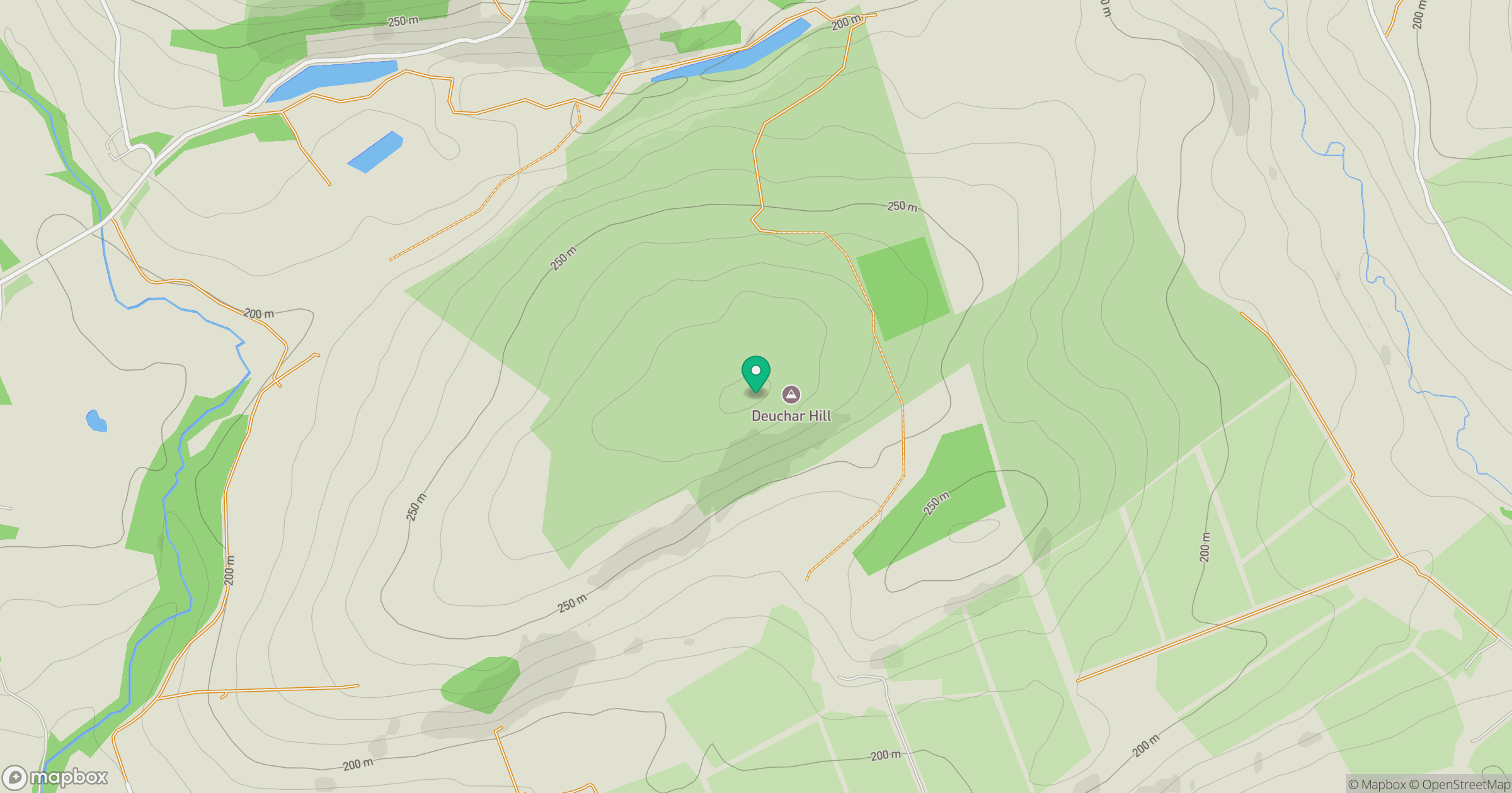
Grid reference: NO464626
View on OpenStreetMapOpens a map in a new tab, centred on the hill.
Hills within 30 km
Straight-line distance, not a walking route or confirmation of access.
No comments yet. Be the first.