

Helvellyn Lower Man
Good walks are even better shared.
Overview
Helvellyn Lower Man
Helvellyn Lower Man offers a delightful adventure for those keen on exploring the Lake District's stunning skyline. Standing at 949 meters, it may not be the tallest peak around, but it certainly packs a punch with its breathtaking views and exhilarating hikes.
Geology
This mountainous marvel is composed primarily of ancient volcanic rock, specifically andesite. These rocks tell tales of fierce volcanic activity that shaped the region millions of years ago, casting a dramatic silhouette against the sky.
Routes
Striding Edge
If you fancy a heart-racing trek, look no further than the Striding Edge route! This thrilling path hugs the ridge, providing stunning panoramas. It's a challenging jaunt and offers an adrenaline rush wrapped in some fresh Lakeland air.
Swirral Edge
For those seeking a more moderate approach, Swirral Edge gives you a chance to soak in the sights without too much heart-pounding stress. This idyllic route meanders through stunning landscapes, perfect for a leisurely stroll or a casual lunch break with a view.
Summit Features
At the summit, you’ll find a proud stone cairn and a trig point standing as a testament to the mountain's majesty. It's a popular spot for selfies, but beware of the blustery winds—your hat might take flight!
Terrain
Expect a mix of rocky patches and lush grassy areas. Just be wary of occasional bogginess, especially after rain, but don’t let that dampen your spirit—literally.
Views
From the top, you’ll be greeted with views that’ll leave you breathless—both from the climb and the sheer beauty of the scene! Glance upon Skiddaw and the calming waters of Ullswater, especially stunning during late spring or summer.
Hazards
As with any great adventure, hazards lurk in the shadows. Weather changes can be abrupt, so check the forecast before you go. The rocky paths demand good grip, so sturdy boots and a steady step are essential to avoid an unplanned dip!
Nearby Summits
Don’t miss the opportunity to explore nearby peaks like Helvellyn and Catstycam, both of which are wonderful companions on your mountain escapade.
Access
Parking can fill up quickly in Glenridding, so it’s wise to arrive early to secure a spot. If you’re relying on public transport, regular buses will whisk you to the village, avoiding the hassle of parking altogether.
Facilities
Glenridding isn't just a gateway to the mountains; it’s also home to quaint cafés and shops. Pop into the famed Helvellyn Café for a pre-hike breakfast!
History
The name ‘Helvellyn’ has roots tracing back to Old Norse, suggesting a rich historical backdrop that enhances the charm of your hike.
Whether you’re an experienced hiker or simply someone looking to catch a glimpse of the stunning Lake District scenery, Helvellyn Lower Man is well worth the effort. Gear up and get ready for an unforgettable day out in the wild!
Explore routes near Helvellyn Lower Man
Walks starting near this hill. Open a route to check its map, distance and full itinerary.
Helvellyn via Striding Edge
View route
Striding Edge, Helvellyn and Catstye Cam
View route
Derwentwater Walk: full lakeside circuit from Keswick
View route
Bow Fell from Langdale
View route
Route planning notes
These notes describe possible approaches. Check a route's map and access information when planning your walk.
Striding Edge
A thrilling route that traverses along a narrow ridge, offering breathtaking views and a sense of adventure.
Swirral Edge
A more moderate route that starts from Glenridding and ascends to the summit via Swirral Edge, providing a gentler option for ascent.
Make a day of it, together
Find someone to share the walk with, or organise a day out along a route you like.
Photo Gallery
View all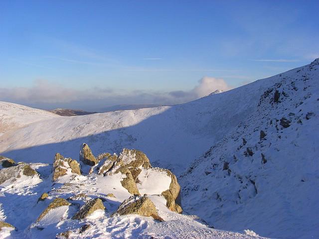 Photo could not load
NY3315 : View across a cove from Browncove Crags
Andrew Smith
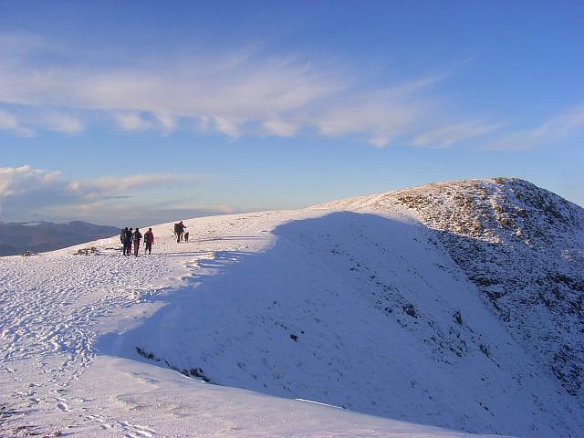 Photo could not load
NY3315 : Helvellyn Lower Man
Andrew Smith
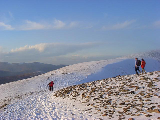 Photo could not load
NY3315 : Col between Helvellyn and Helvellyn Lower Man
Andrew Smith
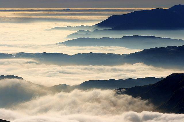 Photo could not load
NY3315 : View South West From Low Man
Mick Garratt
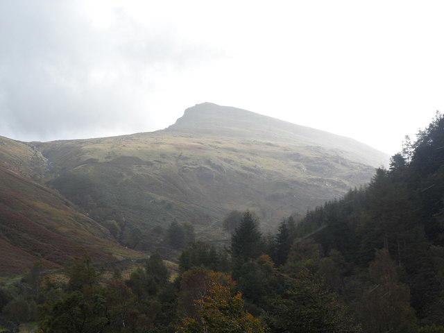 Photo could not load
NY3315 : Helvellyn from Thirlmere Car Park
Anthony Parkes
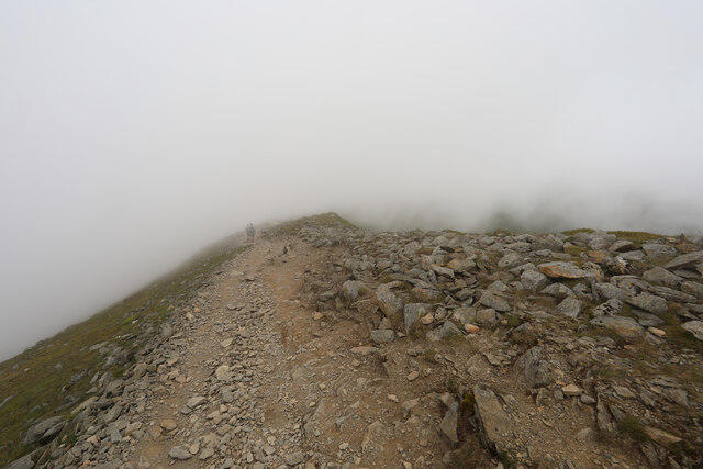 Photo could not load
NY3315 : Descending from Lower Man
Andy Waddington
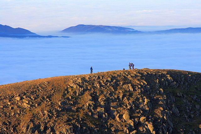 Photo could not load
NY3315 : Lower Man
Mick Garratt
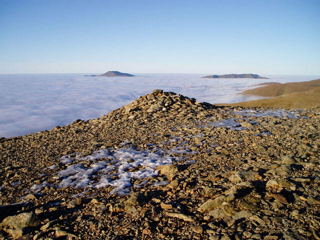 Photo could not load
NY3315 : Helvellyn Lower Man
David Gruar
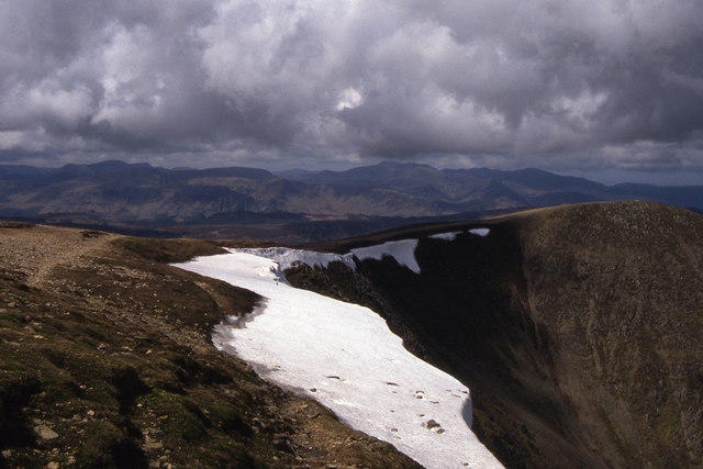 Photo could not load
NY3315 : Looking towards Lower Man from Helvellyn summit
Colin Park
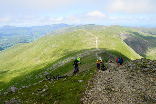
NY3315 : Looking down the arete from Lower Man
Bill Boaden
Hill facts and local notes
Classifications
Elevation
924m
3,033 ft
Prominence
18m
Coordinates
54.5308, -3.0254
NY337155
OS Map
90
Explorer: OL5S
At the Summit
The summit features a stone cairn and an impressive trig point that marks the highest point, offering a perfect photo opportunity (if you can manage to keep your hat on in the wind!).
Terrain & Geology
Helvellyn Lower Man is primarily composed of volcanic rocks, specifically andesite, formed during intense volcanic activity millions of years ago, which gives the mountain its rugged appearance.
Views & Scenery
Panoramic views of surrounding peaks including Skiddaw and the Helvellyn range, as well as the shimmering waters of Ullswater and Thirlmere.
History & Heritage
Name Origin
The name 'Helvellyn' is thought to derive from the Old Norse words 'hellir' (cave) and 'vellyn' (lake), indicating a landscape shaped by volcanic origins.
Historical Significance
Helvellyn and its lower man have been a popular destination for walkers since the Victorian era, and its rugged beauty has inspired numerous poets and artists.
Getting There & Facilities
Parking
The nearest parking is at Glenridding, where there are several pay-and-display car parks that fill up quickly, so an early start is prudent!
Public Transport
Regular buses connect to Glenridding from Penrith and surrounding areas, making it accessible even if you forgot your car keys (again).
Nearby Facilities
Cafés and shops are available in Glenridding, including the famous Helvellyn Café which offers a hearty breakfast to fuel your climb. Public toilets are available near the parking areas.
Safety Information
Known Hazards
- Unpredictable weather can lead to rapid changes in visibility; rocky paths can be slippery when wet, especially on the edges.
General Safety Tips
- Check weather conditions before setting out
- Carry appropriate clothing and equipment
- Let someone know your planned route
- Take a map, compass, and GPS device
- Carry emergency supplies: food, water, first aid kit, torch
Hills
Some common questions about the hills answered
Are there group walks up Helvellyn Lower Man?
Many walkers use Walkmates to join or organise walks with others. You can check for group walks around Helvellyn Lower Man through the maps
Are there other walkers around Helvellyn Lower Man?
Activity varies by location and time, but Walkmates lets you see whether others have shared walks or shown interest in this area. Find other people through the walking friends search walking friends for Helvellyn Lower Man search or of course create your own walk for Helvellyn Lower Man
Can I organise a walk to Helvellyn Lower Man?
Yes. If there aren’t any walks listed already, you can create a walk and make it available for others to join.
If you're signed up to Walkmates, you can create a walk to Helvellyn Lower Man.
How do I find a walk up this hill?
There are often multiple ways to walk this hill, depending on experience and route preference. Walkmates helps you explore walks and routes that others have shared.
Can I suggest a new route up Helvellyn Lower Man?
Yes. You can suggest or create routes to share with others. Walkmates focuses on the social side of walking, so routes are used to help people organise walks and explore areas together, rather than as detailed navigation tools or route libraries.
Other uses really appreciate knowledgeable walkers sharing their routes. Share your favourite route to Helvellyn Lower Man here
The is an error or something incorrect about this hill. How do I let you know?
We always strive to keep the information on Walkmates as accurate as possible. If you find an error, please let us know through the contact form and we'll aim to correct it as quickly as possible
Community Discussion
Comments
Location
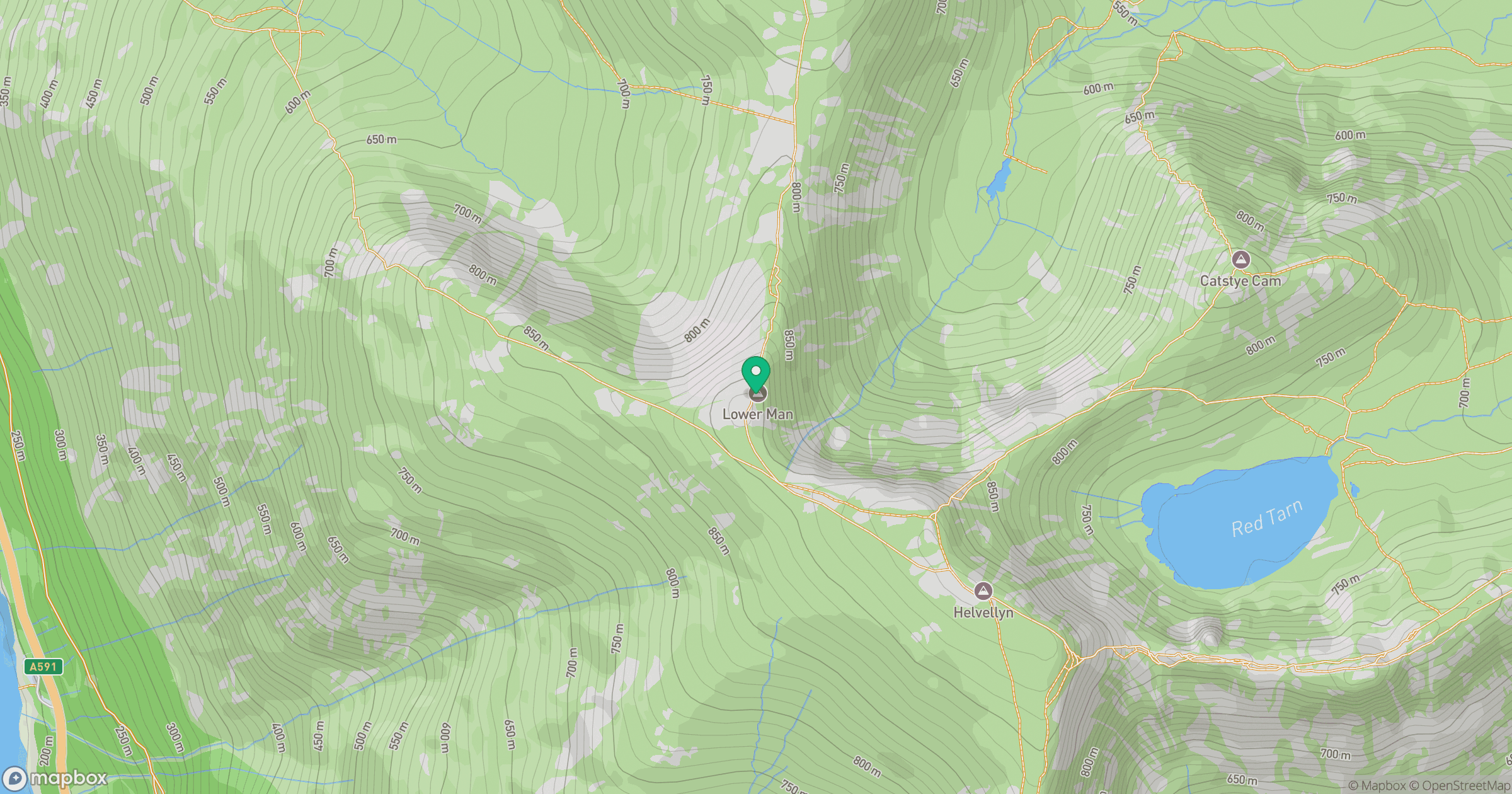
Grid reference: NY337155
View on OpenStreetMapOpens a map in a new tab, centred on the hill.

No comments yet. Be the first.