

Hart Crag
Good walks are even better shared.
NY3611 : Cairn on Hart Crag
Peter Johnson Photo source
Overview
Hart Crag: Your Next Adventure
Overview
Hart Crag, standing proudly at 803 meters, is a gem of the Lake District. Not to be confused with some other crags, it offers both challenge and beauty.
Geology
You'll find Hart Crag primarily comprised of volcanic rock. Yes, that’s right—it's not just any ordinary rock, it’s the kinda stuff that once erupted with gusto! If it could talk, it would have some explosive stories to share.
Getting There
Most adventurers start at Hartsop; think of it as the gateway to your epic ascent. Parking can get a bit tight—imagine playing musical chairs with your car. But once you hit the trails, it’s worth the effort.
Routes
There are several ways to tackle Hart Crag, but the From Hartsop route is a favourite. At about 9.6 km, it features a heart-pumping climb, leading to jaw-dropping views at the top. The From Kirkstone Pass route is a shorter 6.2 km journey that is slightly less strenuous.
Summit Features
Pack a camera; the summit’s cairn and trig point scream to be photographed! You might feel you’re on top of the world, and truth be told, you nearly are.
Terrain
The terrain consists of rocky paths and grassy slopes, with some boggy sections to keep you on your toes. Good shoes (and perhaps a little luck) will serve you well here!
Views
Oh, the views! Standing at the summit, look out over Ullswater and towards the notable peaks like Helvellyn--it’s a sight to see!
Hazards
As with many mountains in the Lake District, the weather can turn quicker than a cat on a hot tin roof. Watch your step on damp stones, as they have been known to provide an unexpected slip!
Nearby Summits
On your journey, why not also keep an eye on nearby peaks like Fairfield or Place Fell? They’re just waiting to be conquered as well.
Conclusion
So, are you ready to trot off to Hart Crag? With its stunning views and varying routes, it’s an experience not to be missed!
Happy hiking!
Remember: The best view comes after the hardest climb, and those who visit Hart Crag certainly won’t be disappointed!
Explore routes near Hart Crag
Walks starting near this hill. Open a route to check its map, distance and full itinerary.
Striding Edge, Helvellyn and Catstye Cam
View route
Helvellyn via Striding Edge
View route
Bow Fell from Langdale
View route
Tarn Hows Fast Route
View route
Route planning notes
These notes describe possible approaches. Check a route's map and access information when planning your walk.
From Hartsop
A popular route starting near Hartsop, ascending via Deepdale and a steep climb to the summit of Hart Crag.
From Kirkstone Pass
An alternative route from Kirkstone Pass, offering stunning views and a straightforward ascent.
Make a day of it, together
Find someone to share the walk with, or organise a day out along a route you like.
Photo Gallery
View all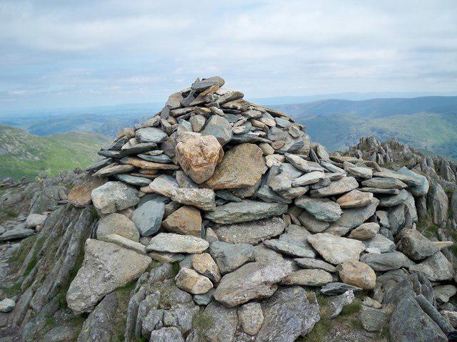 Photo could not load
NY3611 : Cairn on Hart Crag
Peter Johnson
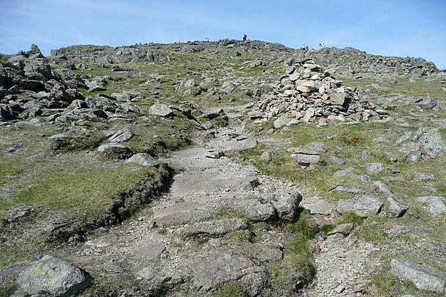 Photo could not load
NY3611 : Towards Hart Crag
Graham Horn
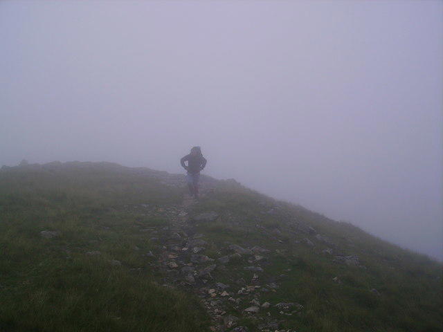 Photo could not load
NY3611 : Approaching Hart Crag
Michael Graham
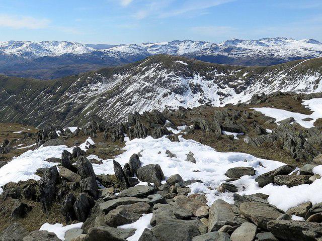 Photo could not load
NY3611 : View from Hart Crag
Andrew Curtis
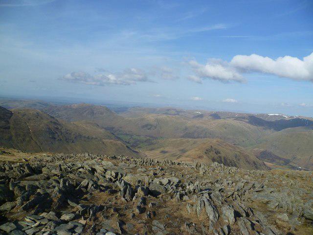 Photo could not load
NY3611 : On Hart Crag
Michael Graham
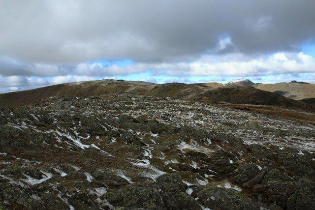 Photo could not load
NY3611 : Exposed rock on Hart Crag
Graham Robson
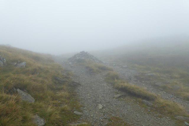 Photo could not load
NY3611 : Cairns near the summit
DS Pugh
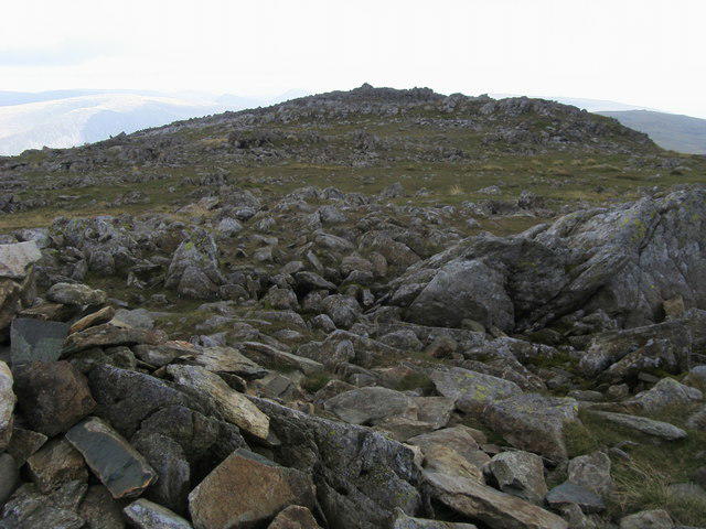 Photo could not load
NY3611 : Hart Crag Summit
Shaun Ferguson
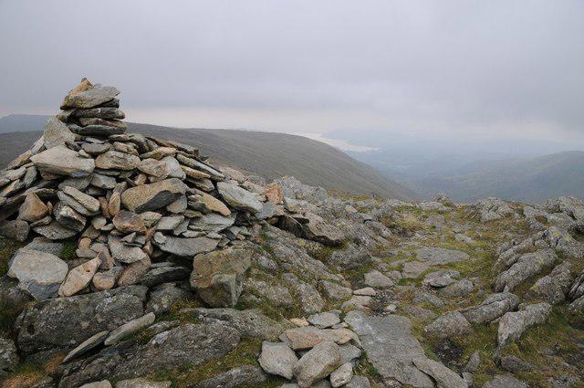 Photo could not load
NY3611 : Cairn on the summit of Hart Crag
Philip Halling
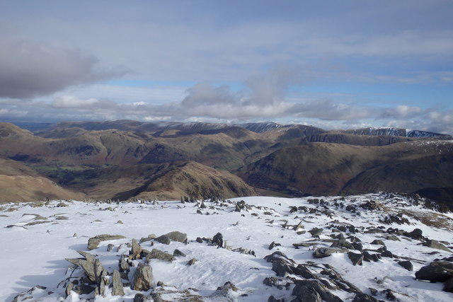
NY3611 : On Hart Crag
Michael Graham
Hill facts and local notes
Classifications
Elevation
823m
2,700 ft
Prominence
51m
Coordinates
54.4928, -2.9770
NY368112
OS Map
90
Explorer: OL5S
At the Summit
The summit features a substantial cairn, providing a perfect photo opportunity. There is also a trig point nearby, which is like the cherry on top of an already magnificent cake.
Terrain & Geology
Hart Crag is primarily composed of volcanic rock, specifically andesite, which gives the summit its rugged terrain. The surrounding area is also rich in slate deposits.
Views & Scenery
Dramatic views of Ullswater, the Helvellyn range, and other surrounding peaks such as Place Fell and Fairfield.
History & Heritage
Name Origin
The name 'Hart Crag' comes from the Old Norse word 'herðr', meaning 'stag', reflecting the wildlife that once roamed these hills.
Historical Significance
Hart Crag has been frequented by hikers for centuries and remains a pivotal point in various walking routes in the Lake District.
Getting There & Facilities
Parking
There is a small car park at Hartsop, which provides access to various routes. Be advised that on busy weekends, finding a spot may require a bit of luck.
Public Transport
Stagecoach buses run to Hartsop from Penrith, offering a sensible choice for those preferring not to drive.
Nearby Facilities
While there are no facilities at the summit, the nearby village of Patterdale offers several cafes and pubs, perfect for a post-hike pint or a slice of cake.
Safety Information
Known Hazards
- Be cautious of sudden weather changes, as the weather can shift quicker than a squirrel at a picnic. Slippery rocks, especially when damp, can make for a thrilling yet risky adventure.
General Safety Tips
- Check weather conditions before setting out
- Carry appropriate clothing and equipment
- Let someone know your planned route
- Take a map, compass, and GPS device
- Carry emergency supplies: food, water, first aid kit, torch
Hills
Some common questions about the hills answered
Are there group walks up Hart Crag?
Many walkers use Walkmates to join or organise walks with others. You can check for group walks around Hart Crag through the maps
Are there other walkers around Hart Crag?
Activity varies by location and time, but Walkmates lets you see whether others have shared walks or shown interest in this area. Find other people through the walking friends search walking friends for Hart Crag search or of course create your own walk for Hart Crag
Can I organise a walk to Hart Crag?
Yes. If there aren’t any walks listed already, you can create a walk and make it available for others to join.
If you're signed up to Walkmates, you can create a walk to Hart Crag.
How do I find a walk up this hill?
There are often multiple ways to walk this hill, depending on experience and route preference. Walkmates helps you explore walks and routes that others have shared.
Can I suggest a new route up Hart Crag?
Yes. You can suggest or create routes to share with others. Walkmates focuses on the social side of walking, so routes are used to help people organise walks and explore areas together, rather than as detailed navigation tools or route libraries.
Other uses really appreciate knowledgeable walkers sharing their routes. Share your favourite route to Hart Crag here
The is an error or something incorrect about this hill. How do I let you know?
We always strive to keep the information on Walkmates as accurate as possible. If you find an error, please let us know through the contact form and we'll aim to correct it as quickly as possible
Community Discussion
Comments
Location
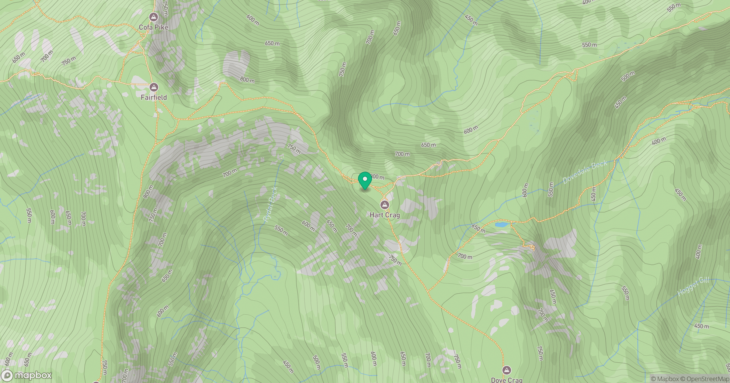
Grid reference: NY368112
View on OpenStreetMapOpens a map in a new tab, centred on the hill.

No comments yet. Be the first.