

Gog Magog Hills
Good walks are even better shared.
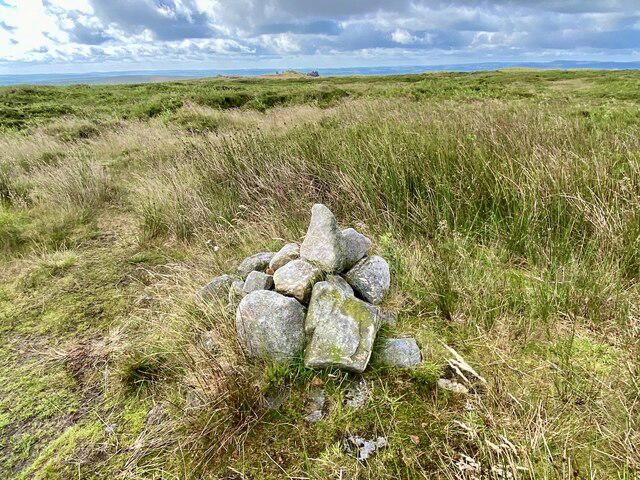
TL4953 : Footpath at Wandlebury
Bob Jones Photo source
Overview
Gog Magog Hills
Overview
The Gog Magog Hills, located just south of the historic city of Cambridge, offer a delightful escape into nature with their rolling chalk hills and stunning vistas. At a modest elevation of 66 meters, they might not be the highest peaks in the UK, but they certainly pack a punch when it comes to beauty and panoramic views.
Geology
The hills are primarily composed of chalk, a result of geological processes dating back to the Cretaceous period. This ancient seabed has given rise to some spectacular landscapes, making Gog Magog a notable example of the area's geological history. Keep an eye out for interesting flint and other geological features scattered throughout the hills.
Routes
One popular route is the Gog Magog Hill Circular Walk, which covers about 5.5 km and typically takes around 1.5 hours to complete. It's rated as easy, making it suitable for families and those looking to unwind while basking in nature.
Summit Features
Reaching the summit affords visitors a wonderful grassy knoll, perfect for a picnic or just kicking back while soaking in the scenery. Don’t forget your camera, as the spectacular views are worth every click!
Terrain Type
The terrain varies from well-trodden paths to grassy hillsides, generally easy to navigate. It’s advisable to wear a good pair of walking shoes, especially after the rain, where a few muddy patches may challenge your footwear choices.
Views
From the summit, you can see far and wide on a clear day. The iconic spires of Cambridge University can just about be made out in the distance, among other landmarks. The best times to enjoy the views are during the spring and autumn, when the scenery is vibrant and the light is just right—get your cameras ready!
Hazards
While the route is generally safe, watch for muddy patches post-rain and be respectful of any livestock you might encounter along the way. Remember to stick to the paths to keep the landscape pristine and enjoy nature without any uninvited surprises.
Nearby Summits
A short distance away is Nine Wells, standing at 60 meters, which is another lovely spot to visit for those who fancy a bit more exploring.
Access
Reaching Gog Magog is simple, with the nearest parking available at Gog Magog Hills Car Park on Gog Magog Way. Parking is free, though spaces can fill up fast on sunny days. If you prefer public transport, buses run frequently to Cambridge city centre, making the transition from city life to hill-walking smooth as butter.
Facilities
While no facilities are on-site, the nearby city of Cambridge is packed with cafés, shops, and public conveniences, ensuring you're well-catered for both before and after your hike.
History
Legend has it that the name 'Gog Magog' may refer to ancient giants, adding a sense of intrigue to your visit. These hills have played a significant role in the cultural history of the region and continue to be a beloved spot for recreational activities.
So, lace up your walking boots, grab your walking stick or a friendly dog, and set off for a lovely jaunt in the Gog Magog Hills—where the only thing higher than the views might be your spirits!
Explore routes near Gog Magog Hills
Walks starting near this hill. Open a route to check its map, distance and full itinerary.
Wandlebury and the Roman Road: Gog Magog woodland and chalk ridge
View route
Fulbourn Fen and Fleam Dyke: chalk ridge to Mutlow Hill
View route
Cambridge Colleges and the Backs Walk: Route Map
View route
Trumpington Meadows fungal foray walk
View route
Route planning notes
These notes describe possible approaches. Check a route's map and access information when planning your walk.
Gog Magog Hill Circular Walk
A scenic loop that takes you around the enchanting hills, showcasing sweeping views and opportunities to spot local wildlife.
Make a day of it, together
Find someone to share the walk with, or organise a day out along a route you like.
Photo Gallery
View all Photo could not load
TL4953 : Footpath at Wandlebury
Bob Jones
 Photo could not load
TL4953 : Hide at Wandlebury Country Park
Gordon Brown
Hill facts and local notes
Classifications
Elevation
77m
253 ft
Prominence
37m
Coordinates
52.1624, 0.1843
TL494538
OS Map
154
Explorer: 209
At the Summit
The summit features a small grassy knoll with lovely views, and on clear days, you might even spot the spires of Cambridge's famous colleges on the horizon.
Terrain & Geology
The Gog Magog Hills are predominantly composed of chalk, indicative of the ancient seabed that once inundated this area during the Cretaceous period. The resulting landscape features rolling hills and valleys, covered with a variety of flora and fauna.
Views & Scenery
On a clear day, the view from Gog Magog Hills can stretch for miles, with landmarks like the city of Cambridge and the River Cam visible in the distance.
History & Heritage
Name Origin
The name 'Gog Magog' is thought to stem from local legend and folklore, possibly referring to ancient giants.
Historical Significance
These hills have been a prominent feature in the landscape for centuries, used historically for grazing, recreation, and various cultural events.
Getting There & Facilities
Parking
Gog Magog Hills Car Park located off Gog Magog Way. Spaces are limited, so arrive early to snag a good spot. Parking is free.
Public Transport
Regular bus services to Cambridge city centre, followed by a short walk or cycle to the hills.
Nearby Facilities
There are numerous cafés and facilities in Cambridge, with several located just a short drive or bus ride away from the hills.
Safety Information
Known Hazards
- Watch out for muddy patches after rainfall, and please mind the livestock if you wander off the beaten path.
General Safety Tips
- Check weather conditions before setting out
- Carry appropriate clothing and equipment
- Let someone know your planned route
- Take a map, compass, and GPS device
- Carry emergency supplies: food, water, first aid kit, torch
Hills
Some common questions about the hills answered
Are there group walks up Gog Magog Hills?
Many walkers use Walkmates to join or organise walks with others. You can check for group walks around Gog Magog Hills through the maps
Are there other walkers around Gog Magog Hills?
Activity varies by location and time, but Walkmates lets you see whether others have shared walks or shown interest in this area. Find other people through the walking friends search walking friends for Gog Magog Hills search or of course create your own walk for Gog Magog Hills
Can I organise a walk to Gog Magog Hills?
Yes. If there aren’t any walks listed already, you can create a walk and make it available for others to join.
If you're signed up to Walkmates, you can create a walk to Gog Magog Hills.
How do I find a walk up this hill?
There are often multiple ways to walk this hill, depending on experience and route preference. Walkmates helps you explore walks and routes that others have shared.
Can I suggest a new route up Gog Magog Hills?
Yes. You can suggest or create routes to share with others. Walkmates focuses on the social side of walking, so routes are used to help people organise walks and explore areas together, rather than as detailed navigation tools or route libraries.
Other uses really appreciate knowledgeable walkers sharing their routes. Share your favourite route to Gog Magog Hills here
The is an error or something incorrect about this hill. How do I let you know?
We always strive to keep the information on Walkmates as accurate as possible. If you find an error, please let us know through the contact form and we'll aim to correct it as quickly as possible
Community Discussion
Comments
Location
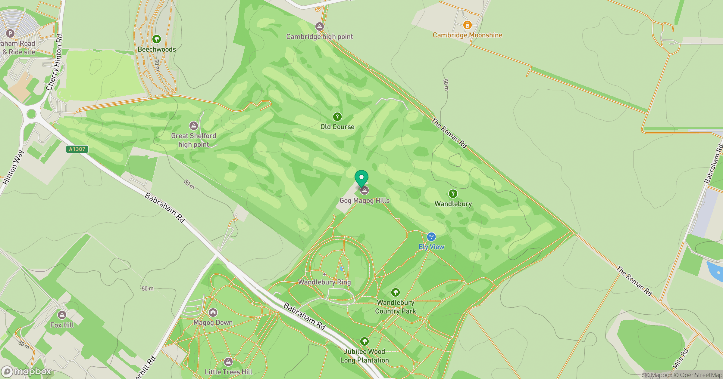
Grid reference: TL494538
View on OpenStreetMapOpens a map in a new tab, centred on the hill.
No comments yet. Be the first.