
Gartmorn Hill
Good walks are even better shared.
Overview
Gartmorn Hill: A Gem in Central Scotland
Nestled in the heart of Central Scotland, Gartmorn Hill offers both accessible hiking and stunning vistas, making it a must-visit for walkers of all skill levels. With an elevation of 260 meters, it may not be the tallest of the hills, but what it lacks in height, it more than makes up for in beauty and charm.
Geology
Gartmorn Hill's geological features primarily consist of ancient sedimentary rocks, telling tales of the landscape's past as a riverbed. Erosion and weathering have sculpted the hill into its present form, providing fascinating insights into natural processes that have unfolded over countless ages.
Routes
The most popular route starts at Lisbon Road in Sauchie. This charming path meanders through peaceful woodlands before gently guiding you up the grassy slopes to the summit. At just 2.5 km with a journey time of around 1.5 hours, it's an enjoyable trek suitable for families and casual walkers alike. Make sure your shoes are tied, otherwise, you might trip over your own enthusiasm!
Summit Features
Upon reaching the summit, you'll find a robust trig point standing proudly, alongside a modest cairn. This is the perfect spot to catch your breath, take out your sandwiches, and soak in the views, all while feeling the childlike wonder of being on top of the world.
Terrain
The terrain is mostly grassy with some rocky patches and is fairly easy to navigate, making it accessible for everyone from seasoned hikers to leisurely strollers. Just watch out for the occasional uneven ground—a reminder that nature isn't always as kind as your grandma!
Views
From the summit, the vistas are incredible. On a clear day, look out for the Ochil Hills, the sweeping Forth Valley, and the majestic Trossachs. The Wallace Monument is also visible, a fine reminder of Scotland's rich heritage. The best time to enjoy these views is in spring or early autumn when the weather’s mild and the scenery is awash with vibrant colours.
Hazards
While Gartmorn Hill is generally safe, be cautious of uneven terrain and slippery patches after rainfall. It's wise to keep an eye on the weather forecast; the Scottish weather can turn on a sixpence.
Nearby Summits
If you’re feeling adventurous, consider extending your hiking experience by exploring nearby summits such as Tullibody Hill and the Ochil Hills, each offering their own unique landscapes and experiences.
Access
Gartmorn Hill is easily accessible, with free parking at Lisbon Road car park. Public transport options include regular buses from Alloa. If you're rolling into town, Alloa is just around 2 miles away, providing all necessary amenities.
Facilities
While there are no facilities directly on the hill, Alloa is a stone's throw away with cafes, shops, and public toilets to refresh you post-hike.
History
The etymology of Gartmorn Hill hints at its lush environment, and historically, it has served as a gathering place for locals, adding a layer of cultural significance to your visit.
In Closing
Gartmorn Hill is more than just a hill; it's a fantastic day out, a slice of Scottish natural beauty that invites you to explore and enjoy. So, lace up your boots, pack a bite, and head out to embrace the great outdoors. You won't regret it!
Explore routes near Gartmorn Hill
Walks starting near this hill. Open a route to check its map, distance and full itinerary.
Devilla Forest: Bordie Loch, Moor Loch and Peppermill Dam Circuit
View route
Fallin Bing Wednesday Walk
View route
Strathallan Court Strollers and Stragglers
View route
Bridge of Allan Strollers and Stragglers
View route
Route planning notes
These notes describe possible approaches. Check a route's map and access information when planning your walk.
Lisbon Road Start
This route begins at Lisbon Road in the village of Sauchie, leading you through lush woodlands before ascending the gentle slopes of Gartmorn Hill.
Make a day of it, together
Find someone to share the walk with, or organise a day out along a route you like.
Hill facts and local notes
Classifications
Elevation
97m
318 ft
Prominence
30m
Coordinates
56.1339, -3.7408
NS919948
OS Map
58
Explorer: 366E
At the Summit
The summit features a prominent trig point, providing not only a great sense of achievement but also ample opportunity for a scenic photo or two. There's also a modest cairn to mark the top.
Terrain & Geology
Gartmorn Hill is primarily composed of sedimentary rock, with evidence of ancient riverbed formations that indicate a dynamic geological history. The hill's enduring form showcases the effects of weathering and erosion over millennia.
Views & Scenery
On a clear day, the views include the nearby Ochil Hills, the expansive Forth Valley, and far-off glimpses of the Trossachs beyond. Keep an eye out for the iconic Wallace Monument across the valley.
History & Heritage
Name Origin
The name 'Gartmorn' is believed to derive from Gaelic, meaning 'the place of the hill with a lot of plants' which reflects the area's lush vegetation.
Historical Significance
Historically, it has been a popular site for local gatherings and has ties to the nearby St. Mungo's, a key figure in Scottish Christian history.
Getting There & Facilities
Parking
There is free parking available at the Lisbon Road car park, which is conveniently located at the start of the trail.
Public Transport
Regular bus services run from Alloa to Sauchie, making it relatively easy to reach the starting point without a car. Check local schedules for availability.
Nearby Facilities
There are no facilities directly on the hill, but Alloa provides numerous cafes and shops where you can grab a bite to eat or refresh yourself. Public toilets are available in Alloa as well.
Safety Information
Known Hazards
- While not generally hazardous, uneven ground can provide occasional trip hazards. Muddy patches after rain can make the ascent a bit slippery, so tread carefully. Also, be mindful of sudden weather changes common in the region.
General Safety Tips
- Check weather conditions before setting out
- Carry appropriate clothing and equipment
- Let someone know your planned route
- Take a map, compass, and GPS device
- Carry emergency supplies: food, water, first aid kit, torch
Hills
Some common questions about the hills answered
Are there group walks up Gartmorn Hill?
Many walkers use Walkmates to join or organise walks with others. You can check for group walks around Gartmorn Hill through the maps
Are there other walkers around Gartmorn Hill?
Activity varies by location and time, but Walkmates lets you see whether others have shared walks or shown interest in this area. Find other people through the walking friends search walking friends for Gartmorn Hill search or of course create your own walk for Gartmorn Hill
Can I organise a walk to Gartmorn Hill?
Yes. If there aren’t any walks listed already, you can create a walk and make it available for others to join.
If you're signed up to Walkmates, you can create a walk to Gartmorn Hill.
How do I find a walk up this hill?
There are often multiple ways to walk this hill, depending on experience and route preference. Walkmates helps you explore walks and routes that others have shared.
Can I suggest a new route up Gartmorn Hill?
Yes. You can suggest or create routes to share with others. Walkmates focuses on the social side of walking, so routes are used to help people organise walks and explore areas together, rather than as detailed navigation tools or route libraries.
Other uses really appreciate knowledgeable walkers sharing their routes. Share your favourite route to Gartmorn Hill here
The is an error or something incorrect about this hill. How do I let you know?
We always strive to keep the information on Walkmates as accurate as possible. If you find an error, please let us know through the contact form and we'll aim to correct it as quickly as possible
Community Discussion
Comments
Location
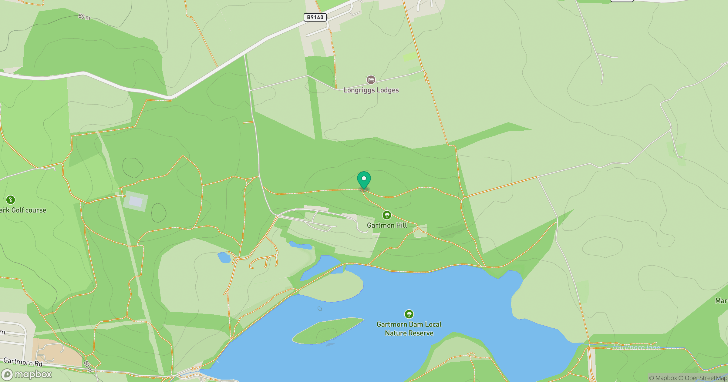
Grid reference: NS919948
View on OpenStreetMapOpens a map in a new tab, centred on the hill.


No comments yet. Be the first.