
Garravagh North Top
Good walks are even better shared.
Overview
Garravagh North Top
Nestled in the scenic County Sligo, Garravagh North Top stands tall at an elevation of 501 meters, beckoning hikers of all levels. Known for its moderate challenge, it's a beloved spot for locals and visitors alike seeking a taste of the great outdoors.
Geology
The geological makeup of Garravagh North Top is primarily granite, which not only shapes its rugged appearance but also provides a sturdy and reliable terrain for hikers. The aftermath of the last Ice Age has left a variety of glacial till in the surrounding areas, which enriches the landscape.
Routes
You have options when it comes to your ascent to the peak. The West Summit Track is a gentle climb, perfect for families and those looking for a more relaxed outing, while the East Approach tests the mettle of more seasoned hikers with a steeper gradient. Whichever path you choose, you're in for a treat!
Summit Features
Upon reaching the summit, you'll find a simple stone cairn that serves as a reassuring marker of your achievement. And, if you're lucky, you may encounter some goats soaking up the sun, who might look at you as if to say, "You did it, well done!"
Terrain Type
Expect a delightful mix of rocky outcrops and grassy slopes, interspersed with the occasional boggy patch that might try to become your new dance partner.
Views
From the peak, take a moment to soak in the stunning views of the Sligo and Leitrim hills. On a clear day, you can even catch a glimpse of the Atlantic Ocean, with the magnificent Benbulben looming in the distance. For the best vista, aim for spring or autumn—or late summer evenings for a splash of golden sunshine!
Hazards
As with all mountain walks, be mindful of slippery rocks, particularly if it's been raining. The weather can change quicker than you can say 'scenic hiking', so keep an eye on your surroundings.
Nearby Summits
If you're feeling ambitious, don't miss the nearby Garravagh South Top and the iconic Benbulben, both of which provide additional hiking opportunities.
Access
Parking is available at a small trailhead on the B125 road, but don't sleep in—spaces fill quickly! If you're relying on public transport, local buses from Sligo to Ballisodare can help you reach your destination, with taxi services also available to ferry you to the trailhead.
Facilities
Ballina is your go-to town for all the amenities one might need, including delightful cafes, clean toilets, and cozy accommodations to rest those weary legs after a day of exploration.
History
The name 'Garravagh' has roots in the Irish language, translating to 'rugged', which is a fitting description of this beautiful land. Historically, it was a vital area for early Celtic culture, with trails that have seen countless boots over the centuries.
Enjoy your adventure up Garravagh North Top—just remember to tread carefully and respect the wild beauty around you. The mountain will welcome you with open arms—and breathtaking views!
Explore routes near Garravagh North Top
Public walks starting within 80 km of this hill. Nearby does not mean a route reaches the summit; check its map and access before setting out.
No public routes are currently listed within 80 km of Garravagh North Top on Walkmates. This does not mean there are no paths here. Explore the map and check local access information before planning a walk.
Route planning notes
These notes describe possible approaches, not verified navigable routes or permission to cross land. Check current paths, local access rules and conditions before setting out.
West Summit Track
A well-marked path leading from the foothills, ascending gradually up to the summit. Ideal for both novice and seasoned hikers.
East Approach
A slightly steeper path starting from the east, offering a more challenging ascent for those seeking a workout.
Make a day of it, together
Find someone to share the walk with, or organise a day out along a route you like.
Hill facts and local notes
Classifications
Elevation
164m
538 ft
Prominence
106m
Coordinates
51.8999, -8.6298
W567721
OS Map
80
At the Summit
The summit features a simple stone cairn, which makes for a lovely photo backdrop. If you're particularly lucky, you might even spot some intrepid goats basking in the sun!
Terrain & Geology
Garravagh North Top is primarily composed of granite, which lends itself to interesting rock formations and provides a sturdy base for hikers. The surrounding area is rich in glacial till from the last Ice Age.
Views & Scenery
Extensive views over the nearby Sligo and Leitrim hills, with the Atlantic Ocean visible on clear days. Look out for Benbulben to the south!
History & Heritage
Name Origin
The name 'Garravagh' is derived from the Irish 'Gearrabhach', meaning 'rugged'. Fits the bill, don't you think?
Historical Significance
This area has historical significance due to its ancient trails and connections to early Celtic culture.
Getting There & Facilities
Check current local access restrictions, parking rules and transport timetables before travelling. These notes do not confirm public access to the summit.
Parking
There is a small parking area at the trailhead on the B125 road. Space is limited, so get there early or risk sharing with some sheep!
Public Transport
Local buses operate from Sligo to the village of Ballisodare, with options for taxi services to the trailhead.
Nearby Facilities
While there are no facilities on the mountain itself, Ballina offers cafes, toilets, and accommodations for visitors.
Safety Information
Known Hazards
- Potential for slippery rocks in wet conditions, and swift weather changes can catch hikers off-guard.
General Safety Tips
- Check weather conditions before setting out
- Carry appropriate clothing and equipment
- Let someone know your planned route
- Take a map, compass, and GPS device
- Carry emergency supplies: food, water, first aid kit, torch
Hills
Some common questions about the hills answered
Are there group walks up Garravagh North Top?
Many walkers use Walkmates to join or organise walks with others. You can check for group walks around Garravagh North Top through the maps
Are there other walkers around Garravagh North Top?
Activity varies by location and time, but Walkmates lets you see whether others have shared walks or shown interest in this area. Find other people through the walking friends search walking friends for Garravagh North Top search or of course create your own walk for Garravagh North Top
Can I organise a walk to Garravagh North Top?
Yes. If there aren’t any walks listed already, you can create a walk and make it available for others to join.
If you're signed up to Walkmates, you can create a walk to Garravagh North Top.
How do I find a walk up this hill?
There are often multiple ways to walk this hill, depending on experience and route preference. Walkmates helps you explore walks and routes that others have shared.
Can I suggest a new route up Garravagh North Top?
Yes. You can suggest or create routes to share with others. Walkmates focuses on the social side of walking, so routes are used to help people organise walks and explore areas together, rather than as detailed navigation tools or route libraries.
Other uses really appreciate knowledgeable walkers sharing their routes. Share your favourite route to Garravagh North Top here
The is an error or something incorrect about this hill. How do I let you know?
We always strive to keep the information on Walkmates as accurate as possible. If you find an error, please let us know through the contact form and we'll aim to correct it as quickly as possible
Community Discussion
Comments
Location
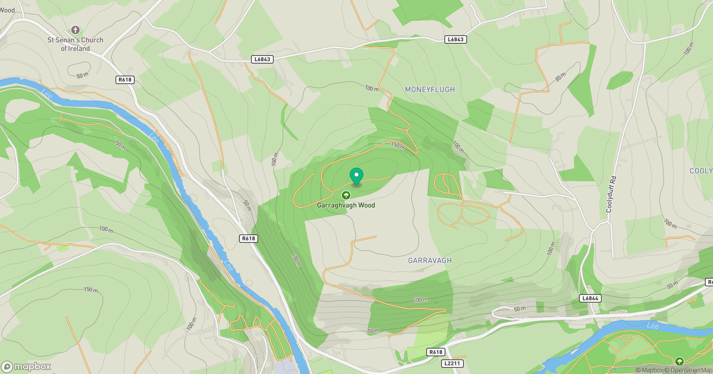
Grid reference: W567721
View on OpenStreetMapOpens a map in a new tab, centred on the hill.
Hills within 30 km
Straight-line distance, not a walking route or confirmation of access.
Knockshanawee
209m
Doolieve
182m
Knockagreenan
263m
Slieveadrohid [Hare Hill]
201m
Knocknaskagh [Cnoc na Sceach]
426m
No comments yet. Be the first.