

Fuar Larach
Good walks are even better shared.
Overview
Fuar Larach: A Hidden Gem in the Western Highlands
Fuar Larach, standing at an impressive elevation of 511 meters, is a charming Marilyn that entices outdoor enthusiasts with its stunning vistas and accessible trails. Located just off the bustling A83, this mountain is a treasure trove for hikers and nature lovers alike.
Geology
The geology of Fuar Larach is defined by its hard schist and gneiss rock formations, results of the area's long and tumultuous geological past. As you ascend, you'll be treated to interesting rock formations that have stood the test of time, much like your ancient hiking boots!
Routes
The 'Fuar Larach Circuit' is the preferred route, covering approximately 8.5 km and taking around 3.5 hours to complete. The initial part of the trail weaves through lush greenery, with vibrant wildflowers during springtime, before ascending toward the rocky summit. It’s a delightful blend of moderate challenge and breathtaking scenery.
Summit Features
Reaching the summit brings you to a small stone cairn, the perfect place to enjoy a well-earned snack while taking in the majestic views around you. Don’t forget to snap a picture – it might just win the ‘Best View’ award amongst your friends!
Terrain
The terrain is mainly grassy, punctuated by rocky sections, providing a good challenge without being overly taxing. Ensure you wear suitable footwear to tackle the uneven ground.
Views
The panoramic views from the top are nothing short of spectacular! You can see the beauty of Loch Fyne and the peaks of the adjoining mountains. The best time to enjoy these views is during spring and early autumn, when the skies are clearer and the landscapes are at their most vibrant.
Hazards
As is the case with the Scottish Highlands, be prepared for the unexpected. The weather can change as fast as you can say 'Scottish summer', so be sure to check the forecast. Be cautious of rocky areas to avoid slips.
Access
Finding your way to Fuar Larach is straightforward. There is free roadside parking available along the A83. A short walk will lead you to the trailhead, and you can catch a bus from Glasgow, making it a convenient destination.
Facilities
After your hike, head back to the picturesque town of Inveraray, where you will find plenty of cafes and restaurants to refuel. Don’t miss out on the public toilets for a well-deserved freshen up!
History
The name 'Fuar Larach', translating to 'the Cold Place', is a nod to the brisk winds that gust through at the top, so dress warmly! The mountain has been cherished by locals for years, and its accessibility makes it a popular choice for hikers looking to experience the Highland charm without the fuss.
Enjoy your adventure on Fuar Larach – where the views are as stunning as a fine Scottish dram is warming!
Explore routes near Fuar Larach
Public walks starting within 80 km of this hill. Nearby does not mean a route reaches the summit; check its map and access before setting out.
Goatfell from Cladach
View route
Crinan Canal: Bellanoch and Dunardry towpath return
View route
Bishop’s Glen group walk
View route
West Bay walk and talk
View route
Route planning notes
These notes describe possible approaches, not verified navigable routes or permission to cross land. Check current paths, local access rules and conditions before setting out.
Fuar Larach Circuit
This scenic route begins at the small parking area by the A83, leading adventurers through lush glades and rocky outcrops before ascending the grassy slopes of Fuar Larach.
Make a day of it, together
Find someone to share the walk with, or organise a day out along a route you like.
Photo Gallery
View all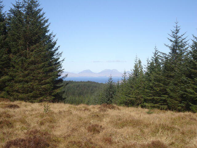 Photo could not load
NR8154 : The summit of Fuar Larach
Michael Earnshaw
Hill facts and local notes
Classifications
Elevation
272m
892 ft
Prominence
118m
Coordinates
55.7341, -5.4876
NR811544
OS Map
62
Explorer: 357N 357S
At the Summit
The summit features a small cairn, offering a perfect spot for a breather and taking in the panoramic views. Be sure to tick it off your summit bagging list!
Terrain & Geology
Fuar Larach is predominantly composed of schist and gneiss, characteristic of the region's complex geological history. These metamorphic rocks give rise to the rugged terrain and stunning landscapes typical of the Scottish Highlands.
Views & Scenery
From the summit, you can see the stunning peaks of the surrounding glens, as well as the shimmering waters of Loch Fyne. On a clear day, the vistas stretch far and wide!
History & Heritage
Name Origin
The name 'Fuar Larach' translates to 'the Cold Place', which is rather apt given the brisk winds that can sneak up on you at the summit.
Historical Significance
The mountain has been a favourite among local hikers for generations, celebrated for its accessibility and stunning landscape.
Getting There & Facilities
Check current local access restrictions, parking rules and transport timetables before travelling. These notes do not confirm public access to the summit.
Parking
Free roadside parking can be found along the A83, just a short walk from the trailhead. Look out for the 'scenic pull-off' signs.
Public Transport
Bus services operate from Glasgow to Inveraray, with the nearest stop located near the A83.
Nearby Facilities
Inveraray boasts a range of facilities including cafes, restaurants, and public toilets. Perfect for a hearty meal post-hike!
Safety Information
Known Hazards
- Be mindful of changing weather conditions, as Highland weather can shift faster than a squirrel on a sugar rush. Also, watch your footing on rocky sections to avoid a slip.
General Safety Tips
- Check weather conditions before setting out
- Carry appropriate clothing and equipment
- Let someone know your planned route
- Take a map, compass, and GPS device
- Carry emergency supplies: food, water, first aid kit, torch
Hills
Some common questions about the hills answered
Are there group walks up Fuar Larach?
Many walkers use Walkmates to join or organise walks with others. You can check for group walks around Fuar Larach through the maps
Are there other walkers around Fuar Larach?
Activity varies by location and time, but Walkmates lets you see whether others have shared walks or shown interest in this area. Find other people through the walking friends search walking friends for Fuar Larach search or of course create your own walk for Fuar Larach
Can I organise a walk to Fuar Larach?
Yes. If there aren’t any walks listed already, you can create a walk and make it available for others to join.
If you're signed up to Walkmates, you can create a walk to Fuar Larach.
How do I find a walk up this hill?
There are often multiple ways to walk this hill, depending on experience and route preference. Walkmates helps you explore walks and routes that others have shared.
Can I suggest a new route up Fuar Larach?
Yes. You can suggest or create routes to share with others. Walkmates focuses on the social side of walking, so routes are used to help people organise walks and explore areas together, rather than as detailed navigation tools or route libraries.
Other uses really appreciate knowledgeable walkers sharing their routes. Share your favourite route to Fuar Larach here
The is an error or something incorrect about this hill. How do I let you know?
We always strive to keep the information on Walkmates as accurate as possible. If you find an error, please let us know through the contact form and we'll aim to correct it as quickly as possible
Community Discussion
Comments
Location
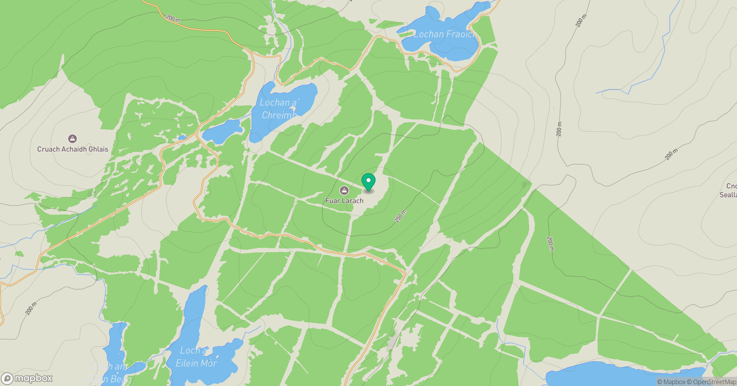
Grid reference: NR811544
View on OpenStreetMapOpens a map in a new tab, centred on the hill.
Hills within 30 km
Straight-line distance, not a walking route or confirmation of access.
Cir Mhor
798m
Goatfell [Goat Fell]
875m
Cnoc a' Bhaile-shios
422m
Cnoc nan Gabhar
230m
Meall nan Damh
570m
No comments yet. Be the first.