

Faraid Head
Good walks are even better shared.
NC3871 : Entrance to Cape Wrath Ranges installation, Faraid Head
Jim Barton Photo source
Overview
Faraid Head
Faraid Head, located in the stunning region of Sutherland in the Scottish Highlands, may not boast towering peaks, but it offers breathtaking views and a rugged allure of its own. With an elevation of 0 meters, it perfectly epitomises the rugged headlands for which this area is famed.
Geology
The geology of Faraid Head is both fascinating and complex. It primarily consists of sandstone and shales, giving rise to the dramatic cliffs and unique formations that attract outdoor enthusiasts. These layers tell the story of sedimentary processes shaped through millions of years of erosion and weathering.
The Routes
A popular choice for walkers is the Faraid Head Circular Walk. This moderate route, spanning approximately 8.5 km, loops around the headland, providing ample opportunity to admire the stunning coastal scenery and local wildlife along the way. It typically takes about 2.5 hours to complete, but do take your time—after all, it's not a race!
Summit Features
The summit of Faraid Head is characterised by its dramatic cliffs and a picturesque lighthouse. The view from the top is nothing short of spectacular, offering a sight that would make any nature lover's heart sing.
Terrain Type
Expect a mix of rocky and grassy terrain. As you navigate this headland, you'll traverse grassy slopes that give way to steep cliffs, so make sure to pack sturdy footwear.
Views
From the summit, be prepared to feast your eyes on the magnificent Atlantic Ocean, the distant Hebrides, and the rugged Sutherland coastline. The views are particularly striking during the spring and summer months, when the landscape is adorned with wildflowers. Grab your camera—this is one for the album!
Hazards
While the headland is beautiful, it comes with its risks. Keep an eye out for strong winds, especially near the cliff edges; safety first, folks! It’s always wise to maintain a respectful distance from the edge.
Nearby Summits
Just a stone's throw from Faraid Head lie impressive peaks like Ben Klibreck (621 meters) and Ben Hope (927 meters), both of which are worth a visit for those seeking a more strenuous hike.
Access
Getting to Faraid Head requires a bit of planning. The nearest parking is available at a small car park near the entrance to the headland. If you're relying on public transport, be warned—service can be sparse, so you might find it easier to drive. The nearest town is Golspie, about 16 km to the south, where you'll find cafes and other amenities.
Facilities
While facilities are sparse at the headland itself, Golspie has plenty of options for food and refreshment as well as public toilets—a crucial stop after a day of hiking.
History
The name 'Faraid', steeped in Norse heritage, is thought to mean 'headland' or 'cape'. It has served as a vital navigational point for mariners throughout history. This headland has seen countless tales unfold, including the occasional wayward seagull crash-landing!
In conclusion, Faraid Head offers a wonderful escape into nature, showcasing not only the beauty of the Scottish coastline but also the rich tapestry of history and geology that makes this region unique. So lace up those boots and enjoy the adventure!
Explore routes near Faraid Head
Walks starting near this hill. Open a route to check its map, distance and full itinerary.
Route planning notes
These notes describe possible approaches. Check a route's map and access information when planning your walk.
Faraid Head Circular Walk
A scenic circular route that provides stunning coastal views and the chance to see local wildlife.
Make a day of it, together
Find someone to share the walk with, or organise a day out along a route you like.
Photo Gallery
View all Photo could not load
NC3871 : Entrance to Cape Wrath Ranges installation, Faraid Head
Jim Barton
 Photo could not load
NC3871 : Gateway to the Cape Wrath Ranges Installation
Oliver Dixon
 Photo could not load
NC3871 : Cliffs at Faraid Head
David Purchase
 Photo could not load
NC3871 : Cliffs at Faraid Head
Julian Paren
 Photo could not load
NC3871 : Northern Cliffs of Faraid Head
Hilmar Ilgenfritz
 Photo could not load
NC3871 : Faraid Head
Bob Jones
 Photo could not load
NC3871 : Faraid Head
PETER PLUCKNETT
 Photo could not load
NC3871 : Triangulation Pillar, Faraid Head.
David Bremner
Hill facts and local notes
Classifications
Elevation
100m
328 ft
Prominence
87m
Coordinates
58.6014, -4.7777
NC387715
OS Map
9
Explorer: 446
At the Summit
The summit features dramatic cliffs and a weathered coastline, with a charming lighthouse standing tall at its peak.
Terrain & Geology
Faraid Head is primarily composed of sandstone and shales, which provide a rich tapestry of rugged coastal scenery. The formation is indicative of the area's complex geological history, shaped by both sedimentary processes and erosion.
Views & Scenery
From the summit, hikers can see the breathtaking vistas of the Atlantic Ocean, the distant Hebrides, and the nearby Sutherland coastline.
History & Heritage
Name Origin
The name 'Faraid' is believed to derive from the Norse word for 'headland' or 'cape'.
Historical Significance
Historically, Faraid Head has guided sailors since the days of old, being a prominent marker along the treacherous northern coastline.
Getting There & Facilities
Parking
There is a small car park at the start of the trail near the entrance to the headland.
Public Transport
Limited public transport options; nearby villages have infrequent bus services. Best to travel by car.
Nearby Facilities
While there are no facilities directly at Faraid Head, the nearby town of Golspie has cafes, shops, and public toilets.
Safety Information
Known Hazards
- Strong coastal winds may be hazardous, especially near the cliffs. Keep a safe distance from the edge.
General Safety Tips
- Check weather conditions before setting out
- Carry appropriate clothing and equipment
- Let someone know your planned route
- Take a map, compass, and GPS device
- Carry emergency supplies: food, water, first aid kit, torch
Hills
Some common questions about the hills answered
Are there group walks up Faraid Head?
Many walkers use Walkmates to join or organise walks with others. You can check for group walks around Faraid Head through the maps
Are there other walkers around Faraid Head?
Activity varies by location and time, but Walkmates lets you see whether others have shared walks or shown interest in this area. Find other people through the walking friends search walking friends for Faraid Head search or of course create your own walk for Faraid Head
Can I organise a walk to Faraid Head?
Yes. If there aren’t any walks listed already, you can create a walk and make it available for others to join.
If you're signed up to Walkmates, you can create a walk to Faraid Head.
How do I find a walk up this hill?
There are often multiple ways to walk this hill, depending on experience and route preference. Walkmates helps you explore walks and routes that others have shared.
Can I suggest a new route up Faraid Head?
Yes. You can suggest or create routes to share with others. Walkmates focuses on the social side of walking, so routes are used to help people organise walks and explore areas together, rather than as detailed navigation tools or route libraries.
Other uses really appreciate knowledgeable walkers sharing their routes. Share your favourite route to Faraid Head here
The is an error or something incorrect about this hill. How do I let you know?
We always strive to keep the information on Walkmates as accurate as possible. If you find an error, please let us know through the contact form and we'll aim to correct it as quickly as possible
Community Discussion
Comments
Location
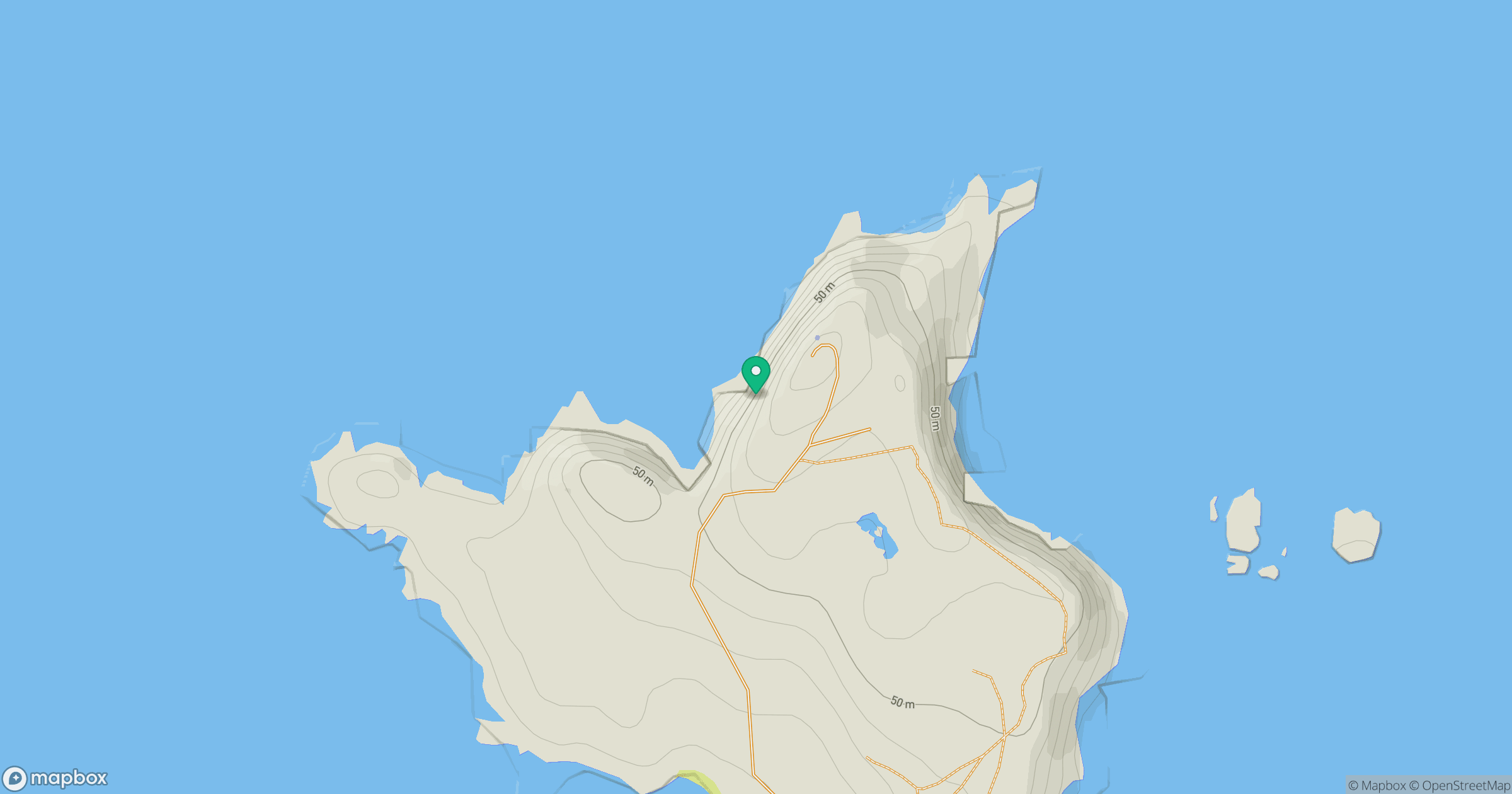
Grid reference: NC387715
View on OpenStreetMapOpens a map in a new tab, centred on the hill.
Nearby Hills
Ben Hope
927m
Ben Stack
721m
Ben Loyal - An Caisteal
764m
Ben More Assynt
999m
Quinag - Sail Gharbh
809m
No comments yet. Be the first.