

Beinn Ceannabeinne
Good walks are even better shared.
Overview
Beinn Ceannabeinne: A Highland Adventure
Beinn Ceannabeinne stands at 416 meters and is classified as a Marilyn, making it a small yet significant peak in the Scottish Highlands. Nestled near the NC422646 coordinates, it offers an excellent outing for hikers seeking to escape into nature without the need for Everest-level equipment.
Geology
The mountain is primarily made up of igneous rock, dominated by resilient basalt and schist. The geological tapestry of Beinn Ceannabeinne tells the tale of ancient volcanic activity that has shaped the Highlands. The rugged landscape we see today is the product of millions of years of geological evolution.
Routes
The most popular route to the summit is the East Ridge Route, which is a moderate trek of about 6.5 km, usually taking around 3.5 hours to ascend. The path begins along the A9 road and leads you gently up the ridge, providing breathtaking views of the surrounding landscape as you climb.
Summit Features
At the summit, you’ll find a traditional stone cairn—the perfect spot for that obligatory selfie. And if you happen to meet a raven up there, it may very well be the local celebrity, so don’t forget to say hello!
Terrain
Expect a mix of rocky and grassy terrain adorned with heather. Just be careful of those sneaky, boggy patches trying to turn your boots into sponges!
Views
Once you reach the top, prepare to be awestruck. The summit offers vistas of Loch Carnaig, and, on a clear day, you may even spot the sprawling peaks of Sutherland in the distance. The best times for these views are during the spring and autumn, when the weather is kind and Mother Nature puts on her finest dressing gown.
Hazards
Like a mischievous child, Highland weather can be unpredictable; be prepared for sudden changes. Slippery rocks and wet grass can turn your hike into an unplanned performance art piece, so tread carefully.
Nearby Summits
If you're feeling ambitious, nearby peaks like Beinn a' Chaisteil and Loch Na Gainmhich offer further opportunities to stretch your legs and marvel at the rugged beauty of the Highlands.
Access
To access Beinn Ceannabeinne, there is a convenient parking area off the A9, which is well-marked. The nearest town, Lairg, is about 10 miles away and provides some essential amenities. Public transport is available along the A9, albeit with limited service—so it's road trip time for most hikers!
Facilities
While the facilities near Beinn Ceannabeinne are few and far between, you can find shops, cafes, and toilets in Lairg to help you refuel after your grand Highland adventure.
Conclusion
Whether you’re a seasoned hiker or just out for a lovely day in the hills, Beinn Ceannabeinne provides a charming mix of stunning landscapes and a sense of the wild that will leave you with memories to cherish. Adventure awaits, so lace up those boots and make your way to this magnificent Marilyn!
Explore routes near Beinn Ceannabeinne
Public walks starting within 80 km of this hill. Nearby does not mean a route reaches the summit; check its map and access before setting out.
Ben Klibreck
View route
Loch Migdale from Torroy: Spinningdale pinewood and loch shore walk
View route
Route planning notes
These notes describe possible approaches, not verified navigable routes or permission to cross land. Check current paths, local access rules and conditions before setting out.
East Ridge Route
Starting from the A9 road, this route takes you along a gentle ascent up the east ridge of Beinn Ceannabeinne, offering stunning views as you gain height.
Make a day of it, together
Find someone to share the walk with, or organise a day out along a route you like.
Photo Gallery
View all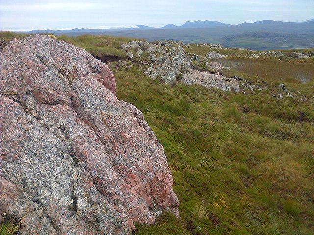 Photo could not load
NC4264 : Pegmatite Outcrop on Beinn Ceannabeinne
Mick Garratt
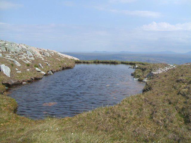 Photo could not load
NC4264 : Lochan near summit of Beinn Ceannabeinne
John McCafferty
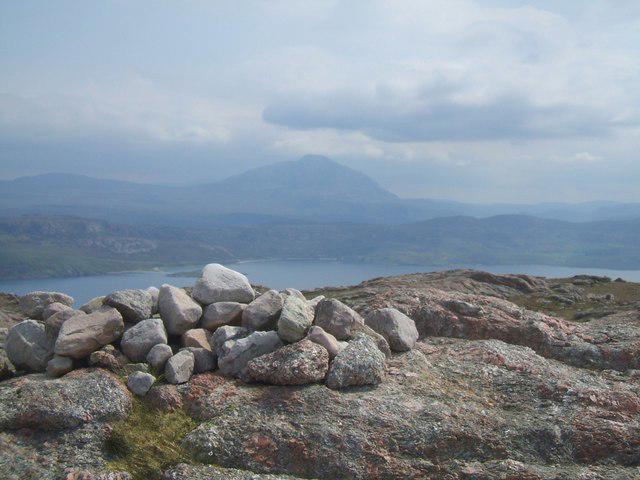 Photo could not load
NC4264 : Cairn near summit of Beinn Ceannabeinne
John McCafferty
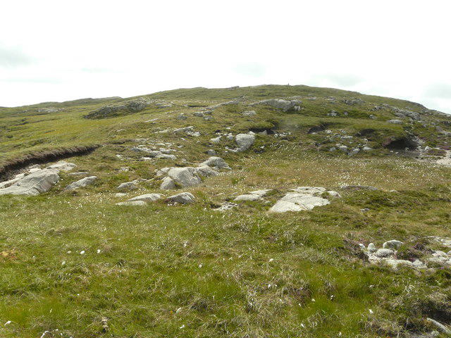 Photo could not load
NC4264 : East side of Ceannabeinne
AlastairG
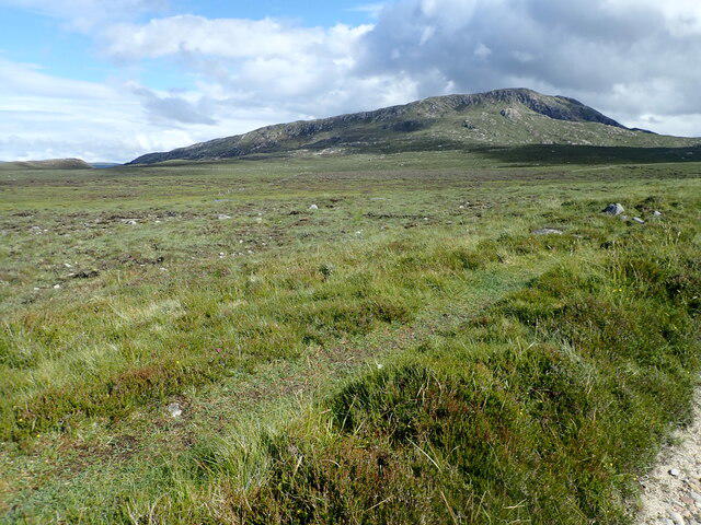 Photo could not load
NC4264 : Beinn Ceannabeinne
Eirian Evans
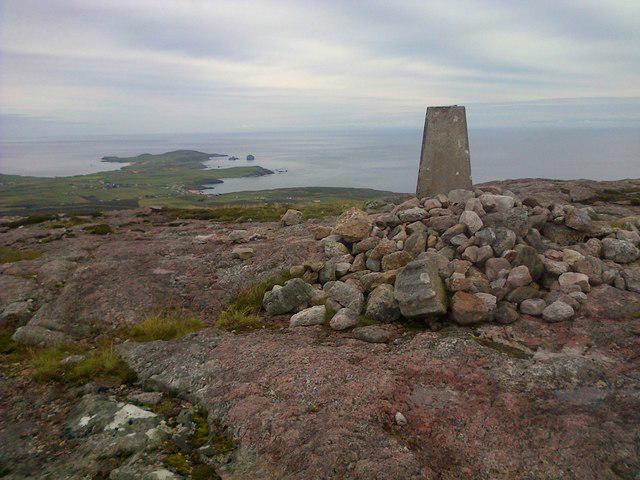 Photo could not load
NC4264 : Trig Point, Beinn Ceannabeinne
Mick Garratt
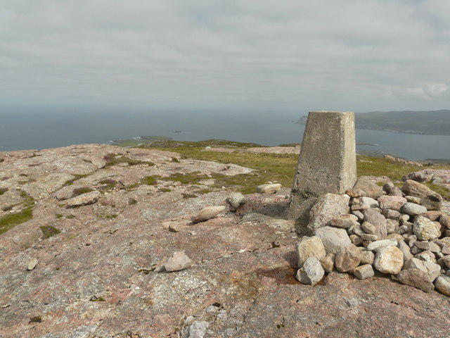 Photo could not load
NC4264 : Ceannabeinne trig point
AlastairG
Hill facts and local notes
Classifications
Elevation
383m
1,257 ft
Prominence
140m
Coordinates
58.5413, -4.7113
NC422646
OS Map
9
Explorer: 446 447N
At the Summit
The summit features a traditional stone cairn and offers a panoramic view of the surrounding Highlands. Look closely for the summit's resident curious ravens!
Terrain & Geology
Beinn Ceannabeinne is primarily composed of igneous rock, with basalt and schist giving it a rugged appearance. The mountain's geological history reflects volcanic activity and subsequent erosion, leading to the striking landscape we see today.
Views & Scenery
From the summit, hikers can enjoy stunning views of Loch Carnaig, the rugged landscape of the Assynt region, and possibly even the distant peaks of Sutherland.
History & Heritage
Name Origin
The name Beinn Ceannabeinne translates to 'Mountain of the Head of Beinn,' reflecting its distinctive summit and prominence in the landscape.
Historical Significance
Historically, the mountain has been a landmark for travellers in the region and holds cultural significance for local clans.
Getting There & Facilities
Check current local access restrictions, parking rules and transport timetables before travelling. These notes do not confirm public access to the summit.
Parking
There is a parking area off the A9 road near the access point to the hiking trails, easily accommodating a few vehicles.
Public Transport
Public transport options are limited, but there are bus services that run along the A9, with stops at nearby villages.
Nearby Facilities
Facilities are minimal close to Beinn Ceannabeinne, but Lairg has shops, cafes, and public toilets.
Safety Information
Known Hazards
- Typical Highland weather can change rapidly. Be prepared for rain, wind, and sudden temperature drops; the terrain can be slippery, especially after rainfall.
General Safety Tips
- Check weather conditions before setting out
- Carry appropriate clothing and equipment
- Let someone know your planned route
- Take a map, compass, and GPS device
- Carry emergency supplies: food, water, first aid kit, torch
Hills
Some common questions about the hills answered
Are there group walks up Beinn Ceannabeinne?
Many walkers use Walkmates to join or organise walks with others. You can check for group walks around Beinn Ceannabeinne through the maps
Are there other walkers around Beinn Ceannabeinne?
Activity varies by location and time, but Walkmates lets you see whether others have shared walks or shown interest in this area. Find other people through the walking friends search walking friends for Beinn Ceannabeinne search or of course create your own walk for Beinn Ceannabeinne
Can I organise a walk to Beinn Ceannabeinne?
Yes. If there aren’t any walks listed already, you can create a walk and make it available for others to join.
If you're signed up to Walkmates, you can create a walk to Beinn Ceannabeinne.
How do I find a walk up this hill?
There are often multiple ways to walk this hill, depending on experience and route preference. Walkmates helps you explore walks and routes that others have shared.
Can I suggest a new route up Beinn Ceannabeinne?
Yes. You can suggest or create routes to share with others. Walkmates focuses on the social side of walking, so routes are used to help people organise walks and explore areas together, rather than as detailed navigation tools or route libraries.
Other uses really appreciate knowledgeable walkers sharing their routes. Share your favourite route to Beinn Ceannabeinne here
The is an error or something incorrect about this hill. How do I let you know?
We always strive to keep the information on Walkmates as accurate as possible. If you find an error, please let us know through the contact form and we'll aim to correct it as quickly as possible
Community Discussion
Comments
Location
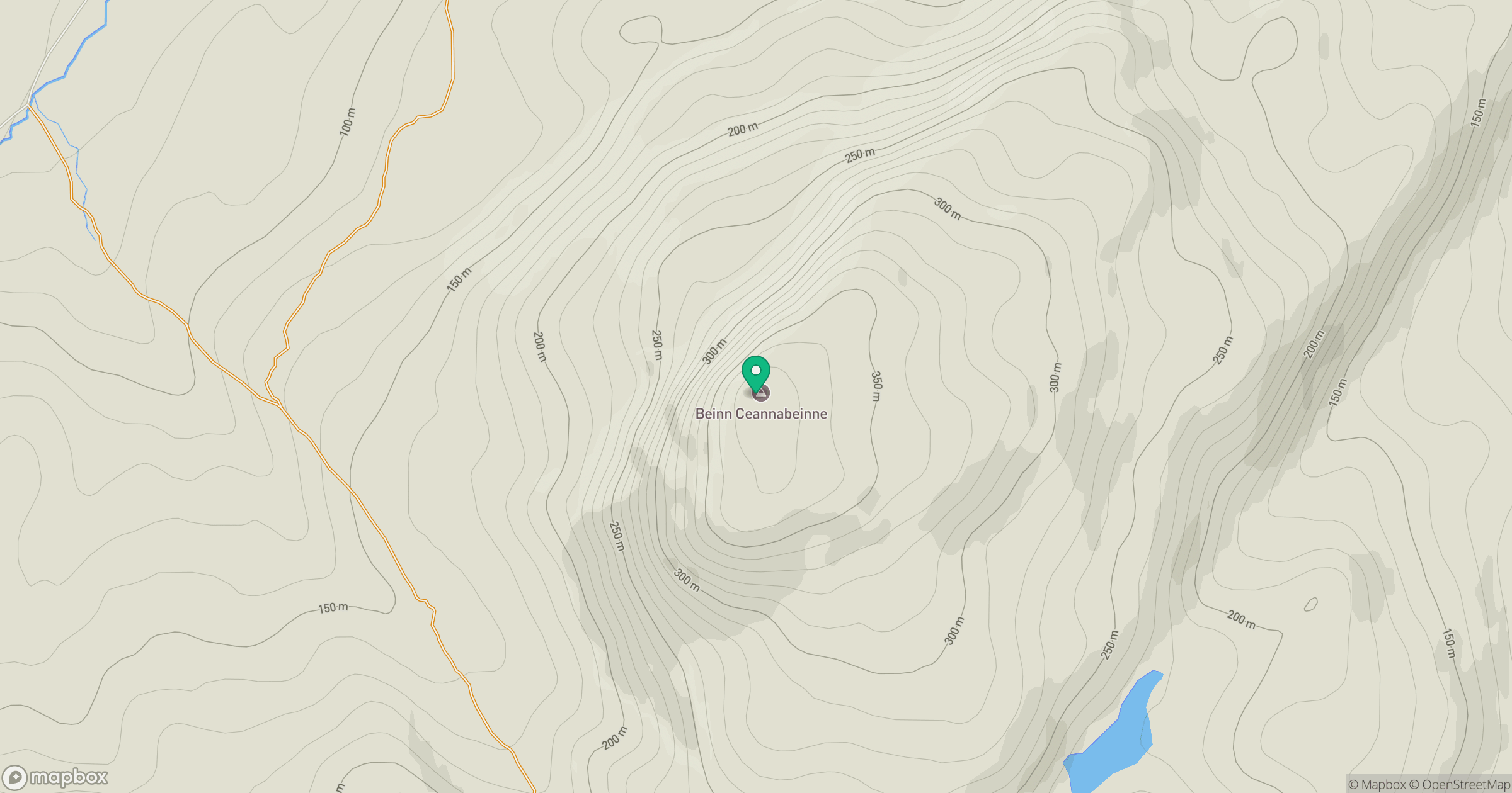
Grid reference: NC422646
View on OpenStreetMapOpens a map in a new tab, centred on the hill.
Hills within 30 km
Straight-line distance, not a walking route or confirmation of access.
No comments yet. Be the first.