

Dundreich
Good walks are even better shared.
NT2749 : Moorland Fences on Dundreich
wrobison Photo source
Overview
Dundreich: A Hidden Treasure in the Southern Uplands
Nestled amidst the rolling hills of the Southern Uplands, Dundreich stands tall at 652 meters, beckoning hikers with its scenic promises. A Marilyn classification adds to its charm, making it a popular destination for both seasoned walkers and those just dipping their toes into hillwalking.
Geology
Dundreich showcases a tapestry of Old Red Sandstone, shaped over aeons by the forces of nature. This ancient rock not only contributes to the mountain's aesthetics but also tells a story of geological transformation. As you ascend, take a moment to ponder the millions of years that created this landscape – it’s hard to complain about a steep incline when you think of it that way!
Routes
One of the more favoured routes starts at the Hill of Dundreich Approach, a well-trodden path winding through serene valleys. Covering a distance of 6.0 km, it typically takes around 3.5 hours to traverse. The gradient is moderate; one could argue it’s the sort of journey that allows for a good chat and a welcome break for snacks. And isn't that what hiking is all about?
Summit Features
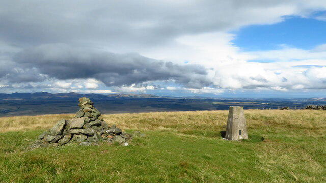
On reaching the summit, you will be greeted by a charming stone cairn. A friendly tip: take a moment to enjoy the sense of achievement – and don't forget to snap a picture while you’re there!
Terrain Type
Expect a mix of moorland and grassy slopes on your ascent, with rocky outcrops adding character. Comfortable hiking boots are recommended, lest you wish to engage in an impromptu ballet performance on the uneven ground.
Views
From the top, the horizon stretches endlessly, offering fantastic views of the Southern Uplands. Come spring or early summer for the most breathtaking scenery, as colourful blooms dot the landscape and the air is crisp enough to invigorate the soul.
Hazards
Hikers should be mindful of the rapidly changing weather conditions, characteristic of the area. A sunny day can quickly turn to fog, so keep an eye on the sky. Also, tread carefully over uneven terrains and be prepared to navigate the odd boggy patch that might threaten to swallow your shoe!
Nearby Summits
Don’t miss out on the opportunities to tackle nearby peaks such as Black Hill (681 m) and Dumtodhill (553 m). Each offers a unique hiking experience and stunning views that complement your adventures in Dundreich.
Access
Parking is available at a nearby layby, so get there early if you want a spot! If you plan to arrive via public transport, Thornhill is the closest bus stop. Don’t be shy about giving your legs a workout; the walk from town can serve as a perfect warm-up!
Facilities
Head into Thornhill for cafes serving warm cups of tea and the occasional slice of cake to refuel post-hike. Public toilets in the town come as a welcome relief after a day spent enjoying nature.
History
The name Dundreich, suggesting a ‘fort on a ridge,’ echoes tales of ancient cultures and their settlements in the area. It’s worth taking a moment to appreciate the history that has unfolded on these very lands.
In conclusion, Dundreich is not just another hill; it’s a journey through time, a challenge of the legs, and a feast for the eyes. So pack your bag, lace up those boots, and prepare for an adventure like no other!
Happy hiking!
Explore routes near Dundreich
Walks starting near this hill. Open a route to check its map, distance and full itinerary.
Peebles to Neidpath Castle: Tweed Riverside Walk
View route
Cademuir Forest Pilots Trail
View route
Dalkeith Country Park: Estate and North Woods Green Trail
View route
Artists’ walk in Craigmillar Castle Park (group meeting)
View route
Route planning notes
These notes describe possible approaches. Check a route's map and access information when planning your walk.
Hill of Dundreich Approach
A moderate ascent through scenic valleys and moorland, offering stunning views as you climb.
Make a day of it, together
Find someone to share the walk with, or organise a day out along a route you like.
Photo Gallery
View all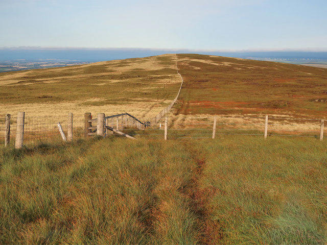 Photo could not load
NT2749 : Moorland Fences on Dundreich
wrobison
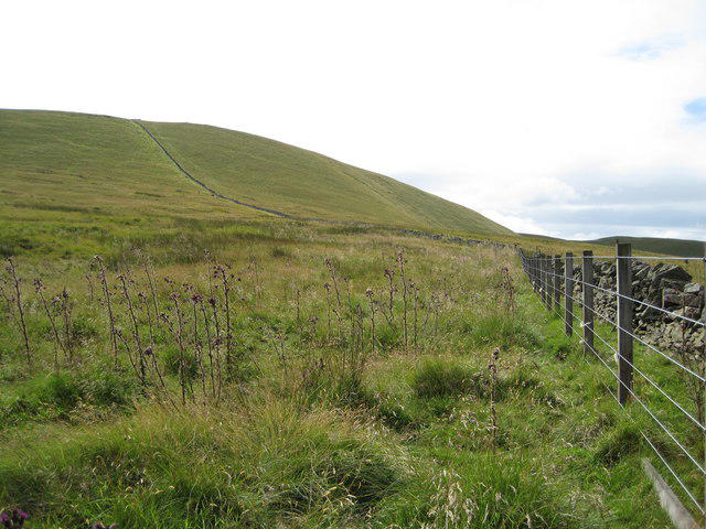 Photo could not load
NT2749 : The last hundred metres, Dundreich
Jim Barton
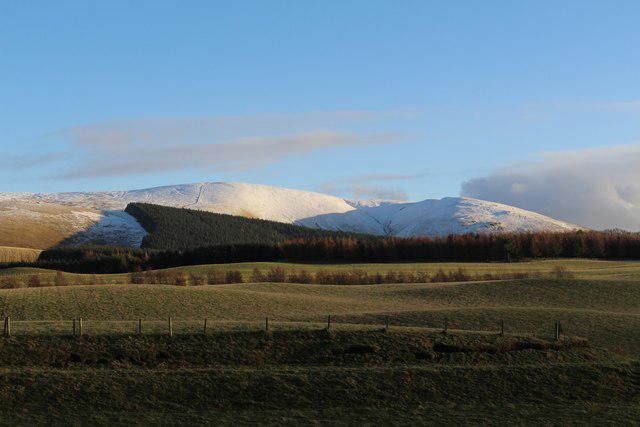 Photo could not load
NT2749 : Dundreich
Graeme Yuill
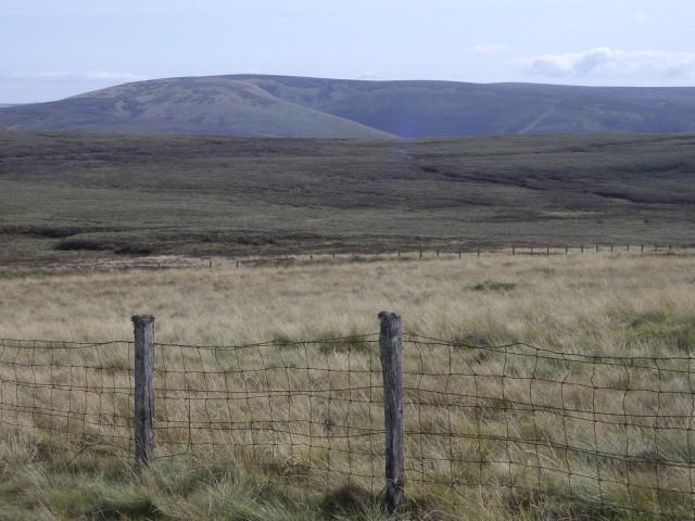 Photo could not load
NT2749 : Dundreich fences
Callum Black
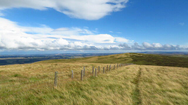 Photo could not load
NT2749 : Ridge & fence leading from Dundreich towards Jeffries Corse
Colin Park
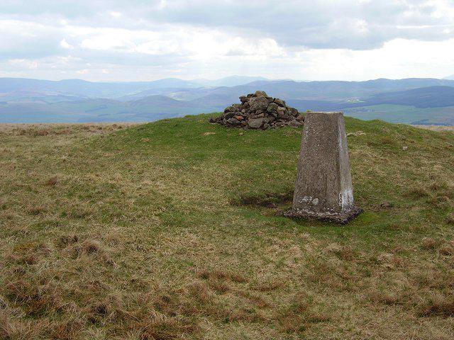 Photo could not load
NT2749 : Dundreich
Richard Webb
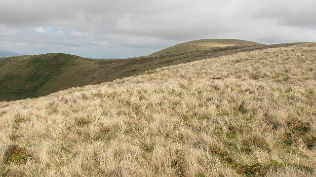 Photo could not load
NT2748 : Dundreich
Richard Webb
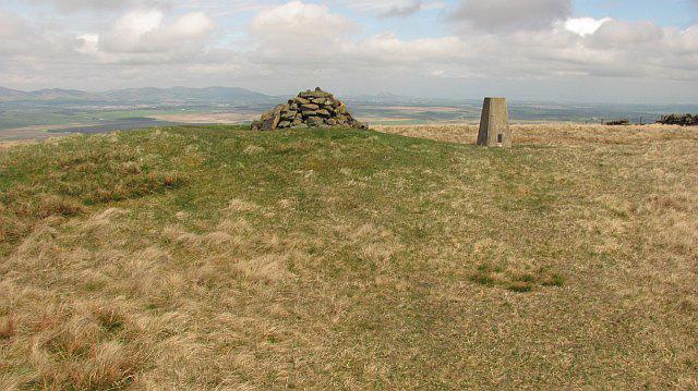 Photo could not load
NT2749 : Summit, Dundreich
Richard Webb
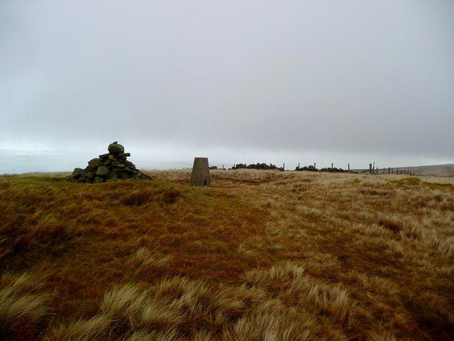 Photo could not load
NT2749 : Cairn and trig on Dundreich
Gordon Brown
NT2749 : Cairn & Trig Point on Dundreich
Colin Park
Hill facts and local notes
Classifications
Elevation
623m
2,044 ft
Prominence
68m
Coordinates
55.7298, -3.1566
NT274490
OS Map
73
Explorer: 337 344
At the Summit
The summit features a simple stone cairn among the grassy expanse, providing a perfect photo opportunity to mark your achievement.
Terrain & Geology
Primarily composed of Old Red Sandstone, with some intriguing sedimentary formations that give the hills their characteristic shape and colour. This geology showcases the dynamic processes that have shaped the landscape over millions of years.
Views & Scenery
From the summit, enjoy panoramic views of the Southern Uplands, the rolling hills, and the distinctive outline of the surrounding peaks.
History & Heritage
Name Origin
The name 'Dundreich' is derived from Gaelic, possibly meaning 'fort on a ridge,' reflecting the area's historic significance.
Historical Significance
Dundreich has been a site of local cultural importance, with stories of ancient settlements and folklore woven into the fabric of the region.
Getting There & Facilities
Parking
Parking is available at the public layby near NT250495, with sufficient space for a few cars. It's a bit of a hidden gem, so make sure you grab a spot early!
Public Transport
Limited public transport is available; the nearest bus stop is in the village of Thornhill. A good old-fashioned hike from there can make for a fine day out.
Nearby Facilities
While the mountain itself is rugged and remote, the nearest town, Thornhill, has cafes and public toilets to refresh you before the trek or upon your return.
Safety Information
Known Hazards
- Beware of sudden weather changes typical of the region, which can include dense fog and rainfall. Also, keep an eye out for uneven ground and the occasional squelchy bog!
General Safety Tips
- Check weather conditions before setting out
- Carry appropriate clothing and equipment
- Let someone know your planned route
- Take a map, compass, and GPS device
- Carry emergency supplies: food, water, first aid kit, torch
Hills
Some common questions about the hills answered
Are there group walks up Dundreich?
Many walkers use Walkmates to join or organise walks with others. You can check for group walks around Dundreich through the maps
Are there other walkers around Dundreich?
Activity varies by location and time, but Walkmates lets you see whether others have shared walks or shown interest in this area. Find other people through the walking friends search walking friends for Dundreich search or of course create your own walk for Dundreich
Can I organise a walk to Dundreich?
Yes. If there aren’t any walks listed already, you can create a walk and make it available for others to join.
If you're signed up to Walkmates, you can create a walk to Dundreich.
How do I find a walk up this hill?
There are often multiple ways to walk this hill, depending on experience and route preference. Walkmates helps you explore walks and routes that others have shared.
Can I suggest a new route up Dundreich?
Yes. You can suggest or create routes to share with others. Walkmates focuses on the social side of walking, so routes are used to help people organise walks and explore areas together, rather than as detailed navigation tools or route libraries.
Other uses really appreciate knowledgeable walkers sharing their routes. Share your favourite route to Dundreich here
The is an error or something incorrect about this hill. How do I let you know?
We always strive to keep the information on Walkmates as accurate as possible. If you find an error, please let us know through the contact form and we'll aim to correct it as quickly as possible
Community Discussion
Comments
Location
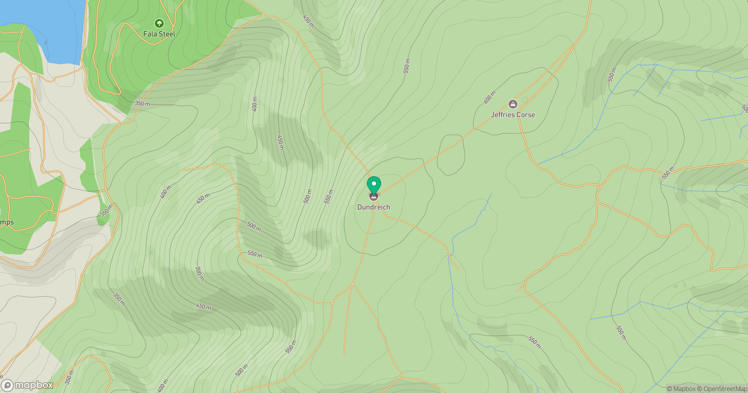
Grid reference: NT274490
View on OpenStreetMapOpens a map in a new tab, centred on the hill.


No comments yet. Be the first.