

Druim Fiaclach East Top
Good walks are even better shared.
NM7978 : Drium Fiaclach Ridge
Gordon Gibb Photo source
Overview
Druim Fiaclach East Top
Located in the heart of the Scottish Highlands, Druim Fiaclach East Top is an appealing destination for outdoor enthusiasts looking for moderate challenges amidst breath-taking scenery.
Geology
This mountain is primarily composed of rugged schist, creating a landscape that is both dramatic and historically rich. The geological formations date back to prehistoric times, making it a fascinating area for those interested in geology or simply enjoying the unique features of the landscape.
Routes
A popular route to the East Top is the Druim Fiaclach Circuit. This medium-difficulty trek spans approximately 8.5 km and takes around 4.5 hours to complete. Expect winding paths that reward you with stunning views of the Highlands as you walk.
Summit Features
Reaching the summit, you'll find a well-built cairn—a classic feature of Scottish hillsides. It's the perfect place to take a breather and snap some photos, providing panoramic views that will leave you both refreshed and inspired.
Terrain & Hazards
The terrain is varied, mixing rocky outcrops and grassy patches with occasional bogs. Sturdy footwear is essential to navigate this exciting mix. Be cautious of sudden weather changes that are typical for the Highlands; fog can drift in unexpectedly, making navigation tricky. Also, loose rocks can be a hazard, so watch your step!
Views
From the top, prepare to be stunned by views encompassing Loch Awe and the Argyll mountains. The best times to savour these vistas are late spring and autumn when nature puts on a vibrant show of colour.
Access
The nearest parking is found in Dalavich, roughly 3 km from the trailhead. Public transport options are limited—best to check schedules in advance or consider a carpool with fellow adventurers. The bustling town of Oban is about 30 km away, providing access to supplies and facilities.
Facilities
In Dalavich, there's a charming little shop and café where you can replenish your energy before or after the hike, though facilities on the mountain are non-existent, so come prepared!
History
The name 'Druim Fiaclach' suggests a rugged history, translating to 'ridge of the teeth'. Local legend is rich in tales of ancient warriors who traversed these very hills, imbuing the landscape with cultural significance that still resonates today.
Whether you’re an avid hiker or just looking to soak in some Highland beauty, Druim Fiaclach East Top offers a rewarding escape into nature.
Happy hiking! Don’t forget to pack a sarnie!
Explore routes near Druim Fiaclach East Top
Walks starting near this hill. Open a route to check its map, distance and full itinerary.
Banavie to Glen Loy Aqueduct: Neptune’s Staircase Canal Towpath
View route
Ben Nevis via Mountain Path
View route
Fort Augustus to Kytra Lock: Caledonian Canal Towpath
View route
Glen Affric: Coire Loch Woodland Trail
View route
Route planning notes
These notes describe possible approaches. Check a route's map and access information when planning your walk.
Druim Fiaclach Circuit
A scenic route that takes you around Druim Fiaclach before ascending to the East Top, showcasing stunning landscapes and wildlife along the way.
Make a day of it, together
Find someone to share the walk with, or organise a day out along a route you like.
Photo Gallery
View all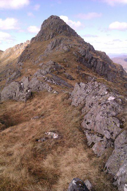 Photo could not load
NM7978 : Drium Fiaclach Ridge
Gordon Gibb
Hill facts and local notes
Classifications
Elevation
829m
2,721 ft
Prominence
31m
Coordinates
56.8501, -5.6109
NM799790
OS Map
40
Explorer: 390E 398W
At the Summit
The summit features a prominent cairn which offers a perfect spot for a picnic and a selfie, as well as panoramic views of the surrounding landscape. It’s a great place to catch your breath or contemplate life's great mysteries.
Terrain & Geology
Primarily composed of rugged schist with pockets of quartzite, giving the landscape a dramatic flair. The area's geology dates back to the prehistoric times, allowing for some fascinating exploration of ancient geological formations.
Views & Scenery
From the summit, you can see Loch Awe and the distant peaks of the Argyll mountains, providing a feast for the eyes. On a clear day, you might even spot the shimmering waters of the Atlantic.
History & Heritage
Name Origin
The name 'Druim Fiaclach' translates to 'ridge of the teeth', likely referencing the rugged terrain that resembles jagged teeth.
Historical Significance
The area is steeped in local legend, with tales of ancient warriors who roamed these hills. It also contributes to the rich tapestry of Highland culture.
Getting There & Facilities
Parking
There is a small car park near the village of Dalavich, about 3 km from the start of the hiking trail.
Public Transport
Limited public transport is available from Oban to Dalavich. Alternatively, consider arranging a lift or carpool with fellow hikers.
Nearby Facilities
There are no facilities on the mountain itself, but Dalavich offers basic amenities including a small shop and a coffee shop for those who need a caffeine fix post-hike.
Safety Information
Known Hazards
- Sudden weather changes, especially in winter months. Navigational challenges due to low visibility in fog. Beware of loose rocks and slippery surfaces.
General Safety Tips
- Check weather conditions before setting out
- Carry appropriate clothing and equipment
- Let someone know your planned route
- Take a map, compass, and GPS device
- Carry emergency supplies: food, water, first aid kit, torch
Hills
Some common questions about the hills answered
Are there group walks up Druim Fiaclach East Top?
Many walkers use Walkmates to join or organise walks with others. You can check for group walks around Druim Fiaclach East Top through the maps
Are there other walkers around Druim Fiaclach East Top?
Activity varies by location and time, but Walkmates lets you see whether others have shared walks or shown interest in this area. Find other people through the walking friends search walking friends for Druim Fiaclach East Top search or of course create your own walk for Druim Fiaclach East Top
Can I organise a walk to Druim Fiaclach East Top?
Yes. If there aren’t any walks listed already, you can create a walk and make it available for others to join.
If you're signed up to Walkmates, you can create a walk to Druim Fiaclach East Top.
How do I find a walk up this hill?
There are often multiple ways to walk this hill, depending on experience and route preference. Walkmates helps you explore walks and routes that others have shared.
Can I suggest a new route up Druim Fiaclach East Top?
Yes. You can suggest or create routes to share with others. Walkmates focuses on the social side of walking, so routes are used to help people organise walks and explore areas together, rather than as detailed navigation tools or route libraries.
Other uses really appreciate knowledgeable walkers sharing their routes. Share your favourite route to Druim Fiaclach East Top here
The is an error or something incorrect about this hill. How do I let you know?
We always strive to keep the information on Walkmates as accurate as possible. If you find an error, please let us know through the contact form and we'll aim to correct it as quickly as possible
Community Discussion
Comments
Location
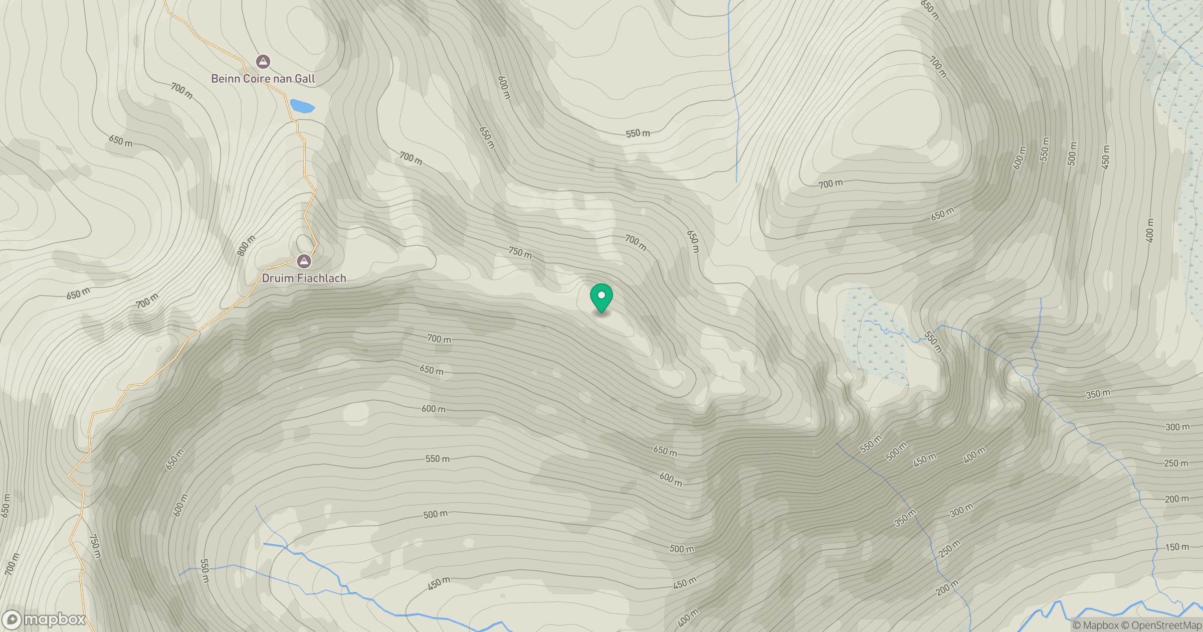
Grid reference: NM799790
View on OpenStreetMapOpens a map in a new tab, centred on the hill.
No comments yet. Be the first.