

Dove Crag
Good walks are even better shared.
NY3710 : Dove Crag
Ian Capper Photo source
Overview
An Adventurer's Guide to Dove Crag
Introduction
Dove Crag is a delightful gem nestled in the heart of the Lake District, standing at a respectable 792 meters above sea level. It offers a moderate challenge to hikers, with routes that put you on ledger with nature's rugged beauty.
Geology
This peak is an example of volcanic rock, making it the perfect playground for rock climbers and geology buffs alike. Keep your eyes peeled for the unique formations and layers as you ascend the crag. Just try not to slip on the rocks, you wouldn’t want to test out the ‘gravity’ component of nature!
Routes
There are several trails leading up to this magnificent peak. Notably, the route starting from Brothers Water is widely regarded as the classic approach, taking you through picturesque landscapes and well-defined paths.
- Dove Crag from Brothers Water: A moderate 9.5 km circular walk — sure, it’ll get your heart racing, but the views will have you puffing for a different reason.
- Dove Crag via Hart Crag: For the more adventurous spirit, this challenging 11 km route combines two stunning summits — not for the faint-hearted!
Summit Features
Upon reaching the summit, hikers are welcomed by an impressive rock outcrop adorned with a well-placed cairn. The sight from the top is nothing short of a visual feast, with a panorama that could make even the most indifferent of hikers stop for a moment.
Terrain Type
Expect a mix of rocky outcrops and grassy slopes interspersed with soggy bits if it’s been raining. Your boots will surely appreciate a bit of grip here!
Views
The breathtaking views from the summit include panoramic views of Windermere, Helvellyn, and Fairfield. Best of all? You'll often experience these views without the throngs of tourists—just you and nature.
Hazards
Be cautious of the steep rocky paths, especially in damp weather—one minute you’re a mountain conqueror and the next, you’re auditioning for Britain's Funniest Home Videos.
Access
- Nearest Parking: Brothers Water car park — a dream location for starting your hike.
- Public Transport: Check for sporadic bus services from Windermere if driving isn’t your thing.
- Nearest Town: Ambleside, perfect for a celebratory pint post-hike.
Facilities
While you won’t find much on the crag itself, the towns of Ambleside and Patterdale offer a variety of cafes and shops to replenish your energy.
Conclusion
Dove Crag is not just another hike; it’s a picturesque journey through one of the UK’s most beloved national parks. So, lace up those boots, pack a snack, and get ready to create some unforgettable memories!
Explore routes near Dove Crag
Walks starting near this hill. Open a route to check its map, distance and full itinerary.
Striding Edge, Helvellyn and Catstye Cam
View route
Helvellyn via Striding Edge
View route
Bow Fell from Langdale
View route
Tarn Hows Fast Route
View route
Route planning notes
These notes describe possible approaches. Check a route's map and access information when planning your walk.
Dove Crag from Brothers Water
A popular circular route starting from Brothers Water, which meanders through lush valleys up to the crag, with a steep section but well-marked paths.
Dove Crag via Hart Crag
An alternative but equally stunning route that combines the summits of Dove Crag and Hart Crag, offering panoramic views of the surrounding fells.
Make a day of it, together
Find someone to share the walk with, or organise a day out along a route you like.
Photo Gallery
View all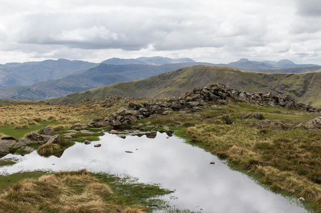 Photo could not load
NY3710 : Dove Crag
Ian Capper
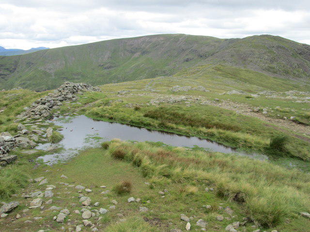 Photo could not load
NY3710 : Tumbledown dry stone wall on Dove Crag
Peter S
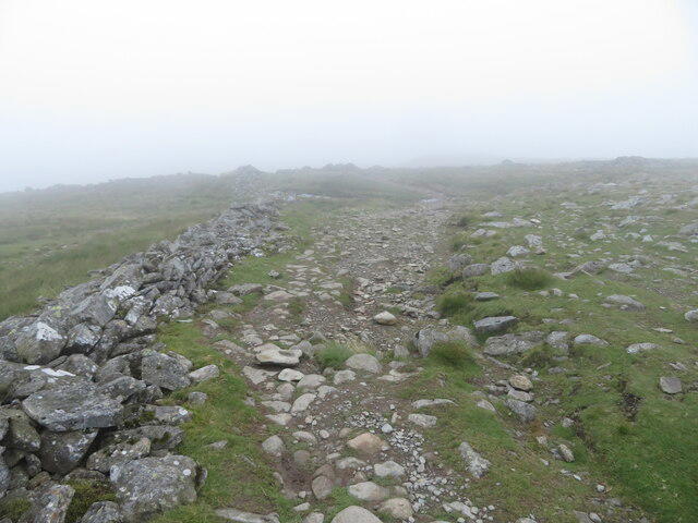 Photo could not load
NY3710 : Path on Dove Crag
Gareth James
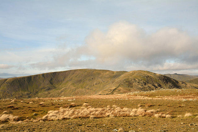 Photo could not load
NY3710 : Plateau of Dove Crag
Trevor Littlewood
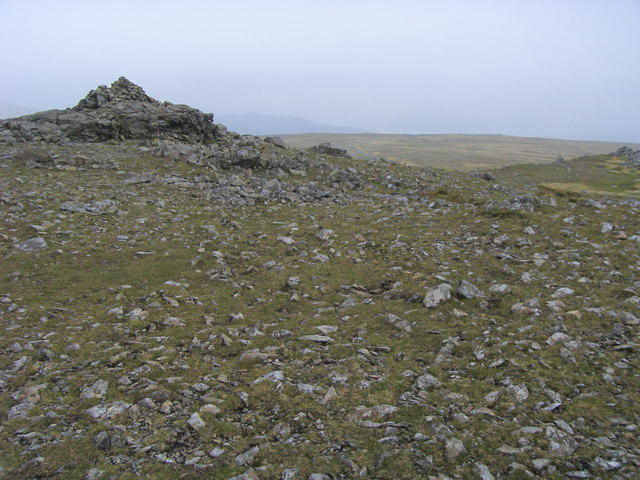 Photo could not load
NY3710 : Dove Crag Summit
Shaun Ferguson
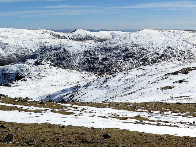 Photo could not load
NY3710 : View from Dove Crag
Andrew Curtis
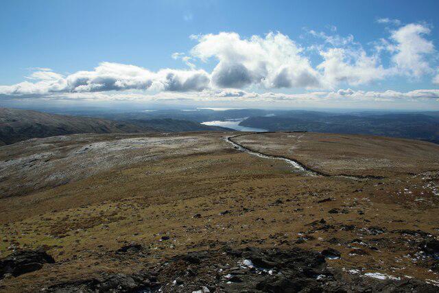 Photo could not load
NY3710 : Looking south from Dove Crag
Graham Robson
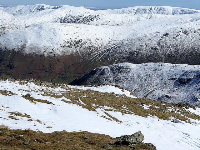 Photo could not load
NY3710 : View from Dove Crag
Andrew Curtis
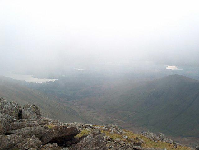 Photo could not load
NY3710 : The top of Dove Crag
Bill Boaden
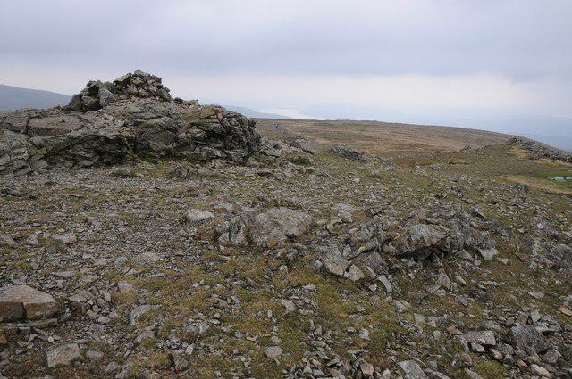
NY3710 : Cairn on Dove Crag
Philip Halling
Hill facts and local notes
Classifications
Elevation
792m
2,598 ft
Prominence
50m
Coordinates
54.4854, -2.9669
NY374104
OS Map
90
Explorer: OL5S OL7N
At the Summit
The summit features a prominent rock outcrop with a small cairn and an impressive view of the nearby peaks and valleys, perfect for a photo op. Just don't forget to ask someone to take your picture - no one can believe how majestic the Welsh mountains are unless they see it!
Terrain & Geology
Dove Crag is primarily composed of volcanic rock, showcasing some stunning crags and cliffs that are a feast for the eyes and the adventurous spirit. It provides a view into the igneous processes that shaped the region.
Views & Scenery
From the summit of Dove Crag, hikers can see the stunning surrounding peaks including Helvellyn, Windermere, and the iconic Fairfield. The view is simply breathtaking, ideal for those Instagram shots.
History & Heritage
Name Origin
The name 'Dove' is believed to be derived from the Old Norse word 'dúfa', meaning dove or pigeon, while 'Crag' simply refers to a steep or rugged cliff.
Historical Significance
Historically, the crag has been a favourite among climbers due to its distinctive rock formations and serves as a vital part of the Lake District's natural beauty.
Getting There & Facilities
Parking
Brothers Water car park offers ample space and is located right by the starting point of the popular route to Dove Crag.
Public Transport
The nearest bus service operates between Windermere and Patterdale, with a stop near Brothers Water, but be sure to check schedules as they can be a bit sporadic.
Nearby Facilities
There are no facilities directly on Dove Crag. However, plenty of options can be found in Ambleside or Patterdale, including cafes, toilets, and shops.
Safety Information
Known Hazards
- Steep rocky sections can be treacherous in wet conditions, and the potential for sudden weather changes in the Lake District can surprise even the most prepared hiker.
General Safety Tips
- Check weather conditions before setting out
- Carry appropriate clothing and equipment
- Let someone know your planned route
- Take a map, compass, and GPS device
- Carry emergency supplies: food, water, first aid kit, torch
Hills
Some common questions about the hills answered
Are there group walks up Dove Crag?
Many walkers use Walkmates to join or organise walks with others. You can check for group walks around Dove Crag through the maps
Are there other walkers around Dove Crag?
Activity varies by location and time, but Walkmates lets you see whether others have shared walks or shown interest in this area. Find other people through the walking friends search walking friends for Dove Crag search or of course create your own walk for Dove Crag
Can I organise a walk to Dove Crag?
Yes. If there aren’t any walks listed already, you can create a walk and make it available for others to join.
If you're signed up to Walkmates, you can create a walk to Dove Crag.
How do I find a walk up this hill?
There are often multiple ways to walk this hill, depending on experience and route preference. Walkmates helps you explore walks and routes that others have shared.
Can I suggest a new route up Dove Crag?
Yes. You can suggest or create routes to share with others. Walkmates focuses on the social side of walking, so routes are used to help people organise walks and explore areas together, rather than as detailed navigation tools or route libraries.
Other uses really appreciate knowledgeable walkers sharing their routes. Share your favourite route to Dove Crag here
The is an error or something incorrect about this hill. How do I let you know?
We always strive to keep the information on Walkmates as accurate as possible. If you find an error, please let us know through the contact form and we'll aim to correct it as quickly as possible
Community Discussion
Comments
Location
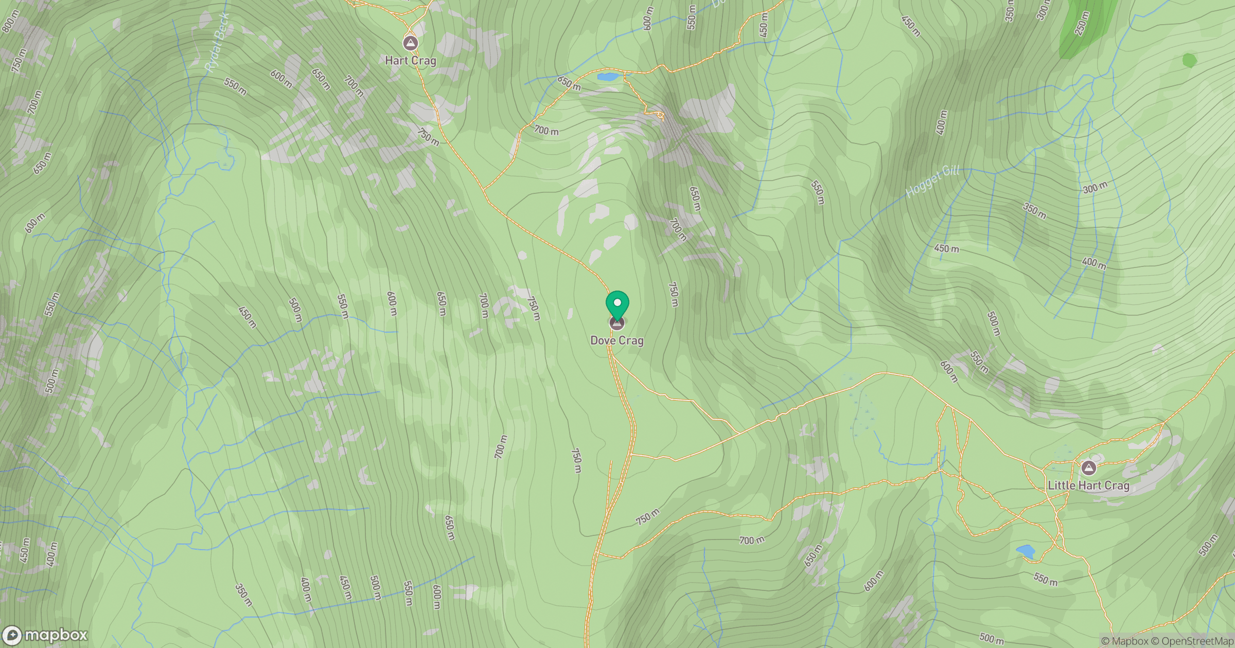
Grid reference: NY374104
View on OpenStreetMapOpens a map in a new tab, centred on the hill.

No comments yet. Be the first.