
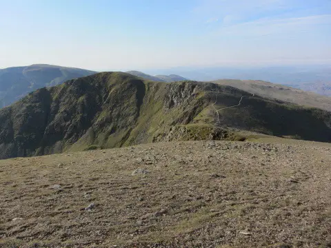
Dollywaggon Pike
Good walks are even better shared.
Overview
Dollywaggon Pike is an 858.5-metre fell above Grisedale Tarn at the southern end of the Helvellyn ridge.
Dollywaggon Pike
Dollywaggon Pike stands at the southern end of the Helvellyn ridge, above Grisedale Tarn. Its summit is 858.5 metres high, at grid reference NY346130. The approach from the tarn gives a good sense of the fell's shape: a long climb up the southern slopes, followed by open ground beside the craggy eastern side. High Crag and Nethermost Pike continue the ridge north towards Helvellyn.
The summit is worth visiting in its own right. The main ridge path passes below it, so following the busiest track does not necessarily take you to the highest point. A small cairn marks the top near the head of The Tongue. A larger cairn nearby is not the summit. In clear weather, the view opens down Grisedale towards Place Fell, across to St Sunday Crag and Fairfield, and north along the Helvellyn range.
Walking from Dunmail Raise
This is an out-and-back walk from the Raise Beck path at Dunmail Raise. It approaches the fell from the west and uses Grisedale Tarn and the zigzag path for the final climb.
Follow the mountain path uphill beside Raise Beck, on its southern side. The ground is rough and the climb sustained, so take your time on the stone sections. At the head of the beck, continue towards Grisedale Tarn. Follow the path above its northern shore to the foot of the zigzags on Dollywaggon's southern slopes.
Climb the zigzags rather than cutting straight up the hillside. As the ground opens out above them, leave the through-route towards Helvellyn to reach Dollywaggon's summit rise. Keep back from the steep eastern edge, particularly if visibility is poor.
Return by reversing the ascent: regain the zigzag path, descend to the tarn-side path, follow it west to the head of Raise Beck and descend beside the beck to the same Dunmail Raise starting point. Continuing north along the ridge or dropping east down The Tongue would take you onto a different walk. WalkLakes route guide
Walking from Mill Bridge, north of Grasmere
This second out-and-back starts at Mill Bridge on the A591, north of Grasmere village. Follow the signed route towards Grisedale Tarn and take the Tongue Gill branch, climbing on the eastern side of Great Tongue. Continue up the valley to Grisedale Hause, the pass between Seat Sandal and Fairfield.
From the hause, descend towards Grisedale Tarn and work round its western end onto the northern shore path. This brings you to the same zigzag ascent used from Dunmail Raise. Climb to the upper slopes and make the short diversion from the main ridge path to Dollywaggon's summit.
For the return, descend the zigzags and retrace the tarn-side path to Grisedale Hause. Cross the hause and follow Tongue Gill downhill to Mill Bridge. This return keeps the walk focused on Dollywaggon Pike without adding Seat Sandal, Fairfield or Helvellyn. If you begin in Grasmere village, include the connecting walk to and from Mill Bridge in your plan. Take particular care wherever your approach meets or crosses the A591. Tongue Gill and Grisedale Hause approach
Terrain and route choice
Both approaches involve a substantial mountain ascent on rough paths, with stone steps, grassy stretches and uneven ground. The zigzags ease the gradient but do not remove the effort. Allow enough daylight for the descent as well as the climb, and carry a map and compass with the skills to use them.
The Tongue is the eastern ridge dropping from the summit towards Grisedale. Its steeper, craggier ground needs a different level of route choice from the tarn paths described here. The same applies to an outing that adds Striding Edge or Swirral Edge on Helvellyn. Choose the whole route before setting off, including the way down, rather than treating every line joining these fells as equivalent.
Mist can hide the summit turn and nearby drops. Wet rock can be slippery, and strong wind makes the exposed upper ground more serious. Heavy rain can make beck crossings unsafe. Snow and ice change the character of the steep paths and demand suitable winter skills and equipment. Check a mountain forecast before leaving and be prepared to turn back. Lake District walking safety
Getting there and facilities
Grasmere is a useful base for the southern approach. Stock Lane has paid parking and public toilets; check the notices and opening arrangements when you arrive. It is in the village rather than at the Mill Bridge trailhead, so allow for the extra walk. Grasmere also has shops and places to eat. Carry the food and water you need for the mountain.
The 555 serves Grasmere. Check the operator's current timetable, your chosen stop and the return journey before setting out. For Dunmail Raise, plan the roadside arrival carefully and follow current signs rather than assuming a verge or gateway is available for parking. Grasmere visitor facilities
Explore routes near Dollywaggon Pike
Public walks starting within 80 km of this hill. Nearby does not mean a route reaches the summit; check its map and access before setting out.
Helvellyn via Striding Edge
View route
Striding Edge, Helvellyn and Catstye Cam
View route
Scafell Pike from Seathwaite via the Corridor Route
View route
Great Carrs Halifax Wreckage from Wrynose Pass
View route
Route planning notes
These notes describe possible approaches, not verified navigable routes or permission to cross land. Check current paths, local access rules and conditions before setting out.
Dunmail Raise via Raise Beck and Grisedale Tarn, out and back
Start and finish at the Raise Beck path at Dunmail Raise. Ascend the path on the southern side of Raise Beck, follow the path above Grisedale Tarn's northern shore, climb the zigzags and leave the main ridge path for Dollywaggon Pike's summit. Reverse the same route via the zigzags, northern tarn-side path and Raise Beck. Rough, steep mountain walking; no eastern ridge or Helvellyn extension included.
Mill Bridge via Tongue Gill and Grisedale Tarn, out and back
Start and finish at Mill Bridge on the A591 north of Grasmere. Follow the route towards Grisedale Tarn via Tongue Gill on the eastern side of Great Tongue to Grisedale Hause. Descend to the tarn, go around its western end to the northern shore path and climb the Dollywaggon zigzags to the summit diversion. Return via the same zigzags, tarn path, Grisedale Hause and Tongue Gill to Mill Bridge. Add the separate connection if starting in Grasmere village. No Seat Sandal, Fairfield or Helvellyn extension included.
Make a day of it, together
Find someone to share the walk with, or organise a day out along a route you like.
Photo Gallery
View all Photo could not load
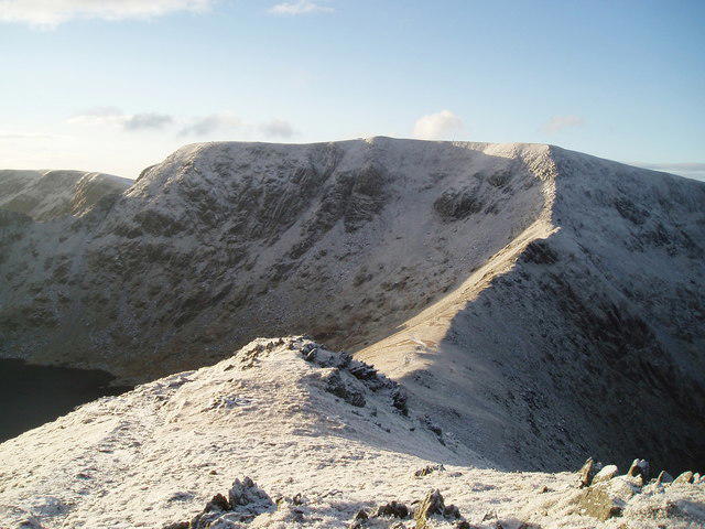
NY3413 : Snowed crags of Dollywaggon Pike
Trevor Littlewood
 Photo could not load
NY3412 : Driven Snow
Michael Graham
 Photo could not load
NY3412 : Crag overlooking Cock Cove
K A
 Photo could not load
NY3413 : On Dollywaggon Pike
Michael Graham
 Photo could not load
NY3413 : The Tongue from Dollywaggon Pike with Grisedale beyond
Colin Park
 Photo could not load
NY3413 : The Tongue
Michael Graham
 Photo could not load
NY3413 : Summit Cairn Dollywaggon Pike
Michael Graham
 Photo could not load
NY3413 : On Nethermost Pike - View towards Dollywagon Pike
Colin Park
 Photo could not load
NY3413 : Dollywagon Pike Summit
Graham Robson

NY3413 : On Dollywaggon Pike
Michael Graham
Hill facts and local notes
Classifications
Elevation
858m
2,817 ft
Prominence
50m
Coordinates
54.5087, -3.0112
NY346130
OS Map
90
Explorer: OL5S
At the Summit
A small cairn on the summit rise near the head of The Tongue. A larger nearby cairn is lower; the main ridge path bypasses the summit.
Terrain & Geology
Views & Scenery
Views down Grisedale towards Place Fell, across to St Sunday Crag and Fairfield, and north along the Helvellyn ridge.
Getting There & Facilities
Check current local access restrictions, parking rules and transport timetables before travelling. These notes do not confirm public access to the summit.
Parking
Stock Lane, Grasmere, offers paid village parking for the southern approach. Include the connecting walk to Mill Bridge. At Dunmail Raise, obey current roadside restrictions and keep gateways clear.
Public Transport
The 555 serves Grasmere. Check the current operator timetable, chosen stop and return service before travelling.
Nearby Facilities
Public toilets at Stock Lane in Grasmere, with shops and places to eat in the village. Check current opening arrangements and carry food and water for the walk.
Safety Information
Known Hazards
- Steep eastern crags and exposed upper ground.
- Mist can obscure the summit diversion and route choices.
- Wet rock and stone steps can be slippery.
- Heavy rain can make beck crossings unsafe.
- The Tongue and routes adding Helvellyn's exposed edges need separate planning.
Seasonal Hazards
Snow and ice make the steep paths serious winter terrain; suitable skills and equipment are essential.
General Safety Tips
- Check weather conditions before setting out
- Carry appropriate clothing and equipment
- Let someone know your planned route
- Take a map, compass, and GPS device
- Carry emergency supplies: food, water, first aid kit, torch
Hills
Some common questions about the hills answered
Are there group walks up Dollywaggon Pike?
Many walkers use Walkmates to join or organise walks with others. You can check for group walks around Dollywaggon Pike through the maps
Are there other walkers around Dollywaggon Pike?
Activity varies by location and time, but Walkmates lets you see whether others have shared walks or shown interest in this area. Find other people through the walking friends search walking friends for Dollywaggon Pike search or of course create your own walk for Dollywaggon Pike
Can I organise a walk to Dollywaggon Pike?
Yes. If there aren’t any walks listed already, you can create a walk and make it available for others to join.
If you're signed up to Walkmates, you can create a walk to Dollywaggon Pike.
How do I find a walk up this hill?
There are often multiple ways to walk this hill, depending on experience and route preference. Walkmates helps you explore walks and routes that others have shared.
Can I suggest a new route up Dollywaggon Pike?
Yes. You can suggest or create routes to share with others. Walkmates focuses on the social side of walking, so routes are used to help people organise walks and explore areas together, rather than as detailed navigation tools or route libraries.
Other uses really appreciate knowledgeable walkers sharing their routes. Share your favourite route to Dollywaggon Pike here
The is an error or something incorrect about this hill. How do I let you know?
We always strive to keep the information on Walkmates as accurate as possible. If you find an error, please let us know through the contact form and we'll aim to correct it as quickly as possible
Community Discussion
Comments
Location
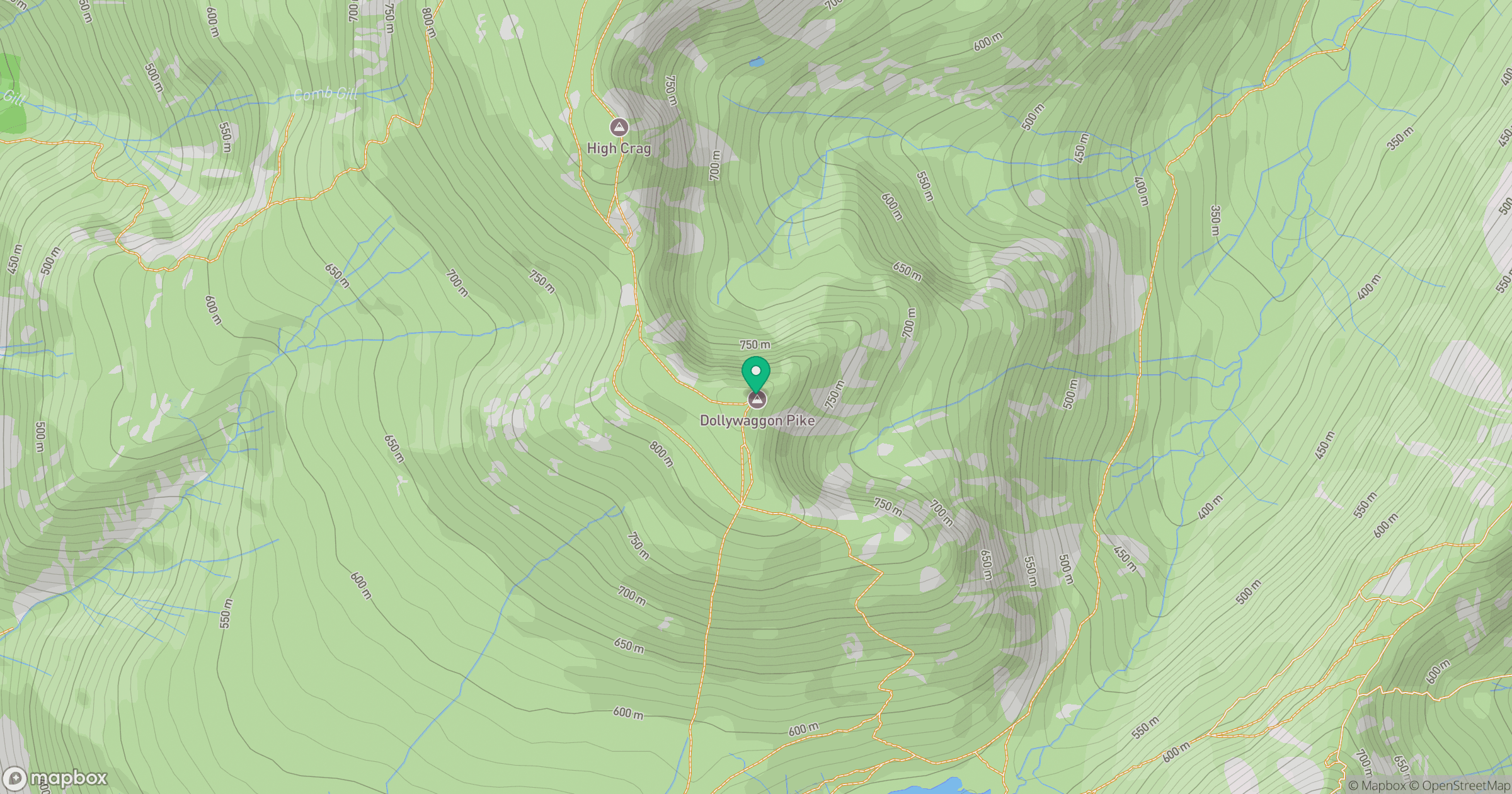
Grid reference: NY346130
View on OpenStreetMapOpens a map in a new tab, centred on the hill.
Hills within 30 km
Straight-line distance, not a walking route or confirmation of access.
No comments yet. Be the first.