
Cruach Dhubh an Ruidhe Fearna
Good walks are even better shared.
Overview
Cruach Dhubh an Ruidhe Fearna
Introduction
Cruach Dhubh an Ruidhe Fearna is a striking Marilyn located in the scenic Argyll and Bute region of Scotland, standing proud at an elevation of 827 meters. It may not be the tallest of peaks, but it more than makes up for it with its rugged charm and stunning vistas.
Geology
The mountain's composition is primarily metamorphic rock, which tells the story of countless millennia of geological transformation. Glacial activity has carved out its dramatic features, leaving behind crags and cliffs that will leave any geologist grinning from ear to ear.
Routes
There are a couple of popular routes to conquer this peak. The West Highland Way Approach offers a more leisurely trek while soaking in the beauty of the Scottish Highlands. For those feeling a bit adventurous, the East Ridge Route promises a challenging scramble that rewards hikers with a rewarding sense of achievement at the summit.
Summit Features
At the very top, you’ll find a rocky outcrop adorned with a small cairn. This humble structure serves as a beacon for mountain enthusiasts and ensures you’ll have the perfect Instagram shot to boast about your conquest.
Terrain
Expect a mix of rocky outcrops and grassy slopes, but don't let the grass fool you—there are plenty of boggy patches to navigate, particularly after a good rain. Bring good boots, and you should be golden!
Views
Once you’ve reached the summit, your efforts definitely won’t go unrewarded. The views stretch across hills and valleys, with Loch Awe glistening in the distance. For the best experience, aim for late spring or early autumn when the scenery is particularly fabulous.
Hazards
As always in the Highlands, keep your eyes peeled! With slippery stones and sudden fog, it’s easy to go from ‘hero’ to ‘where am I?’ in no time. Always pack your common sense, and maybe wear a whistle for good measure.
Nearby Summits
If you have time (and energy), consider exploring nearby peaks such as Ben Cruachan and Meall na Sroine. After all, what's better than one summit? A whole bunch of them!
Access and Facilities
Parking is available at the Ben Cruachan visitor centre, about 10 km from the start of the trail. The friendly town of Dalmally has some quaint cafes where you can fuel up before your journey. Just remember, no facilities on the mountain, so don't forget the essentials!
History
The name Cruach Dhubh is quite evocative, meaning 'Dark Hill' in Gaelic. Its history is rich, with tales of ancient clans and stone circles dotting the landscape. So, as you hike, you'll be walking through centuries of stories.
Enjoy your adventure on Cruach Dhubh an Ruidhe Fearna, and remember: take nothing but pictures, leave nothing but footprints!
Explore routes near Cruach Dhubh an Ruidhe Fearna
Public walks starting within 80 km of this hill. Nearby does not mean a route reaches the summit; check its map and access before setting out.
Banavie to Glen Loy Aqueduct: Neptune’s Staircase Canal Towpath
View route
Ben Nevis via Mountain Path
View route
Loch Affric full circuit from River Affric
View route
Fort Augustus to Kytra Lock: Caledonian Canal Towpath
View route
Route planning notes
These notes describe possible approaches, not verified navigable routes or permission to cross land. Check current paths, local access rules and conditions before setting out.
West Highland Way Approach
A scenic route that approaches the mountain from the West Highland Way, offering stunning views of the surrounding landscape.
East Ridge Route
This route takes you along the eastern ridge, providing a direct ascent to the summit, with some rocky scrambling involved.
Make a day of it, together
Find someone to share the walk with, or organise a day out along a route you like.
Hill facts and local notes
Classifications
Elevation
446m
1,463 ft
Prominence
144m
Coordinates
56.9341, -5.6714
NM767885
OS Map
40
Explorer: 398W
At the Summit
The summit features a prominent rocky outcrop with a small cairn, providing a perfect backdrop for your summit photo. The views from here are nothing short of breathtaking.
Terrain & Geology
The mountain is primarily composed of metamorphic rock, offering a peek into the ancient geological history of Scotland. The rugged cliffs and crags provide excellent evidence of glacial activity.
Views & Scenery
From the summit, enjoy panoramic views of the surrounding hills, including Loch Awe and the distant peaks of the Munros.
History & Heritage
Name Origin
Cruach Dhubh means 'Dark Hill' in Gaelic, reflecting the mountain’s rugged and shadowy character.
Historical Significance
The region is steeped in history, with ancient stone circles and remnants of clan battles from centuries past.
Getting There & Facilities
Check current local access restrictions, parking rules and transport timetables before travelling. These notes do not confirm public access to the summit.
Parking
There is parking available at the 'Ben Cruachan' visitor centre, less than 10 km from the foot of the trail.
Public Transport
Buses operate from Oban to the nearby village of Dalmally, with connections to other major towns.
Nearby Facilities
There are no facilities directly on the mountain; however, Dalmally offers a couple of cafes and toilets for pre- or post-hike refreshments.
Safety Information
Known Hazards
- Be cautious of slippery stones, particularly in wet conditions. Fog can roll in unexpectedly, reducing visibility significantly.
General Safety Tips
- Check weather conditions before setting out
- Carry appropriate clothing and equipment
- Let someone know your planned route
- Take a map, compass, and GPS device
- Carry emergency supplies: food, water, first aid kit, torch
Hills
Some common questions about the hills answered
Are there group walks up Cruach Dhubh an Ruidhe Fearna?
Many walkers use Walkmates to join or organise walks with others. You can check for group walks around Cruach Dhubh an Ruidhe Fearna through the maps
Are there other walkers around Cruach Dhubh an Ruidhe Fearna?
Activity varies by location and time, but Walkmates lets you see whether others have shared walks or shown interest in this area. Find other people through the walking friends search walking friends for Cruach Dhubh an Ruidhe Fearna search or of course create your own walk for Cruach Dhubh an Ruidhe Fearna
Can I organise a walk to Cruach Dhubh an Ruidhe Fearna?
Yes. If there aren’t any walks listed already, you can create a walk and make it available for others to join.
If you're signed up to Walkmates, you can create a walk to Cruach Dhubh an Ruidhe Fearna.
How do I find a walk up this hill?
There are often multiple ways to walk this hill, depending on experience and route preference. Walkmates helps you explore walks and routes that others have shared.
Can I suggest a new route up Cruach Dhubh an Ruidhe Fearna?
Yes. You can suggest or create routes to share with others. Walkmates focuses on the social side of walking, so routes are used to help people organise walks and explore areas together, rather than as detailed navigation tools or route libraries.
Other uses really appreciate knowledgeable walkers sharing their routes. Share your favourite route to Cruach Dhubh an Ruidhe Fearna here
The is an error or something incorrect about this hill. How do I let you know?
We always strive to keep the information on Walkmates as accurate as possible. If you find an error, please let us know through the contact form and we'll aim to correct it as quickly as possible
Community Discussion
Comments
Location
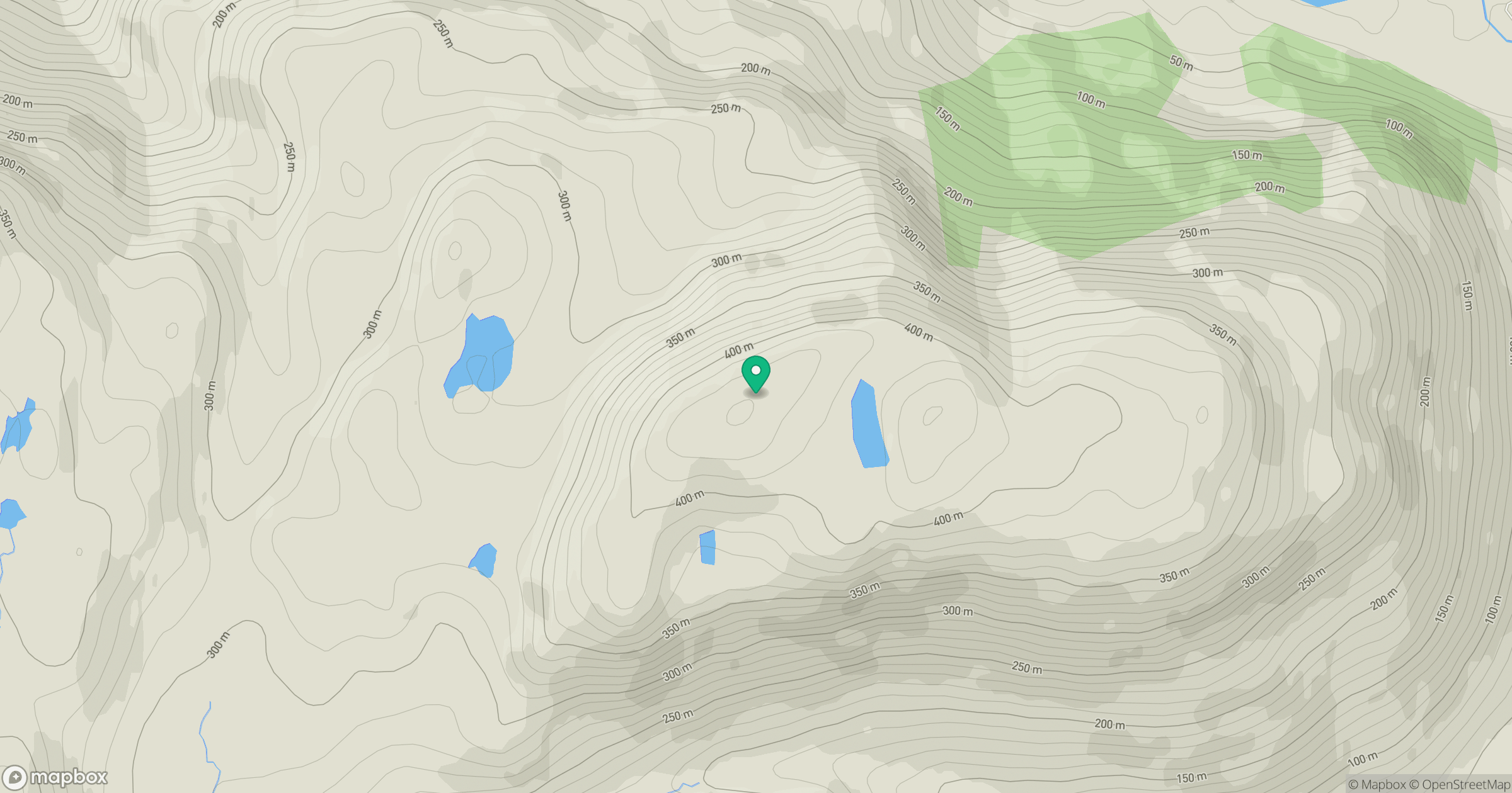
Grid reference: NM767885
View on OpenStreetMapOpens a map in a new tab, centred on the hill.
Hills within 30 km
Straight-line distance, not a walking route or confirmation of access.
Ladhar Bheinn
1,020m
Beinn Sgritheall
974m
An Caisteal
622m
Sgurr a' Mhaoraich
1,027m
Beinn nan Cabar
574m
No comments yet. Be the first.