

Mount Blair
Good walks are even better shared.
NO1662 : Mount Blair
Alan O'Dowd Photo source
Overview
Mount Blair
Nestled in the stunning Scottish Highlands, Mount Blair stands proudly at an elevation of 828 meters, marking it as a Marilyn. With its rugged charm and evocative history, it has become a must-visit for hikers and outdoor enthusiasts alike.
Geology
Primarily composed of Old Red Sandstone, the geological features here tell tales from the Devonian Period. It's like the mountain is wearing its history on its sleeve—or should I say, on its rocky outcrops?
Access and Parking
You can easily find parking at Blair Castle, which is just a hop, skip, and a jump away from the trailhead. If you’re opting for public transport, buses frequently travel from Pitlochry to Blair Atholl, making it a convenient option for all adventurers.
The Hike
One of the most popular routes is the Blair Castle to the summit trail. Spanning approximately 7 km, this hike typically takes around three hours at a moderate pace. The trail takes you through lush woodland before presenting that familiar steep ascent. Be sure to break for a bit of a giggle—you might just encounter a sheep who fancies itself as your hiking buddy!
Summit Features
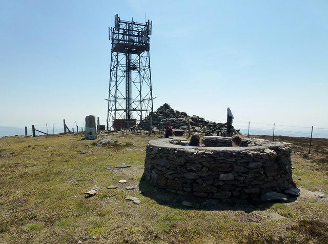
Reaching the summit, you'll be greeted by a proud cairn and a stone wall. It’s the perfect place to take a moment, soak in the sweeping views, and pat yourself on the back for a job well done.
Terrain and Hazards
Expect a delightful mix of grassy slopes and rocky outcrops, with the occasional boggy patch that may challenge your balance! Do keep an eye on the weather—it can be a bit moody up here, with unexpected changes leading to mist and slippery paths.
Views
From the top, you’re treated to breathtaking views of Glenshee hills and the surrounding valleys. Just remember, the best time to go is late spring through early autumn, when the skies are more forgiving and the scenery just begs to be captured on camera.
Nearby Summits
If you happen to be feeling adventurous, why not also tackle Cairn an t-Sithein, which looms at 835 meters nearby?
Facilities
Don’t forget to refuel after your hike! The café at Blair Castle offers a refreshing break with tasty treats. Plus, you’ll find toilets there, ensuring you're all set for the journey back.
History
The name 'Blair' comes from the Gaelic 'blàr', meaning 'field'. This strategic spot has a rich history, especially during the Jacobite risings. If mountains could talk, this one would have stories to tell!
So, there you have it! Mount Blair isn’t just a mountain; it’s an experience waiting to be had. Grab your pack, lace up your boots, and hit the trail!
Happy hiking!
Explore routes near Mount Blair
Walks starting near this hill. Open a route to check its map, distance and full itinerary.
Unled club outing: West Drumochter/Beinn Udlamain (coach departure)
View route
Unled club outing: Glenesk (coach departure)
View route
Unled club outing: Xmas Walk - Bankfoot - Dunkeld (coach departure)
View route
Unled club outing: Angus coastal walk (coach departure)
View route
Route planning notes
These notes describe possible approaches. Check a route's map and access information when planning your walk.
Blair Castle to the Summit
A popular route starting from the historic Blair Castle, winding through lush woodland before ascending to the summit with stunning views.
Make a day of it, together
Find someone to share the walk with, or organise a day out along a route you like.
Photo Gallery
View all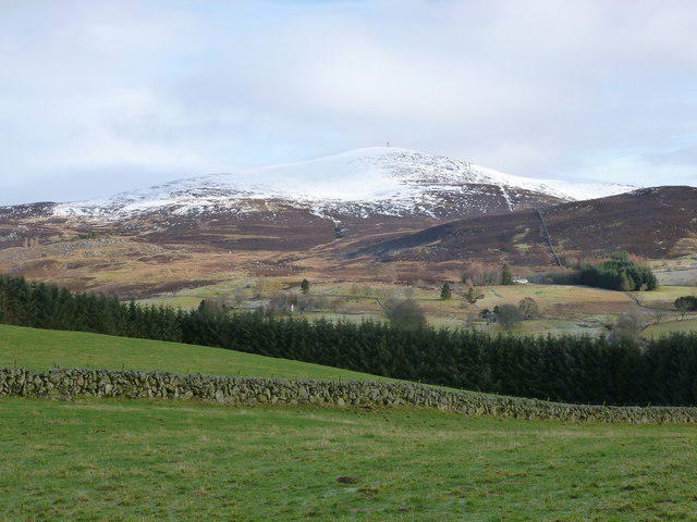 Photo could not load
NO1662 : Mount Blair
Alan O'Dowd
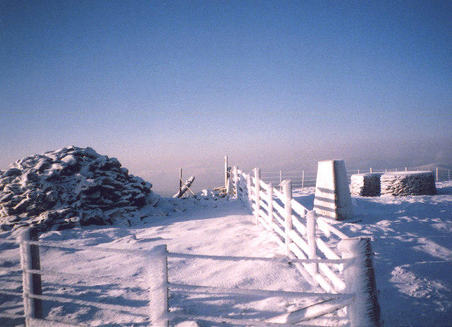 Photo could not load
NO1662 : The summit of Mount Blair
bill copland
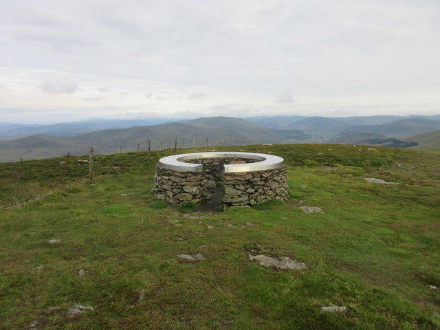 Photo could not load
NO1662 : Mount Blair Viewpoint
Scott Cormie
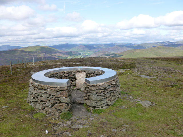 Photo could not load
NO1662 : Repaired summit viewpoint on Mount Blair
Alan O'Dowd
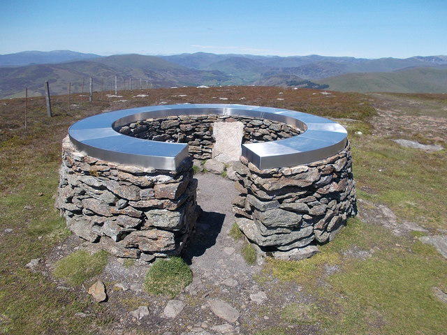 Photo could not load
NO1662 : View indicator on Mount Blair
Iain Russell
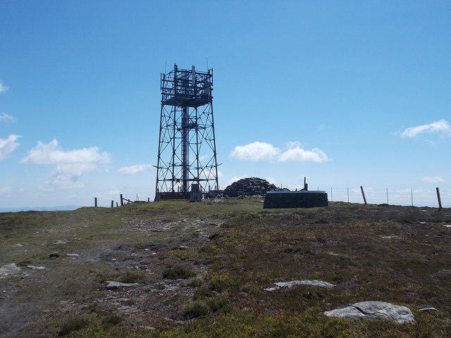 Photo could not load
NO1662 : Summit of Mount Blair
Iain Russell
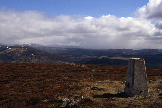 Photo could not load
NO1662 : The summit of Mount Blair with snow showers on the horizon
Colin Park
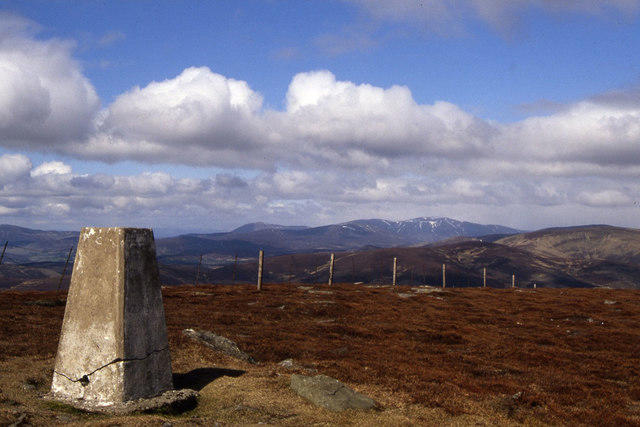 Photo could not load
NO1662 : The trig point on Mount Blair
Colin Park
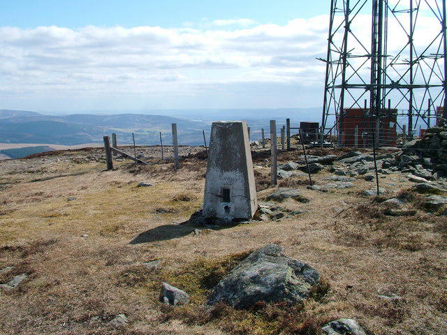 Photo could not load
NO1662 : Summit of Mount Blair
David Brown
NO1662 : Mount Blair
Rude Health
Hill facts and local notes
Classifications
Elevation
744m
2,442 ft
Prominence
400m
Coordinates
56.7509, -3.3631
NO167629
OS Map
43
Explorer: OL52S 387S
At the Summit
The summit features a stone wall and a cairn, offering a perfect photo opportunity for hikers celebrating their achievement.
Terrain & Geology
Primarily composed of Old Red Sandstone, Mount Blair showcases unique geological features formed during the Devonian Period, creating a striking landscape worthy of exploration.
Views & Scenery
From the summit, admire views of the nearby Glenshee hills and the sprawling valleys below, with the majestic peaks in the distance providing a stunning backdrop.
History & Heritage
Name Origin
The name 'Blair' is derived from the Gaelic word 'blàr', meaning 'field' or 'plain', while 'Mount' is quite self-explanatory!
Historical Significance
This area was historically significant as a strategic location during the Jacobite risings and is rich in stories of ancient clans.
Getting There & Facilities
Parking
Blair Castle has a designated parking area with ample space, just a short walk from the trailhead.
Public Transport
Buses run regularly from Pitlochry to Blair Atholl, providing convenient access for those relying on public transport.
Nearby Facilities
The nearby Blair Castle offers facilities, including a café for refueling after your hike and toilets for a much-needed pit stop.
Safety Information
Known Hazards
- Be wary of changing weather conditions, as fog and rain can roll in unexpectedly, reducing visibility and making paths slippery.
General Safety Tips
- Check weather conditions before setting out
- Carry appropriate clothing and equipment
- Let someone know your planned route
- Take a map, compass, and GPS device
- Carry emergency supplies: food, water, first aid kit, torch
Hills
Some common questions about the hills answered
Are there group walks up Mount Blair?
Many walkers use Walkmates to join or organise walks with others. You can check for group walks around Mount Blair through the maps
Are there other walkers around Mount Blair?
Activity varies by location and time, but Walkmates lets you see whether others have shared walks or shown interest in this area. Find other people through the walking friends search walking friends for Mount Blair search or of course create your own walk for Mount Blair
Can I organise a walk to Mount Blair?
Yes. If there aren’t any walks listed already, you can create a walk and make it available for others to join.
If you're signed up to Walkmates, you can create a walk to Mount Blair.
How do I find a walk up this hill?
There are often multiple ways to walk this hill, depending on experience and route preference. Walkmates helps you explore walks and routes that others have shared.
Can I suggest a new route up Mount Blair?
Yes. You can suggest or create routes to share with others. Walkmates focuses on the social side of walking, so routes are used to help people organise walks and explore areas together, rather than as detailed navigation tools or route libraries.
Other uses really appreciate knowledgeable walkers sharing their routes. Share your favourite route to Mount Blair here
The is an error or something incorrect about this hill. How do I let you know?
We always strive to keep the information on Walkmates as accurate as possible. If you find an error, please let us know through the contact form and we'll aim to correct it as quickly as possible
Community Discussion
Comments
Location
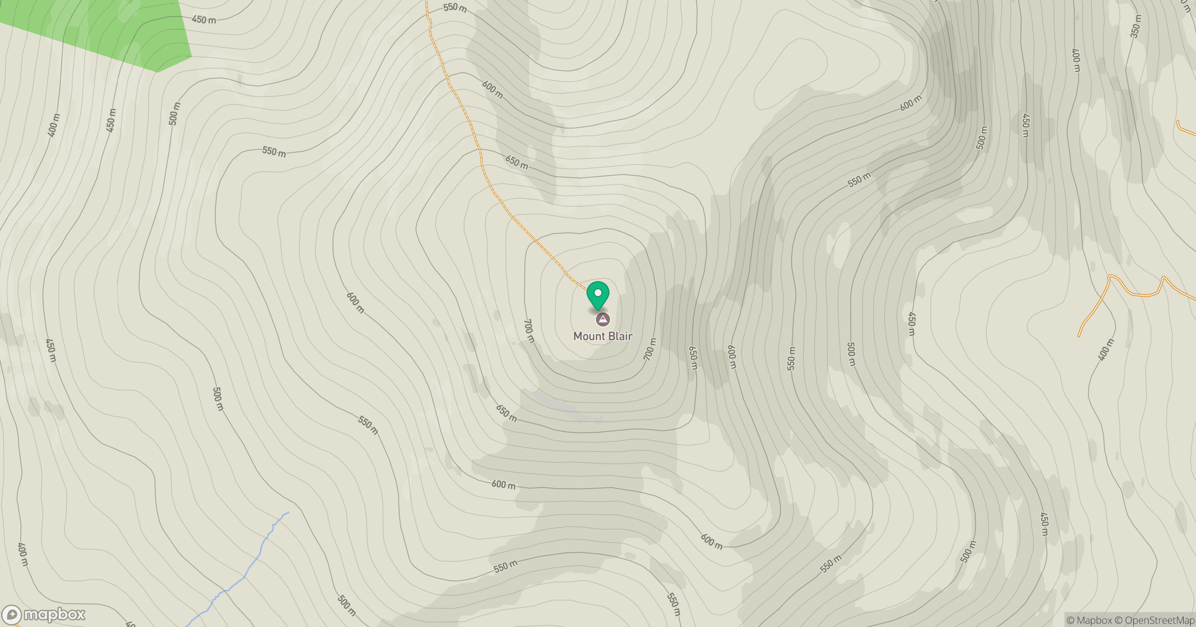
Grid reference: NO167629
View on OpenStreetMapOpens a map in a new tab, centred on the hill.
No comments yet. Be the first.