

Coldingham Loch Hill
Good walks are even better shared.
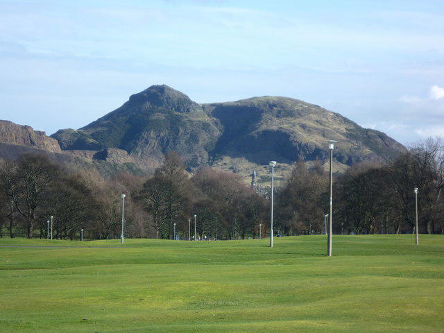
NT8968 : Coldingham Loch
Mick Garratt Photo source
Overview
Coldingham Loch Hill
Coldingham Loch Hill emerges majestically from the Scottish Borders, a delightful Marilyn that beckons adventurers and ambles alike. At an elevation of 185 meters, it may not be the highest crag in Scotland, but it is certainly a highlight for those exploring the Berwickshire coastline.
Geology
The hill's geology is a fascinating mix of sedimentary sandstone and shales, shaped over millions of years. Erosion has carved stunning landscapes and microhabitats, making exploring the area an educational treat for budding geologists. Be sure to inspect the rock formations; who knows what secrets they hold?
Route Overview
One popular route is the Coldingham Loch Trail, stretching about 6.5 km. It’s a delightful circuit starting from the Coldingham Loch car park. The route features gentle ascents and provides various points to rest and take in the surroundings. Progress at a leisurely pace, and ensure to have a snack or two ready; you’ll want to fuel up for those enchanting view stops!
Terrain Features
Expect grassy slopes that can sometimes surprise you with rocky outcrops. The marshy terrain near the loch can be a bit tricky—think of it as nature’s way of ensuring you have the requisite “slip and slide” experience, just without the fun of a water slide!
Views and Best Seasons
From the summit, the panoramas are breathtaking! Coldingham Loch sparkles below, with the rugged coast to the south and rolling hills in all directions. Visiting during spring or autumn is ideal, as you can capture vibrant colours—every hiker's dream Instagram backdrop.
Hazards
As gorgeous as the hill is, it's not without its perils. Be cautious of slippery rocks while climbing, especially if there's been a bit of rain. The boggy sections can turn you into a less-than-impressive mud statue if you’re not careful.
Nearby Adventures
The hill shares its gorgeous surroundings with nearby peaks such as St. Abbs Head and Meikle Says Law, which offer additional hiking opportunities and stunning views along the way.
Access
Conveniently, you can park at Coldingham Loch's designated car park, which costs you nothing but a smile. If you’re not driving, a bus from Eyemouth will get you close enough to stretch your legs to the trailhead. Eyemouth itself is a quaint town worth a visit, perhaps for some fish and chips post-hike!
Facilities
The car park includes basic restroom facilities, and trust us, no one wants to be caught unprepared after that hill-climb. A short jaunt to Coldingham village awards you with cafes that serve everything from coffee to comforting cakes.
Historical Tidbits
Coldingham translates to something along the lines of 'cold stream,' which is quite fitting given the local geography. This area isn’t just a pretty face—it’s steeped in history, particularly with the nearby Coldingham Priory, a site of medieval significance.
In summary, whether you're in it for the workout, the views, or to say you’ve trodden the slopes of Coldingham Loch Hill, it's a hike that wraps up in adventure and cultural gems. Just remember to pack your sense of humour and maybe a light jacket—Scotland can be a tad temperamental when it comes to weather!
Happy hiking!
Explore routes near Coldingham Loch Hill
Walks starting near this hill. Open a route to check its map, distance and full itinerary.
St Abbs Head Lighthouse and Pettico Wick
View route
St Abbs Circular with seal pups at Horsecastle Bay
View route
Coldingham Creel Path and St Abbs Bay
View route
Cockburnspath to Dunglass Dean and Old Bridge
View route
Route planning notes
These notes describe possible approaches. Check a route's map and access information when planning your walk.
Coldingham Loch Trail
A scenic circular route that begins at Coldingham Loch, offering gentle ascents and panoramic views.
Make a day of it, together
Find someone to share the walk with, or organise a day out along a route you like.
Photo Gallery
View all Photo could not load
NT8968 : Coldingham Loch
Mick Garratt
 Photo could not load
NT8968 : Mating Common Blue Damselflies at Coldingham Loch
Walter Baxter
 Photo could not load
NT8968 : An angler at Coldingham Loch
Walter Baxter
 Photo could not load
NT8968 : Coldingham Loch
Brian Turner
 Photo could not load
NT8968 : The Barn at Coldingham Loch
Graham Robson
 Photo could not load
NT8968 : Above Coldingham Loch
Richard Webb
Hill facts and local notes
Classifications
Elevation
166m
544 ft
Prominence
31m
Coordinates
55.9099, -2.1739
NT892685
OS Map
67
Explorer: 346
At the Summit
At the summit, you'll find a small stone cairn and several marker poles that provide orientation to the surrounding hills.
Terrain & Geology
The area around Coldingham Loch Hill is predominantly composed of sedimentary rocks, primarily sandstone and shales, formed in the carboniferous period. The erosion of these rocks creates not only a variety of interesting terrains but also unique microhabitats.
Views & Scenery
From the summit, you'll have views of the picturesque Coldingham Loch, the coastline to the south, and the rolling hills of the Scottish Borders.
History & Heritage
Name Origin
The name 'Coldingham' possibly derives from the Old English 'Colding', linked to a cold river or winter stream, reflecting the area's natural features.
Historical Significance
Historically, the site is close to the ancient Coldingham Priory, which dates back to the 12th century and played a significant role in the region's ecclesiastical history.
Getting There & Facilities
Parking
There is parking available at Coldingham Loch car park, which is free and provides good access to the trail.
Public Transport
The area is accessible by bus from Eyemouth, with routes operating several times daily.
Nearby Facilities
There are basic restroom facilities at the Coldingham Loch car park, and the village of Coldingham nearby offers a few cafes and shops for refreshments.
Safety Information
Known Hazards
- Beware of slippery rocks on the ascent and watch your footing in marshy areas, particularly after rainfall.
General Safety Tips
- Check weather conditions before setting out
- Carry appropriate clothing and equipment
- Let someone know your planned route
- Take a map, compass, and GPS device
- Carry emergency supplies: food, water, first aid kit, torch
Hills
Some common questions about the hills answered
Are there group walks up Coldingham Loch Hill?
Many walkers use Walkmates to join or organise walks with others. You can check for group walks around Coldingham Loch Hill through the maps
Are there other walkers around Coldingham Loch Hill?
Activity varies by location and time, but Walkmates lets you see whether others have shared walks or shown interest in this area. Find other people through the walking friends search walking friends for Coldingham Loch Hill search or of course create your own walk for Coldingham Loch Hill
Can I organise a walk to Coldingham Loch Hill?
Yes. If there aren’t any walks listed already, you can create a walk and make it available for others to join.
If you're signed up to Walkmates, you can create a walk to Coldingham Loch Hill.
How do I find a walk up this hill?
There are often multiple ways to walk this hill, depending on experience and route preference. Walkmates helps you explore walks and routes that others have shared.
Can I suggest a new route up Coldingham Loch Hill?
Yes. You can suggest or create routes to share with others. Walkmates focuses on the social side of walking, so routes are used to help people organise walks and explore areas together, rather than as detailed navigation tools or route libraries.
Other uses really appreciate knowledgeable walkers sharing their routes. Share your favourite route to Coldingham Loch Hill here
The is an error or something incorrect about this hill. How do I let you know?
We always strive to keep the information on Walkmates as accurate as possible. If you find an error, please let us know through the contact form and we'll aim to correct it as quickly as possible
Community Discussion
Comments
Location
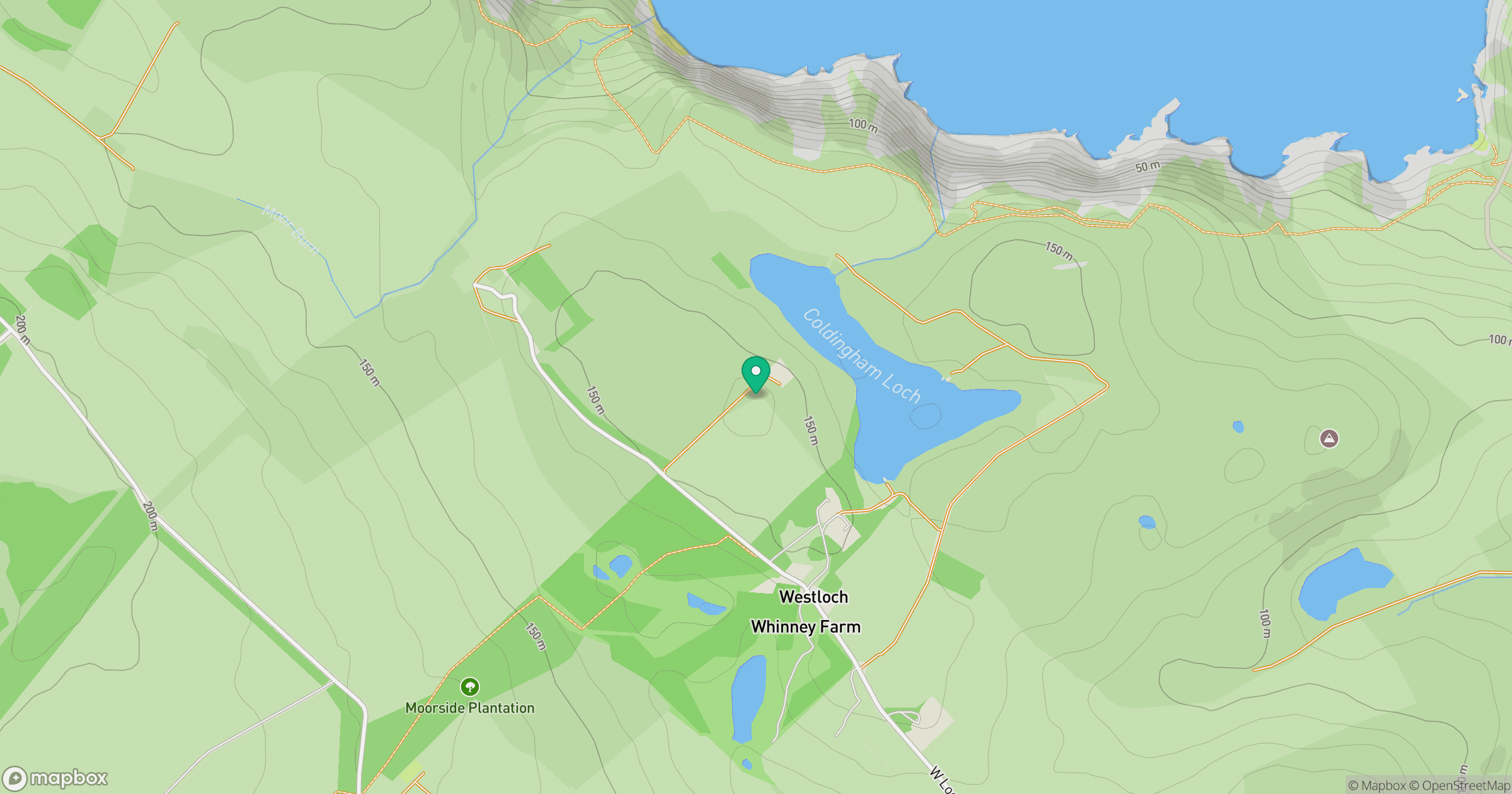
Grid reference: NT892685
View on OpenStreetMapOpens a map in a new tab, centred on the hill.
No comments yet. Be the first.