
Cnoc Thulagain
Good walks are even better shared.
Overview
Discovering Cnoc Thulagain
Cnoc Thulagain, standing at 602 meters, is a Marilyn nestled in the stunning Scottish Highlands. Its prominent rocky summit and grassy slopes make it a favoured choice for hikers looking for a moderate challenge with a fulfilling payoff.
Geology
The mountain's volcanic rock structure is part of the Scottish geological masterpiece known as the Highland Boundary Fault zone. This means you can enjoy not just the hike but also a lesson in geology - what more could a hiker want? Keep an eye out for the diverse plant life that flourishes in this unique environment.
The Route
Starting from Balquhidder, the ascent to the summit is an experience to remember. Over 5.5 km, hikers will tread through lush greenery and rugged rock, tracing the footsteps of ancient Highland warriors, or at least daydreaming of such things while you chase those sheep off the path. Expect to spend about 2.5 hours, depending on how often you stop to take ‘just one more’ photo.
Summit Features
At the summit, you'll be welcomed by a simple cairn and a feast of breathtaking views. On a clear day, Loch Voil sprawls beneath you, and the sight of Ben More pokes its head above the horizon - it’s enough to make anyone feel on top of the world.
Terrain and Hazards
The terrain presents a mix of grassy hills and occasional rocky outcrops that will challenge your dodging skills when in full mudslide mode after rain. Keep your footing, mind the weather, and don't let the Highlands put you in a bit of a pickle!
Nearby Summits
After conquering Cnoc Thulagain, adventurous souls can venture to nearby summits like Ben More and Stob Binnein for more views and a chance to stretch those legs further.
Access
The path begins in Balquhidder, a quaint village that offers a few parking spaces and local amenities. It’s wise to arrive early during peak seasons. For those relying on public transport, a bit of prior planning is necessary; the buses aren’t frequent and you'll want to avoid a lengthy pilgrimage back home!
Final Thoughts
Whether you're seeking solitude, stunning vistas, or a dash of Highland lore, Cnoc Thulagain has a bit of everything up its sleeve. Just remember your waterproofs and maybe, just maybe, pack a snack for the journey - trust us, you’ll earn it!
Last Remarks
Hiking Cnoc Thulagain is not just about the destination; it’s about soaking in the atmosphere, the views, and maybe meeting a friendly local sheep or two. Happy hiking!
Explore routes near Cnoc Thulagain
Public walks starting within 80 km of this hill. Nearby does not mean a route reaches the summit; check its map and access before setting out.
Aviemore: Loch an Eilein and the Croft Track from Rothiemurchus
View route
Rothiemurchus: Beaver Trail and Lochan Mor
View route
Inverness: River Ness and Caledonian Canal circuit
View route
Great Glen Way low route: Fort Augustus to Invermoriston Old Bridge
View route
Route planning notes
These notes describe possible approaches, not verified navigable routes or permission to cross land. Check current paths, local access rules and conditions before setting out.
From Balquhidder
A scenic route starting from the charming village of Balquhidder, leading up to the summit of Cnoc Thulagain. Perfect for a leisurely hike with splendid views while getting your steps in.
Make a day of it, together
Find someone to share the walk with, or organise a day out along a route you like.
Hill facts and local notes
Classifications
Elevation
529m
1,736 ft
Prominence
141m
Coordinates
57.2710, -4.0865
NH742219
OS Map
35
Explorer: 417
At the Summit
The summit features a small stone cairn, which is perfect for a quick selfie, and an impressive 360-degree view that will make your social media followers green with envy.
Terrain & Geology
Cnoc Thulagain is predominantly composed of volcanic rock characteristic of the Highland Boundary Fault zone, offering a rich tapestry of geological history and rugged terrain.
Views & Scenery
Panoramic views of Loch Voil, the surrounding mountains, and on a clear day, you might even catch a glimpse of Ben More.
History & Heritage
Name Origin
The name 'Cnoc Thulagain' translates to 'Hill of the Horrors', a stark reminder of its rugged terrain and unpredictable weather. But fear not, it’s mostly just a pleasant stroll.
Historical Significance
This mountain is part of the folklore of the area, with tales of spirits and warriors adding a layer of intrigue to your hiking experience.
Getting There & Facilities
Check current local access restrictions, parking rules and transport timetables before travelling. These notes do not confirm public access to the summit.
Parking
There is a small car park at the entrance to Balquhidder, with space for approximately 10-12 cars. Arrive early if you're going on the weekend.
Public Transport
The nearest bus service operates from Callander, approximately 12 miles away. Buses are infrequent, so plan accordingly unless you fancy a long walk.
Nearby Facilities
Cafes and a few local shops are available in Balquhidder, but public toilets should be used before hitting the trails.
Safety Information
Known Hazards
- Condition of paths can be variable; watch for slippery sections especially after rain. Be wary of sudden weather changes, common in mountainous regions.
General Safety Tips
- Check weather conditions before setting out
- Carry appropriate clothing and equipment
- Let someone know your planned route
- Take a map, compass, and GPS device
- Carry emergency supplies: food, water, first aid kit, torch
Hills
Some common questions about the hills answered
Are there group walks up Cnoc Thulagain?
Many walkers use Walkmates to join or organise walks with others. You can check for group walks around Cnoc Thulagain through the maps
Are there other walkers around Cnoc Thulagain?
Activity varies by location and time, but Walkmates lets you see whether others have shared walks or shown interest in this area. Find other people through the walking friends search walking friends for Cnoc Thulagain search or of course create your own walk for Cnoc Thulagain
Can I organise a walk to Cnoc Thulagain?
Yes. If there aren’t any walks listed already, you can create a walk and make it available for others to join.
If you're signed up to Walkmates, you can create a walk to Cnoc Thulagain.
How do I find a walk up this hill?
There are often multiple ways to walk this hill, depending on experience and route preference. Walkmates helps you explore walks and routes that others have shared.
Can I suggest a new route up Cnoc Thulagain?
Yes. You can suggest or create routes to share with others. Walkmates focuses on the social side of walking, so routes are used to help people organise walks and explore areas together, rather than as detailed navigation tools or route libraries.
Other uses really appreciate knowledgeable walkers sharing their routes. Share your favourite route to Cnoc Thulagain here
The is an error or something incorrect about this hill. How do I let you know?
We always strive to keep the information on Walkmates as accurate as possible. If you find an error, please let us know through the contact form and we'll aim to correct it as quickly as possible
Community Discussion
Comments
Location
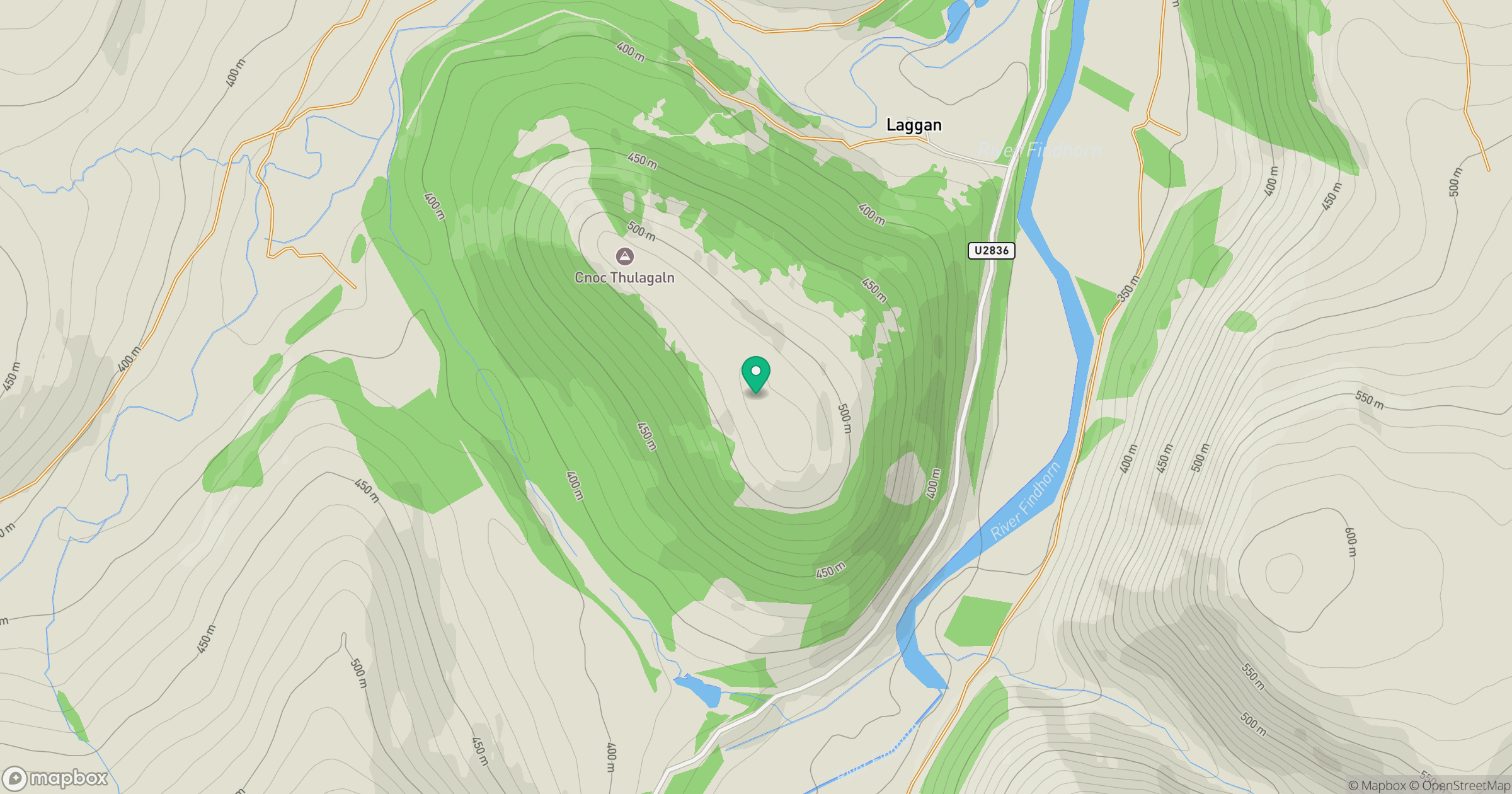
Grid reference: NH742219
View on OpenStreetMapOpens a map in a new tab, centred on the hill.
Hills within 30 km
Straight-line distance, not a walking route or confirmation of access.
No comments yet. Be the first.