

Chapelfell Top
Good walks are even better shared.
Overview
Chapelfell Top
Chapelfell Top is the highest point within the North Pennines, standing proudly at 738 meters above sea level. Known for its breathtaking views and a distinct geological landscape, it is a favoured spot for hikers and nature enthusiasts alike.
Geology
The mountain's Carboniferous limestone embodies intriguing geological formations. Numerous limestone pavements and gorges serve as reminders of the area's rich geological history, making it a great spot for budding geologists and anyone who appreciates a good rock!
Routes
Two primary routes lead to the summit, catering to different levels of hikers.
Brampton to Chapelfell Top: This moderate 9.5 km trek takes about 3.5 hours, winding through valleys with lush scenery before the satisfying ascent. Perfect for those looking to soak in the beauty of the North Pennines!
Roadside Ascent from Hartside Pass: A shorter, easier route starting right from the Hartside Pass makes it ideal for families or those short on time. At just 4 km and taking around 1.5 hours, it offers a delightful escape into the hills.
Summit Features
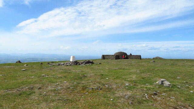
On reaching the summit, hikers are greeted by a trig point—a perfect photo op. A small stone cairn sits close by, just waiting to be adorned by your very own rock offering!
Terrain
Expect a mix of grassy pathways interspersed with rocky sections. Beware of the occasional bog, especially if you have a knack for finding all the mucky bits!
Views
The views from Chapelfell Top are nothing short of spectacular. You can gaze upon stunning vistas featuring the Lake District's peaks to the west. If you squint just right, you might even see the North Sea on a particularly clear day!
Hazards
As with any mountain, hazards are afoot. Keep an eye out for boggy areas that can sneak up on you, especially after rain. The weather can also be capricious, swinging from sunny to drizzly in the blink of an eye, so it's wise to be prepared.
Access & Facilities
Access to Chapelfell Top is primarily via Hartside Pass, where limited parking is available—arrive early to avoid disappointment! Public transport options are available from Penrith, but expect a bit of a walk. The nearest town, Alston, offers a multitude of facilities, including charming cafes perfect for a post-hike treat.
History
The name Chapelfell hints at a rich history, possibly linked to nearby religious sites. The area was also shaped by lead mining activities in the past, with remnants still visible today, adding a touch of historical intrigue to your adventure.
In summary, if you're looking for a rewarding hike full of stunning scenery, intriguing geology, and a touch of history, look no further than Chapelfell Top!
Happy hiking!
Explore routes near Chapelfell Top
Public walks starting within 80 km of this hill. Nearby does not mean a route reaches the summit; check its map and access before setting out.
Allenheads heritage precinct and woodland return
View route
Stanhope, the River Wear and the Fossil Tree
View route
Blanchland Geotrail
View route
Tunstall Reservoir and Backstone Bank Wood
View route
Route planning notes
These notes describe possible approaches, not verified navigable routes or permission to cross land. Check current paths, local access rules and conditions before setting out.
Brampton to Chapelfell Top
A scenic route starting from Brampton, this pathway winds through lush valleys before ascending to the summit. Great views await, especially in the final stretch!
Roadside Ascent from Hartside Pass
Starting directly from Hartside Pass, this route offers a straightforward ascent with gentle inclines. Perfect for those looking for a quick dash to the top!
Make a day of it, together
Find someone to share the walk with, or organise a day out along a route you like.
Photo Gallery
View all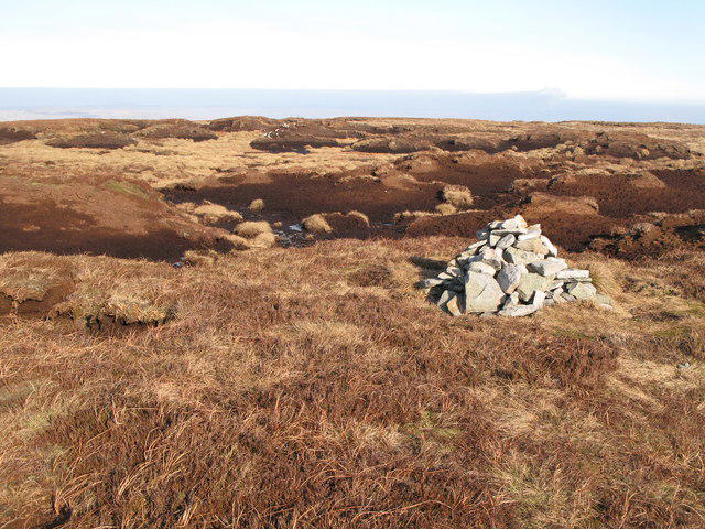 Photo could not load
NY8734 : Currick on Chapelfell Top (2)
Mike Quinn
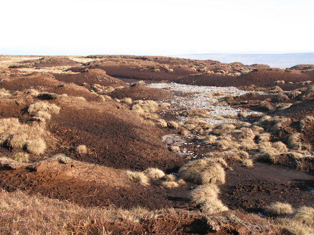 Photo could not load
NY8734 : Peat haggs on Chapelfell Top (7)
Mike Quinn
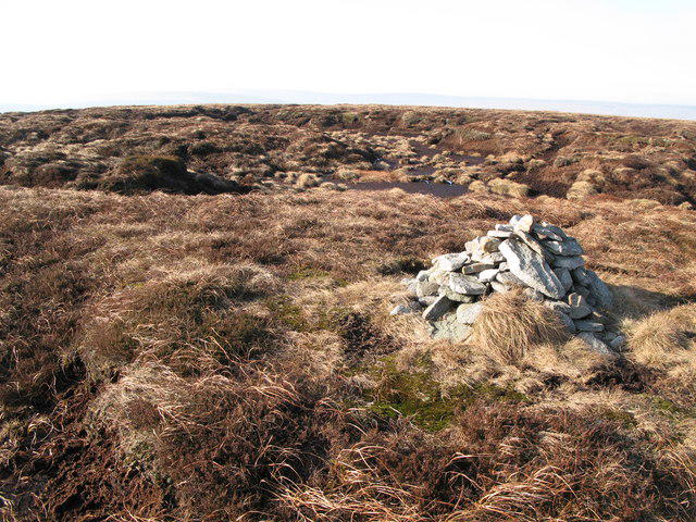 Photo could not load
NY8734 : Currick on Chapelfell Top (3)
Mike Quinn
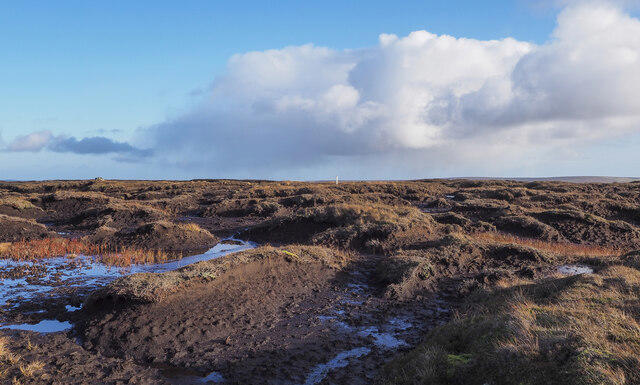 Photo could not load
NY8734 : Chaos of peat banks and bog at summit of Chapel Fell
Trevor Littlewood
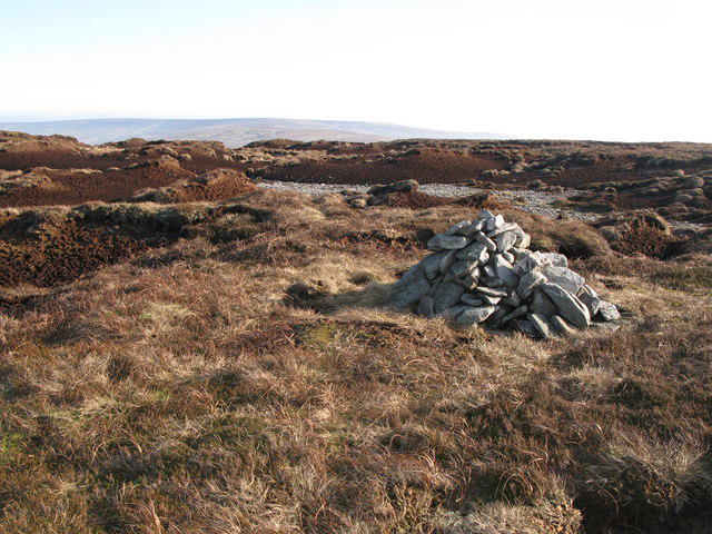 Photo could not load
NY8734 : Currick on Chapelfell Top
Mike Quinn
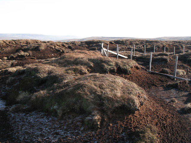 Photo could not load
NY8734 : The corner of the boundary fence on Chapelfell Top
Mike Quinn
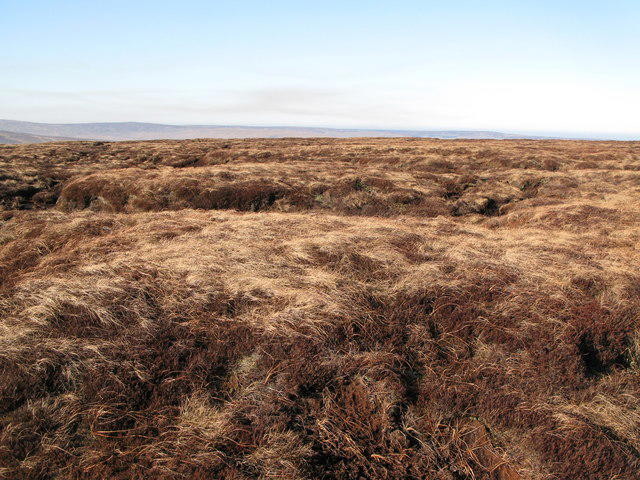 Photo could not load
NY8734 : Chapelfell Top (2)
Mike Quinn
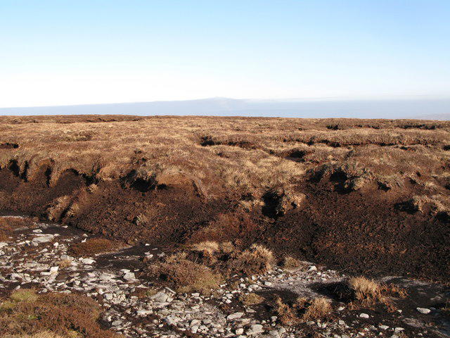 Photo could not load
NY8734 : Chapelfell Top (4)
Mike Quinn
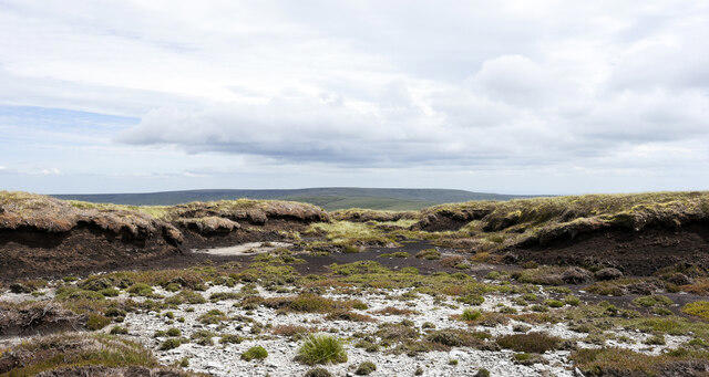 Photo could not load
NY8734 : Bare ground and peat banks close to summit of Chapel Fell
Trevor Littlewood
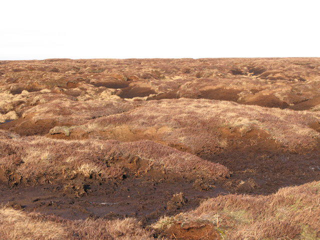
NY8734 : Peat haggs on Chapelfell Top (9)
Mike Quinn
Hill facts and local notes
Classifications
Elevation
700m
2,298 ft
Prominence
142m
Coordinates
54.7063, -2.1943
NY875346
OS Map
91 92
Explorer: OL31W
At the Summit
The summit features a prominent trig point and a small stone cairn, providing an excellent photo opportunity. On a clear day, you'll feel on top of the world—literally!
Terrain & Geology
Chapelfell Top is primarily composed of Carboniferous limestone, giving it a unique rugged landscape. The area showcases features like limestone pavements and deep gorges, providing a fascinating insight into the region's geological past.
Views & Scenery
From the summit, you can admire views of the Lake District to the west, the North Pennines landscape stretching out in all directions, and, if you're lucky, the distant North Sea on a really clear day.
History & Heritage
Name Origin
The name 'Chapelfell' suggests a connection to religious or spiritual significance, possibly derived from nearby chapel ruins.
Historical Significance
The area has historical significance related to the lead mining industry, with remnants of old mine workings scattered around the hills.
Getting There & Facilities
Check current local access restrictions, parking rules and transport timetables before travelling. These notes do not confirm public access to the summit.
Parking
There is limited parking available at Hartside Pass, directly accessible from the A686. Arrive early, as it can fill up quickly on weekends.
Public Transport
The nearest bus service operates from Penrith. You may need to walk a bit from the bus stop to reach the trails.
Nearby Facilities
While facilities at the foot of the mountain are sparse, Alston offers shops, cafes, and public toilets. Perfect for a cup of tea or perhaps a cheeky slice of cake after your hike!
Safety Information
Known Hazards
- Watch out for boggy areas, particularly after heavy rains. Also, be cautious of sudden weather changes—it's the hills, and they can be fickle!
General Safety Tips
- Check weather conditions before setting out
- Carry appropriate clothing and equipment
- Let someone know your planned route
- Take a map, compass, and GPS device
- Carry emergency supplies: food, water, first aid kit, torch
Hills
Some common questions about the hills answered
Are there group walks up Chapelfell Top?
Many walkers use Walkmates to join or organise walks with others. You can check for group walks around Chapelfell Top through the maps
Are there other walkers around Chapelfell Top?
Activity varies by location and time, but Walkmates lets you see whether others have shared walks or shown interest in this area. Find other people through the walking friends search walking friends for Chapelfell Top search or of course create your own walk for Chapelfell Top
Can I organise a walk to Chapelfell Top?
Yes. If there aren’t any walks listed already, you can create a walk and make it available for others to join.
If you're signed up to Walkmates, you can create a walk to Chapelfell Top.
How do I find a walk up this hill?
There are often multiple ways to walk this hill, depending on experience and route preference. Walkmates helps you explore walks and routes that others have shared.
Can I suggest a new route up Chapelfell Top?
Yes. You can suggest or create routes to share with others. Walkmates focuses on the social side of walking, so routes are used to help people organise walks and explore areas together, rather than as detailed navigation tools or route libraries.
Other uses really appreciate knowledgeable walkers sharing their routes. Share your favourite route to Chapelfell Top here
The is an error or something incorrect about this hill. How do I let you know?
We always strive to keep the information on Walkmates as accurate as possible. If you find an error, please let us know through the contact form and we'll aim to correct it as quickly as possible
Community Discussion
Comments
Location
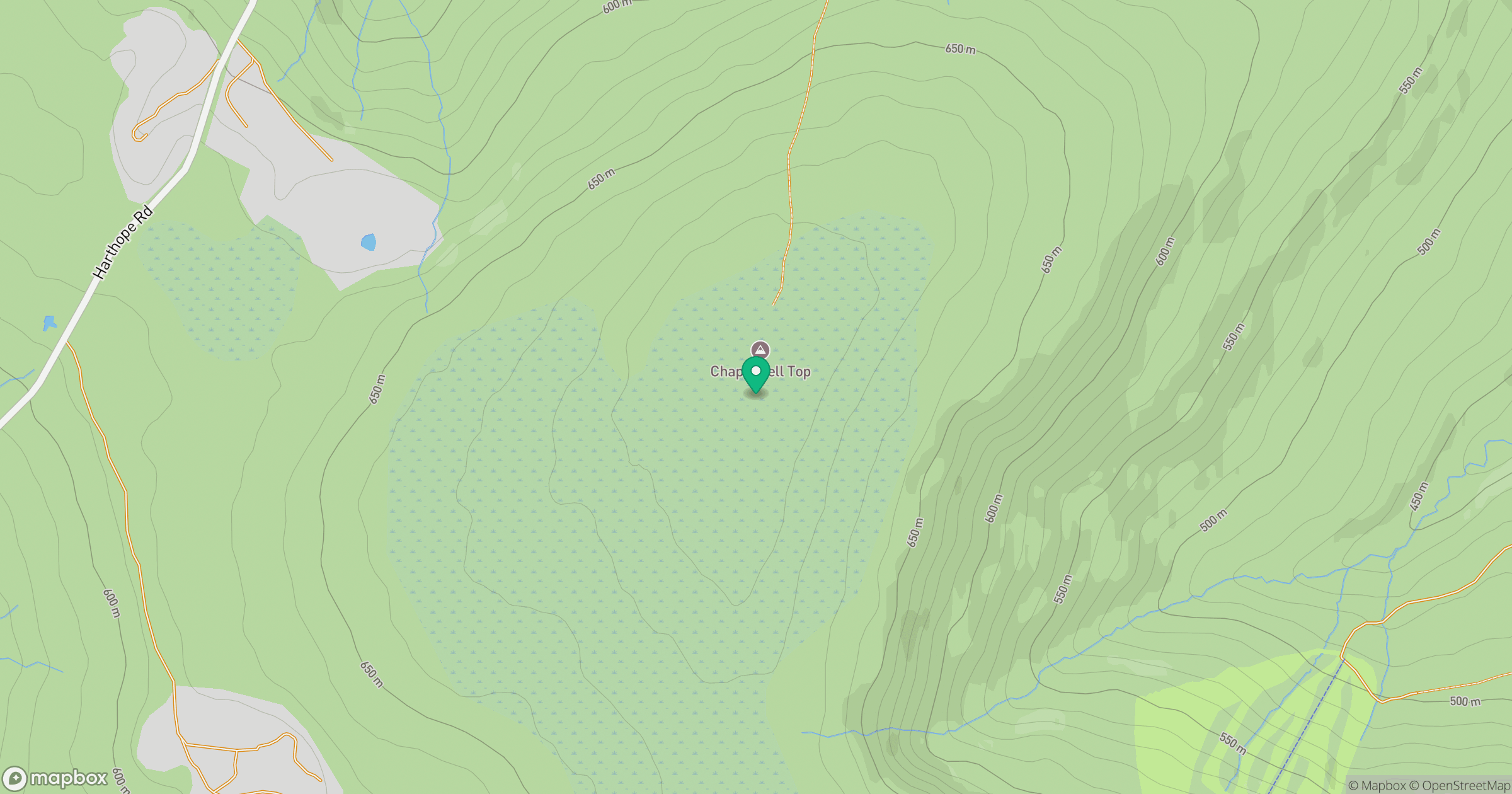
Grid reference: NY875346
View on OpenStreetMapOpens a map in a new tab, centred on the hill.
Hills within 30 km
Straight-line distance, not a walking route or confirmation of access.
No comments yet. Be the first.