

Catstye Cam
Good walks are even better shared.
Overview
Catstye Cam
Catstye Cam stands at an impressive 890 metres, making it a notable peak in the Lake District. Often overshadowed by its more famous neighbours, this Marilyn offers hikers rewarding views and a sense of adventure that certainly shouldn't be missed.
Geology
The mountain's rocky landscape is primarily composed of volcanic rock, with layers of andesite and basalt that give it a unique character. Hiking over these ancient formations, one can only marvel at their resilience against time and the elements. Just don't worry too much about tripping over—consider it a bonding moment with the local geology!
Routes
A popular route is the Catstye Cam via Glenridding, a trek of approximately 7.5 km that should take about 3.5 hours. This moderate difficulty route rewards you with breathtaking views interspersed with delightful scrambles. Though steep in places, it is absolutely doable for most hikers, especially with a little determination and perhaps an extra slice of cake in your pack!
Summit Features
Upon reaching the top, you're greeted by a lovely stone cairn—a perfect spot for a well-deserved rest or a celebratory selfie!
Terrain Type
Expect a delightful mix of rocky outcrops and grassy slopes that keeps the adventure alive. Just be prepared: it's Scotland's equivalent to nature's gym, and trust us, those squats come in handy!
Views
The views from Catstye Cam are nothing short of spectacular. Gaze towards Helvellyn, the esteemed neighbours, and take in the shimmering waters of Ullswater. The best times for these vistas are undoubtedly in the spring and autumn when the atmosphere is crisp and the scenery vibrant.
Hazards
While this trek is generally safe, take heed of muddy paths, especially during the wetter months. The rocks can be slippery and treacherous—ideal for emphasising your gymnastics skills, but we recommend avoiding that!
Nearby Summits
Don't forget to explore nearby gems such as Helvellyn and Sharp Edge, both offering their own unique challenges and stunning landscapes to appreciate.
Access
For those driving, the nearest parking is found in Glenridding, but don't be surprised if it's packed to the brim! Public transport is efficient too, with regular bus links connecting you to this beautiful corner of the Lake District.
Facilities
Glenridding is equipped with cafes and pubs, perfect for a post-hike pint or a comforting slice of cake. And yes, toilets are available too—essential after a long trek!
History
The name 'Catstye Cam' is steeped in local dialect, likely referring to a broad hill. The region, rich in mining history, tells tales of old as you traverse its paths—imagine the stories these rocky giants could tell if they could speak!
In conclusion, Catstye Cam is not just a hike; it’s an invitation to experience the beauty and rugged charm of the Lake District, challenging and rewarding in equal measure. Pack your boots, grab a friend, and make your way to this splendid peak—trust us, your Instagram feed will thank you for it!
Explore routes near Catstye Cam
Walks starting near this hill. Open a route to check its map, distance and full itinerary.
Helvellyn via Striding Edge
View route
Striding Edge, Helvellyn and Catstye Cam
View route
Bow Fell from Langdale
View route
Scafell Pike from Seathwaite via the Corridor Route
View route
Route planning notes
These notes describe possible approaches. Check a route's map and access information when planning your walk.
Catstye Cam via Glenridding
A popular ascent route that starts from Glenridding, offering stunning views as you climb steeply up through beautiful landscapes.
Make a day of it, together
Find someone to share the walk with, or organise a day out along a route you like.
Photo Gallery
View all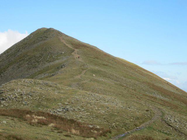 Photo could not load
NY3415 : Path to Catstycam from Red Tarn
Graham Robson
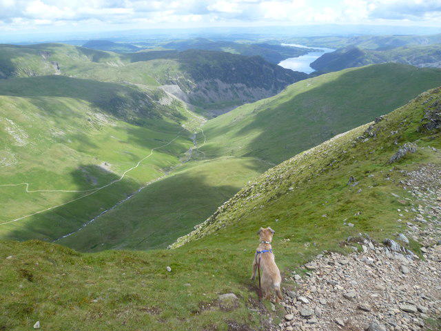 Photo could not load
NY3415 : Descending Catstycam
Michael Graham
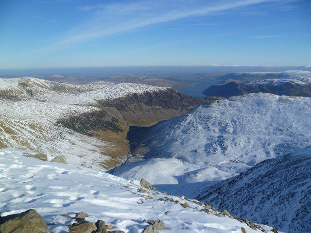 Photo could not load
NY3415 : On Catsye Cam
Michael Graham
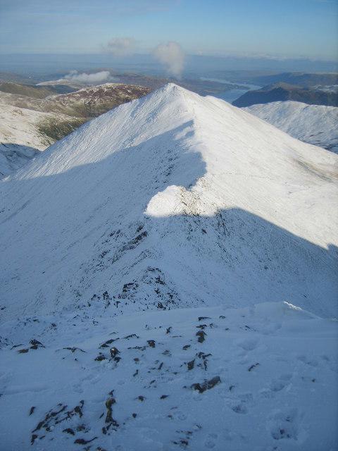 Photo could not load
NY3415 : Swirral Edge
Michael Graham
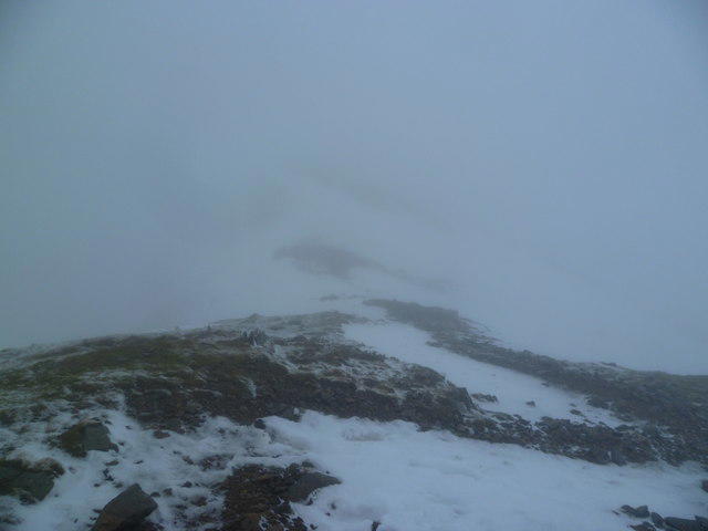 Photo could not load
NY3415 : Descending Catstye Cam
Michael Graham
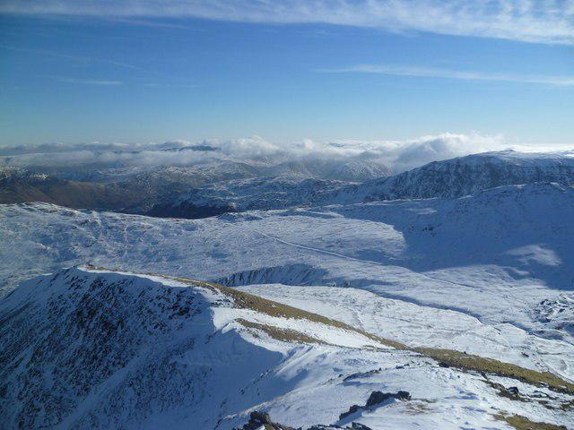 Photo could not load
NY3415 : On Catstye Cam
Michael Graham
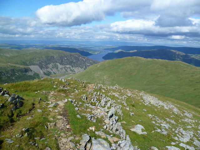 Photo could not load
NY3415 : On Catstycam
Michael Graham
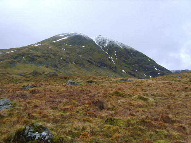 Photo could not load
NY3415 : Catstye Cam
Michael Graham
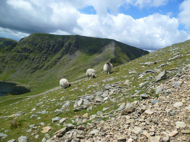 Photo could not load
NY3415 : Sheep on Catstycam
Michael Graham
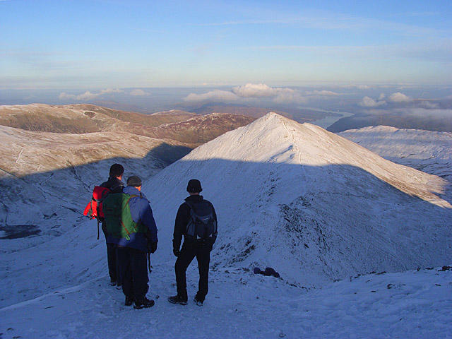
NY3415 : Catstycam from the top of Swirral Edge
Andrew Smith
Hill facts and local notes
Classifications
Elevation
890m
2,919 ft
Prominence
62m
Coordinates
54.5335, -3.0089
NY348158
OS Map
90
Explorer: OL5S
At the Summit
The summit features a prominent cairn, perfect for a photo-op to capture the triumphant moment of reaching the peak.
Terrain & Geology
The mountain is primarily composed of volcanic rock, with significant formations of andesite and basalt. This rugged geological history contributes to its striking landscape and steep ascents.
Views & Scenery
From the summit, you can see Helvellyn, the surrounding fells, and the sparkling waters of Ullswater below.
History & Heritage
Name Origin
The name Catstye Cam is thought to be derived from dialect words referring to a 'broad hill' or 'tump', fitting for its distinctive profile.
Historical Significance
The area has a rich history of mining, with residues of past activities still visible in the landscape.
Getting There & Facilities
Parking
Glenridding has a car park available, but it can get busy. Arrive early to secure a spot!
Public Transport
Regular buses run from Penrith to Glenridding, making it easy to reach without a car.
Nearby Facilities
Glenridding offers cafes, pubs, and toilets, so you can fuel up before or refuel after your hike.
Safety Information
Known Hazards
- Muddy paths can be slippery, especially in wet conditions. Take care on rocky scrambles and beware of sudden weather changes.
General Safety Tips
- Check weather conditions before setting out
- Carry appropriate clothing and equipment
- Let someone know your planned route
- Take a map, compass, and GPS device
- Carry emergency supplies: food, water, first aid kit, torch
Hills
Some common questions about the hills answered
Are there group walks up Catstye Cam?
Many walkers use Walkmates to join or organise walks with others. You can check for group walks around Catstye Cam through the maps
Are there other walkers around Catstye Cam?
Activity varies by location and time, but Walkmates lets you see whether others have shared walks or shown interest in this area. Find other people through the walking friends search walking friends for Catstye Cam search or of course create your own walk for Catstye Cam
Can I organise a walk to Catstye Cam?
Yes. If there aren’t any walks listed already, you can create a walk and make it available for others to join.
If you're signed up to Walkmates, you can create a walk to Catstye Cam.
How do I find a walk up this hill?
There are often multiple ways to walk this hill, depending on experience and route preference. Walkmates helps you explore walks and routes that others have shared.
Can I suggest a new route up Catstye Cam?
Yes. You can suggest or create routes to share with others. Walkmates focuses on the social side of walking, so routes are used to help people organise walks and explore areas together, rather than as detailed navigation tools or route libraries.
Other uses really appreciate knowledgeable walkers sharing their routes. Share your favourite route to Catstye Cam here
The is an error or something incorrect about this hill. How do I let you know?
We always strive to keep the information on Walkmates as accurate as possible. If you find an error, please let us know through the contact form and we'll aim to correct it as quickly as possible
Community Discussion
Comments
Location
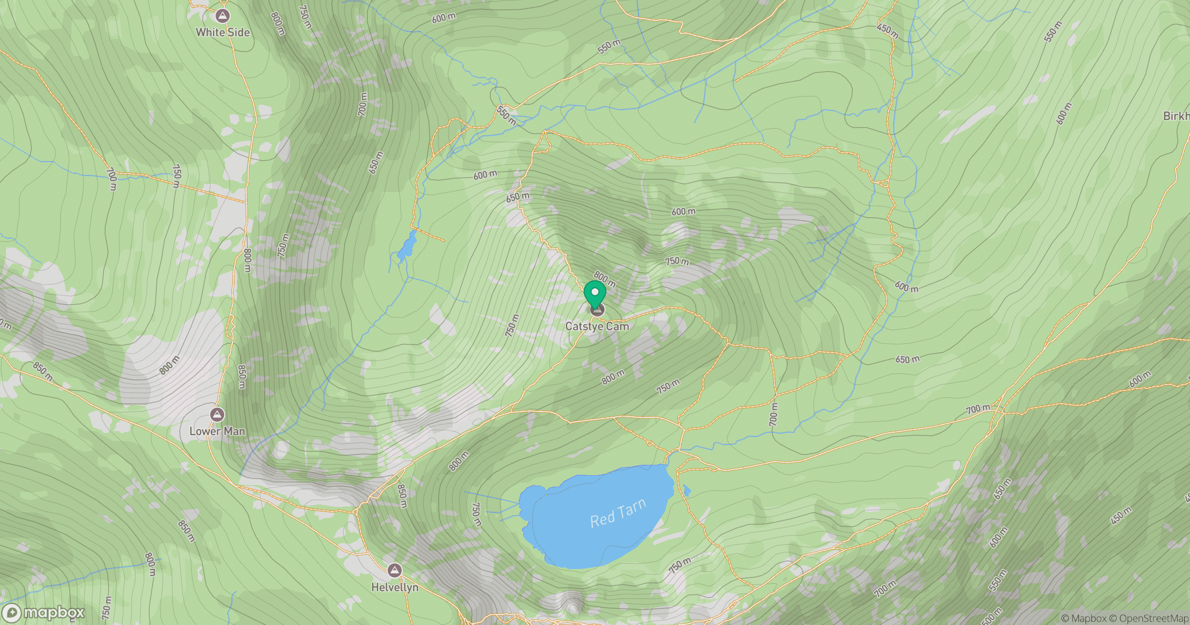
Grid reference: NY348158
View on OpenStreetMapOpens a map in a new tab, centred on the hill.

No comments yet. Be the first.