
Castle Crag
Good walks are even better shared.
Overview
Castle Crag: A Jewel in the Lake District
Nestled in the heart of the Lake District, Castle Crag stands proudly at 290 meters, with a prominence of 80 meters. Although not the tallest summit in the region, it offers an intimate experience of the dramatic landscape.
Geology
The magnificent Castle Crag is made up of Skiddaw slate, a striking testament to the region's ancient geological history. The rock formations here showcase the natural sculpting done by millennia of glacial activity, making it a hotspot for geology enthusiasts.
Routes to the Summit
One of the most recommended routes is from Borrowdale. This well-defined path weaves through lush woods and leads to the rocky outcrops of the crag, revealing elevated views with every twist and turn. It's a moderate hike, suitable for anyone with a reasonable level of fitness, and can typically be completed in about two hours.
Summit Features
When you finally reach the summit, you’ll be greeted by a delightful stone cairn—ideal for a photo op! The sense of accomplishment mixed with the fabulous views makes every step worthwhile.
Terrain Type
The terrain is rugged, with rocky outcrops and well-established paths. While the route is well-trodden, be mindful of the slippery conditions after rainfall.
Breathtaking Views
The summit rewards you with sweeping views of Derwent Water, Skiddaw, and surrounding valleys. For the best spectacles, visit during Spring or Autumn when the colours are vibrant and the skies are often clearer.
Hazards
As with any outdoor adventure, be prepared! Slippery rocks are common after rainfall, and loose gravel can cause slips. Always check the weather before your trek, as conditions can change rapidly.
Nearby Summits
Some notable nearby peaks include Catbells and the towering Skiddaw. Both are fantastic additions to your hiking itinerary if you're after a full day of exploration.
Access and Facilities
Accessing Castle Crag is straightforward, with a small car park available in Grange, just a short walk from the trailhead. Public transport from Keswick makes it even easier. While there are no facilities on the crag itself, the nearby town of Keswick boasts plenty of cafes and toilets.
History
The name Castle Crag hints at its formidable silhouette, derived from Old Norse. For history buffs, it’s worth noting that this spot has drawn walkers for centuries and is well documented in Alfred Wainwright’s famous guides.
Whether you're a seasoned hiker or a weekend rambler, Castle Crag promises an exhilarating adventure with breathtaking views that are sure to leave you spellbound. Don’t forget your camera and a thermos of tea! Happy hiking!
Explore routes near Castle Crag
Walks starting near this hill. Open a route to check its map, distance and full itinerary.
Windermere west shore: Ash Landing to Wray and back
View route
Striding Edge, Helvellyn and Catstye Cam
View route
Tarn Hows Fast Route
View route
Helvellyn via Striding Edge
View route
Route planning notes
These notes describe possible approaches. Check a route's map and access information when planning your walk.
Borrowdale to Castle Crag
A popular and scenic route that starts in Borrowdale, this path takes you through woodland before ascending the rocky outcrops of Castle Crag.
Make a day of it, together
Find someone to share the walk with, or organise a day out along a route you like.
Hill facts and local notes
Classifications
Elevation
490m
1,608 ft
Prominence
15m
Coordinates
54.4388, -2.8561
NY445051
OS Map
90
Explorer: OL7N
At the Summit
At the summit, you'll find a lovely stone cairn, which is the perfect spot for a quick selfie to prove you made it to the top! On a clear day, the views are spectacular.
Terrain & Geology
Castle Crag is primarily composed of Skiddaw slate, a fine-grained, dark grey slate that was formed during the Ordovician period. The summit offers a glimpse into the geological history of the area, showcasing sediments which have been compressed and folded over millions of years.
Views & Scenery
From the summit, you can catch a glimpse of Derwent Water, the majestic peaks of Skiddaw, and the crags of the surrounding valleys.
History & Heritage
Name Origin
The name 'Castle Crag' likely derives from the Old Norse word 'kastr', meaning fortress or stronghold, suggesting the rugged nature of the crag itself.
Historical Significance
Historically, Castle Crag has been popular with walkers since the 19th century and is noted in Wainwright's guides.
Getting There & Facilities
Parking
There is a small car park at the end of the road in Grange, approximately 1 mile from the base of Castle Crag.
Public Transport
Regular buses run from Keswick to Grange, providing easy access to the area.
Nearby Facilities
There are no facilities directly at Castle Crag, but Keswick offers numerous cafes, toilets, and other amenities.
Safety Information
Known Hazards
- Slippery rocks during wet conditions, loose gravel on paths, and sudden changes in weather.
General Safety Tips
- Check weather conditions before setting out
- Carry appropriate clothing and equipment
- Let someone know your planned route
- Take a map, compass, and GPS device
- Carry emergency supplies: food, water, first aid kit, torch
Hills
Some common questions about the hills answered
Are there group walks up Castle Crag?
Many walkers use Walkmates to join or organise walks with others. You can check for group walks around Castle Crag through the maps
Are there other walkers around Castle Crag?
Activity varies by location and time, but Walkmates lets you see whether others have shared walks or shown interest in this area. Find other people through the walking friends search walking friends for Castle Crag search or of course create your own walk for Castle Crag
Can I organise a walk to Castle Crag?
Yes. If there aren’t any walks listed already, you can create a walk and make it available for others to join.
If you're signed up to Walkmates, you can create a walk to Castle Crag.
How do I find a walk up this hill?
There are often multiple ways to walk this hill, depending on experience and route preference. Walkmates helps you explore walks and routes that others have shared.
Can I suggest a new route up Castle Crag?
Yes. You can suggest or create routes to share with others. Walkmates focuses on the social side of walking, so routes are used to help people organise walks and explore areas together, rather than as detailed navigation tools or route libraries.
Other uses really appreciate knowledgeable walkers sharing their routes. Share your favourite route to Castle Crag here
The is an error or something incorrect about this hill. How do I let you know?
We always strive to keep the information on Walkmates as accurate as possible. If you find an error, please let us know through the contact form and we'll aim to correct it as quickly as possible
Community Discussion
Comments
Location
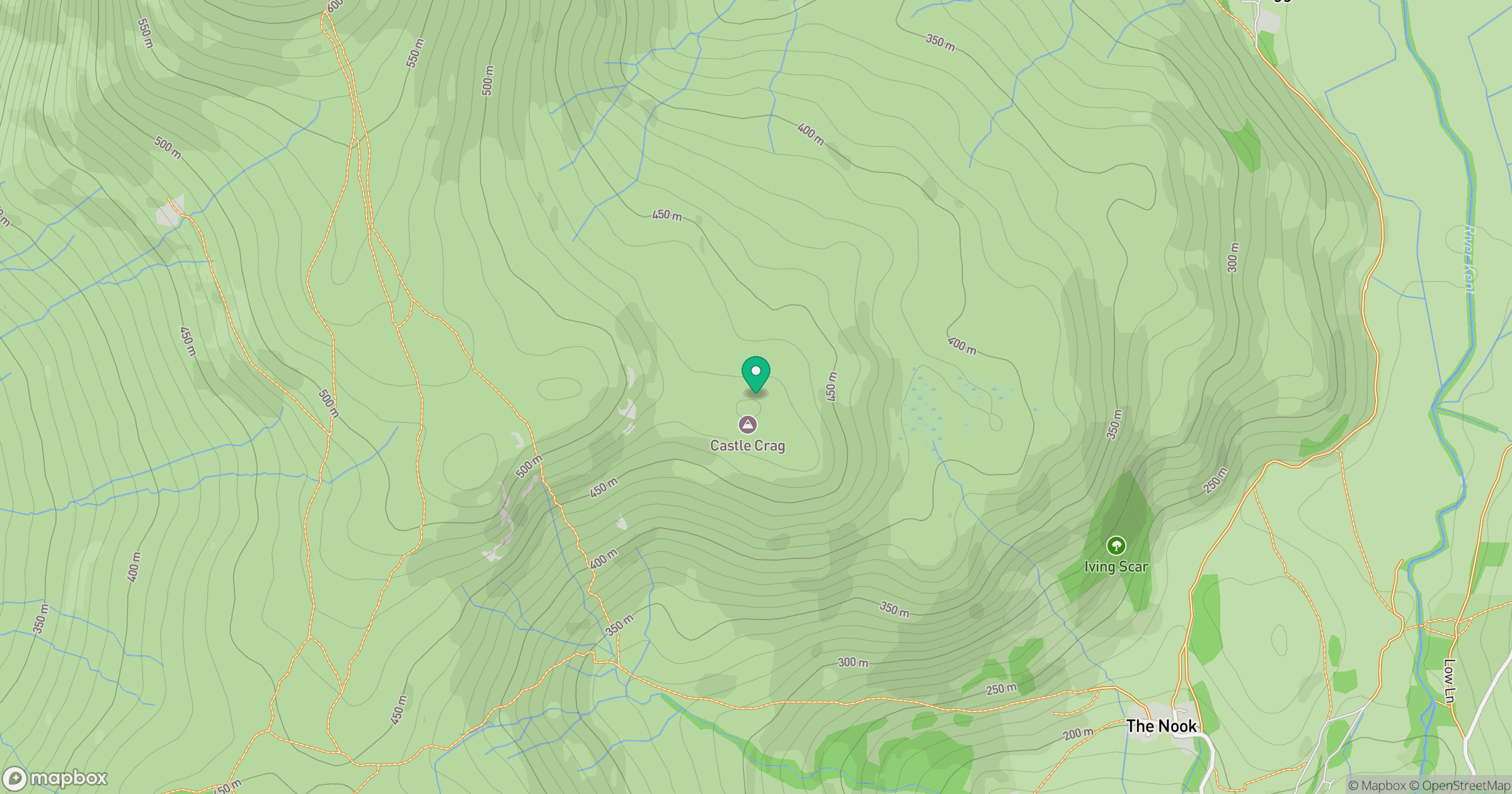
Grid reference: NY445051
View on OpenStreetMapOpens a map in a new tab, centred on the hill.
No comments yet. Be the first.