

Carnllundain
Good walks are even better shared.
Overview
Carnllundain: A Delightful Climb in the Cambrian Mountains
Carnllundain, rising gracefully at an elevation of 757 meters, is known not just for its height but also for its stunning views and unique geological features.
Geology
The terrain of Carnllundain is a patchwork of mudstone and sandstone, representing the Cambrian period. This ancient rock formation provides valuable insight into our planet's past, making it a fascinating spot for geology enthusiasts.
Routes
North Ridge Trail
For those looking for a moderate challenge, the North Ridge Trail is a perfect choice. Spanning 7.5 km, this route takes approximately 3.5 hours to complete.
South Ascent
If you prefer a leisurely stroll, opt for the South Ascent. It's a shorter trail at 6 km and will take about 2.5 hours with a difficulty level marked as easy.
Summit Features
Upon reaching the summit, you'll be greeted by a hefty stone cairn, perfect for that all-important summit selfie! The trig point stands proudly, marking your accomplishment amidst the stunning views surrounding you.
Terrain
Be ready for rugged and rocky terrain, with some grassy slopes interspersed. You’ll likely encounter some boggy patches, especially after a rain shower—waterproof boots are a wise choice!
Views
Highlights
From atop Carnllundain, breathtaking views await you. Enjoy the sweeping panoramas of the Cambrian Mountains, the majestic Snowdonia range to the north, and, if lucky, a glimpse of the sparkling Irish Sea.
Best Seasons
Plan your hike in spring or summer for the clearest views, while autumn enchants with its riot of colours.
Hazards
Be mindful of the uneven terrain and changing weather conditions. It can be sunny one moment and a downpour the next—dress in layers for every eventuality.
Access
Parking
A small car park at SM697226 allows for a convenient start to your adventure.
Public Transport
Buses from Aberystwyth head to Tregaron, where a quick taxi can get you to the trailheads.
Nearest Town
The charming town of Tregaron is just a stone's throw away, where you can refuel after your exertions.
Facilities
Tregaron boasts a range of amenities, including cafes for a comforting cuppa and public toilets for those essential pit stops.
History
Name Meaning
The name 'Carnllundain' literally stands for 'the cairn of the little fort', perhaps hinting at ancient settlements in the vicinity.
Significance
This mountain is steeped in local folklore, adding to its charm and cultural significance within the Welsh landscape.
In summary, whether you're an avid hiker or just fancy a gentle amble, Carnllundain offers a delightful experience filled with nature and stunning vistas. Happy hiking!
Explore routes near Carnllundain
Public walks starting within 80 km of this hill. Nearby does not mean a route reaches the summit; check its map and access before setting out.
Neyland to Johnston: Brunel and Westfield Railway Trail
View route
Pembrokeshire Coast Path: Newport Parrog to Fishguard via Dinas Head
View route
Stackpole Estate: Bosherston Lily Ponds and Lodge Park Woodland Circuit
View route
Abergwili to Nantgaredig: Tywi Valley Path out and back
View route
Route planning notes
These notes describe possible approaches, not verified navigable routes or permission to cross land. Check current paths, local access rules and conditions before setting out.
North Ridge Trail
An exhilarating ascent via the North Ridge, offering spectacular views and a chance to engage with the local flora and fauna.
South Ascent
A gentler approach from the south, perfect for those looking to enjoy a leisurely stroll rather than a strenuous hike.
Make a day of it, together
Find someone to share the walk with, or organise a day out along a route you like.
Photo Gallery
View all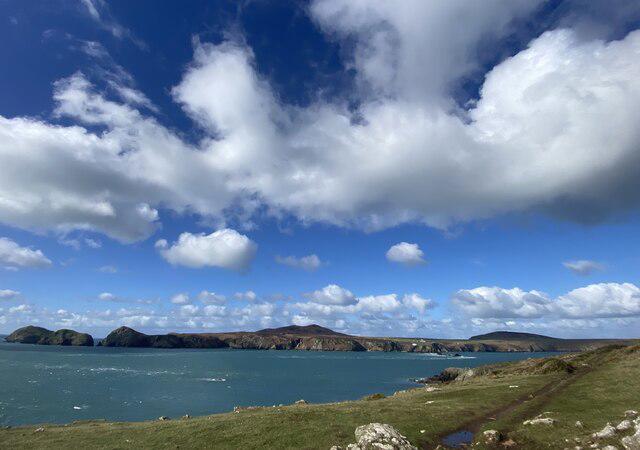 Photo could not load
SM6923 : Clouds over Ramsey Island
Alan Hughes
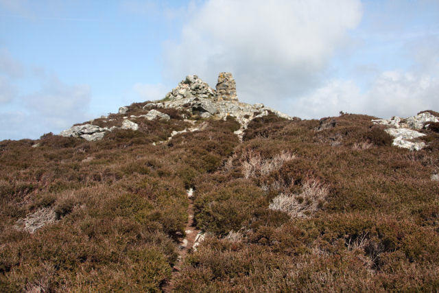 Photo could not load
SM6923 : Summit of Carnllundain, Ramsey Island
Bob Jones
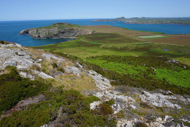 Photo could not load
SM6923 : The north-eastern side of Carnllundain
Bill Boaden
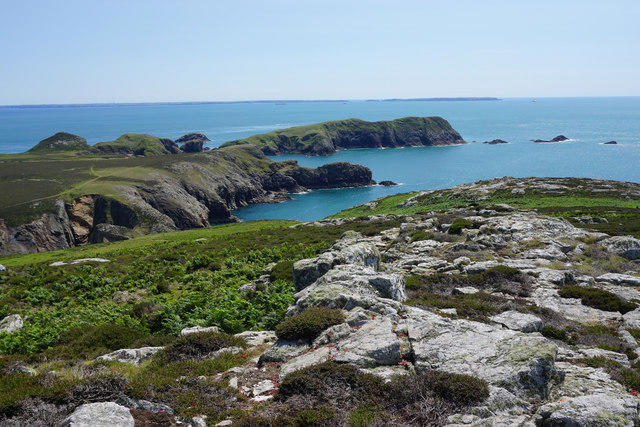 Photo could not load
SM6923 : Exposed rock on the subsidiary summit of Carnllundain
Bill Boaden
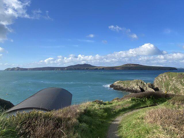 Photo could not load
SM6923 : Ramsey Island
Alan Hughes
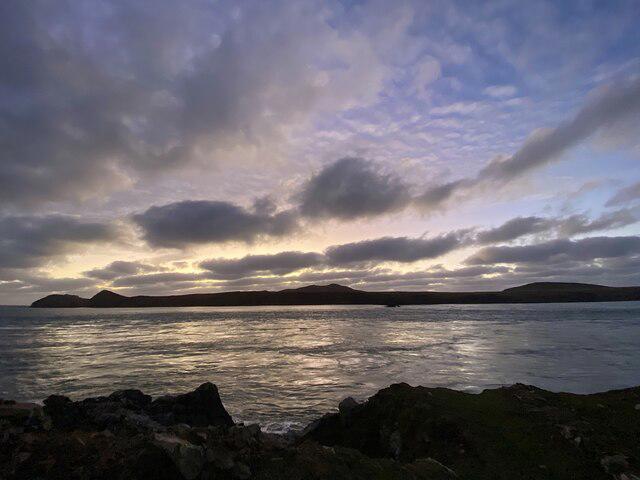 Photo could not load
SM6923 : Sunset behind Ramsey Island
Alan Hughes
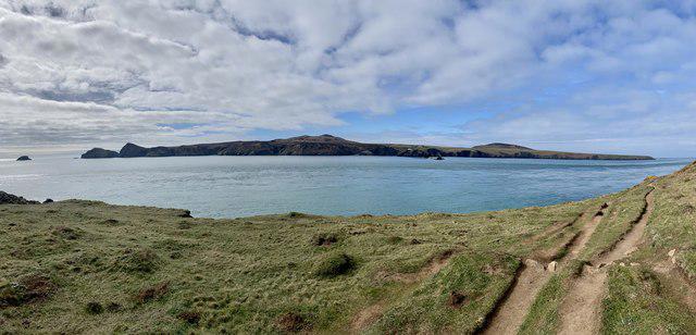 Photo could not load
SM6923 : A panoramic view of Ramsey Island
Alan Hughes
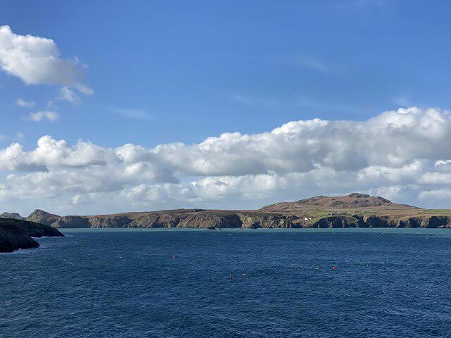 Photo could not load
SM6923 : Carnllundain, Ramsey Island
Alan Hughes
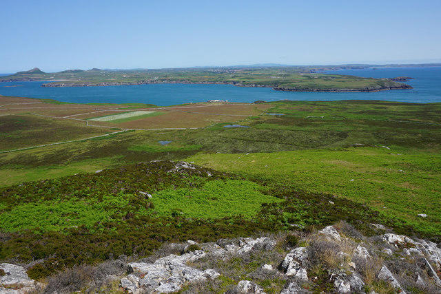 Photo could not load
SM6923 : The eastern side of Carnllundain
Bill Boaden
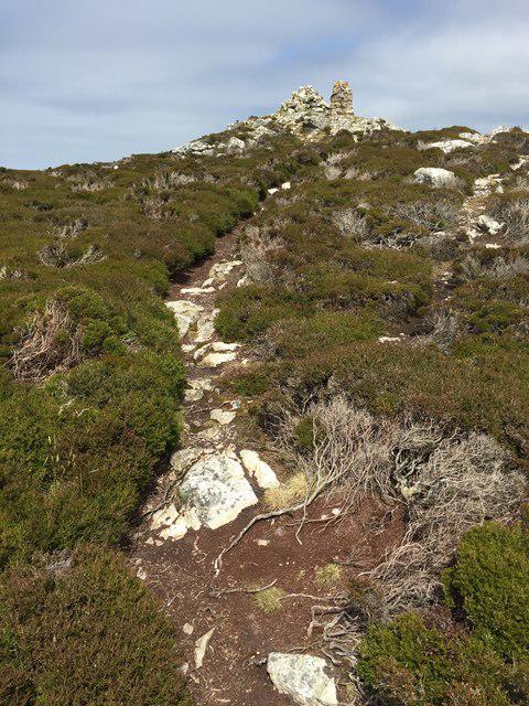
SM6923 : Carn Llundain
Alan Hughes
Hill facts and local notes
Classifications
Elevation
136m
446 ft
Prominence
136m
Coordinates
51.8620, -5.3475
SM696234
OS Map
157
Explorer: OL35W
At the Summit
The summit boasts a large stone cairn and a small trig point, providing an excellent photo opportunity and a sense of achievement for conquering this peak.
Terrain & Geology
Carnllundain is predominantly formed of mudstone and sandstone, characteristic of the Cambrian geology. Its rugged terrain provides a glimpse into the ancient geological processes that have shaped this striking landscape.
Views & Scenery
From the summit, hikers can enjoy panoramic views of the Cambrian Mountains, the Snowdonia range to the north, and on a clear day, even the Irish Sea.
History & Heritage
Name Origin
The name 'Carnllundain' translates to 'the cairn of the little fort', possibly referring to ancient settlements in the area.
Historical Significance
This mountain holds cultural significance within local folklore and is a part of the natural heritage of Wales.
Getting There & Facilities
Check current local access restrictions, parking rules and transport timetables before travelling. These notes do not confirm public access to the summit.
Parking
There is a small car park at the start of the North Ridge Trail at SM697226, which can accommodate several vehicles.
Public Transport
Buses run from nearby towns such as Aberystwyth to the village of Tregaron, from where it's a short taxi ride to the trailheads.
Nearby Facilities
Facilities in Tregaron include cafes, pubs, and public toilets, perfect for a pre-hike snack or post-hike pint.
Safety Information
Known Hazards
- Uneven terrain and sudden weather changes can pose risks. Always check forecasts and dress appropriately.
General Safety Tips
- Check weather conditions before setting out
- Carry appropriate clothing and equipment
- Let someone know your planned route
- Take a map, compass, and GPS device
- Carry emergency supplies: food, water, first aid kit, torch
Hills
Some common questions about the hills answered
Are there group walks up Carnllundain?
Many walkers use Walkmates to join or organise walks with others. You can check for group walks around Carnllundain through the maps
Are there other walkers around Carnllundain?
Activity varies by location and time, but Walkmates lets you see whether others have shared walks or shown interest in this area. Find other people through the walking friends search walking friends for Carnllundain search or of course create your own walk for Carnllundain
Can I organise a walk to Carnllundain?
Yes. If there aren’t any walks listed already, you can create a walk and make it available for others to join.
If you're signed up to Walkmates, you can create a walk to Carnllundain.
How do I find a walk up this hill?
There are often multiple ways to walk this hill, depending on experience and route preference. Walkmates helps you explore walks and routes that others have shared.
Can I suggest a new route up Carnllundain?
Yes. You can suggest or create routes to share with others. Walkmates focuses on the social side of walking, so routes are used to help people organise walks and explore areas together, rather than as detailed navigation tools or route libraries.
Other uses really appreciate knowledgeable walkers sharing their routes. Share your favourite route to Carnllundain here
The is an error or something incorrect about this hill. How do I let you know?
We always strive to keep the information on Walkmates as accurate as possible. If you find an error, please let us know through the contact form and we'll aim to correct it as quickly as possible
Community Discussion
Comments
Location
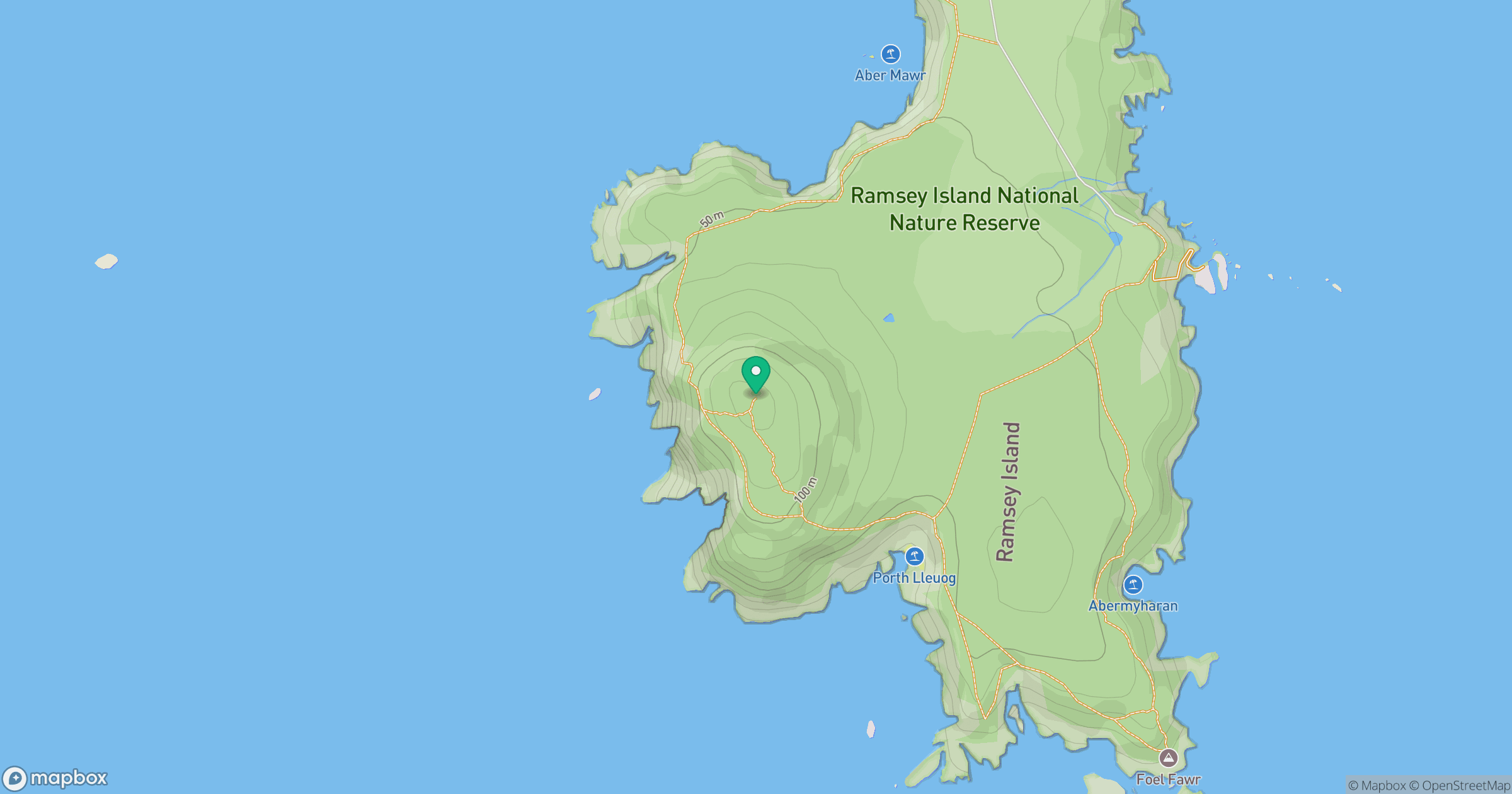
Grid reference: SM696234
View on OpenStreetMapOpens a map in a new tab, centred on the hill.
Hills within 30 km
Straight-line distance, not a walking route or confirmation of access.
No comments yet. Be the first.