

Carnan Eoin
Good walks are even better shared.
Overview
Carnan Eoin
Overview
Nestled in the heart of the Scottish Highlands, Carnan Eoin is a gem for hikers looking for an uplifting adventure. Standing at 365 meters high, it's not the tallest mountain in the region, but what it lacks in elevation, it makes up for in stunning views.
Geology
The mountain is primarily composed of volcanic rock, shaped over millennia by the natural elements. Glacial activity has left behind a deeply fascinating geological portrait, with exposed layers narrating a story of Earth's ancient past. On your walk, take a moment to marvel at these natural wonders—just don’t get too engrossed; you wouldn’t want to trip over a rock!
Routes
The most popular route is from the south end, a leisurely 4 km trek that takes approximately 2.5 hours to complete. This moderate trek suits all levels, allowing you to soak in the sights at your own pace.
Summit Features
Upon reaching the summit, you’ll be greeted by a robust stone cairn and a trig point that proudly marks your achievement. The sight of the Highlands sprawling out below you will make the uphill slog worthwhile. And yes, the sheep are there for moral support!
Terrain
Expect a blend of rocky outcrops and rolling grassy hills, perfect for those who enjoy a bit of ruggedness in their hike. Just watch out for the heather—it has a knack for making your boots feel heavier!
Views
From the top, Loch Sgioh sparkles in the distance while the surrounding peaks show off their rugged beauty. The views are at their best in spring and autumn, so plan your hike for those seasons if you want to treat your eyes to a spectacular show.
Hazards
While the trail is sound, loose rocks and slippery grass can present challenges. Always be prepared for the notorious Highland weather that can change faster than you can say 'scotch'!
Access
- Nearest Parking: A car park along the A85 road, about 5 km from Dalmally.
- Public Transport: The nearest bus stop is in Dalmally, which has services from towns including Oban and Glasgow.
- Nearest Town: Dalmally, known for its charm and basic amenities.
Facilities
In Dalmally, you’ll find a convenience store and cafes for a well-deserved bite post-hike. Be aware of toilet availability at the village hall; you may need to ask nicely!
History
The name 'Carnan Eoin' means 'John's Cairn', believed to relate to a local historical figure. The region is steeped in neolithic history, contributing to its charm and intrigue. When hiking, take a moment to reflect on the many who have walked these paths before you!
Enjoy your journey, but remember: it's not just about the destination, but the stories you collect along the way. Happy hiking!
Explore routes near Carnan Eoin
Public walks starting within 80 km of this hill. Nearby does not mean a route reaches the summit; check its map and access before setting out.
Crinan Canal: Bellanoch and Dunardry towpath return
View route
Glen Kin group walk
View route
Bishop’s Glen group walk
View route
West Bay walk and talk
View route
Route planning notes
These notes describe possible approaches, not verified navigable routes or permission to cross land. Check current paths, local access rules and conditions before setting out.
South End Approach
A straightforward route starting from the south end of the mountain, suitable for all levels of hikers. This route meanders alongside a lovely burn before gently ascending towards the summit.
Make a day of it, together
Find someone to share the walk with, or organise a day out along a route you like.
Photo Gallery
View all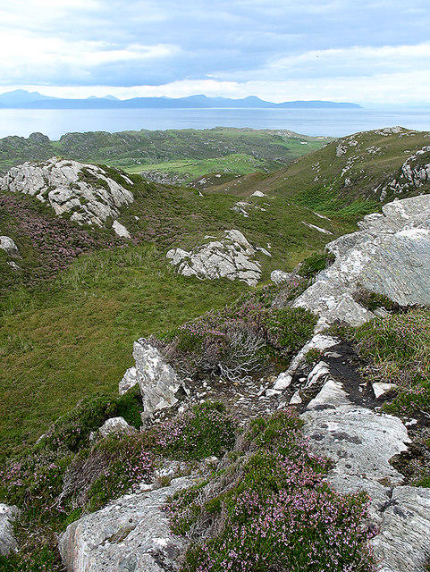 Photo could not load
NR4198 : View from Carnan Eoin
William Starkey
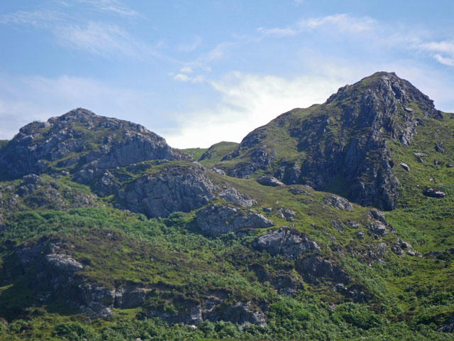 Photo could not load
NR4098 : Carnan Eoin
C Michael Hogan
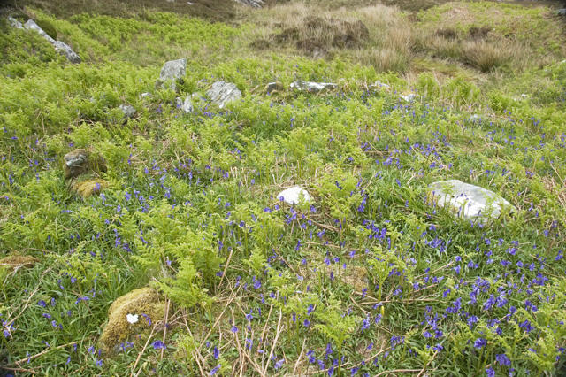 Photo could not load
NR4198 : Ruins below Carnan Eoin
Tom Richardson
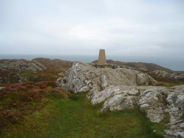 Photo could not load
NR4098 : The summit of Carnan Eoin, Colonsay
Michael Earnshaw
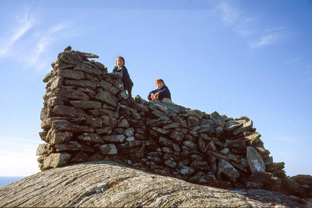 Photo could not load
NR4098 : The cairn on Carnan Eoin
Julian Paren
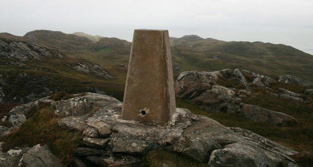 Photo could not load
NR4098 : Trigpoint, Carnan Eoin, Colonsay
Becky Williamson
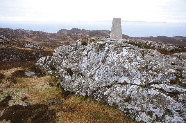 Photo could not load
NR4098 : Trig Point on Carnan Eoin
Julian Paren
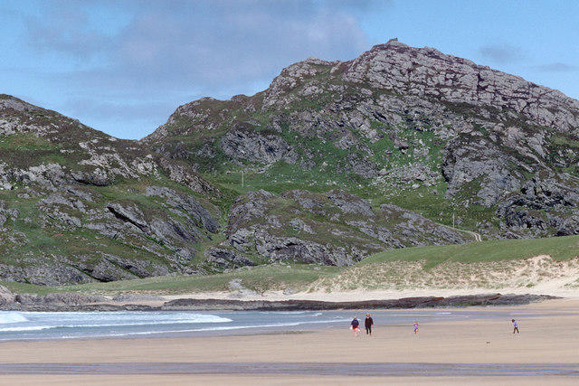 Photo could not load
NR4098 : Carnan Eoin across the sand of Kiloran Bay
Julian Paren
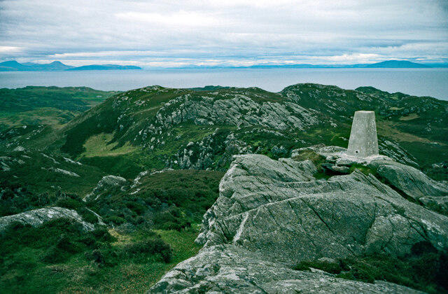 Photo could not load
NR4098 : The summit of Carnan Eoin, Colonsay
Julian Paren
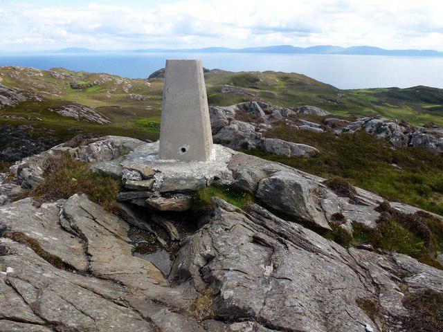
NR4098 : Carnan Eoin Trig
Rude Health
Hill facts and local notes
Classifications
Elevation
143m
470 ft
Prominence
143m
Coordinates
56.1085, -6.1687
NR409984
OS Map
61
Explorer: 354
At the Summit
The summit features a substantial stone cairn, offering great photo opportunities. There is also a small trig point which marks the highest point, and if you're lucky, you'll spot some curious sheep peeking over the edge.
Terrain & Geology
Carnan Eoin is primarily composed of volcanic rock, which has been shaped by glacial activity. Its rugged terrain offers a glimpse into the geological history of the region, revealing layers of ancient lava flows and glacial deposits.
Views & Scenery
From the summit, you can enjoy breathtaking views of the surrounding hills and lochs, including the sweeping vista of Loch Sgioh and the distant peaks of the surrounding ranges.
History & Heritage
Name Origin
The name 'Carnan Eoin' translates to 'John's Cairn' in Gaelic, likely referencing a local historical figure or a saint.
Historical Significance
The area has been inhabited since neolithic times, and the surrounding landscape is rich in archaeological sites. Local folklore also hints at ancient stories tied to the mountain.
Getting There & Facilities
Check current local access restrictions, parking rules and transport timetables before travelling. These notes do not confirm public access to the summit.
Parking
There is a small car park along the A85 road, approximately 5 km from the nearest village. Ensure to check for any parking restrictions before leaving your car.
Public Transport
The nearest bus stop is in the village of Dalmally, which is serviced by several routes operating from larger towns such as Oban and Glasgow. A bit of a walk will be needed from the bus stop to reach the trailhead.
Nearby Facilities
Dalmally has a small convenience store and a couple of cafes. Toilets are available at the village hall, but plan accordingly as they may not always be open!
Safety Information
Known Hazards
- Loose rocks and slippery grass can make descents tricky. Be wary of sudden weather changes in the Highlands, as they can turn a sunny hike into a rain-sodden adventure before you know it.
General Safety Tips
- Check weather conditions before setting out
- Carry appropriate clothing and equipment
- Let someone know your planned route
- Take a map, compass, and GPS device
- Carry emergency supplies: food, water, first aid kit, torch
Hills
Some common questions about the hills answered
Are there group walks up Carnan Eoin?
Many walkers use Walkmates to join or organise walks with others. You can check for group walks around Carnan Eoin through the maps
Are there other walkers around Carnan Eoin?
Activity varies by location and time, but Walkmates lets you see whether others have shared walks or shown interest in this area. Find other people through the walking friends search walking friends for Carnan Eoin search or of course create your own walk for Carnan Eoin
Can I organise a walk to Carnan Eoin?
Yes. If there aren’t any walks listed already, you can create a walk and make it available for others to join.
If you're signed up to Walkmates, you can create a walk to Carnan Eoin.
How do I find a walk up this hill?
There are often multiple ways to walk this hill, depending on experience and route preference. Walkmates helps you explore walks and routes that others have shared.
Can I suggest a new route up Carnan Eoin?
Yes. You can suggest or create routes to share with others. Walkmates focuses on the social side of walking, so routes are used to help people organise walks and explore areas together, rather than as detailed navigation tools or route libraries.
Other uses really appreciate knowledgeable walkers sharing their routes. Share your favourite route to Carnan Eoin here
The is an error or something incorrect about this hill. How do I let you know?
We always strive to keep the information on Walkmates as accurate as possible. If you find an error, please let us know through the contact form and we'll aim to correct it as quickly as possible
Community Discussion
Comments
Location
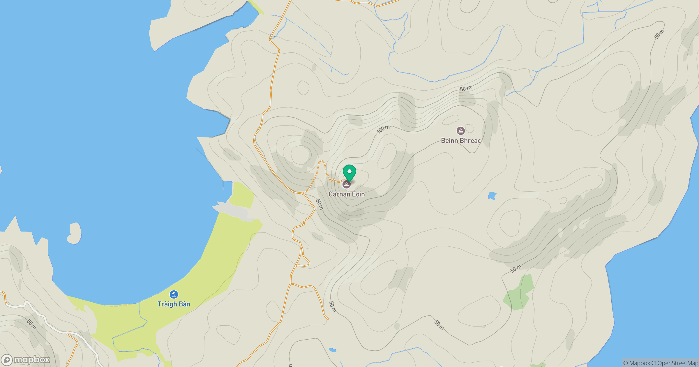
Grid reference: NR409984
View on OpenStreetMapOpens a map in a new tab, centred on the hill.
Hills within 30 km
Straight-line distance, not a walking route or confirmation of access.
No comments yet. Be the first.