

Carn an t-Sagairt Mor
Good walks are even better shared.
NO2084 : Cairn, Carn an t-Sagairt Mòr
Richard Webb Photo source
Overview
Carn an t-Sagairt Mor
Carn an t-Sagairt Mor stands proudly at 1027 meters in the heart of the Scottish Highlands. Known as a Munro, it is one of the prominent peaks offering adventurers breathtaking views and a real taste of the rugged beauty that characterizes this part of Scotland.
Geology
This towering beast is made up primarily of schist and granite, showcasing the geological history of the region. The schist gives the mountain its distinctive ruggedness, while the granite adds an awe-inspiring charm, making it a favourite among geology enthusiasts. If rocks had personalities, these would be the stalwart and wise ones.
Routes
The most popular route begins in the village of Inverie, a delightful spot accessible only by boat or foot. This path weaves its way through lush landscapes and offers ever-changing views as you ascend. You'll traverse around 14 kilometers, and if you take it easy, you can negotiate the trek in about 6 hours. Remember to pace yourself; there’s no need to rush when traversing such splendid countryside!
Summit Features
Upon reaching the summit, hikers are greeted by a formidable cairn, a perfectly placed monument that seems to beckon all to enjoy the stunning surrounds. It’s an excellent spot for snapping some envy-inducing photographs to share with family and friends. Just make sure to stand back; you wouldn't want to be mistaken for a rock!
Terrain Type
Expect a bit of a mixed bag underfoot. The terrain is predominantly rocky but includes grassy patches as you approach the summit; just keep an eye out for those sneaky boggy areas that can surprise you! A sturdy pair of hiking boots is your best friend here.
Views
From the summit, your effort will be rewarded with spectacular vistas of Loch Nevis and the rugged Knoydart Peninsula. On a clear day, you'll be treated to panoramic views that will make all your hiking mates green with envy. For the best experience, aim for late spring or early autumn when the weather is milder, and the views are at their finest.
Hazards
The Highlands are notorious for their swift weather changes, so be prepared! Carry layers and keep an eye on the forecast. Slippery rocks and muddy patches can pose risks, so tread carefully – the last thing you want is to be the punchline to your hiking group’s jokes about falling into a bog!
Nearby Summits
If you’re feeling ambitious, you could also conquer nearby Ladhar Bheinn (1020m) or Sgurr na Ciche (1068m). Just make sure you’ve got enough snacks to last!
Access
The nearest parking is at Inverie, which is just a hop, skip, and a jump (or a short hike) from the actual trailhead. If you're depending on public transport, you’ll need to hop a ferry from Mallaig, which adds a dash of adventure to your day.
Facilities
After a long day of hiking, head back to Inverie for a pint or a bite at The Old Forge, the most remote pub on the mainland! A perfect way to unwind.
History
The name 'Carn an t-Sagairt Mor' roughly translates to 'The Cairn of the Great Priest', suggesting a rich cultural history that is just as steeped as the mountain itself. Locals have likely shared more than a few ghost stories about this area over a wee dram.
In conclusion, Carn an t-Sagairt Mor is not just a mountain; it’s an adventure waiting to happen. So pack your bags, lace up those boots, and embark on a journey through Scotland's breathtaking landscape. Happy hiking!
Explore routes near Carn an t-Sagairt Mor
Walks starting near this hill. Open a route to check its map, distance and full itinerary.
Cairngorms night walk and stargazing (event meeting)
View route
Cairngorms night walk and stargazing (event meeting)
View route
Cairngorms night walk and stargazing (event meeting)
View route
Cairngorms night walk and stargazing (event meeting)
View route
Route planning notes
These notes describe possible approaches. Check a route's map and access information when planning your walk.
From Inverie
A well-trodden path from the village of Inverie that offers stunning views as you ascend, winding through beautiful glens and alongside scenic lochs.
Make a day of it, together
Find someone to share the walk with, or organise a day out along a route you like.
Photo Gallery
View all Photo could not load
NO2084 : Cairn, Carn an t-Sagairt Mòr
Richard Webb
 Photo could not load
NO2084 : Summit Cairn & ironwork
Liz Gray
 Photo could not load
NO2084 : Cairn on Carn an t-Sagairt Mor
Iain Russell
 Photo could not load
NO2084 : Aircraft wreckage - Carn an t-Sagairt Mor
Elliott Simpson
 Photo could not load
NO2084 : Aircraft wreckage Carn an t-Saigairt Mor
David Brown
 Photo could not load
NO2084 : Summit of the hill
Ralph Greig
 Photo could not load
NO2084 : Aircraft wreckage - Carn an t-Sagairt Mor
Elliott Simpson
 Photo could not load
NO2084 : Aircraft wreckage - Carn an t-Sagairt Mor
Elliott Simpson
 Photo could not load
NO2084 : Summit, Carn an t-Sagairt Mòr
Richard Webb

NO2084 : Carn an t-Sagairt Mor
Stephen Sweeney
Hill facts and local notes
Classifications
Elevation
1,047m
3,435 ft
Prominence
85m
Coordinates
56.9430, -3.3032
NO208842
OS Map
44
Explorer: OL53N 388N
At the Summit
The summit boasts a grand cairn that acts as a perfect lookout point, along with stunning views of the Knoydart Peninsula and surrounding mountains.
Terrain & Geology
Carn an t-Sagairt Mor is primarily composed of schist and granite, offering a fascinating glimpse into the geological history of the region, with ancient rocks forming the backbone of this majestic peak.
Views & Scenery
On a clear day, you'll be rewarded with breathtaking vistas over Loch Nevis, the rugged coastline, and the majestic surrounding peaks including the likes of Ladhar Bheinn.
History & Heritage
Name Origin
The name 'Carn an t-Sagairt Mor' translates to 'The Cairn of the Great Priest', hinting at the area's cultural and spiritual significance.
Historical Significance
Historically, the mountain has been a significant landmark for navigation and is steeped in local folklore.
Getting There & Facilities
Parking
Parking is available in Inverie, which is a short hike from the actual trailhead.
Public Transport
Access to Inverie is primarily by ferry from Mallaig, with some bus services available to the ferry terminal.
Nearby Facilities
Inverie has a small shop and a pub (The Old Forge), the most remote pub on mainland Britain, offering food and drink to refuel after your adventure.
Safety Information
Known Hazards
- Watch out for sudden weather changes typical of the Highlands, slippery rocks, and muddy sections that can be deceptively tricky.
General Safety Tips
- Check weather conditions before setting out
- Carry appropriate clothing and equipment
- Let someone know your planned route
- Take a map, compass, and GPS device
- Carry emergency supplies: food, water, first aid kit, torch
Hills
Some common questions about the hills answered
Are there group walks up Carn an t-Sagairt Mor?
Many walkers use Walkmates to join or organise walks with others. You can check for group walks around Carn an t-Sagairt Mor through the maps
Are there other walkers around Carn an t-Sagairt Mor?
Activity varies by location and time, but Walkmates lets you see whether others have shared walks or shown interest in this area. Find other people through the walking friends search walking friends for Carn an t-Sagairt Mor search or of course create your own walk for Carn an t-Sagairt Mor
Can I organise a walk to Carn an t-Sagairt Mor?
Yes. If there aren’t any walks listed already, you can create a walk and make it available for others to join.
If you're signed up to Walkmates, you can create a walk to Carn an t-Sagairt Mor.
How do I find a walk up this hill?
There are often multiple ways to walk this hill, depending on experience and route preference. Walkmates helps you explore walks and routes that others have shared.
Can I suggest a new route up Carn an t-Sagairt Mor?
Yes. You can suggest or create routes to share with others. Walkmates focuses on the social side of walking, so routes are used to help people organise walks and explore areas together, rather than as detailed navigation tools or route libraries.
Other uses really appreciate knowledgeable walkers sharing their routes. Share your favourite route to Carn an t-Sagairt Mor here
The is an error or something incorrect about this hill. How do I let you know?
We always strive to keep the information on Walkmates as accurate as possible. If you find an error, please let us know through the contact form and we'll aim to correct it as quickly as possible
Community Discussion
Comments
Location
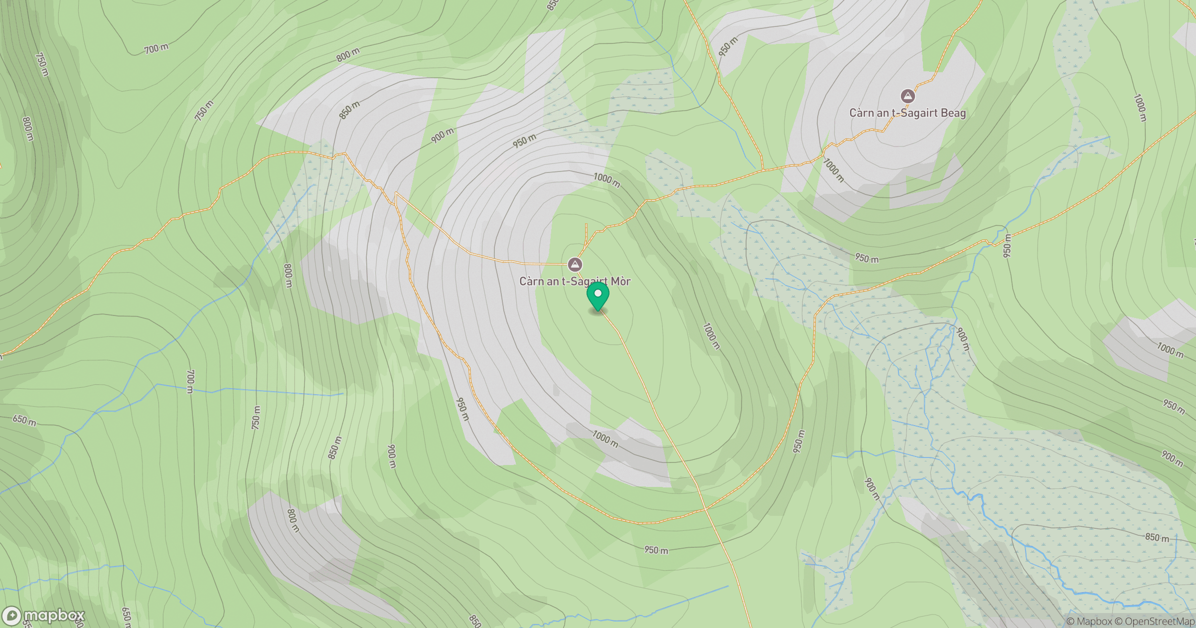
Grid reference: NO208842
View on OpenStreetMapOpens a map in a new tab, centred on the hill.
No comments yet. Be the first.