

Carn Ait
Good walks are even better shared.
NO1473 : Carn Ait
Ali Ogden Photo source
Overview
Welcome to Carn Ait
Nestled in the picturesque Grampian Mountains of the Scottish Highlands, Carn Ait stands proud at an elevation of 885 meters. This Marilyn may not be one of the highest summits, but it promises a delightful adventure for those keen to enjoy its scenic beauty and tranquil surroundings.
Geology
Carn Ait is primarily composed of schist, distinguished by its rugged appearance. Glacial activity has sculpted the landscape, leaving behind fascinating erosion features. The combination of its geological makeup and the surrounding natural elements make it a visual feast for geology enthusiasts.
Routes
One of the most popular hiking routes starts from Glen Quaich. Covering approximately 8 km, this route is moderately challenging and showcases the stunning beauty of the Highland landscape. Expect a mix of forest trails and rocky uphills, all culminating in a superb panoramic view at the summit. Plan for about 3.5 hours of walking, but do factor in extra time for that all-important tea break at the top.
Summit Features
When you finally reach the summit, you’ll be greeted by a striking rocky outcrop topped with a small cairn. It's an ideal spot to catch your breath, take in the views, and perhaps share tales of your hiking exploits—just remember to avoid any tall tales about how you single-handedly helped a lost sheep find its way home!
Terrain
The terrain is predominantly rocky, interspersed with patches of heather and grass. Prepare for a bit of a bumpy ascent; good hiking boots are a must unless you enjoy playing an impromptu game of 'slip and slide.'
Views
The views from Carn Ait are nothing short of breathtaking. You’ll catch glimpses of the Loch Tay and the majestic Ben Lawers range in the distance. The best times to experience these views are during spring or early summer when the landscape is alive with wildflowers, and the air is clear enough to see for miles—perfect for planning future adventures.
Hazards
As with many Highlands outings, be cautious of the variable weather conditions. What starts as a sunny day can quickly turn into thick mist. Stay mindful of loose rocks underfoot; they have a cheeky way of surprising unsuspecting hikers!
Access
To reach Carn Ait, park at the end of the minor road at NO157735, where there’s space for a handful of cars. Public transport options are limited, but you can find some bus services linking Aberfeldy with nearby villages. The nearest town for refreshments is Aberfeldy, just a short drive away.
Facilities
While there are no facilities on the mountain itself, Aberfeldy is well-equipped with cafes, shops, and public toilets. Stock up on snacks before your trek; nothing beats a good biscuit at the summit!
History
The mountain's name, 'Carn Ait,' loosely translates to 'hill of the place,' reflecting its prominent presence in the Highland landscape. Locally, it's historically significant for shepherding, and nowadays, it attracts a myriad of walkers eager to soak in nature's bounty.
So lace up your walking boots, pack your rucksack, and get ready to explore Carn Ait—where the views are worth every step!
Happy hiking!
Explore routes near Carn Ait
Walks starting near this hill. Open a route to check its map, distance and full itinerary.
Loch Muick full circuit from Spittal of Glen Muick
View route
Glen Banvie Trail with the Bruar viewpoint
View route
Unled club outing: West Drumochter/Beinn Udlamain (coach departure)
View route
Unled club outing: Glenesk (coach departure)
View route
Route planning notes
These notes describe possible approaches. Check a route's map and access information when planning your walk.
From Glen Quaich
A scenic route that meanders through forested glens and gradually ascends to the summit.
Make a day of it, together
Find someone to share the walk with, or organise a day out along a route you like.
Photo Gallery
View all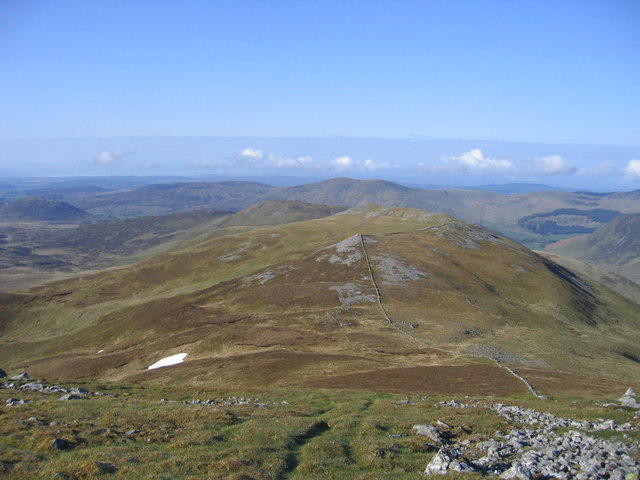 Photo could not load
NO1473 : Carn Ait
Ali Ogden
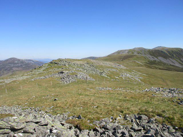 Photo could not load
NO1473 : Stony ground on Carn Ait
Scott Cormie
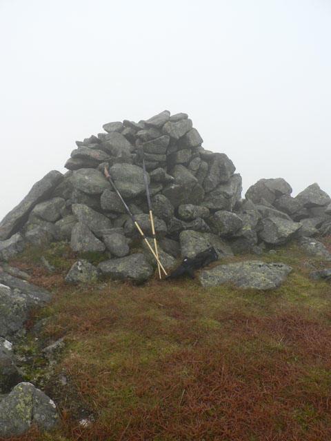 Photo could not load
NO1473 : Cairn
Liz Gray
Hill facts and local notes
Classifications
Elevation
865m
2,837 ft
Prominence
32m
Coordinates
56.8442, -3.4067
NO142734
OS Map
43
Explorer: OL52N 387N
At the Summit
The summit features a rocky outcrop with a small cairn, which also provides a perfect spot for a well-deserved rest and a sandwich.
Terrain & Geology
Carn Ait is primarily composed of schist, a metamorphic rock, giving it a rugged and textured terrain. The bedrock has been shaped by glacial activity, resulting in distinctive erosion features.
Views & Scenery
From the summit, you can enjoy sweeping views of the surrounding hills, including Loch Tay and the distant peaks of the Ben Lawers range.
History & Heritage
Name Origin
The name 'Carn Ait' translates to 'hill of the place,' possibly referring to its prominent position in the landscape.
Historical Significance
Historically, the area has been significant for local shepherding practices and has become a popular destination for walkers and nature lovers.
Getting There & Facilities
Parking
Parking is available at the end of the minor road at NO157735, with space for several cars.
Public Transport
Limited bus services operate from Aberfeldy to nearby villages, with further connections to larger towns.
Nearby Facilities
There are no facilities on the mountain itself, but Aberfeldy offers cafes, shops, and public toilets.
Safety Information
Known Hazards
- Variable weather conditions can change rapidly, low visibility in mist, and loose rocks in certain areas.
General Safety Tips
- Check weather conditions before setting out
- Carry appropriate clothing and equipment
- Let someone know your planned route
- Take a map, compass, and GPS device
- Carry emergency supplies: food, water, first aid kit, torch
Hills
Some common questions about the hills answered
Are there group walks up Carn Ait?
Many walkers use Walkmates to join or organise walks with others. You can check for group walks around Carn Ait through the maps
Are there other walkers around Carn Ait?
Activity varies by location and time, but Walkmates lets you see whether others have shared walks or shown interest in this area. Find other people through the walking friends search walking friends for Carn Ait search or of course create your own walk for Carn Ait
Can I organise a walk to Carn Ait?
Yes. If there aren’t any walks listed already, you can create a walk and make it available for others to join.
If you're signed up to Walkmates, you can create a walk to Carn Ait.
How do I find a walk up this hill?
There are often multiple ways to walk this hill, depending on experience and route preference. Walkmates helps you explore walks and routes that others have shared.
Can I suggest a new route up Carn Ait?
Yes. You can suggest or create routes to share with others. Walkmates focuses on the social side of walking, so routes are used to help people organise walks and explore areas together, rather than as detailed navigation tools or route libraries.
Other uses really appreciate knowledgeable walkers sharing their routes. Share your favourite route to Carn Ait here
The is an error or something incorrect about this hill. How do I let you know?
We always strive to keep the information on Walkmates as accurate as possible. If you find an error, please let us know through the contact form and we'll aim to correct it as quickly as possible
Community Discussion
Comments
Location
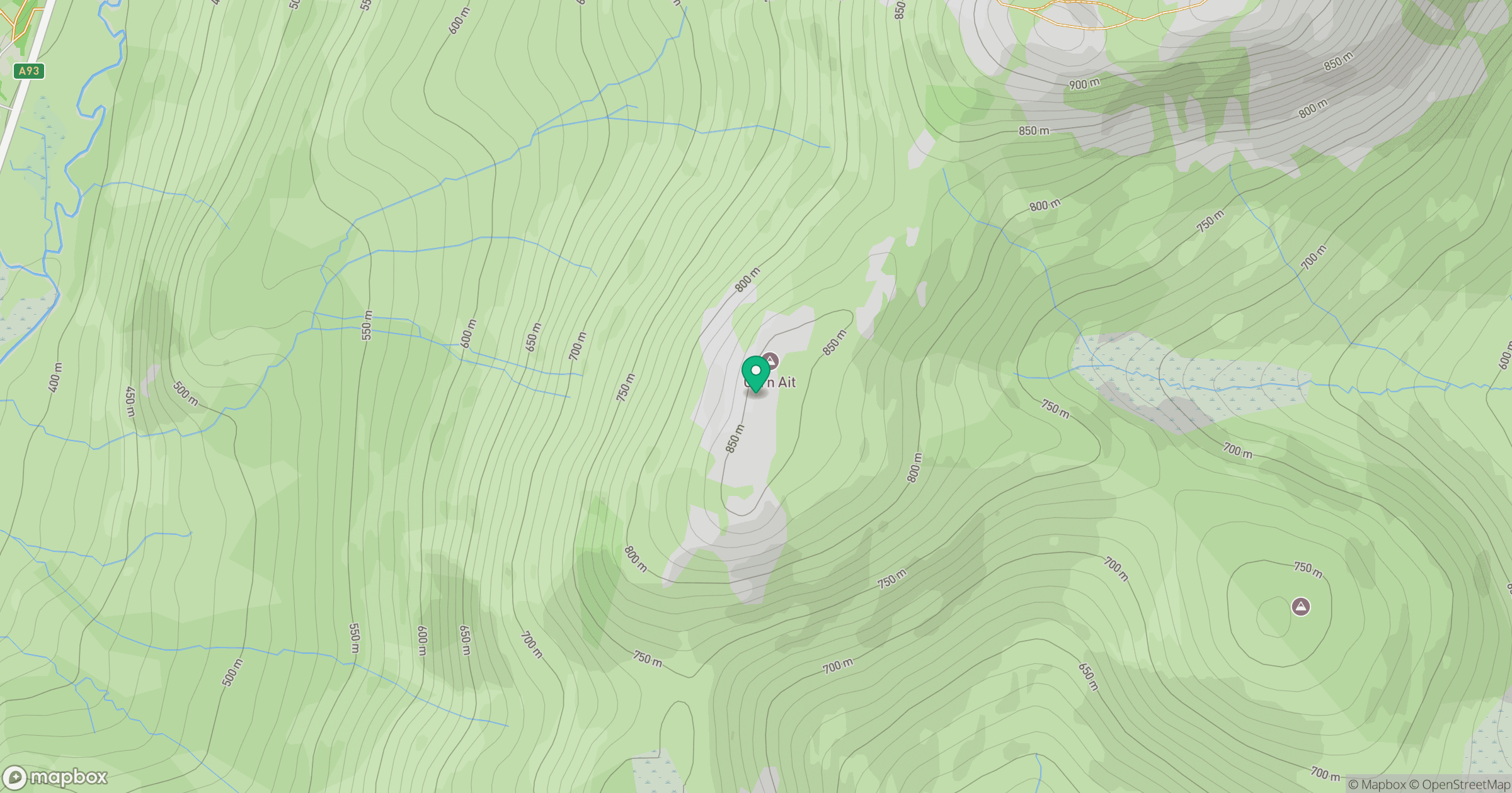
Grid reference: NO142734
View on OpenStreetMapOpens a map in a new tab, centred on the hill.
No comments yet. Be the first.