

Glas Maol
Good walks are even better shared.
NO1676 : Microlight Wreckage Near Glas Maol Summit
Mick Garratt Photo source
Overview
Exploring Glas Maol
Nestled in the heart of the Scottish Highlands, Glas Maol rises to a respectable height of 1068 meters, making it a proud Munro among its peers. This lofty peak not only offers a rewarding hike but also a wealth of stunning landscapes that will leave any outdoor enthusiast swooning.
Geology
The mountain is predominantly granite, a rock noted for its tough disposition. You might feel like you're on the set of a nature documentary as you ponder how glaciers sculpted this terrain, creating distinct valleys and lochs which sparkle invitingly in the sunlight.
Route Overview
The Glen Callater Route
This popular route stretches approximately 12.5 kilometres and typically takes around 4 hours to complete. Although it presents some moderate challenges, it's accessible for most hikers. Look out for the scenic views, possibly accompanied by a few surprised sheep who might be debating where to travel next!
Summit Features
Upon reaching the summit, climbers are greeted by a classic Scottish hillwalking feature: a cairn. It's a place to catch your breath and snap some photos, with stunning panoramas that make the ascent worthwhile.
Terrain Type
Expect a mix of rocky outcrops and lush moorland, with the iconic rolling hills of heather completing the picturesque setting. Don't forget to enjoy the wild beauty around you—it might just inspire heartfelt poetry, or at least a very thoughtful Instagram caption.
Views
On a clear day, the views from Glas Maol are praise-worthy. You can gaze across the Cairngorms and admire the shimmering lochs that dot the landscape. The best times for these views are during spring and summer when the weather is kinder. Autumn, however, serves up a glorious palette of colours if you fancy an aesthetic hike.
Hazards
As is the norm in the Highlands, the weather can turn on a dime. Be prepared for rain or sudden gusts of wind. The rocky terrain can be a tripping hazard, so sturdy footwear is highly recommended.
Nearby Summits
If you're feeling adventurous, consider tackling nearby peaks such as Cairn of Claise and Mullach Clach a' Bhlair—both familiar friends to those who relish the tranquillity and challenge of Highland hiking.
Access and Facilities
The nearest parking is at Glen Callater (NO 172 855). If you prefer public transport, buses from Aberdeen will take you to Braemar, the closest town. Braemar also offers ample amenities, including cafes, shops, and toilets for your convenience.
History
The name 'Glas Maol' means 'green hill' in Gaelic—an accurate descriptor for both the flora and the spirit of the place. Its significance as a popular hiking destination has cemented its place in the hearts of both locals and visitors alike. There's no doubt about it; Glas Maol is a gem in the Highlands, offering adventure, beauty, and a touch of magic for all who visit.
Happy hiking and may your boots carry you safely to the top!
Explore routes near Glas Maol
Walks starting near this hill. Open a route to check its map, distance and full itinerary.
Cairngorms night walk and stargazing (event meeting)
View route
Cairngorms night walk and stargazing (event meeting)
View route
Cairngorms night walk and stargazing (event meeting)
View route
Cairngorms night walk and stargazing (event meeting)
View route
Route planning notes
These notes describe possible approaches. Check a route's map and access information when planning your walk.
The Glen Callater Route
A scenic ascent beginning from Glen Callater, this route offers a steady climb with breathtaking views of the surrounding hills as you make your way to the summit.
Make a day of it, together
Find someone to share the walk with, or organise a day out along a route you like.
Photo Gallery
View all Photo could not load
NO1676 : Microlight Wreckage Near Glas Maol Summit
Mick Garratt
 Photo could not load
NO1676 : Lunch at the summit
Richard Sutcliffe
 Photo could not load
NO1676 : Glas Maol summit
Ali Ogden
 Photo could not load
NO1676 : Summit shelter & trig point
Liz Gray
 Photo could not load
NO1676 : Summit of Glas Maol
Iain Russell
 Photo could not load
NO1676 : Cairn and trig on Glas Maol
Steven Brown
 Photo could not load
NO1676 : Cairn and trig point on Glas Maol
Richard Law
 Photo could not load
NO1676 : Glas Maol Summit
Michael Graham
 Photo could not load
NO1676 : Glas Maol from Gleann Beag
Mike Pennington

NO1676 : Glas Maol
Mike Pennington
Hill facts and local notes
Classifications
Elevation
1,068m
3,503 ft
Prominence
195m
Coordinates
56.8731, -3.3682
NO166765
OS Map
43
Explorer: OL52N 387N
At the Summit
The summit features a well-constructed cairn, a classic sight for any hillwalker. On a clear day, you might even spot a few bemused sheep admiring the view.
Terrain & Geology
Glas Maol primarily consists of granite, a robust and resilient rock that has shaped this majestic mountain over millennia. The surrounding landscape is influenced by glacial activity, leaving behind U-shaped valleys and deep lochs that still charm today.
Views & Scenery
From the summit, you can enjoy views of the sprawling Cairngorms, the shimmering lochs, and the vast expanse of heather-clad hills. It's a photographer's paradise!
History & Heritage
Name Origin
The name 'Glas Maol' translates to 'green hill' in Scots Gaelic, which is a fitting tribute to the vibrant flora that greets visitors.
Historical Significance
Glas Maol has long been a favourite amongst hillwalkers, often enjoyed for its accessibility and the stunning panoramas it offers.
Getting There & Facilities
Parking
Parking is available at the end of the Glen Callater road (NO 172 855). Please mind the locals and park sensibly.
Public Transport
The nearest public transport can be found in Braemar, which is accessible via bus from Aberdeen and beyond.
Nearby Facilities
Braemar has a few lovely cafes and shops where you can refill your water bottle or grab a hearty meal. Toilets are available in the village.
Safety Information
Known Hazards
- As with any mountain hike, be wary of sudden weather changes, especially in the Highlands. The terrain can be slippery with loose rocks, so sturdy footwear is a must.
General Safety Tips
- Check weather conditions before setting out
- Carry appropriate clothing and equipment
- Let someone know your planned route
- Take a map, compass, and GPS device
- Carry emergency supplies: food, water, first aid kit, torch
Hills
Some common questions about the hills answered
Are there group walks up Glas Maol?
Many walkers use Walkmates to join or organise walks with others. You can check for group walks around Glas Maol through the maps
Are there other walkers around Glas Maol?
Activity varies by location and time, but Walkmates lets you see whether others have shared walks or shown interest in this area. Find other people through the walking friends search walking friends for Glas Maol search or of course create your own walk for Glas Maol
Can I organise a walk to Glas Maol?
Yes. If there aren’t any walks listed already, you can create a walk and make it available for others to join.
If you're signed up to Walkmates, you can create a walk to Glas Maol.
How do I find a walk up this hill?
There are often multiple ways to walk this hill, depending on experience and route preference. Walkmates helps you explore walks and routes that others have shared.
Can I suggest a new route up Glas Maol?
Yes. You can suggest or create routes to share with others. Walkmates focuses on the social side of walking, so routes are used to help people organise walks and explore areas together, rather than as detailed navigation tools or route libraries.
Other uses really appreciate knowledgeable walkers sharing their routes. Share your favourite route to Glas Maol here
The is an error or something incorrect about this hill. How do I let you know?
We always strive to keep the information on Walkmates as accurate as possible. If you find an error, please let us know through the contact form and we'll aim to correct it as quickly as possible
Community Discussion
Comments
Location
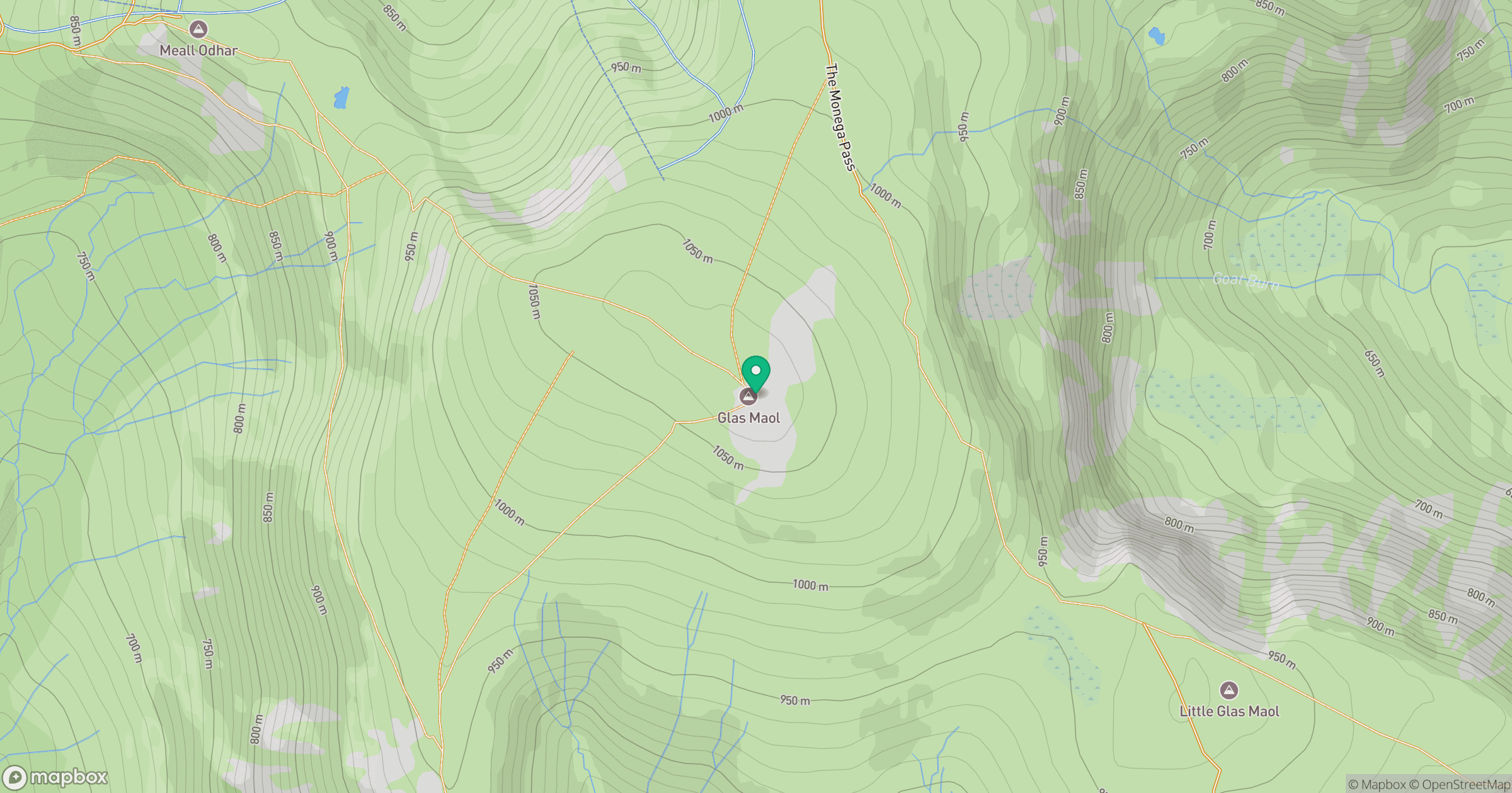
Grid reference: NO166765
View on OpenStreetMapOpens a map in a new tab, centred on the hill.
No comments yet. Be the first.