

Carn a' Gheoidh
Good walks are even better shared.
NO1076 : West from Gheoidh
Adam Ward Photo source
Overview
Carn a' Gheoidh
Overview
Nestled in the heart of the Scottish Highlands, Carn a' Gheoidh stands tall at 975 meters. Often celebrated for its stunning views, this Munro attracts hikers eager to explore its rugged charms.
Geology
The mountain's foundation consists of ancient metamorphic rocks, primarily schist and gneiss. These rocks not only define the mountain's structure but also offer an intriguing glimpse into the Earth's geological history, giving this peak a character that is both old and majestic.
Routes
Glen Ey Approach
This is the most popular route, starting from Glen Ey. As you walk through heather-clad hills and rocky outcrops, be prepared for some challenging yet rewarding sections. Covering approximately 12 km, this moderate hike can be done in about 4.5 hours, depending on your pace and how much you stop to admire the views!
Summit Features
Upon reaching the summit, hikers are greeted by a substantial cairn—a perfect backdrop for that obligatory summit selfie. Take a moment to soak in the tranquillity before descending.
Terrain Type
The terrain here is a mix of rocky paths interspersed with patches of lush grasses and beautiful heather, all of which enhance the Highland experience.
Views
From the peak, the panoramic views are nothing short of breathtaking. You can see the majestic Ben Macdui and the verdant Glen Ey below. The best times to enjoy these views are during spring and early summer when the skies are typically clear and the heather is blooming.
Hazards
As with any Highland adventure, keep an eye out for loose rocks. And remember, the weather can change quicker than a squirrel on a nut hunt! Always be prepared.
Nearby Summits
If you're feeling energetic, consider combining your ascent of Carn a' Gheoidh with a hike to nearby Beinn a' Ghlo, which tops 1128 meters.
Access
- Nearest Parking: You can find parking at the end of the public road leading into Glen Ey, roughly 10 km from the A93.
- Public Transport: Limited bus services operate to Braemar, making it a useful base.
- Nearest Town: The charming village of Braemar offers a friendly atmosphere and serves as a great starting point for your hike.
Facilities
Braemar’s amenities include a quaint café and public toilets, perfect for a quick break before or after your hike.
History
The name Carn a' Gheoidh echoes its landscape, translating to 'hill of the ghyll or ravine.' Its popularity among hikers reflects its cultural significance in showcasing the natural heritage of Scotland.
So lace up those boots, grab your walking pole, and prepare for an unforgettable adventure on Carn a' Gheoidh—all with the knowledge that a wee café awaits you back in Braemar!
Explore routes near Carn a' Gheoidh
Walks starting near this hill. Open a route to check its map, distance and full itinerary.
Cairngorms night walk and stargazing (event meeting)
View route
Cairngorms night walk and stargazing (event meeting)
View route
Cairngorms night walk and stargazing (event meeting)
View route
Cairngorms night walk and stargazing (event meeting)
View route
Route planning notes
These notes describe possible approaches. Check a route's map and access information when planning your walk.
Glen Ey Approach
A scenic walk starting from Glen Ey, this route ascends through heather and rocky outcrops to the summit.
Make a day of it, together
Find someone to share the walk with, or organise a day out along a route you like.
Photo Gallery
View all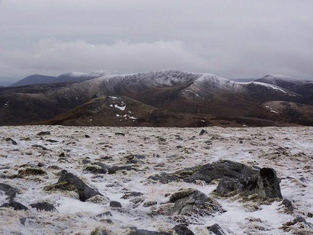 Photo could not load
NO1076 : West from Gheoidh
Adam Ward
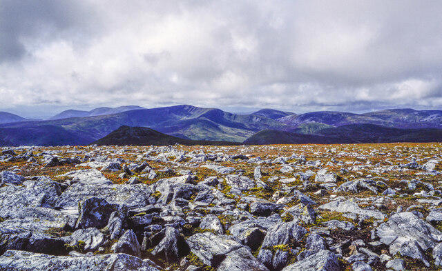 Photo could not load
NO1076 : Angular rocks on summit plateau of Carn a' Gheòidh
Trevor Littlewood
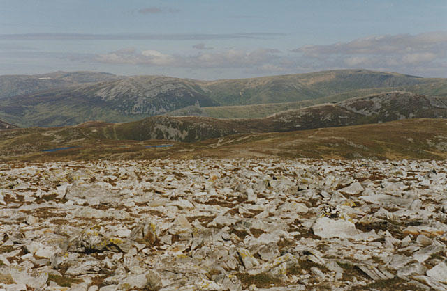 Photo could not load
NO1076 : Eastern slopes of Carn a' Gheoidh
Nigel Brown
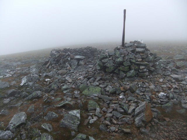 Photo could not load
NO1076 : Summit, Carn a' Gheoidh
David Brown
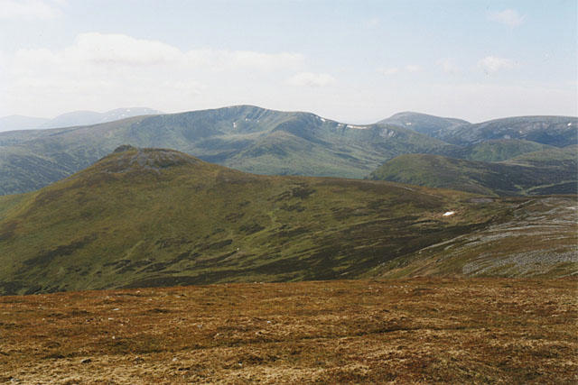 Photo could not load
NO1076 : View west from Carn a' Gheoidh
Nigel Brown
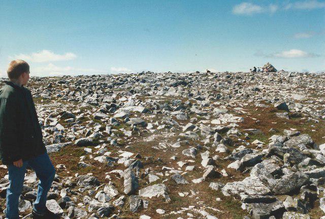 Photo could not load
NO1076 : Approaching the summit of Carn a' Gheoidh
Tim Glover
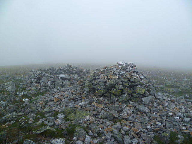 Photo could not load
NO1076 : On Carn a Gheoidh
Michael Graham
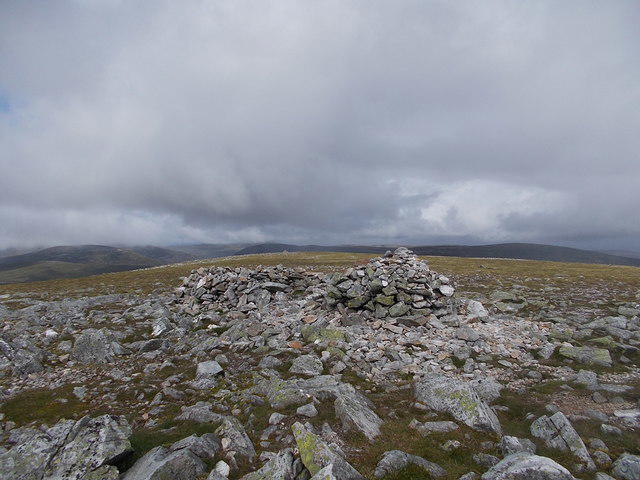 Photo could not load
NO1076 : Summit of Carn a'Gheoidh
Iain Russell
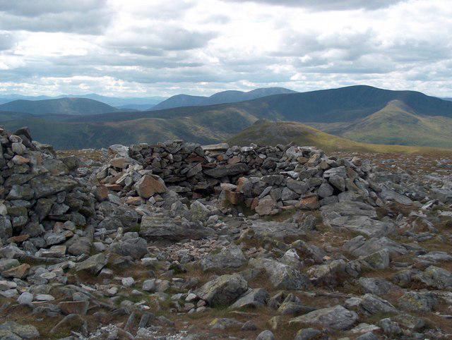 Photo could not load
NO1076 : The top of Carn a Gheoidh
Bill Boaden
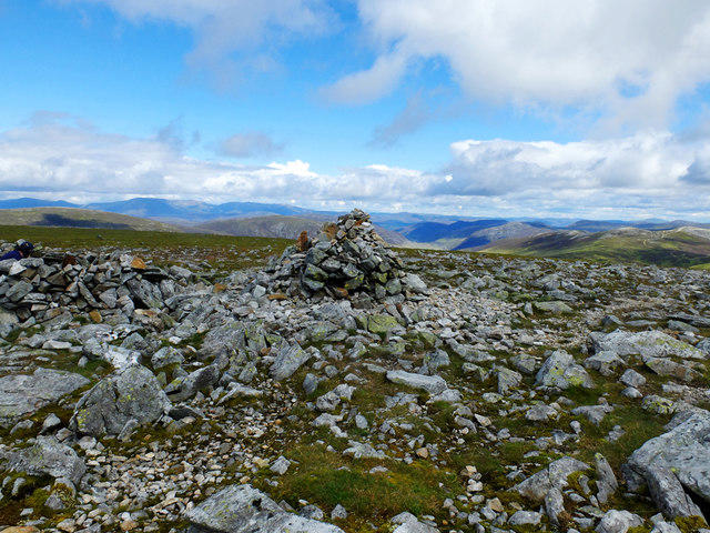
NO1076 : Summit of Carn a'Gheoidh
John Allan
Hill facts and local notes
Classifications
Elevation
976m
3,202 ft
Prominence
299m
Coordinates
56.8731, -3.4666
NO107767
OS Map
43
Explorer: OL52N 387N
At the Summit
The summit features a large, distinct cairn which offers a welcoming sight for tired legs and a fantastic spot for photos.
Terrain & Geology
Carn a' Gheoidh is primarily composed of ancient metamorphic rocks, including schist and gneiss. These geological features add to its rugged beauty and provide hikers with a taste of the area's tumultuous geological past.
Views & Scenery
From the summit, you can gaze over the stunning landscapes of the Cairngorms, including Ben Macdui and the lushness of Glen Ey.
History & Heritage
Name Origin
The name 'Carn a' Gheoidh' roughly translates to 'hill of the ghyll or ravine', reflecting the rugged terrain.
Historical Significance
This mountain is significant for its challenging climbs that attract keen hikers and climbers, offering insight into the region's natural beauty and history.
Getting There & Facilities
Parking
Parking is available at the end of the public road near the entrance to Glen Ey, approximately 10 km from the A93.
Public Transport
There are limited bus services to the nearby village of Braemar, from where the hike can be initiated.
Nearby Facilities
There are basic facilities such as a café in Braemar, as well as public toilets.
Safety Information
Known Hazards
- Watch out for loose rocks and sudden weather changes, which are common in the Highlands. Always be prepared!
General Safety Tips
- Check weather conditions before setting out
- Carry appropriate clothing and equipment
- Let someone know your planned route
- Take a map, compass, and GPS device
- Carry emergency supplies: food, water, first aid kit, torch
Hills
Some common questions about the hills answered
Are there group walks up Carn a' Gheoidh?
Many walkers use Walkmates to join or organise walks with others. You can check for group walks around Carn a' Gheoidh through the maps
Are there other walkers around Carn a' Gheoidh?
Activity varies by location and time, but Walkmates lets you see whether others have shared walks or shown interest in this area. Find other people through the walking friends search walking friends for Carn a' Gheoidh search or of course create your own walk for Carn a' Gheoidh
Can I organise a walk to Carn a' Gheoidh?
Yes. If there aren’t any walks listed already, you can create a walk and make it available for others to join.
If you're signed up to Walkmates, you can create a walk to Carn a' Gheoidh.
How do I find a walk up this hill?
There are often multiple ways to walk this hill, depending on experience and route preference. Walkmates helps you explore walks and routes that others have shared.
Can I suggest a new route up Carn a' Gheoidh?
Yes. You can suggest or create routes to share with others. Walkmates focuses on the social side of walking, so routes are used to help people organise walks and explore areas together, rather than as detailed navigation tools or route libraries.
Other uses really appreciate knowledgeable walkers sharing their routes. Share your favourite route to Carn a' Gheoidh here
The is an error or something incorrect about this hill. How do I let you know?
We always strive to keep the information on Walkmates as accurate as possible. If you find an error, please let us know through the contact form and we'll aim to correct it as quickly as possible
Community Discussion
Comments
Location
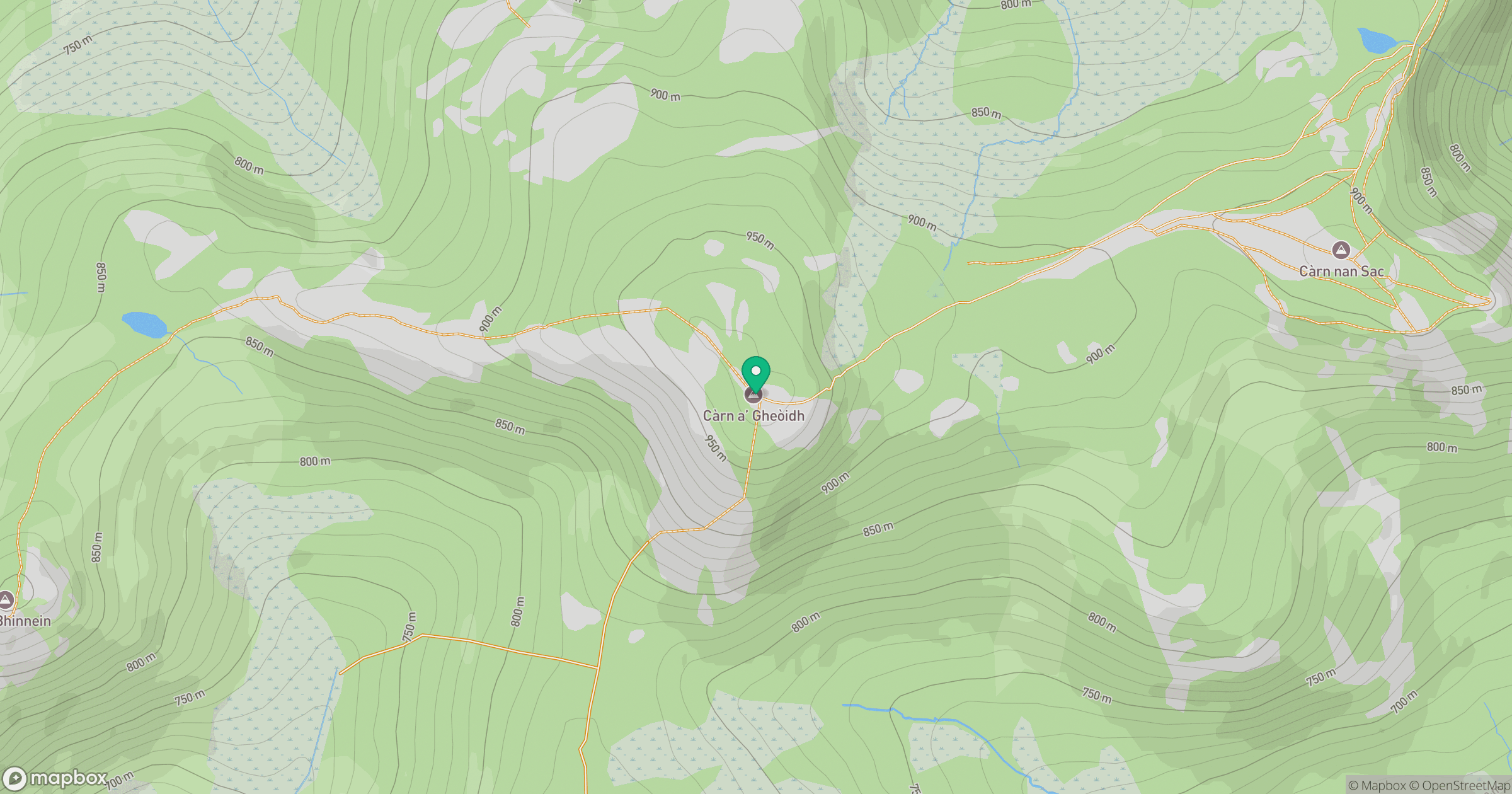
Grid reference: NO107767
View on OpenStreetMapOpens a map in a new tab, centred on the hill.
No comments yet. Be the first.