
Callahaniska
Good walks are even better shared.
Overview
Callahaniska: A Charming Highland Marvel
Nestled in the heart of the Scottish Highlands, Callahaniska offers both adventure and beauty, drawing hikers who crave scenic panoramas and an energetic footpath. At an elevation of 786 meters, this mountain might not be the highest in the region, but it certainly is one of the most stunning.
Geology
The geological formations around Callahaniska are comprised mainly of ancient schist rock. If rocks could talk, these would have quite the story to tell, dating back over a billion years! You'll see an array of interesting mineral veins and strange formations, each carefully shaped by the elements of time.
Routes
There are a couple of well-trodden paths leading to the summit, each offering unique challenges and views:
North Ridge Route
This is often the go-to route for many hikers. Starting quietly with mild slopes, it prepares you for the shenanigans that follow as you scramble towards the top.
- Distance: 3.5 km
- Time: Approximately 2.5 hours
- Difficulty: Moderate
South Trail
If you’re feeling particularly energetic, the South Trail delivers a more daunting challenge but rewards with magnificent, sweeping views.
- Distance: 4.0 km
- Time: Approximately 3.0 hours
- Difficulty: Challenging
Summit Features
Upon reaching the summit, you're welcomed by a robust cairn that stands proud against the Highland winds, alongside breathtaking views of Ben Nevis and other peaks in the distance. Don’t forget to pause, breathe and take it all in! This summit could easily be mistaken for the set of a grand Scottish tale — it's that beautiful.
Terrain
Expect a rugged ascent with a mix of rocky outcrops and lush patches of heather. The mountain’s charm lies in its wildness — and perhaps a touch of its eccentricity.
Views
The vistas are nothing short of spectacular. You’ll encounter sweeping landscapes of the Highlands, with Ben Nevis looming majestically to the south-west. Spring and Autumn are particularly gorgeous times to soak up the views, when the weather is kinder and nature puts on a brilliant show.
Hazards
While Callahaniska may seem inviting, it’s not without its perils. Watch your step on steep drop-offs and be cautious of loose rocks. Always keep an eye on the weather — it can change quicker than a local can tell a good yarn.
Access and Facilities
Getting There
The nearest parking can be found near Fort Augustus, where a small car park awaits those ready to conquer the mountain.
Amenities
Fort Augustus is not just a dot on the map; it’s a charming village loaded with cafes, restaurants, and public toilets, where you can reward yourself post-hike with a cup of hot chocolate.
History
The name Callahaniska is steeped in local lore, believed to mean ‘the home of the calyn’. The mountain has captured the hearts of adventurers and locals alike, becoming a treasured part of the region’s hiking legacy.
In conclusion, if you're searching for a Highland adventure combined with breathtaking views and the chance to dust off your hiking boots, Callahaniska awaits to be explored! Don’t forget your camera — the sights are far too pretty to be left undocumented.
Happy hiking!
Explore routes near Callahaniska
Public walks starting within 80 km of this hill. Nearby does not mean a route reaches the summit; check its map and access before setting out.
No public routes are currently listed within 80 km of Callahaniska on Walkmates. This does not mean there are no paths here. Explore the map and check local access information before planning a walk.
Route planning notes
These notes describe possible approaches, not verified navigable routes or permission to cross land. Check current paths, local access rules and conditions before setting out.
North Ridge Route
A scenic ascent beginning from the north, featuring gentle slopes before a steep climb towards the summit.
South Trail
A more challenging route that offers great panoramic views but requires a bit more stamina and determination.
Make a day of it, together
Find someone to share the walk with, or organise a day out along a route you like.
Hill facts and local notes
Classifications
Elevation
217m
712 ft
Prominence
109m
Coordinates
52.0582, -9.8815
V710912
OS Map
78
At the Summit
At the summit, visitors are greeted by a sturdy cairn marking the top, alongside a splendid view of the surrounding peaks and valleys that might just take your breath away (in a good way).
Terrain & Geology
Callahaniska is primarily composed of ancient schist, formed over millions of years and is littered with intriguing mineral veins. The bedrock creates some stunning cliff formations to admire and even a few to grimace at — don’t forget your camera!
Views & Scenery
From the summit, one can view the magnificent Ben Nevis to the south-west and the rolling hills of the Highlands stretching endlessly to the horizon.
History & Heritage
Name Origin
The name Callahaniska is believed to derive from the Gaelic term meaning ‘the home of the calyn’, referring to a long-lost local legend.
Historical Significance
This mountain has been a beloved destination for outdoor enthusiasts for decades, contributing to the rich tapestry of the region's hiking culture.
Getting There & Facilities
Check current local access restrictions, parking rules and transport timetables before travelling. These notes do not confirm public access to the summit.
Parking
There is a small car park located near the village of Fort Augustus, providing a good starting point for the hikes with space for about 15 vehicles.
Public Transport
Regular bus services from Inverness to Fort Augustus are available, making it an easy trip for those without a car.
Nearby Facilities
The nearby village of Fort Augustus offers charming cafes, restaurants, and public toilets for hikers' convenience.
Safety Information
Known Hazards
- Steep drop-offs near the summit, loose rocks on the trails, and rapidly changing weather conditions.
General Safety Tips
- Check weather conditions before setting out
- Carry appropriate clothing and equipment
- Let someone know your planned route
- Take a map, compass, and GPS device
- Carry emergency supplies: food, water, first aid kit, torch
Hills
Some common questions about the hills answered
Are there group walks up Callahaniska?
Many walkers use Walkmates to join or organise walks with others. You can check for group walks around Callahaniska through the maps
Are there other walkers around Callahaniska?
Activity varies by location and time, but Walkmates lets you see whether others have shared walks or shown interest in this area. Find other people through the walking friends search walking friends for Callahaniska search or of course create your own walk for Callahaniska
Can I organise a walk to Callahaniska?
Yes. If there aren’t any walks listed already, you can create a walk and make it available for others to join.
If you're signed up to Walkmates, you can create a walk to Callahaniska.
How do I find a walk up this hill?
There are often multiple ways to walk this hill, depending on experience and route preference. Walkmates helps you explore walks and routes that others have shared.
Can I suggest a new route up Callahaniska?
Yes. You can suggest or create routes to share with others. Walkmates focuses on the social side of walking, so routes are used to help people organise walks and explore areas together, rather than as detailed navigation tools or route libraries.
Other uses really appreciate knowledgeable walkers sharing their routes. Share your favourite route to Callahaniska here
The is an error or something incorrect about this hill. How do I let you know?
We always strive to keep the information on Walkmates as accurate as possible. If you find an error, please let us know through the contact form and we'll aim to correct it as quickly as possible
Community Discussion
Comments
Location
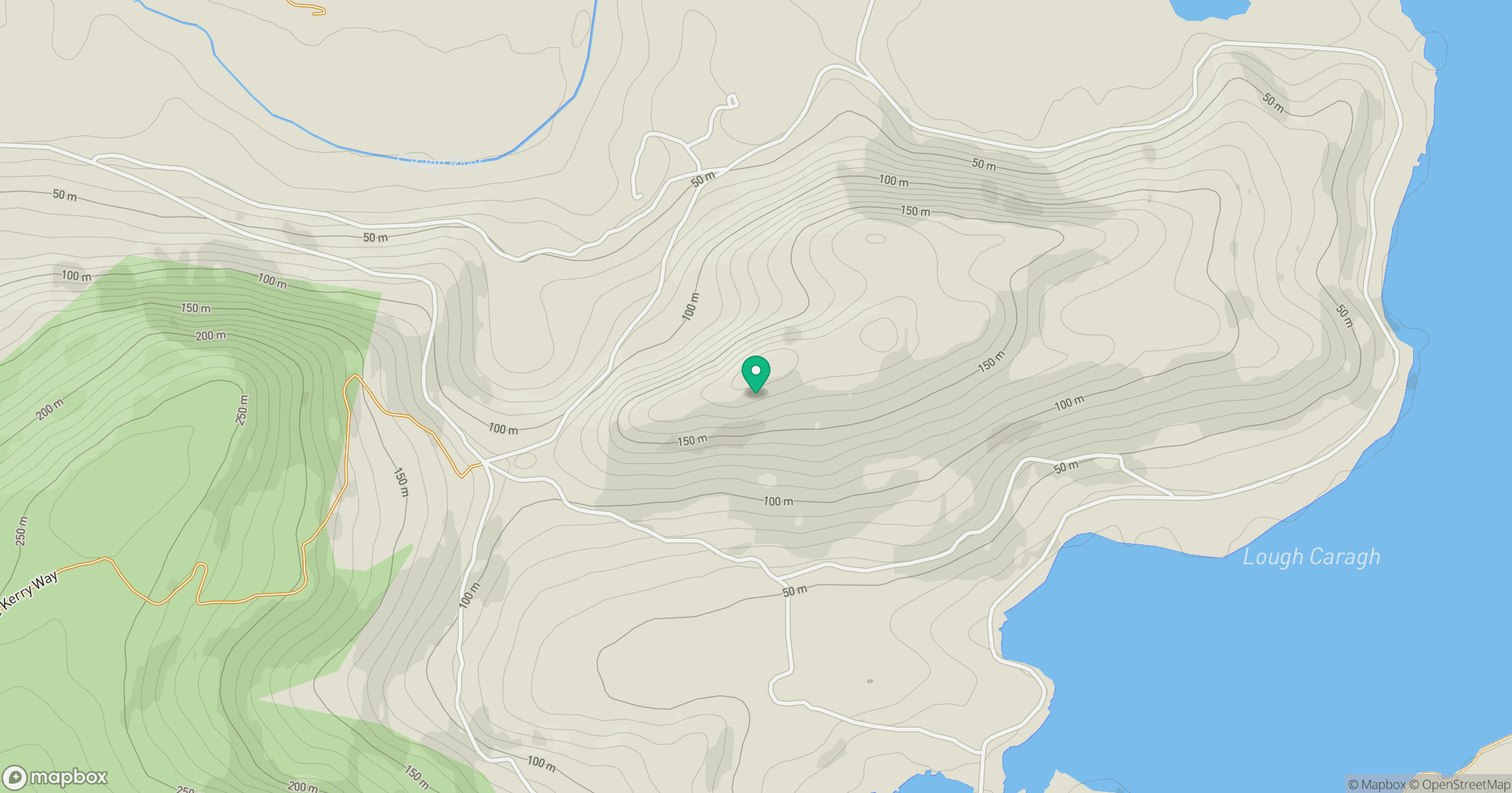
Grid reference: V710912
View on OpenStreetMapOpens a map in a new tab, centred on the hill.
Hills within 30 km
Straight-line distance, not a walking route or confirmation of access.
No comments yet. Be the first.