

Caldey Island
Good walks are even better shared.
SS1396 : Redberry Bay, Caldey Island
Nigel Thompson Photo source
Overview
Caldey Island: A Coastal Gem
Caldey Island, located just a short boat ride from the bustling town of Tenby, is a stunning destination for those who appreciate natural beauty and a dash of history. With its gorgeous landscapes and peaceable atmosphere, it is a perfect spot for a day-trip hike.
Geology
The island's geological makeup consists of limestone and sandstone, giving it striking coastal features and inviting sandy beaches. The combination of rock formations around the edges and soft grassy pathways throughout makes Caldey a unique exploration point. Keep an eye out for interesting fossils that can often be discovered along the shoreline!
Routes
Caldey Island Path: This easy, circular route spans approximately 4 km and takes about 1.5 hours to complete. As you stroll, you’ll pass charming cottages, ancient ruins, and can stop for a breather on one of the many beautiful beaches. It's like taking a stroll with a picturesque postcard as your backdrop!
Summit Features
Though there’s no formal summit, elevated paths provide splendid views, particularly from the area near the old lighthouse. Don't forget your camera – the views are Instagram-worthy!
Terrain Type
The terrain here is predominantly grassy with inviting beach paths, interspersed with rocky outcrops and cliff edges that provide dramatic views of the surrounding waters. So, watch your step near those cliffs!
Views
From the various vantage points on the island, hikers can enjoy breathtaking views of the Bristol Channel and the stretching coastline of Pembrokeshire. Springtime bursts forth in wildflowers, while summer welcomes warm, clear skies – excellent for taking in those views.
Hazards
While Caldey Island is fairly safe, do keep your wits about you near steep cliffs and slippery paths, particularly after rain. A tumble could spoil your day trip!
Access
Getting to Caldey Island is straightforward. You can park in Tenby, and after a bite of lunch and some photographs of the town, catch a boat to the island. Buses and a local train service also run to Tenby, making it accessible for day trippers.
Facilities
On the island, you’ll find seasonal cafés, modest shop offerings, and toilet facilities to keep you comfortable while you explore. Just a tip: check what the cafés have on offer, as their treats can be the highlight of your adventure!
History
Caldey has a storied past, having been home to a monastic community for over 1,500 years. The name 'Caldey' itself means 'warm' in Welsh, reflecting the island’s temperate climate. It’s a place where nature and spirituality harmoniously intertwine, inviting you to soak in both the scenery and the serenity.
Conclusion
So, if you're looking for a delightful day of exploration, Caldey Island welcomes you with open arms (and some stunning views). Just don’t forget to wave goodbye to the boat captain on your way back!
Explore routes near Caldey Island
Walks starting near this hill. Open a route to check its map, distance and full itinerary.
Stackpole Estate: Bosherston Lily Ponds and Lodge Park Woodland Circuit
View route
Neyland to Johnston: Brunel and Westfield Railway Trail
View route
Gower winter wildlife and birdwatching walk
View route
Llanelli North Dock to Machynys Point and Wetland Centre
View route
Route planning notes
These notes describe possible approaches. Check a route's map and access information when planning your walk.
Caldey Island Path
A scenic circular route around the island, providing access to beaches, the village, and historic sites.
Make a day of it, together
Find someone to share the walk with, or organise a day out along a route you like.
Photo Gallery
View all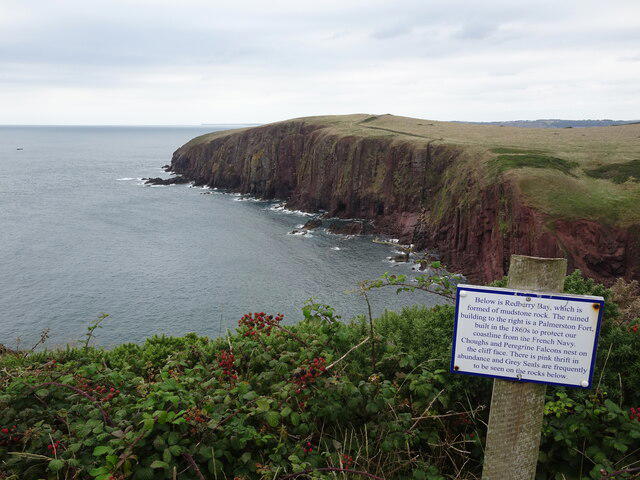 Photo could not load
SS1396 : Redberry Bay, Caldey Island
Nigel Thompson
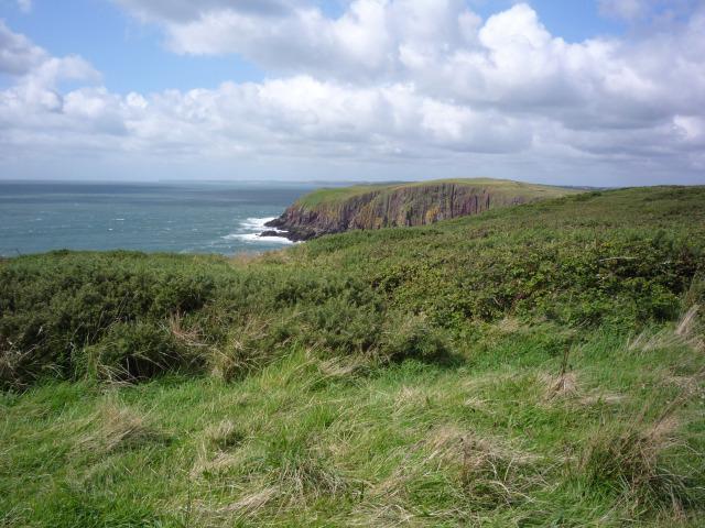 Photo could not load
SS1396 : Towards Red Berry Bay
DS Pugh
Hill facts and local notes
Classifications
Elevation
60m
197 ft
Prominence
60m
Coordinates
51.6338, -4.7002
SS132962
OS Map
158
Explorer: OL36E
At the Summit
The island does not feature a summit in the traditional sense, but visitors will enjoy the beautiful views from various coastal paths and elevated areas, particularly near the old lighthouse.
Terrain & Geology
Caldey Island is largely composed of limestone and sandstone, which contribute to its coastal charm and natural beauty. The shoreline features interesting rock formations and fossil beds, making it a delightful spot for geological enthusiasts.
Views & Scenery
Stunning views of the Bristol Channel, nearby islands, and the picturesque coastline of Pembrokeshire.
History & Heritage
Name Origin
The name 'Caldey' is derived from the Welsh 'Caldy,' meaning 'warm,' likely referring to the island's mild climate.
Historical Significance
Caldey Island has been inhabited for over 1,500 years and is home to a monastic community, making it a site of historical and cultural interest.
Getting There & Facilities
Parking
Parking is available at the main quay in Tenby, Pembrokeshire, followed by a short boat ride to Caldey Island.
Public Transport
Regular bus services operate between Tenby and nearby towns; the train station in Tenby also connects to Swindon and Cardiff.
Nearby Facilities
There are a few seasonal cafes and a shop on the island, as well as church facilities. Toilets are available close to the landing area.
Safety Information
Known Hazards
- Be cautious of steep cliffs along the coastline and slippery paths, especially when wet.
General Safety Tips
- Check weather conditions before setting out
- Carry appropriate clothing and equipment
- Let someone know your planned route
- Take a map, compass, and GPS device
- Carry emergency supplies: food, water, first aid kit, torch
Hills
Some common questions about the hills answered
Are there group walks up Caldey Island?
Many walkers use Walkmates to join or organise walks with others. You can check for group walks around Caldey Island through the maps
Are there other walkers around Caldey Island?
Activity varies by location and time, but Walkmates lets you see whether others have shared walks or shown interest in this area. Find other people through the walking friends search walking friends for Caldey Island search or of course create your own walk for Caldey Island
Can I organise a walk to Caldey Island?
Yes. If there aren’t any walks listed already, you can create a walk and make it available for others to join.
If you're signed up to Walkmates, you can create a walk to Caldey Island.
How do I find a walk up this hill?
There are often multiple ways to walk this hill, depending on experience and route preference. Walkmates helps you explore walks and routes that others have shared.
Can I suggest a new route up Caldey Island?
Yes. You can suggest or create routes to share with others. Walkmates focuses on the social side of walking, so routes are used to help people organise walks and explore areas together, rather than as detailed navigation tools or route libraries.
Other uses really appreciate knowledgeable walkers sharing their routes. Share your favourite route to Caldey Island here
The is an error or something incorrect about this hill. How do I let you know?
We always strive to keep the information on Walkmates as accurate as possible. If you find an error, please let us know through the contact form and we'll aim to correct it as quickly as possible
Community Discussion
Comments
Location
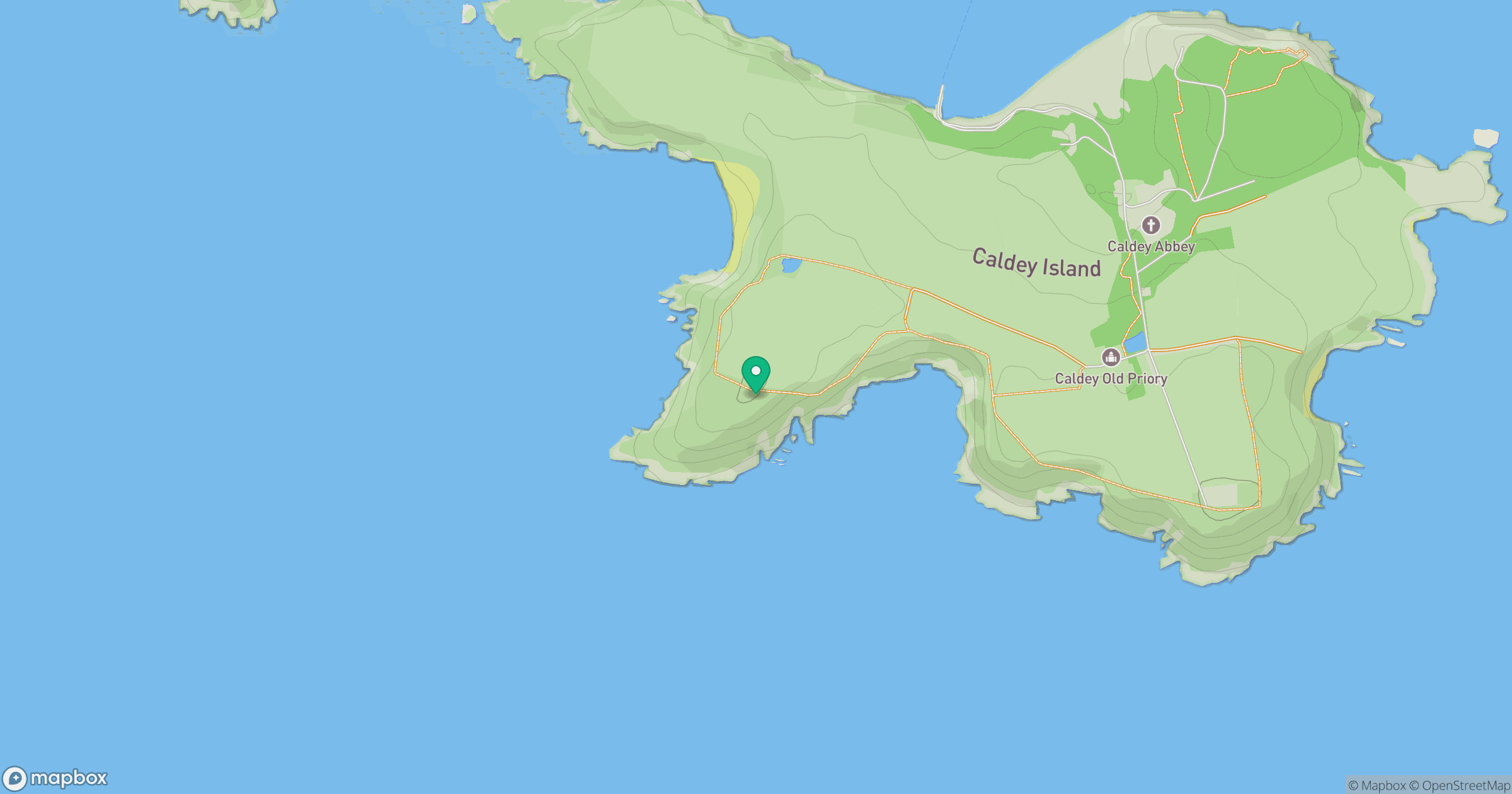
Grid reference: SS132962
View on OpenStreetMapOpens a map in a new tab, centred on the hill.

No comments yet. Be the first.