

Burgh Island
Good walks are even better shared.
SX6443 : Little Island, Burgh Island
Derek Harper Photo source
Overview
Burgh Island
Nestled off the Devon coast, Burgh Island is not just a sleepy islet; it’s a treasure trove of charm, history, and stunning vistas.
Geology
Burgh Island’s geology tells a story of time gone by, with its ancient Devonian slate and sandstone forming the rugged backdrop against the crashing waves. Coastal erosion creates intriguing rock formations that are perfect for photography enthusiasts.
Access
Parking
To reach Burgh Island, head to Bigbury-on-Sea where you'll find ample parking. Keep an eye on parking fees as these can skyrocket in the summer months – it seems even cars want to sprout holiday wings!
Public Transport
Public transport can get you to Bigbury-on-Sea fairly easily, with bus services running from towns like Kingsbridge and Totnes. Your stop will be just a short stroll away from the beach.
Nearest Town
Bigbury-on-Sea is your go-to for facilities, refreshments and a supremely friendly atmosphere.
Routes
One of the best ways to approach Burgh Island is along the Coastal Walk from Bigbury-on-Sea. This picturesque route spans approximately 3.5 kilometers, takes about 1.5 hours, and is rated as easy. Expect to be mesmerised by the stunning views of cliffs and beaches along the way – just remember to bring your camera!
Summit Features
Unlike most peaks, this islet's 'summit' features a rather grand art deco hotel, standing in splendid isolation and offering a touch of glamour. If walls could talk, this place would have tales from the rich and famous!
Terrain Type
The terrain is diverse, with sandy beaches inviting sunbathers and rocky outcrops offering challenges to adventurous kids and adults alike. The grassy areas add a comfortable texture to your exploration.
Views
Highlights
The views from Burgh Island are nothing short of spectacular, with the English Channel sprawling out before you and wonderful panoramas of the dramatic Devon coastline. Keep an eye out for ships and perhaps even a cheeky dolphin!
Best Seasons
Spring and summer are the best times for a visit. With flowers in bloom and the sea sparkling like diamonds, it’s hard not to feel that life’s a beach!
Hazards
A gentle reminder: be mindful of the tides! The causeway can be submerged, so check the tide times to avoid an unplanned swim with the fishes.
Nearby Summits
While Burgh Island itself isn’t traditionally hilly, the nearby coastal landscape offers gentle climbs and beautiful walks for those seeking slightly higher ground.
Facilities
If you’re feeling peckish after a jaunt around the island, you can find a café or grab a meal at the elegant Burgh Island Hotel. They serve a mean cream tea that’s worth every calorie!
In summary, whether you desire a relaxing day at the beach, an adventurous coastal walk, or a peek into the luxurious history of Burgh Island, it serves as a delightful escape.
Remember, every adventure is a story waiting to be told, so make it a good one!
Explore routes near Burgh Island
Walks starting near this hill. Open a route to check its map, distance and full itinerary.
Salcombe, Batson Creek and Snapes Point estuary circuit
View route
Cotehele: Danescombe Valley and Mining Heritage Circuit
View route
Moretonhampstead to Lustleigh: Wray Valley woodland railway trail
View route
Castle Drogo and Fingle Bridge: Teign Gorge woodland circuit
View route
Route planning notes
These notes describe possible approaches. Check a route's map and access information when planning your walk.
Coastal Walk from Bigbury-on-Sea
A scenic walk along the coastline, offering stunning views of the cliffs and beach before crossing the tidal causeway to the island.
Make a day of it, together
Find someone to share the walk with, or organise a day out along a route you like.
Photo Gallery
View all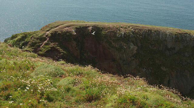 Photo could not load
SX6443 : Little Island, Burgh Island
Derek Harper
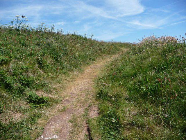 Photo could not load
SX6443 : Path to the summit of Burgh Island
Christine Johnstone
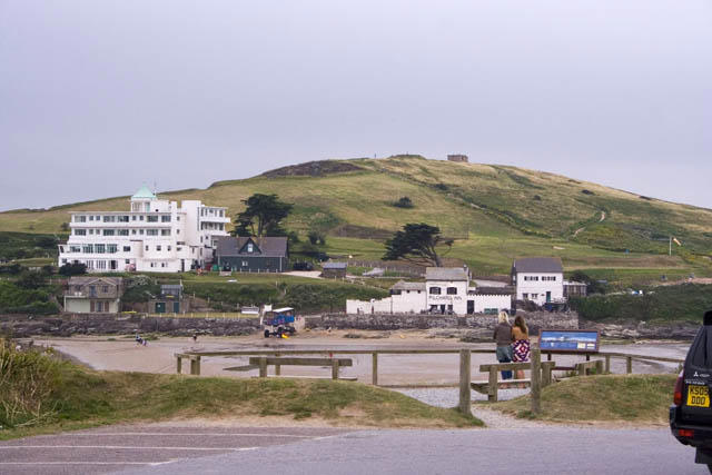 Photo could not load
SX6443 : From the car-park at Bigbury on Sea
Kate Jewell
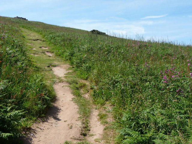 Photo could not load
SX6443 : Path to Burgh Island summit
Christine Johnstone
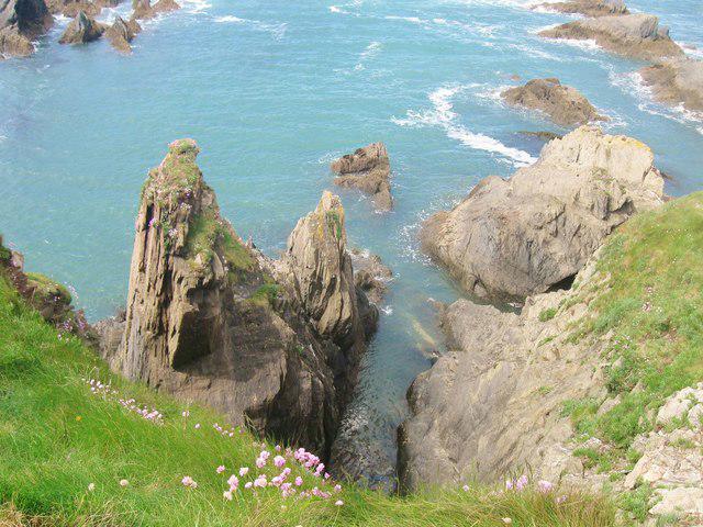 Photo could not load
SX6443 : The rocky western shore of Burgh Island, Bigbury-on-Sea, Devon
Derek Voller
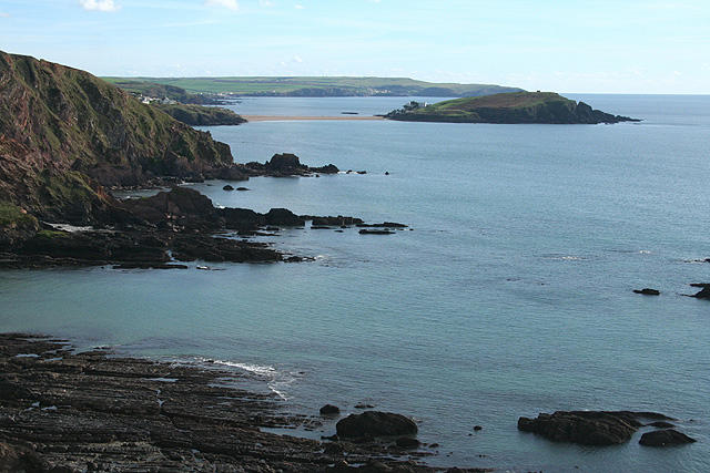 Photo could not load
SX6443 : Bigbury: Burgh Island from the north west
Martin Bodman
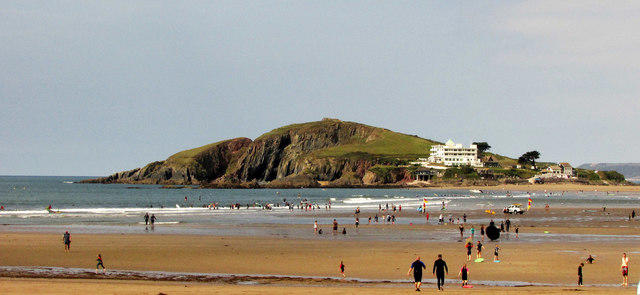 Photo could not load
SX6443 : Burgh Island
Derek Harper
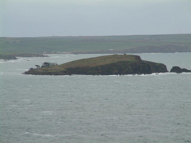 Photo could not load
SX6443 : Burgh Island, Devon
Robin Lucas
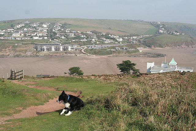 Photo could not load
SX6443 : Bigbury: on Burgh Island
Martin Bodman
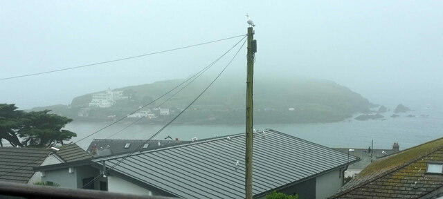
SX6443 : Burgh island in mist
Derek Harper
Hill facts and local notes
Classifications
Elevation
48m
157 ft
Prominence
48m
Coordinates
50.2791, -3.9007
SX646438
OS Map
202
Explorer: OL20W
At the Summit
The island is crowned with art deco buildings, notably the Burgh Island Hotel, which is as historic as it is elegant.
Terrain & Geology
The island comprises mostly of Devonian slate and sandstone, giving it a rugged charm. The coastal erosion has also resulted in intriguing rock formations along the shoreline.
Views & Scenery
From the island, gaze out over the English Channel and the beautiful coastline, including the picturesque Bigbury Bay.
History & Heritage
Name Origin
The name 'Burgh' is derived from the Old English word for fort or fortified place, indicating the island's strategic importance.
Historical Significance
Burgh Island has a rich history connected to shipwrecks, and it was notably the inspiration for Agatha Christie's 'And Then There Were None'.
Getting There & Facilities
Parking
Parking is available at Bigbury-on-Sea, with a car park near the beach. Be sure to keep an eye on parking fees during peak seasons.
Public Transport
Buses run from nearby towns such as Kingsbridge and Totnes, with the nearest stop at Bigbury-on-Sea.
Nearby Facilities
There are facilities available at the Burgh Island Hotel and local cafes in Bigbury-on-Sea.
Safety Information
Known Hazards
- Tidal changes can be hazardous when crossing the causeway; check tide times before traversing.
General Safety Tips
- Check weather conditions before setting out
- Carry appropriate clothing and equipment
- Let someone know your planned route
- Take a map, compass, and GPS device
- Carry emergency supplies: food, water, first aid kit, torch
Hills
Some common questions about the hills answered
Are there group walks up Burgh Island?
Many walkers use Walkmates to join or organise walks with others. You can check for group walks around Burgh Island through the maps
Are there other walkers around Burgh Island?
Activity varies by location and time, but Walkmates lets you see whether others have shared walks or shown interest in this area. Find other people through the walking friends search walking friends for Burgh Island search or of course create your own walk for Burgh Island
Can I organise a walk to Burgh Island?
Yes. If there aren’t any walks listed already, you can create a walk and make it available for others to join.
If you're signed up to Walkmates, you can create a walk to Burgh Island.
How do I find a walk up this hill?
There are often multiple ways to walk this hill, depending on experience and route preference. Walkmates helps you explore walks and routes that others have shared.
Can I suggest a new route up Burgh Island?
Yes. You can suggest or create routes to share with others. Walkmates focuses on the social side of walking, so routes are used to help people organise walks and explore areas together, rather than as detailed navigation tools or route libraries.
Other uses really appreciate knowledgeable walkers sharing their routes. Share your favourite route to Burgh Island here
The is an error or something incorrect about this hill. How do I let you know?
We always strive to keep the information on Walkmates as accurate as possible. If you find an error, please let us know through the contact form and we'll aim to correct it as quickly as possible
Community Discussion
Comments
Location
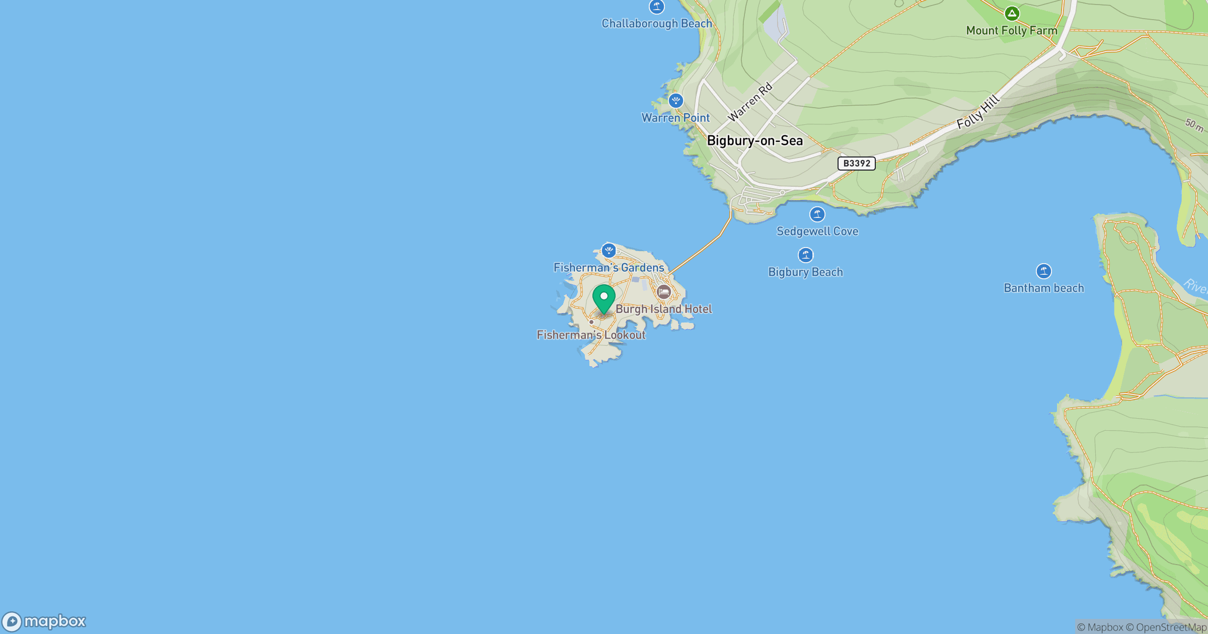
Grid reference: SX646438
View on OpenStreetMapOpens a map in a new tab, centred on the hill.
Nearby Hills

Brent Tor
334m

High Willhays
622m
Brown Willy
420m

Dunkery Beacon
520m
Rhossili Down - The Beacon
193m
No comments yet. Be the first.