

Bryn-y-tail
Good walks are even better shared.
Overview
Bryn-y-tail: A Hidden Gem in Snowdonia
Nestled within the enchanting Snowdonia National Park, Bryn-y-tail is a haven for walkers and nature enthusiasts alike. Standing at an elevation of 450 meters, this Hewitt offers a moderate challenge with ample rewards.
Geology
Bryn-y-tail is primarily composed of slate and granite, characteristic of the region’s dramatic landscape. This rugged geology provides excellent scrambling opportunities but be cautious—those loose rocks can surprise you!
Routes
The most popular route begins at the village of Dolwyddelan. The route, spanning approximately 7.5 km, takes around 3.5 hours to complete, combining delightful woodland paths and rocky ascents. Don’t forget to bring a camera to capture the stunning scenery—your friends will want to see that you actually left the couch!
Summit Features
At the summit, hikers are greeted by a quaint stone cairn, with remnants of an ancient burial site to add a touch of mystique. On clear days, the panoramic views are nothing short of spectacular.
Terrain Type
The terrain ranges from grassy slopes to rocky outcrops, and you may encounter a few boggy areas that challenge your footwork—mind your step!
Views
From the top, you can enjoy panoramic vistas of the Moelwynion mountains and, on a clear day, even catch glimpses of Snowdon itself. Autumn showcases brilliant foliage while summer brightens up the landscape.
Hazards
Be aware of potential loose rocks, especially on steeper paths. And while it’s charming to see sheep grazing about, just remember—they’re watching you as much as you’re watching them!
Access
Nearest Parking
The closest parking is located in Dolwyddelan, providing space for about 15 cars—get there early on weekends!
Public Transport
Catch the train to Betws-y-Coed, where you can then hop on a bus heading towards Dolwyddelan.
Nearest Town
Dolwyddelan is the closest village and offers a taste of Welsh life. It’s friendly, quaint, and proudly rustic.
Facilities
Dolwyddelan has a couple of tea shops for refreshments post-adventure, but pack your lunch to ensure you have enough energy for the return trek!
History
Bryn-y-tail translates to ‘Hill of the Tail,’ possibly referencing its unique shape and rich folklore. Historical burial mounds nearby signify the cultural significance this locality has held through the ages.
In conclusion, Bryn-y-tail is a wonderful destination for hikers looking for magnificent views without the throngs of tourists found on more popular hills. So lace up your walking boots, grab a snack, and enjoy what nature has to offer!
Explore routes near Bryn-y-tail
Public walks starting within 80 km of this hill. Nearby does not mean a route reaches the summit; check its map and access before setting out.
Hafren Forest: full Source of the Severn Trail
View route
Elan Valley: Reservoir Trail to Pen y Garreg Dam
View route
Waun-oer, Maesglase and Cribin Fawr guided mountain walk
View route
Ystwyth Trail: Black Covert to Llanilar and back
View route
Route planning notes
These notes describe possible approaches, not verified navigable routes or permission to cross land. Check current paths, local access rules and conditions before setting out.
Bryn-y-tail Via Dolwyddelan
This route starts in the village of Dolwyddelan, offering a delightful ascent through lush woodland and rocky terrain. As you climb, you'll be greeted by the sounds of nature, though hopefully not too many sheep proclaiming their territory.
Make a day of it, together
Find someone to share the walk with, or organise a day out along a route you like.
Photo Gallery
View all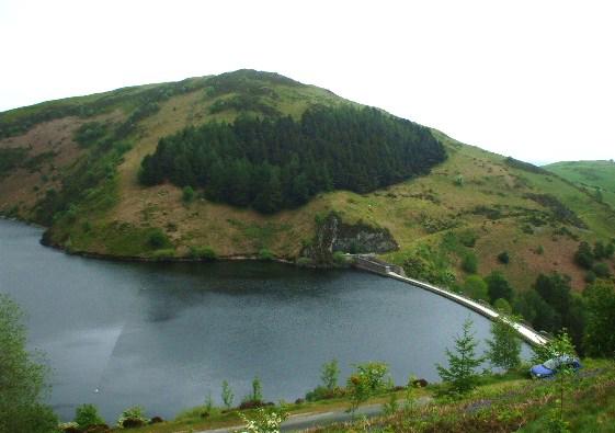 Photo could not load
SN9187 : Bryn-y-tail Hill
Phillip Perry
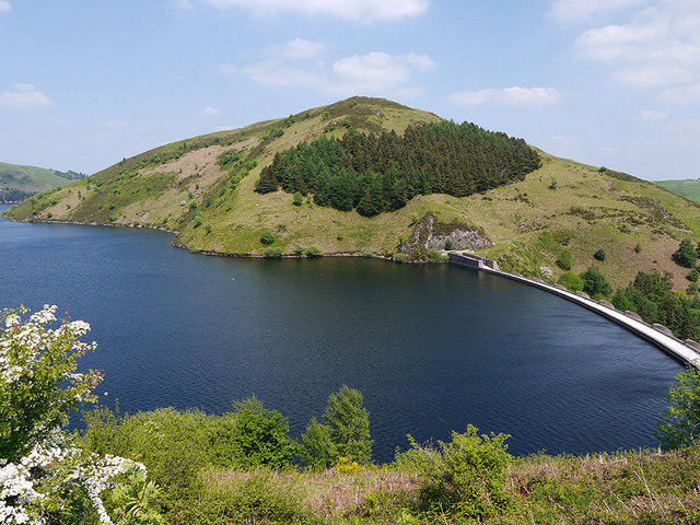 Photo could not load
SN9187 : Bryn-y-tail
Nigel Brown
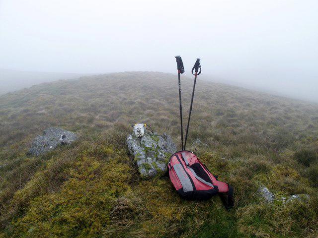 Photo could not load
SN9187 : Bryn-y-tail
Rude Health
Hill facts and local notes
Classifications
Elevation
403m
1,323 ft
Prominence
126m
Coordinates
52.4742, -3.5964
SN916874
OS Map
136
Explorer: 214W
At the Summit
At the summit, hikers will find a modest stone cairn and the remains of an ancient burial site, along with stunning panoramic views of the surrounding mountains.
Terrain & Geology
Bryn-y-tail boasts a mix of slate and granite, typical of the beautiful Snowdonia region. The rugged rock formations tell tales of ancient geological processes and provide great climbing opportunities for those inclined to scramble.
Views & Scenery
The summit offers breathtaking views of the Moelwynion mountains to the north and the distant peaks of Snowdon to the south, with Llyn Cau shimmering below.
History & Heritage
Name Origin
‘Bryn-y-tail’ translates to ‘Hill of the Tail’ in English, possibly referencing its unique shape or nearby mythical stories.
Historical Significance
The site has historical importance, being close to ancient burial mounds, indicative of its long-standing presence in local lore.
Getting There & Facilities
Check current local access restrictions, parking rules and transport timetables before travelling. These notes do not confirm public access to the summit.
Parking
There is a small car park at Dolwyddelan, which can accommodate about 15 vehicles. It fills up quickly during peak seasons!
Public Transport
The closest train station is in Betws-y-Coed, with frequent bus services to Dolwyddelan.
Nearby Facilities
While Dolwyddelan offers a couple of tea shops and pubs, it's wise to bring your own provisions as options are limited during busy periods.
Safety Information
Known Hazards
- Loose rocks on steeper sections, sudden weather changes, and the ever-present chance of encountering overly friendly sheep.
General Safety Tips
- Check weather conditions before setting out
- Carry appropriate clothing and equipment
- Let someone know your planned route
- Take a map, compass, and GPS device
- Carry emergency supplies: food, water, first aid kit, torch
Hills
Some common questions about the hills answered
Are there group walks up Bryn-y-tail?
Many walkers use Walkmates to join or organise walks with others. You can check for group walks around Bryn-y-tail through the maps
Are there other walkers around Bryn-y-tail?
Activity varies by location and time, but Walkmates lets you see whether others have shared walks or shown interest in this area. Find other people through the walking friends search walking friends for Bryn-y-tail search or of course create your own walk for Bryn-y-tail
Can I organise a walk to Bryn-y-tail?
Yes. If there aren’t any walks listed already, you can create a walk and make it available for others to join.
If you're signed up to Walkmates, you can create a walk to Bryn-y-tail.
How do I find a walk up this hill?
There are often multiple ways to walk this hill, depending on experience and route preference. Walkmates helps you explore walks and routes that others have shared.
Can I suggest a new route up Bryn-y-tail?
Yes. You can suggest or create routes to share with others. Walkmates focuses on the social side of walking, so routes are used to help people organise walks and explore areas together, rather than as detailed navigation tools or route libraries.
Other uses really appreciate knowledgeable walkers sharing their routes. Share your favourite route to Bryn-y-tail here
The is an error or something incorrect about this hill. How do I let you know?
We always strive to keep the information on Walkmates as accurate as possible. If you find an error, please let us know through the contact form and we'll aim to correct it as quickly as possible
Community Discussion
Comments
Location
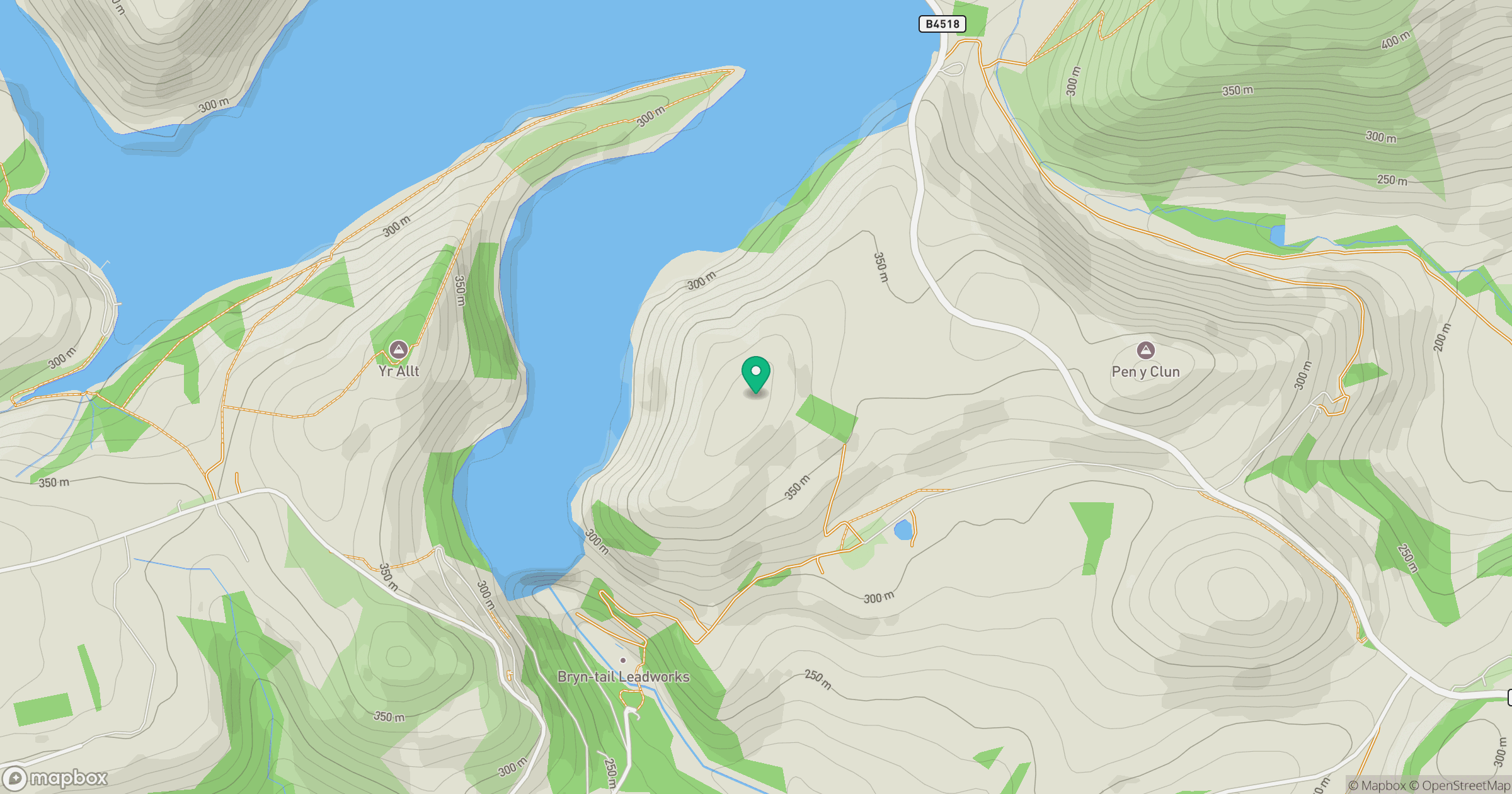
Grid reference: SN916874
View on OpenStreetMapOpens a map in a new tab, centred on the hill.
Hills within 30 km
Straight-line distance, not a walking route or confirmation of access.
No comments yet. Be the first.