
Dinas
Good walks are even better shared.
Overview
Dinas
Overview
Dinas, rising to a modest 480 meters, is a marvellous Marilyn perched in the heart of Snowdonia National Park. With its dramatic slate cliffs and lush green valleys, it remains a favourite for local hikers and visitors alike.
Geology
Dinas's geology is a fascinating tableau of slate and volcanic rock, dating back to the Ordovician period. The area showcases striking cliffs and a variety of mineral compositions—a true geological wonder! If you’re ever in a bind for a conversation topic, you could always wax lyrical about the nuances of slate!
Routes
The Dinas Circular Route is highly recommended. Clocking in at about 10 kilometers and taking approximately 3.5 hours to complete, this moderate trek rewards your efforts with stunning views and a good dose of fresh Welsh air. Make sure to take breaks; those spectacular vistas don’t capture themselves!
Summit Features
At the summit, you’ll find a quaint cairn and a rather impressive rock outcrop, perfect for posing for photos. Whether you’re braving the elements alone or with friends, there’s nothing quite like enjoying a sandwich at the top of a mountain!
Terrain Type
Expect a mix of grassy slopes and rocky scrambles—typical of this rugged part of Wales. A good pair of stout boots is recommended as you navigate this beautiful terrain, and keep an eye out for any slippery spots!
Views
From the summit, the view is nothing short of spectacular. On a clear day, you can see the Cadair Idris range and even Llyn Tegid—just don’t forget your camera! The best season to visit for optimal visibility is during the spring and autumn months, where nature truly shows off.
Hazards
While Dinas is a lovely walk, be aware of the uneven terrain that can lead to stumbles, especially as the weather changes. Fog can roll in faster than you can say 'where’s my compass?', so make sure you’re prepared!
Nearby Summits
Nearby, you’ll find the towering Cadair Idris at 893 meters and Aran Fawddwy reaching 905 meters, both worthy challengers for your next hiking adventure.
Access
Dinas Mawddwy serves as the best access point, with parking available for eager explorers. The village offers basic amenities, and you can catch a bus from Machynlleth if you're relying on public transport—just don’t miss the last one!
Facilities
You won’t go hungry, as there’s a lovely café nearby to fuel your adventures. Plus, if the call of nature strikes, there are public toilets in the village.
History
The name Dinas means ‘fortress’, a nod to the ancient settlements that once existed here. The mountain is steeped in local folklore, with stories of mystical beings roaming the hillsides.
So grab your rucksack and head on for a delightful day out on Dinas – just remember to pack an extra sandwich for the best view of your life!
Explore routes near Dinas
Public walks starting within 80 km of this hill. Nearby does not mean a route reaches the summit; check its map and access before setting out.
Hafren Forest: full Source of the Severn Trail
View route
Elan Valley: Reservoir Trail to Pen y Garreg Dam
View route
Waun-oer, Maesglase and Cribin Fawr guided mountain walk
View route
Ystwyth Trail: Black Covert to Llanilar and back
View route
Route planning notes
These notes describe possible approaches, not verified navigable routes or permission to cross land. Check current paths, local access rules and conditions before setting out.
Dinas Circular Route
A popular and scenic circular route starting from the nearby village of Dinas Mawddwy, offering impressive views of the surrounding mountains along with a good workout.
Make a day of it, together
Find someone to share the walk with, or organise a day out along a route you like.
Hill facts and local notes
Classifications
Elevation
445m
1,461 ft
Prominence
102m
Coordinates
52.4834, -3.6153
SN904885
OS Map
136
Explorer: 214W
At the Summit
The summit features a small cairn and a distinctive rock outcrop, providing an excellent area for a well-deserved picnic whilst enjoying the panoramic views.
Terrain & Geology
Dinas is primarily composed of slate and volcanic rock, typical of the region's complex geology formed during the Ordovician period. The striking cliffs are a testimony to the area's tumultuous geological past, often reflecting various hues of grey and green.
Views & Scenery
On a clear day, hikers can enjoy views of the Cadair Idris range, Llyn Tegid, and even the deep valleys below, making it a photographer's paradise.
History & Heritage
Name Origin
The name 'Dinas' derives from the Welsh word for 'fortress', likely indicative of ancient settlements in the region.
Historical Significance
Dinas has played a significant role in local folklore, often regarded as a mystical site, steeped in legends and tales of ancient warriors.
Getting There & Facilities
Check current local access restrictions, parking rules and transport timetables before travelling. These notes do not confirm public access to the summit.
Parking
Parking is available at the village of Dinas Mawddwy, with a small fee likely required. Please ensure to follow all local parking regulations.
Public Transport
Regular bus services run from Machynlleth and other local towns to Dinas Mawddwy, but check schedules as they can vary, especially on weekends.
Nearby Facilities
Nearby facilities include a small café in Dinas Mawddwy and public toilets. It's advisable to stock up on snacks before heading out.
Safety Information
Known Hazards
- Uneven terrain and potential for rocky scrambles. Be cautious of changing weather conditions, particularly fog.
General Safety Tips
- Check weather conditions before setting out
- Carry appropriate clothing and equipment
- Let someone know your planned route
- Take a map, compass, and GPS device
- Carry emergency supplies: food, water, first aid kit, torch
Hills
Some common questions about the hills answered
Are there group walks up Dinas?
Many walkers use Walkmates to join or organise walks with others. You can check for group walks around Dinas through the maps
Are there other walkers around Dinas?
Activity varies by location and time, but Walkmates lets you see whether others have shared walks or shown interest in this area. Find other people through the walking friends search walking friends for Dinas search or of course create your own walk for Dinas
Can I organise a walk to Dinas?
Yes. If there aren’t any walks listed already, you can create a walk and make it available for others to join.
If you're signed up to Walkmates, you can create a walk to Dinas.
How do I find a walk up this hill?
There are often multiple ways to walk this hill, depending on experience and route preference. Walkmates helps you explore walks and routes that others have shared.
Can I suggest a new route up Dinas?
Yes. You can suggest or create routes to share with others. Walkmates focuses on the social side of walking, so routes are used to help people organise walks and explore areas together, rather than as detailed navigation tools or route libraries.
Other uses really appreciate knowledgeable walkers sharing their routes. Share your favourite route to Dinas here
The is an error or something incorrect about this hill. How do I let you know?
We always strive to keep the information on Walkmates as accurate as possible. If you find an error, please let us know through the contact form and we'll aim to correct it as quickly as possible
Community Discussion
Comments
Location
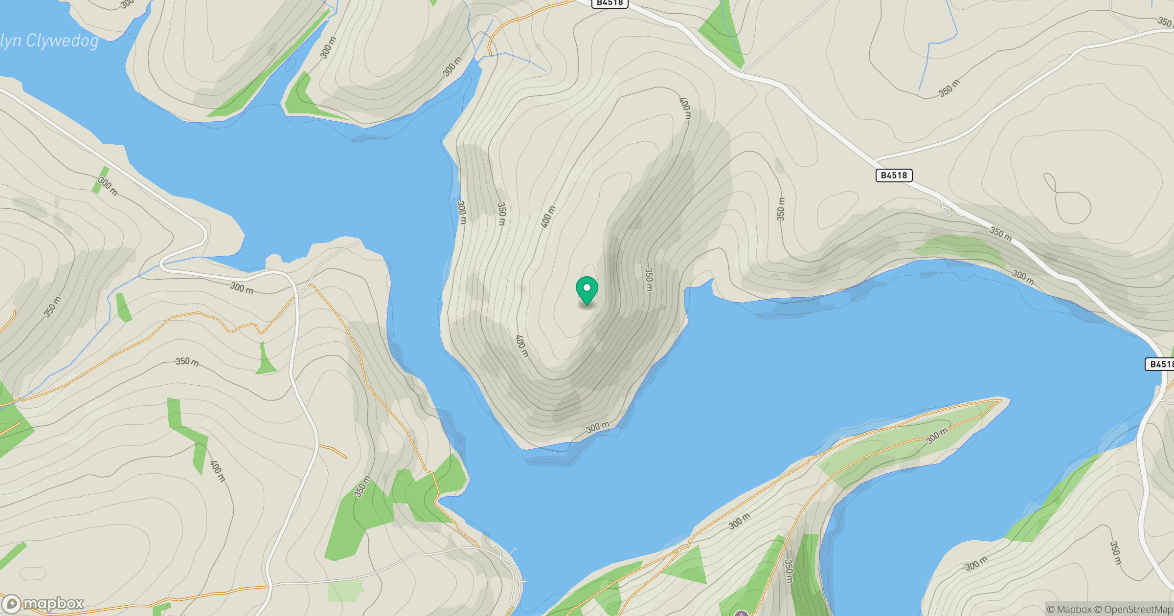
Grid reference: SN904885
View on OpenStreetMapOpens a map in a new tab, centred on the hill.
Hills within 30 km
Straight-line distance, not a walking route or confirmation of access.
No comments yet. Be the first.