
Bryn-y-Brain
Good walks are even better shared.
Overview
Bryn-y-Brain: A Hidden Jewel in the Brecon Beacons
Nestled in the heart of the Brecon Beacons, Bryn-y-Brain may not be the highest peak, but it certainly packs a punch in terms of beauty and charm. Standing at 445 meters, this Marilyn offers an accessible adventure for all levels of hikers.
Geology
Composed primarily of Old Red Sandstone, Bryn-y-Brain's rugged terrain presents a landscape that is not only visually striking but also rich in geological history. The unique red hues of the sandstone are especially eye-catching at dawn and dusk.
Routes
One of the most popular routes is the Bryn-y-Brain Trail starting from the A479. This 4.5 km trail is defined as moderate and can be comfortably completed in about one and a half hours, making it perfect for a leisurely outing or a quick escape from the daily grind.
Summit Features
At the summit, hikers will discover a trig point proudly standing sentinel over the rolling hills. The open grassy area is fantastic for enjoying a packed lunch while soaking in the views or simply relaxing in the crisp mountain air.
Terrain Type
Expect a delightful mix of grassy paths interspersed with rocky outcrops, particularly as you near the summit. The varied terrain keeps the trek interesting and engaging the whole journey.
Views
The panoramic views from the top are nothing short of breathtaking, with Mt. Pen y Fan and Cribyn readily identifiable amongst the impressive peaks of the Brecon Beacons. The best times to savour these views are during spring or autumn, when the landscape is awash with colours.
Hazards
While the hike is relatively straightforward, it’s important to keep an eye on the weather. Mist can descend upon the peaks at a moment's notice, so be prepared. Paths can also become slippery in damp conditions, so good footwear is a must.
Nearby Summits
Bryn-y-Brain is conveniently located near other notable peaks like Pen y Fan (886m) and Cribyn (795m), making it a great base for exploring the wider Brecon Beacons.
Access
Accessing these beautiful hills is relatively easy. There’s parking along the A479, but it may fill up quickly. If public transport is your main mode of travel, the bus service runs from Brecon to Talgarth, with a brisk walk or short taxi ride required to reach the trailhead.
Facilities
While the mountain itself doesn't have facilities, nearby Talgarth offers various options, including cafes and pubs where you can refuel after your adventure.
History
Etymologically, Bryn-y-Brain translates to 'Hill of the Crows'. This captivating name gives a nod to the wildlife that can be spotted in the skies above. The local area is steeped in rich Welsh history, making it a significant landmark in both a natural and cultural context.
In conclusion, Bryn-y-Brain is a beautiful destination worth visiting for its stunning vistas, rich geological heritage, and accessibility. Whether you're after a quick jaunt or an introduction to the wonders of the Brecon Beacons, this hill will leave you with a fond memory and perhaps the urge to return.
Explore routes near Bryn-y-Brain
Public walks starting within 80 km of this hill. Nearby does not mean a route reaches the summit; check its map and access before setting out.
Hafren Forest: full Source of the Severn Trail
View route
Waun-oer, Maesglase and Cribin Fawr guided mountain walk
View route
Cadair Idris - Pony Path
View route
Mawddach Trail: Dolgellau to Barmouth
View route
Route planning notes
These notes describe possible approaches, not verified navigable routes or permission to cross land. Check current paths, local access rules and conditions before setting out.
Bryn-y-Brain Trail from the A479
This scenic trail starts from the A479, winding gently upwards through lush pastures before leading to the rocky summit.
Make a day of it, together
Find someone to share the walk with, or organise a day out along a route you like.
Hill facts and local notes
Classifications
Elevation
294m
965 ft
Prominence
122m
Coordinates
52.5823, -3.7473
SN817997
OS Map
135 136
Explorer: 215W
At the Summit
The summit boasts a modest trig point and lush grassy areas perfect for a picnic, along with impressive vistas that entice both experienced trekkers and casual walkers alike.
Terrain & Geology
The mountain is predominantly composed of Old Red Sandstone, which is renowned for its striking reddish hue that catches the light beautifully, especially during sunrise and sunset. This geology contributes to the rugged terrain typical of the region.
Views & Scenery
From the summit, hikers can view the majestic peaks of the Brecon Beacons, including Pen y Fan and Cribyn, as well as the sweeping valleys below.
History & Heritage
Name Origin
Bryn-y-Brain translates from Welsh to 'Hill of the Crows', possibly reflecting the birdlife in the area.
Historical Significance
The mountain is part of the rich landscape steeped in Welsh myths and history, often linked to local folklore.
Getting There & Facilities
Check current local access restrictions, parking rules and transport timetables before travelling. These notes do not confirm public access to the summit.
Parking
Parking is available along the A479 at grid reference SN 829 997; however, space can be limited on busy weekends.
Public Transport
The nearest bus service operates from Brecon to Talgarth, with a short taxi ride or a 45-minute walk to the trailhead.
Nearby Facilities
There are no facilities on the mountain itself, but Talgarth has pubs, cafes, and public toilets available for thirsty climbers.
Safety Information
Known Hazards
- Be wary of fog that can roll in quickly, reducing visibility. Wet and slippery conditions can also be found after rainfall, particularly on the grassy paths.
General Safety Tips
- Check weather conditions before setting out
- Carry appropriate clothing and equipment
- Let someone know your planned route
- Take a map, compass, and GPS device
- Carry emergency supplies: food, water, first aid kit, torch
Hills
Some common questions about the hills answered
Are there group walks up Bryn-y-Brain?
Many walkers use Walkmates to join or organise walks with others. You can check for group walks around Bryn-y-Brain through the maps
Are there other walkers around Bryn-y-Brain?
Activity varies by location and time, but Walkmates lets you see whether others have shared walks or shown interest in this area. Find other people through the walking friends search walking friends for Bryn-y-Brain search or of course create your own walk for Bryn-y-Brain
Can I organise a walk to Bryn-y-Brain?
Yes. If there aren’t any walks listed already, you can create a walk and make it available for others to join.
If you're signed up to Walkmates, you can create a walk to Bryn-y-Brain.
How do I find a walk up this hill?
There are often multiple ways to walk this hill, depending on experience and route preference. Walkmates helps you explore walks and routes that others have shared.
Can I suggest a new route up Bryn-y-Brain?
Yes. You can suggest or create routes to share with others. Walkmates focuses on the social side of walking, so routes are used to help people organise walks and explore areas together, rather than as detailed navigation tools or route libraries.
Other uses really appreciate knowledgeable walkers sharing their routes. Share your favourite route to Bryn-y-Brain here
The is an error or something incorrect about this hill. How do I let you know?
We always strive to keep the information on Walkmates as accurate as possible. If you find an error, please let us know through the contact form and we'll aim to correct it as quickly as possible
Community Discussion
Comments
Location
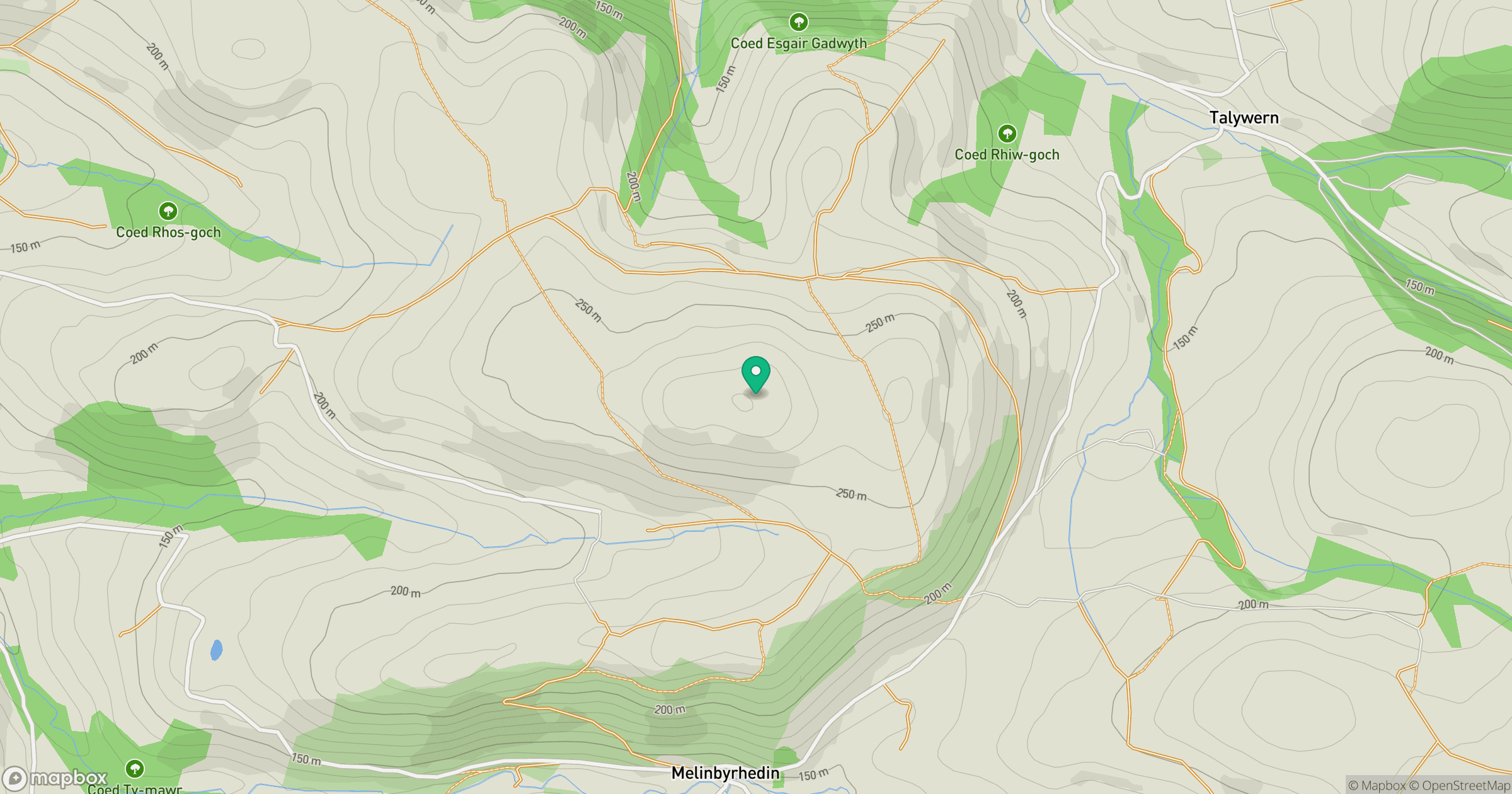
Grid reference: SN817997
View on OpenStreetMapOpens a map in a new tab, centred on the hill.
Hills within 30 km
Straight-line distance, not a walking route or confirmation of access.
No comments yet. Be the first.