

Broad Cairn
Good walks are even better shared.
NO2481 : Broad Cairn looking East to Loch Muick
trevor willis Photo source
Overview
Broad Cairn: A Majestic Munro in the Heart of the Cairngorms
Overview
Broad Cairn is an impressive Munro standing tall at 998 meters, offering a friendly challenge to hikers seeking a taste of the Scottish Highlands. With its prominent stone cairn marking the summit, it invites adventurers to appreciate the breathtaking views and rugged beauty of the surrounding Cairngorms.
Geology
Broad Cairn is dominated by granite formations, shaped over millennia by the relentless forces of nature. The distinctive glacial valleys and rugged cliffs add character to this striking landscape, making it a perfect spot for both geology enthusiasts and casual hikers alike.
Routes
The most popular route is the Loch Muick Circular, which combines picturesque loch views before the ascent. It covers about 14 km and takes approximately 5 hours round-trip, making it accessible to many.
Summit Features
Atop Broad Cairn, the stone cairn provides a sense of accomplishment and an idyllic spot for a well-deserved rest. The 360-degree views promise to take your breath away - just be careful you don't drop your sandwich in admiration!
Terrain
The terrain is a delightful mix of rocky paths and grassy slopes, interspersed with boggy patches, particularly after rainfall. It’s advisable to bring sturdy footwear and perhaps some gaiters to keep those pesky pebbles and puddles at bay.
Views
From the summit, the view extends to the peaks of the Cairngorms, Loch Muick, and surrounding heaths, with the best seasons being spring and early autumn when nature is in full bloom.
Hazards
Be wary of the quickly changing weather; it can shift from sunny to snow in a quick blink. Paths may be slippery, so take care, especially after a good soaking.
Nearby Summits
If you're keen on ticking off more peaks, consider nearby summits like Lochnagar and Cairn Bannoch; they’re just begging for exploration.
Access
The nearest parking is at the Invermark car park, followed by a scenic trek. Public transport options are limited but taxi services from Aboyne are available.
Facilities
While the summit offers no facilities, Invermark car park does have basic amenities like toilets. If you fancy a bite, the village of Aboyne has various cafes to replenish your energy post-hike.
History
The mountain's name reflects its geographical features, and it holds a cherished place in Scottish hiking culture, drawing climbers from near and far.
Whether you're a seasoned Munro-bagger or a casual walker seeking a bit of Highland exploration, Broad Cairn truly has something for everyone. Roam wise, and enjoy the breathtaking beauty of Scotland’s landscapes!
Explore routes near Broad Cairn
Walks starting near this hill. Open a route to check its map, distance and full itinerary.
Cairngorms night walk and stargazing (event meeting)
View route
Cairngorms night walk and stargazing (event meeting)
View route
Cairngorms night walk and stargazing (event meeting)
View route
Cairngorms night walk and stargazing (event meeting)
View route
Route planning notes
These notes describe possible approaches. Check a route's map and access information when planning your walk.
Broad Cairn via Loch Muick
This is the most popular route to Broad Cairn, starting from the Spittal of Glenmuick car park. The path follows the shore of Loch Muick before ascending via the Glas-allt Shiel bothy and continuing up a clear path to the summit of Broad Cairn.
Broad Cairn Circuit via Dubh Loch
Starting at the Spittal of Glenmuick, this route takes you along Loch Muick's western shore before heading to the dramatic Dubh Loch. From there, ascend steeply to the summit of Broad Cairn, and return via the Glas-allt Shiel path.
Broad Cairn and Cairn Bannoch
This route combines Broad Cairn with its neighbouring Munro, Cairn Bannoch. Starting from the Spittal of Glenmuick, the path ascends to Broad Cairn, then continues along the plateau to Cairn Bannoch before returning via the same route.
Broad Cairn from Glen Doll
Starting from the Glen Doll car park, this alternative route approaches Broad Cairn from the south. The path follows Jock's Road through a scenic glen, ascending steadily to the summit before retracing your steps.
Broad Cairn and White Mounth Circuit
A full day hike, this route combines Broad Cairn with several other White Mounth Munros, including Lochnagar. Starting from the Spittal of Glenmuick, it is a long and demanding circuit with stunning views across the Cairngorms.
Make a day of it, together
Find someone to share the walk with, or organise a day out along a route you like.
Photo Gallery
View all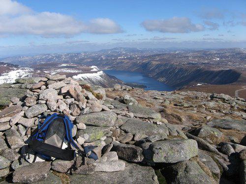 Photo could not load
NO2481 : Broad Cairn looking East to Loch Muick
trevor willis
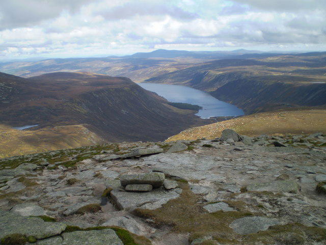 Photo could not load
NO2481 : Looking east towards Loch Muick from the upper slopes of Broad Cairn
Andrew McCallum
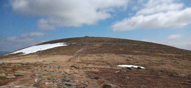 Photo could not load
NO2381 : Summit area of Broad Cairn
Iain Russell
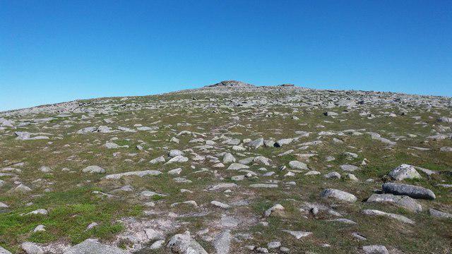 Photo could not load
NO2381 : Approaching Broad Cairn
Stephen Sweeney
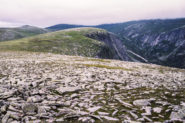 Photo could not load
NO2481 : Scattered flat rocks on summit of Broad Cairn
Trevor Littlewood
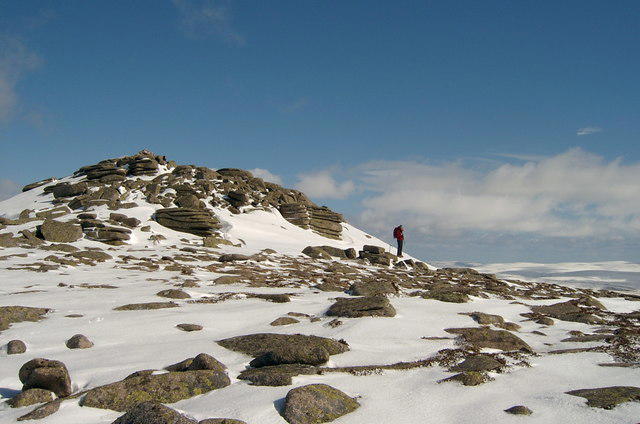 Photo could not load
NO2481 : Broad Cairn in the snow.
Gwen and James Anderson
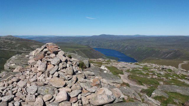 Photo could not load
NO2481 : Broad Cairn
Stephen Sweeney
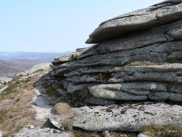 Photo could not load
NO2481 : Rock layers
Liz Gray
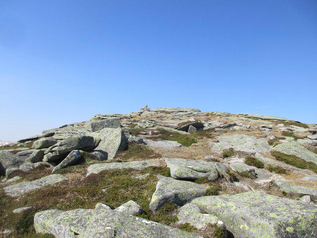 Photo could not load
NO2481 : Summit of Broad Cairn
Scott Cormie
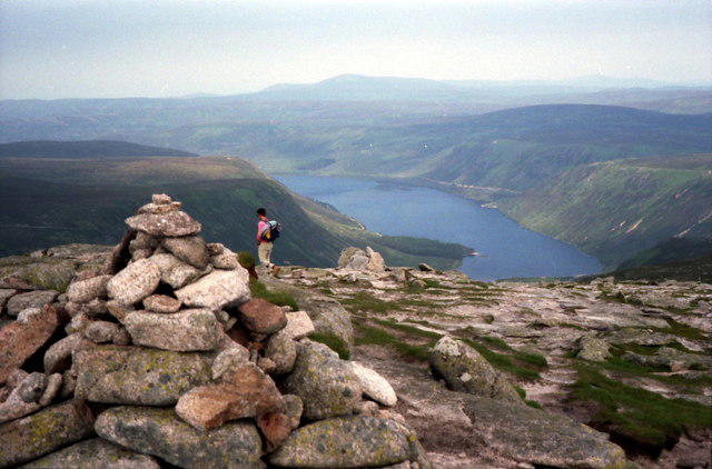
NO2481 : Summit cairn on Broad Cairn
Russel Wills
Hill facts and local notes
Classifications
Elevation
997m
3,271 ft
Prominence
64m
Coordinates
56.9192, -3.2491
NO240815
OS Map
44
Explorer: OL53N 388N
At the Summit
At the summit, you will find a substantial stone cairn which adds to the scenic charm. The views from here could easily make a newcomer feel like a seasoned mountaineer.
Terrain & Geology
Broad Cairn is primarily composed of granite, a resilient rock type that withstands the elements, providing a rocky yet navigable terrain. The mountain's geological history is marked by glacial activity, shaping its rugged landscape.
Views & Scenery
From the summit, panoramic views include the iconic peaks of the Cairngorms, the shimmering waters of Loch Muick, and the sprawling heathlands beneath. You can spot other Munros like Lochnagar and even the ancient ruins of the bothy at the foot of the hill.
History & Heritage
Name Origin
The name 'Broad Cairn' is derived from the large stone pile (cairn) found at its peak, signifying its importance to climbers and local lore.
Historical Significance
Broad Cairn has been a popular destination for walkers and climbers, contributing to the rich tapestry of Scottish mountaineering culture.
Getting There & Facilities
Parking
Invermark car park (NO228876), with enough space for several vehicles. It is advisable to arrive early during peak seasons.
Public Transport
The nearest bus service is available from Aboyne to Deeside, followed by a taxi to Invermark.
Nearby Facilities
There are no facilities at the summit, but you can find toilets at the Invermark car park and a few cafes in Aboyne.
Safety Information
Known Hazards
- Weather can change rapidly; be prepared for everything from sun to snow. There's also the risk of slippery paths, particularly in wet conditions.
General Safety Tips
- Check weather conditions before setting out
- Carry appropriate clothing and equipment
- Let someone know your planned route
- Take a map, compass, and GPS device
- Carry emergency supplies: food, water, first aid kit, torch
Hills
Some common questions about the hills answered
Are there group walks up Broad Cairn?
Many walkers use Walkmates to join or organise walks with others. You can check for group walks around Broad Cairn through the maps
Are there other walkers around Broad Cairn?
Activity varies by location and time, but Walkmates lets you see whether others have shared walks or shown interest in this area. Find other people through the walking friends search walking friends for Broad Cairn search or of course create your own walk for Broad Cairn
Can I organise a walk to Broad Cairn?
Yes. If there aren’t any walks listed already, you can create a walk and make it available for others to join.
If you're signed up to Walkmates, you can create a walk to Broad Cairn.
How do I find a walk up this hill?
There are often multiple ways to walk this hill, depending on experience and route preference. Walkmates helps you explore walks and routes that others have shared.
Can I suggest a new route up Broad Cairn?
Yes. You can suggest or create routes to share with others. Walkmates focuses on the social side of walking, so routes are used to help people organise walks and explore areas together, rather than as detailed navigation tools or route libraries.
Other uses really appreciate knowledgeable walkers sharing their routes. Share your favourite route to Broad Cairn here
The is an error or something incorrect about this hill. How do I let you know?
We always strive to keep the information on Walkmates as accurate as possible. If you find an error, please let us know through the contact form and we'll aim to correct it as quickly as possible
Community Discussion
Comments
Location
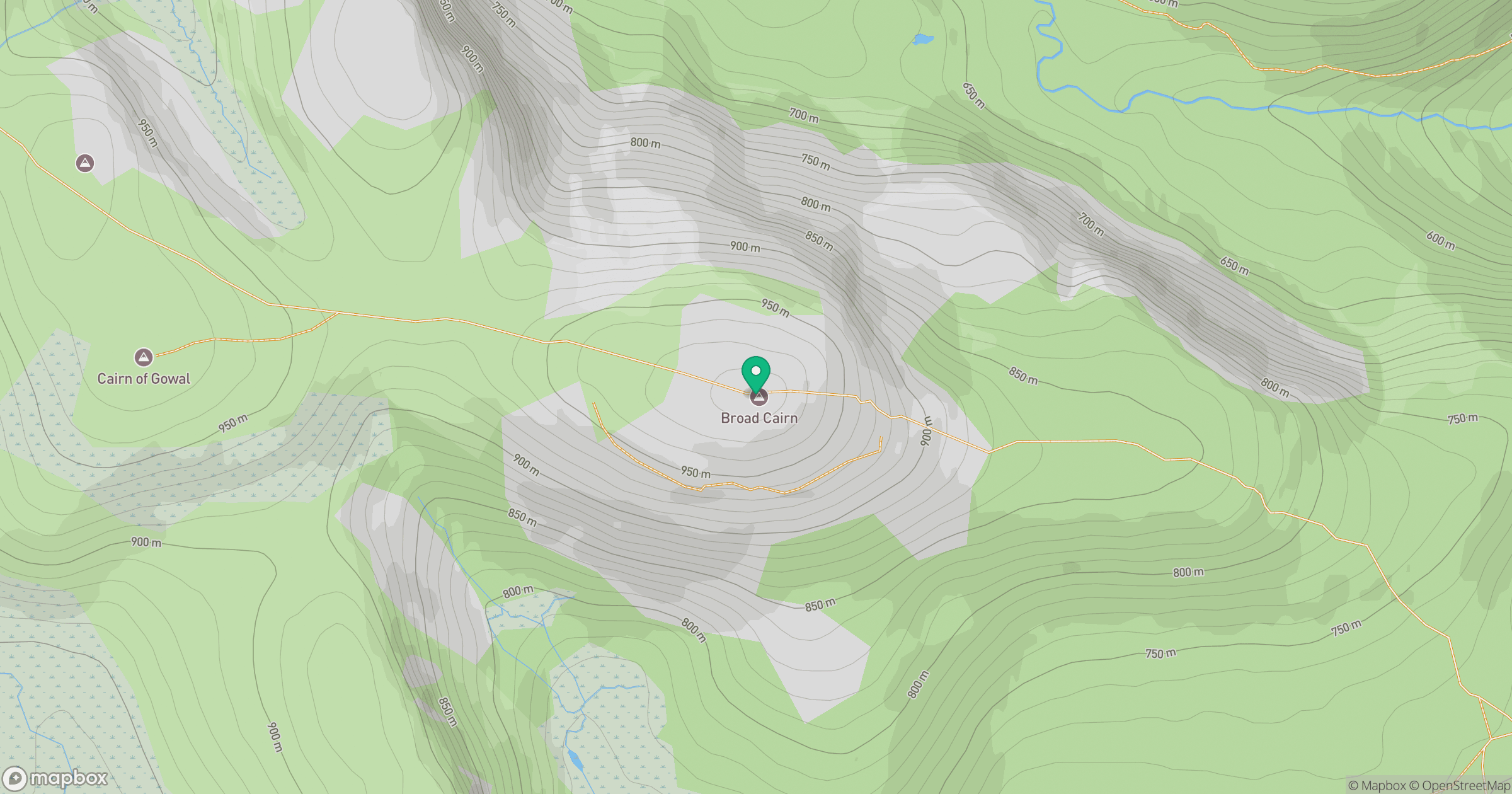
Grid reference: NO240815
View on OpenStreetMapOpens a map in a new tab, centred on the hill.
No comments yet. Be the first.