
Black Fell
Good walks are even better shared.
Overview
Black Fell: An Overview
Black Fell stands proudly in the Lake District, reaching a height of 520 meters. Though not the tallest, it offers an ideal hike for those looking to appreciate the stunning landscapes of this region without ascending Everest!
Geology
The fell is primarily composed of ancient volcanic rock, which adds depth to its character. If you fancy yourself a geologist, this is a great spot to observe the geological history of the Lake District. Just be prepared for the terrain - it's a bit rocky and can become slippery, especially after a downpour!
Hiking Routes
The Black Fell Circular route is a popular choice among hikers. Spanning about 7.5 km and taking roughly 3.5 hours, it is rated as moderate, making it perfect for most walkers. Don’t forget to bring your buddy (or a dedicated walking stick); the sheep might just stare at you longingly, wondering when their turn to hike is!
Terrain and Summit Features
The terrain on your ascent varies from grassy slopes to rocky outcrops, with a sprinkle of bog being typical in wetter months. Once at the top, you'll be greeted by a humble cairn that begs for your personal touch – adding your stone is almost a rite of passage. The summit promises lovely panoramic views, particularly of Coniston Water below.
Views
On a clear day, the sights from Black Fell are simply breathtaking. The nearby peaks of Scafell Pike and the shimmer of Coniston Water are particularly magnificent. If you're an early riser, spring or early autumn will reward you with vibrant heather blooms and clearer vistas.
Hazards
Keep your wits about you! The rocks can get oh-so-slippery and mischievous weather changes are frequent. Always be prepared for a sudden shower - it’s the Lake District, after all!
Access and Facilities
The closest parking lies at the end of the B5286, and it's perfect for a small gathering of hikers. Public transport is available via the Stagecoach 505 bus, connecting you to Coniston and Ambleside. This charming town has all the amenities: cafes for warming up post-hike and toilets to refresh after your adventure.
History
The name 'Black Fell' echoes tales of its past. It reflects the word for mountain in Old Norse combined with a nod to its dark surface, painting it as both imposing and approachable. Historically, it thrived with lead mining, leaving its tales carved into the landscape.
It's easy to see why Black Fell is loved by those in the know! Pack your boots and give it a go!
Happy hiking!
Explore routes near Black Fell
Walks starting near this hill. Open a route to check its map, distance and full itinerary.
Tarn Hows Fast Route
View route
Coniston to Tarn Hows: Monk Coniston Gardens and Woodland Circuit
View route
Great Carrs Halifax Wreckage from Wrynose Pass
View route
Bow Fell from Langdale
View route
Route planning notes
These notes describe possible approaches. Check a route's map and access information when planning your walk.
Black Fell Circular
A delightful circular route that takes you through lush valleys and up to the summit. Keep your eyes peeled for sheep – they might just be your best hiking buddies.
Make a day of it, together
Find someone to share the walk with, or organise a day out along a route you like.
Hill facts and local notes
Classifications
Elevation
323m
1,060 ft
Prominence
126m
Coordinates
54.4055, -3.0180
NY340015
OS Map
90
Explorer: OL7N
At the Summit
The summit is adorned with a modest cairn and offers an impressive panoramic view of the surrounding fells. Remember to add a stone to the cairn – it's like joining an exclusive club of hikers.
Terrain & Geology
Black Fell is primarily composed of volcanic rock, particularly basalt and andesite, which gives it a rugged appearance. The area around the fell had significant volcanic activity millions of years ago, and you might just find remnants of this fiery history if you look closely.
Views & Scenery
From the summit, you can see Coniston Water shimmering in the distance, alongside the impressive outlines of the central Lake District fells including the mighty Scafell Pike.
History & Heritage
Name Origin
The name 'Black Fell' derives from the Old Norse word 'fell' meaning mountain or hill, combined with the word 'black', likely a nod to its dark, rocky appearance.
Historical Significance
Historically, the area was known for its lead mining, and evidence of this industrious past can be found in the surrounding landscape.
Getting There & Facilities
Parking
The nearest parking is at the end of the B5286 road, where there's a small car park suitable for a handful of vehicles.
Public Transport
Public transport options include the Stagecoach 505 bus service that runs between Coniston and Ambleside, with a stop near the start of the hiking route.
Nearby Facilities
Coniston has several facilities, including cafes, pubs, and public toilets. Perfect for a post-hike cuppa!
Safety Information
Known Hazards
- Watch out for slippery rocks, especially after rain, and do keep an eye out for sudden weather changes typical of the Lake District.
General Safety Tips
- Check weather conditions before setting out
- Carry appropriate clothing and equipment
- Let someone know your planned route
- Take a map, compass, and GPS device
- Carry emergency supplies: food, water, first aid kit, torch
Hills
Some common questions about the hills answered
Are there group walks up Black Fell?
Many walkers use Walkmates to join or organise walks with others. You can check for group walks around Black Fell through the maps
Are there other walkers around Black Fell?
Activity varies by location and time, but Walkmates lets you see whether others have shared walks or shown interest in this area. Find other people through the walking friends search walking friends for Black Fell search or of course create your own walk for Black Fell
Can I organise a walk to Black Fell?
Yes. If there aren’t any walks listed already, you can create a walk and make it available for others to join.
If you're signed up to Walkmates, you can create a walk to Black Fell.
How do I find a walk up this hill?
There are often multiple ways to walk this hill, depending on experience and route preference. Walkmates helps you explore walks and routes that others have shared.
Can I suggest a new route up Black Fell?
Yes. You can suggest or create routes to share with others. Walkmates focuses on the social side of walking, so routes are used to help people organise walks and explore areas together, rather than as detailed navigation tools or route libraries.
Other uses really appreciate knowledgeable walkers sharing their routes. Share your favourite route to Black Fell here
The is an error or something incorrect about this hill. How do I let you know?
We always strive to keep the information on Walkmates as accurate as possible. If you find an error, please let us know through the contact form and we'll aim to correct it as quickly as possible
Community Discussion
Comments
Location
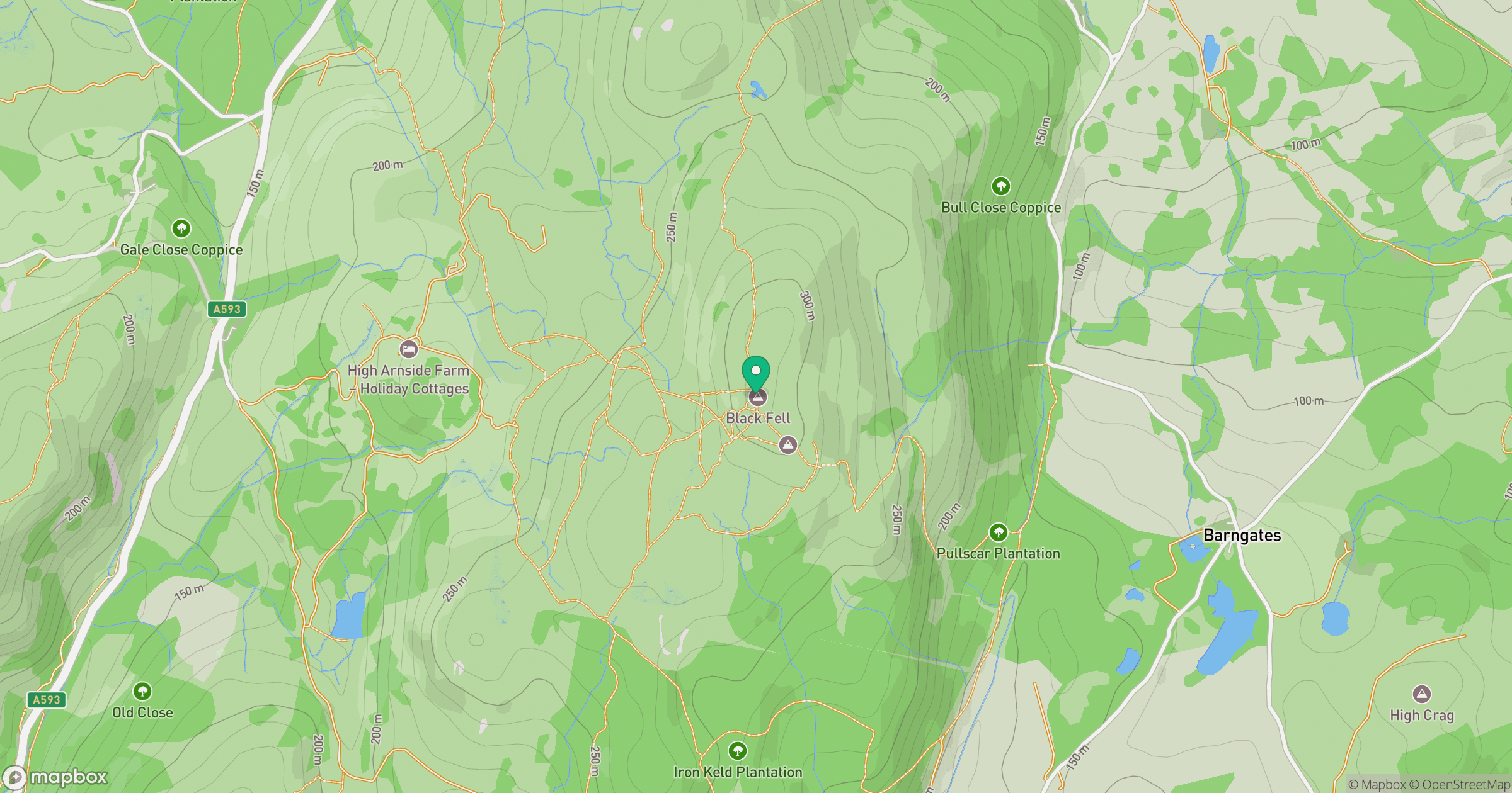
Grid reference: NY340015
View on OpenStreetMapOpens a map in a new tab, centred on the hill.
![The Old Man of Coniston [Coniston Old Man]](https://cdn.walkmates.com/gallery-images/0c140e91269b49abbee339fc41828d25.jpg)
No comments yet. Be the first.