

Ben Dash
Good walks are even better shared.
Overview
Ben Dash
Overview
Ben Dash stands proudly at 742 meters in the Scottish Highlands, offering a delightful climbing experience for hikers of varying abilities. Often overshadowed by its taller neighbours, this 'Marilyn' has its own charm, not least of which are the unbeatable views on a clear day.
Geology
The mountain is largely granite, characterized by striking cliffs and boulders that make for fascinating exploration. Surrounding formations showcase the complex geological history of the area, shaped over millions of years, offering insight into the earth's past.
Routes
North Face Approach
Distance: 4.5 km
Time: 2.5 hours
Difficulty: Moderate
This route takes you directly up the northern aspect of the mountain. The thrill of ascending the steeper sections is balanced by the stunning views opening up around you.West Ridge Walk
Distance: 5.8 km
Time: 3 hours
Difficulty: Easy
An excellent choice for families, this path offers a gentler ascent with plenty of spaces to stop and enjoy the scenery.
Summit Features
The summit is marked by a modest cairn and a trig point, where you can sit for a moment or two, enjoying the panoramic vistas of the surrounding hills and valleys. Remember to leave a small stone on the cairn – it’s considered good hiking karma!
Terrain
Be prepared for a mixed bag of terrain. The paths might lead you through fluffy grass, rocky areas, and, of course, the occasional bog – just to keep you humble!
Views
From the top, the sight of Ben Nevis in the distance steals the show. You might even spot a few rainbow trout jumping in the Loch Ness if you have eagle eyes. Don’t miss out on capturing these moments!
Hazards
Weather can change faster than a Scottish drizzle, turning sunny paths into slippery ventures, so pack waterproofs! Also, watch your step on the rocky paths to avoid any embarrassing tumbles — unless, of course, you’re keen on adding a little slapstick to your hike.
Access
- Nearest Parking: A small parking area can be found at the end of the minor road, roughly 5 km from Fort Augustus. It’s free, which is a bonus!
- Public Transport: Regular buses from Fort Augustus lead to the nearest access points, with Spean Bridge being the closest train station.
- Nearest Town: Fort Augustus, where you can gear up and grab a bite.
Facilities
You can find cafés and shops in Fort Augustus, perfect for stocking up on snacks or enjoying a post-hike tea. Remember to hydrate!
History
The name Ben Dash reflects the area's flora, with daisies said to bloom large at its base. While it lacks the rich history of some of its imposing neighbours, it’s a peaceful haven, perfect for those seeking solace outdoors.
Enjoy your hike, and may your boots stay dry and your views be forever breathtaking!
Explore routes near Ben Dash
Public walks starting within 80 km of this hill. Nearby does not mean a route reaches the summit; check its map and access before setting out.
No public routes are currently listed within 80 km of Ben Dash on Walkmates. This does not mean there are no paths here. Explore the map and check local access information before planning a walk.
Route planning notes
These notes describe possible approaches, not verified navigable routes or permission to cross land. Check current paths, local access rules and conditions before setting out.
North Face Approach
A direct ascent from the north face, taking you through stunning heather-covered slopes towards the summit.
West Ridge Walk
A more leisurely route that meanders along the west ridge with breathtaking views, perfect for a family outing.
Make a day of it, together
Find someone to share the walk with, or organise a day out along a route you like.
Photo Gallery
View all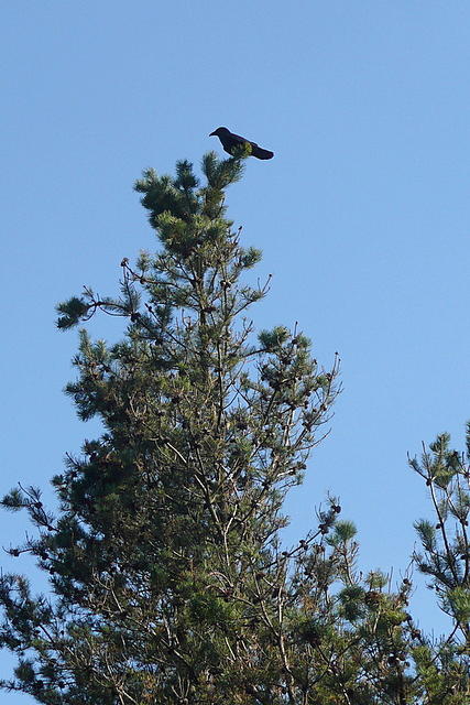 Photo could not load
R2171 : Alone with a crow
Graham Horn
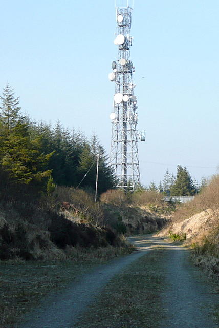 Photo could not load
R2171 : Ben Dash transmitter
Graham Horn
Hill facts and local notes
Classifications
Elevation
267m
876 ft
Prominence
119m
Coordinates
52.7855, -9.1701
R211711
OS Map
57
At the Summit
The summit features a modest cairn, a trig point, and stunning panoramic views of the surrounding highlands. Be sure to check in with the local pigeons; they've got gossip on the weather.
Terrain & Geology
Ben Dash is primarily composed of granite, lending a rugged beauty and a solid foundation for the adventurous. The surrounding schists and gneisses speak to a geological history shaped by ancient tectonic forces, making it a fascinating study for geology enthusiasts.
Views & Scenery
From the summit of Ben Dash, you can gaze upon the majesty of the Ben Nevis range, the sweeping valleys below, and on a clear day, the shimmering waters of Loch Ness. Don’t forget your camera!
History & Heritage
Name Origin
The name 'Ben Dash' derives from the Gaelic 'Beinn Dais', meaning 'the hill of the daisy'. Legend has it that daisies of exceptional size bloom at its base – or maybe they just look a bit bigger after a long hike!
Historical Significance
While not steeped in dramatic battles or ancient ruins, Ben Dash presents a humbler, yet significant place for nature lovers and a quiet retreat for reflection.
Getting There & Facilities
Check current local access restrictions, parking rules and transport timetables before travelling. These notes do not confirm public access to the summit.
Parking
There is a small parking area at the end of the minor road accessed from the A82, about 5 km from the village of Fort Augustus.
Public Transport
Regular buses run from Fort Augustus to nearby villages. The closest train station is at Spean Bridge, followed by a bus or taxi ride.
Nearby Facilities
Fort Augustus offers several cafes, shops, and toilet facilities, so be sure to stock up on snacks before your adventure or grab a well-earned cuppa afterward.
Safety Information
Known Hazards
- Watch for sudden weather changes, as conditions can turn from pleasant to perilous quicker than your kettle can boil. Also, be wary of slippery rocks, especially after rain.
General Safety Tips
- Check weather conditions before setting out
- Carry appropriate clothing and equipment
- Let someone know your planned route
- Take a map, compass, and GPS device
- Carry emergency supplies: food, water, first aid kit, torch
Hills
Some common questions about the hills answered
Are there group walks up Ben Dash?
Many walkers use Walkmates to join or organise walks with others. You can check for group walks around Ben Dash through the maps
Are there other walkers around Ben Dash?
Activity varies by location and time, but Walkmates lets you see whether others have shared walks or shown interest in this area. Find other people through the walking friends search walking friends for Ben Dash search or of course create your own walk for Ben Dash
Can I organise a walk to Ben Dash?
Yes. If there aren’t any walks listed already, you can create a walk and make it available for others to join.
If you're signed up to Walkmates, you can create a walk to Ben Dash.
How do I find a walk up this hill?
There are often multiple ways to walk this hill, depending on experience and route preference. Walkmates helps you explore walks and routes that others have shared.
Can I suggest a new route up Ben Dash?
Yes. You can suggest or create routes to share with others. Walkmates focuses on the social side of walking, so routes are used to help people organise walks and explore areas together, rather than as detailed navigation tools or route libraries.
Other uses really appreciate knowledgeable walkers sharing their routes. Share your favourite route to Ben Dash here
The is an error or something incorrect about this hill. How do I let you know?
We always strive to keep the information on Walkmates as accurate as possible. If you find an error, please let us know through the contact form and we'll aim to correct it as quickly as possible
Community Discussion
Comments
Location
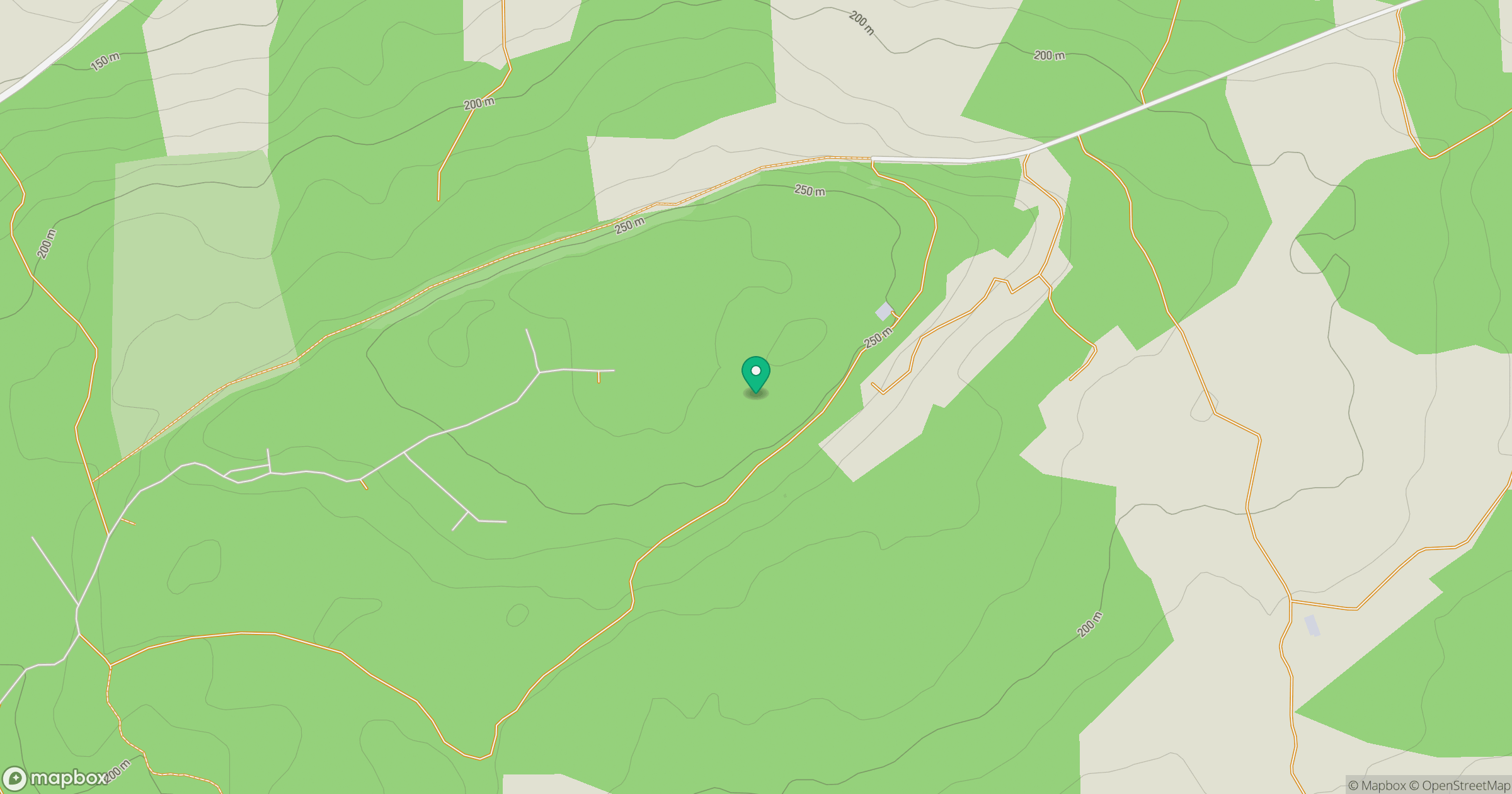
Grid reference: R211711
View on OpenStreetMapOpens a map in a new tab, centred on the hill.
Hills within 30 km
Straight-line distance, not a walking route or confirmation of access.
No comments yet. Be the first.