

Beinn Airein
Good walks are even better shared.
Overview
Beinn Airein
Overview
Beinn Airein, a stunning Marilyn in the heart of the Scottish Highlands, offers adventurers a chance to experience both challenging hikes and breathtaking scenery. Standing at 898 meters, it may not be the tallest mountain in the region, but it’s certainly one of the most rewarding to climb.
Geology
The enduring beauty of Beinn Airein is partly due to its rugged geological features. Granite and gneiss form the backbone of this mountain, remnants of the ancient forces that shaped Scotland’s landscape. The varied rock formations give a sense of majesty and drama, making the hike a visual feast.
Routes
- Glen Etive Approach: Perfect for those looking to take in the sights at a manageable pace. This route leads through the enchanting Glen Etive, famous for its wild landscapes. Expect it to take about 4.5 hours to reach the summit, covering 9 km.
- North Ridge: For those who crave a mix of challenge and excitement, the north ridge offers a splendid scramble. It’s short, just 6 km, but will require about 3 hours and some careful footing.
Summit Features
At the summit, a grand cairn greets you, while the surrounding views stretch as far as the eye can see. It’s a photographer’s paradise—just remember to keep your feet grounded while snapping that perfect shot!
Terrain
The terrain is notably rugged and rocky. Watch out for the patches of heather that add charm but may also trip you up if you're not careful. A good pair of boots is essential to navigate the boggy bits that you might encounter.
Views
The views from Beinn Airein are the icing on the cake! With iconic landmarks like Buachaille Etive Mòr gracing the horizon, you might consider setting up camp and staying forever. For the best views, spring and autumn are recommended, with vibrant colours transforming the landscape into a postcard-perfect image.
Hazards
While the adventure is thrilling, it’s essential to stay vigilant. Loose rocks can send you on an unplanned slide if you’re not careful, especially when the weather turns wet. Take your time and don’t rush!
Nearby Summits
Nearby, Buachaille Etive Mòr and Stob a' Choire Odhair beckon to be explored. Why not tackle them all during a multi-summit adventure?
Access
Accessing Beinn Airein is straightforward, with the nearest parking located near the Glen Etive road. A public bus can get you close, but remember to check the schedule—nobody likes a long walk back!
Facilities
Facilities near Beinn Airein are somewhat sparse. Consider packing a picnic or heading to the towns of Ballachulish or Crianlarich for a café pit stop once your adventure is concluded.
History
The name ‘Beinn Airein’ whispers tales of the past, with its Gaelic roots suggesting a ghostly charm. It’s notable in local folklore as well, where enchanting stories of mystical beings add to the mountain’s allure.
Conclusion
In conclusion, Beinn Airein is an adventure waiting to be embraced. Whether you are an experienced mountaineer or a casual hiker, the charm and beauty of this Marilyn in the Scottish Highlands will ensure you leave with unforgettable memories.
Happy hiking! Just remember – as the Scots say, there’s no such thing as bad weather, only inappropriate clothing.
Explore routes near Beinn Airein
Public walks starting within 80 km of this hill. Nearby does not mean a route reaches the summit; check its map and access before setting out.
Banavie to Glen Loy Aqueduct: Neptune’s Staircase Canal Towpath
View route
Ben Nevis via Mountain Path
View route
Route planning notes
These notes describe possible approaches, not verified navigable routes or permission to cross land. Check current paths, local access rules and conditions before setting out.
Glen Etive Approach
A scenic route winding through Glen Etive, offering striking views of the surrounding mountains.
North Ridge
An exhilarating scramble up the north ridge, suitable for those with a head for heights.
Make a day of it, together
Find someone to share the walk with, or organise a day out along a route you like.
Photo Gallery
View all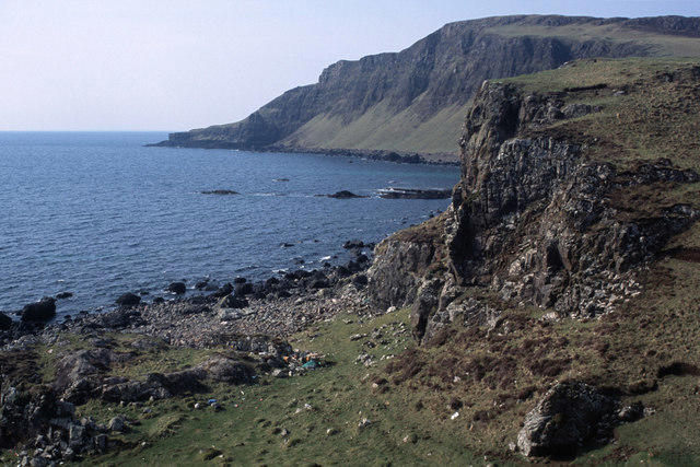 Photo could not load
NM4079 : The crag of Torr nam Fitheach at Camas Mòr
Julian Paren
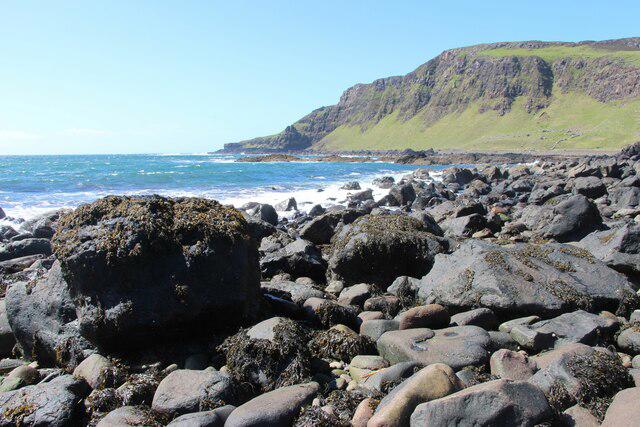 Photo could not load
NM4079 : An Stac across Camas Mor
Alan Reid
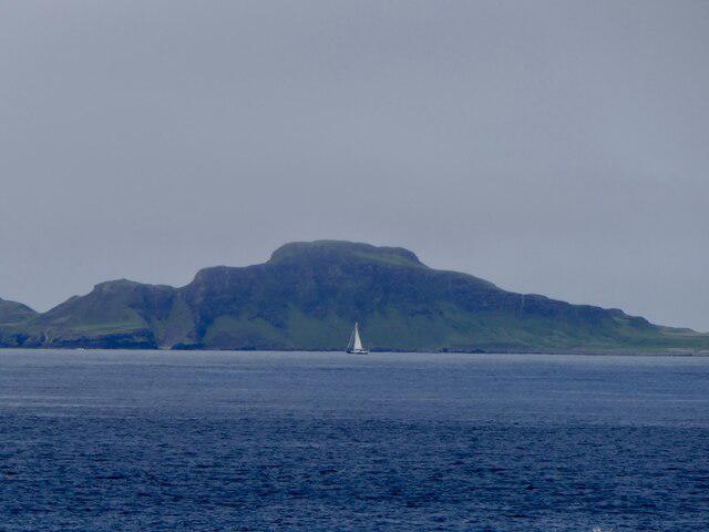 Photo could not load
NM4079 : Beinn Airean, Muck
Richard Webb
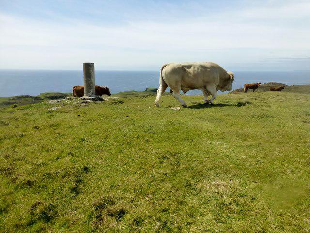 Photo could not load
NM4079 : Beinn Airein
Rude Health
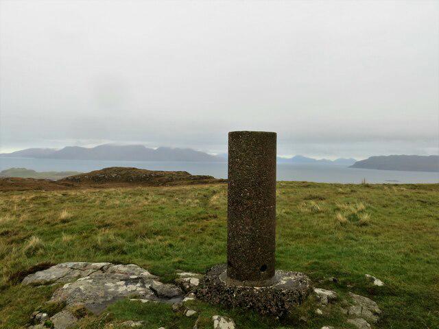 Photo could not load
NM4079 : Trig pillar on Beinn Airein 137m
John Ferguson
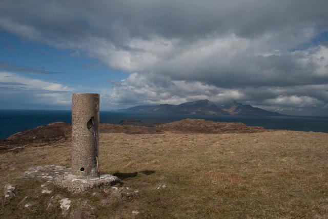 Photo could not load
NM4079 : Beinn Airein, Muck
Becky Williamson
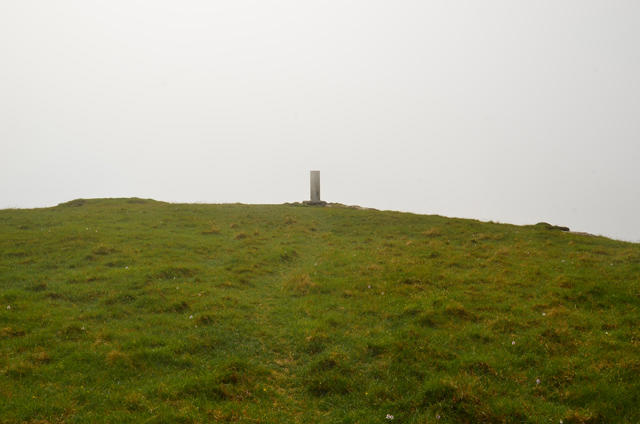 Photo could not load
NM4079 : Approaching the summit of Beinn Airein
John Allan
Hill facts and local notes
Classifications
Elevation
138m
453 ft
Prominence
138m
Coordinates
56.8309, -6.2585
NM403791
OS Map
39
Explorer: 390W 397
At the Summit
The summit features a large cairn and sweeping views that can make even the most seasoned hiker feel like a giddy child at a candy shop.
Terrain & Geology
Beinn Airein is primarily composed of granite and gneiss, offering a rugged landscape shaped by glacial activity. The prominent rock formations provide a great backdrop for your Instagram snaps.
Views & Scenery
From the summit, enjoy panoramic views of the surrounding hills, including the iconic Buachaille Etive Mòr and the tranquil waters of Loch Etive.
History & Heritage
Name Origin
The name 'Beinn Airein' is thought to derive from Gaelic, meaning 'mountain of the eerie', hinting at perhaps a ghostly presence or simply that the views are enough to leave you spellbound.
Historical Significance
The mountain has long been a favourite among local climbers and is steeped in local folklore, with many stories of mystical creatures lurking among the crags.
Getting There & Facilities
Check current local access restrictions, parking rules and transport timetables before travelling. These notes do not confirm public access to the summit.
Parking
There is a car park near the start of the Glen Etive road, approximately 3 km from the foot of Beinn Airein.
Public Transport
Buses from Glasgow to A82 run regularly, with a walk or taxi service available to reach Glen Etive.
Nearby Facilities
Facilities are limited in the immediate area, but you can find cafes and toilets in nearby towns like Ballachulish and Crianlarich.
Safety Information
Known Hazards
- Loose rocks on steep slopes can pose a danger, particularly in wet weather. Watch your step and keep your wits about you.
General Safety Tips
- Check weather conditions before setting out
- Carry appropriate clothing and equipment
- Let someone know your planned route
- Take a map, compass, and GPS device
- Carry emergency supplies: food, water, first aid kit, torch
Hills
Some common questions about the hills answered
Are there group walks up Beinn Airein?
Many walkers use Walkmates to join or organise walks with others. You can check for group walks around Beinn Airein through the maps
Are there other walkers around Beinn Airein?
Activity varies by location and time, but Walkmates lets you see whether others have shared walks or shown interest in this area. Find other people through the walking friends search walking friends for Beinn Airein search or of course create your own walk for Beinn Airein
Can I organise a walk to Beinn Airein?
Yes. If there aren’t any walks listed already, you can create a walk and make it available for others to join.
If you're signed up to Walkmates, you can create a walk to Beinn Airein.
How do I find a walk up this hill?
There are often multiple ways to walk this hill, depending on experience and route preference. Walkmates helps you explore walks and routes that others have shared.
Can I suggest a new route up Beinn Airein?
Yes. You can suggest or create routes to share with others. Walkmates focuses on the social side of walking, so routes are used to help people organise walks and explore areas together, rather than as detailed navigation tools or route libraries.
Other uses really appreciate knowledgeable walkers sharing their routes. Share your favourite route to Beinn Airein here
The is an error or something incorrect about this hill. How do I let you know?
We always strive to keep the information on Walkmates as accurate as possible. If you find an error, please let us know through the contact form and we'll aim to correct it as quickly as possible
Community Discussion
Comments
Location
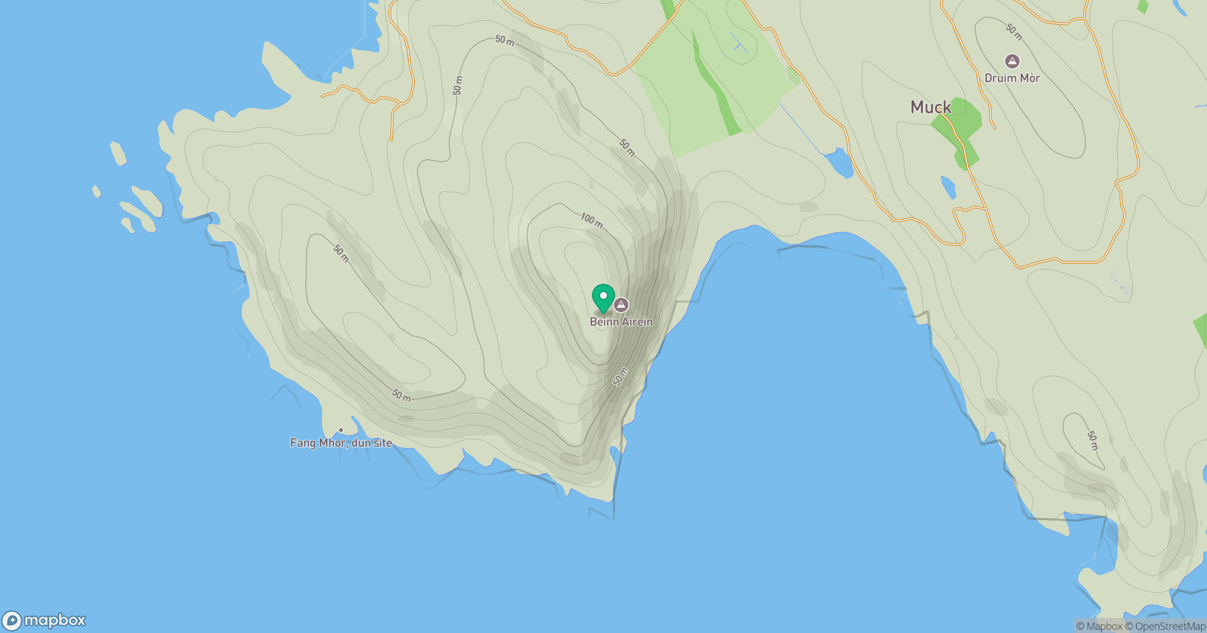
Grid reference: NM403791
View on OpenStreetMapOpens a map in a new tab, centred on the hill.
Hills within 30 km
Straight-line distance, not a walking route or confirmation of access.
No comments yet. Be the first.