
Beinn a' Bhathaich
Good walks are even better shared.
Overview
Beinn a' Bhathaich: A Splendid Highland Experience
Located in the enchanting Scottish Highlands, Beinn a' Bhathaich stands at a respectable 725 meters. This Munro is not just another hill, but a gateway to breathtaking views and the thrill of conquering a peak that’s seen its fair share of adventurers.
Geology
Beinn a' Bhathaich is formed predominantly of ancient schist and granite, boasting a rugged topography sculpted by glacial action. As you traverse its slopes, you'll encounter stunning rock formations that tell the story of a land shaped over millions of years.
Routes
One of the popular routes to the summit is the Beinn a' Bhathaich Circuit. This moderate trek spans about 10.5 km and typically takes around 5 hours to complete. Make sure to keep an eye on the time; while the views are incredible, returning in the dark could lead to some unexpected wildlife encounters!
Summit Features
At the summit, a notable cairn marks your achievement, providing a perfect opportunity for that triumphant selfie. The panoramic views from this point are nothing short of fantastic.
Terrain Type
The terrain predominantly consists of rocky outcrops and lush grassy sections, interspersed with heather. Be warned, following rain, you might find yourself squishy-footed, as certain areas can become quite boggy.
Views
The vistas from Beinn a' Bhathaich are a feast for the eyes. With the peaks of The Fannichs to the northeast and the coastline of Loch Ewe stretching beyond, make sure your camera is ready. Late spring and early autumn are particularly good times to tread these paths where the light plays beautifully across the landscape.
Hazards
Every adventure comes with its risks. The boggy terrain warrants careful foot placement to avoid unwanted splashes. Additionally, mountain weather can change quicker than you can say 'Oh dear!', so be sure to carry a waterproof jacket.
Nearby Summits
Fancy more of a challenge? Nearby summits like Creag Dhubh and Sgorr na Diollaid beckon for the more ambitious walker. Why not make it a hill-hopping day?
Access
A small gravel car park is conveniently located a short drive from the A832 road. Just remember, it’s not the Ritz, so come prepared! The nearest town, Aultbea, has basic amenities should you need supplies.
Facilities
Despite its remote setting, the nearby Aultbea offers a café and shops for a well-deserved cuppa after your trek. Don’t forget to pop in!
History
The name 'Beinn a' Bhathaich' carries an interesting etymology, translating to 'Hill of the Bog', reflecting the natural landscape surrounding it. The mountain is steeped in the cultural significance of the area, tied closely to the histories of the clans that roamed these lands.
In conclusion, Beinn a' Bhathaich provides an ideal mix of adventure, beauty, and a dash of Scottish culture. So lace up your hiking boots, grab your walking pole, and embark on this Munro adventure. Happy trekking!
Explore routes near Beinn a' Bhathaich
Public walks starting within 80 km of this hill. Nearby does not mean a route reaches the summit; check its map and access before setting out.
Inverness: River Ness and Caledonian Canal circuit
View route
Great Glen Way low route: Fort Augustus to Invermoriston Old Bridge
View route
Fort Augustus to Kytra Lock: Caledonian Canal Towpath
View route
Glen Affric: Coire Loch Woodland Trail
View route
Route planning notes
These notes describe possible approaches, not verified navigable routes or permission to cross land. Check current paths, local access rules and conditions before setting out.
Beinn a' Bhathaich Circuit
A classic circular walk starting from the small car park near the Allt a' Chaoilidh, taking in the stunning scenery of the surrounding glens.
Make a day of it, together
Find someone to share the walk with, or organise a day out along a route you like.
Hill facts and local notes
Classifications
Elevation
456m
1,496 ft
Prominence
105m
Coordinates
57.3274, -4.3737
NH571288
OS Map
26 35
Explorer: 417
At the Summit
The summit is marked by a prominent cairn, offering a perfect vantage point for photographers and those looking to conquer the peak's heights.
Terrain & Geology
The mountain is primarily composed of ancient schist and granite, characteristic of the Scottish Highlands. The rugged landscape is indicative of glacial activity, with features sculpted by ice over millennia.
Views & Scenery
From the summit, one can observe the majestic peaks of the surrounding area including the nearby The Fannichs and the distant peaks of Torridon. The expansive views of Loch Ewe and the coastline add to the spectacular panorama.
History & Heritage
Name Origin
The name 'Beinn a' Bhathaich' translates roughly to 'Hill of the Bog', a nod to its damp and mossy terrain.
Historical Significance
Like many Munros, this mountain holds significance in Scottish culture and history, often associated with the clans inhabiting the region.
Getting There & Facilities
Check current local access restrictions, parking rules and transport timetables before travelling. These notes do not confirm public access to the summit.
Parking
There is a small gravel car park located at NH540298 along the road leading from A832, providing access to the walking paths.
Public Transport
The nearest bus stop is in the village of Aultbea, serviced by local routes, though a taxi may be required to reach the trailhead.
Nearby Facilities
Limited facilities in Aultbea including small shops and a café. Be prepared for a lack of amenities near the mountain itself.
Safety Information
Known Hazards
- Boggy sections can be slippery; always tread carefully. Weather can change rapidly, so be prepared for sudden rain or wind. Take care near crags and cliffs.
General Safety Tips
- Check weather conditions before setting out
- Carry appropriate clothing and equipment
- Let someone know your planned route
- Take a map, compass, and GPS device
- Carry emergency supplies: food, water, first aid kit, torch
Hills
Some common questions about the hills answered
Are there group walks up Beinn a' Bhathaich?
Many walkers use Walkmates to join or organise walks with others. You can check for group walks around Beinn a' Bhathaich through the maps
Are there other walkers around Beinn a' Bhathaich?
Activity varies by location and time, but Walkmates lets you see whether others have shared walks or shown interest in this area. Find other people through the walking friends search walking friends for Beinn a' Bhathaich search or of course create your own walk for Beinn a' Bhathaich
Can I organise a walk to Beinn a' Bhathaich?
Yes. If there aren’t any walks listed already, you can create a walk and make it available for others to join.
If you're signed up to Walkmates, you can create a walk to Beinn a' Bhathaich.
How do I find a walk up this hill?
There are often multiple ways to walk this hill, depending on experience and route preference. Walkmates helps you explore walks and routes that others have shared.
Can I suggest a new route up Beinn a' Bhathaich?
Yes. You can suggest or create routes to share with others. Walkmates focuses on the social side of walking, so routes are used to help people organise walks and explore areas together, rather than as detailed navigation tools or route libraries.
Other uses really appreciate knowledgeable walkers sharing their routes. Share your favourite route to Beinn a' Bhathaich here
The is an error or something incorrect about this hill. How do I let you know?
We always strive to keep the information on Walkmates as accurate as possible. If you find an error, please let us know through the contact form and we'll aim to correct it as quickly as possible
Community Discussion
Comments
Location
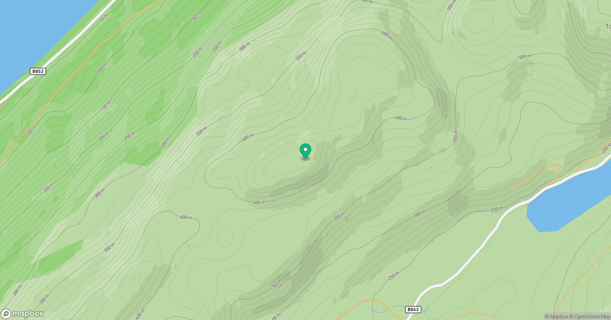
Grid reference: NH571288
View on OpenStreetMapOpens a map in a new tab, centred on the hill.
Hills within 30 km
Straight-line distance, not a walking route or confirmation of access.
No comments yet. Be the first.