

Wytham Hill
Good walks are even better shared.
SP4508 : "The Chalet", Wytham Woods
Ian Paterson Photo source
Overview
Exploring Wytham Hill
Wytham Hill, rising to an elevation of 100 meters, might not take your breath away with height, but it sure will with its stunning views. Nestled in the heart of South East England, it serves as a beloved spot for locals and visitors alike.
Geology
The hill is comprised primarily of limestone, with some clay areas adding to the geological diversity. This blend provides a lush habitat for various flora and fauna, ensuring a delightful walk for nature enthusiasts.
Routes
There are plenty of paths to explore, but two stand out:
- Wytham Woods to Summit: This relatively easy 3.5 km route winds its way through the tranquil Wytham Woods and up to the summit. It’s perfect for an afternoon stroll or a family outing.
- River Thames Circular Route: For those looking for a bit more challenge, this 8 km route takes you along the scenic River Thames and loops around to include Wytham Hill. A lovely way to spend a few hours with nature.
Summit Features
At the summit, you'll find a trig point, which is a favourite spot for photos. The panoramic views from here are nothing short of spectacular, allowing you to soak in the landscapes of Oxford and beyond.
Terrain
The terrain is predominantly grassy with some rocky outcrops. While most paths are well-trodden, be cautious of uneven paths and occasional muddy spots, particularly after rain.
Views
You’ll be treated to lovely views of Oxford and can even spot the Cotswolds on a clear day. The best time to appreciate these vistas is during spring and autumn when the foliage is vibrant.
Hazards
While Wytham Hill is welcoming, it’s important to be aware of the uneven terrain. Post-rain conditions can create slippery patches, so tread wisely.
Nearby Summits
Just a stone's throw away is Boar's Hill, offering further exploration opportunities for the adventurous.
Access
Parking is available at the Wytham Woods car park, easily accessible off the A420. Public transport options are plentiful, with regular buses from Oxford ensuring that reaching Wytham is a breeze.
Facilities
Should you require refreshments, the vibrant city of Oxford, a short drive away, is a treasure trove of cafes and amenities.
History
The name Wytham reflects its ancient roots, translating to 'the place at the wood'. The hill holds a special place in local culture, known for its rich biodiversity and historical significance.
Grab your walking boots and venture to Wytham Hill for a delightful day out. Whether you're after stunning views, a gentle stroll, or a bit of wildlife spotting, this little gem has something for everyone. Remember – it’s not the height, it’s the company (or the view!) that counts.
Happy hiking!
Explore routes near Wytham Hill
Walks starting near this hill. Open a route to check its map, distance and full itinerary.
Shotover Country Park Circular
View route
Cowleaze Wood Halifax Crash Memorial Circuit
View route
Bourton-on-the-Water and Wyck Rissington: Greystones and three rivers
View route
Sonning Common Walk with Men Walking & Talking
View route
Route planning notes
These notes describe possible approaches. Check a route's map and access information when planning your walk.
Wytham Woods to Summit
A beautiful trail that meanders through Wytham Woods, leading you to the summit with a gentle ascent.
River Thames Circular Route
A scenic circular walk starting from the River Thames, looping around to include Wytham Hill before returning.
Make a day of it, together
Find someone to share the walk with, or organise a day out along a route you like.
Photo Gallery
View all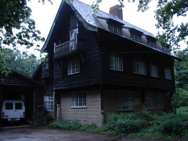 Photo could not load
SP4508 : "The Chalet", Wytham Woods
Ian Paterson
Hill facts and local notes
Classifications
Elevation
164m
539 ft
Prominence
95m
Coordinates
51.7713, -1.3364
SP458082
OS Map
164
Explorer: 180W
At the Summit
The summit features a trig point offering a panoramic view of the surrounding countryside and the spires of Oxford.
Terrain & Geology
Wytham Hill comprises mainly limestone with areas of clay, offering a fascinating mix of geological features. The hill contributes to the lush green landscape of the Oxfordshire countryside.
Views & Scenery
From the summit, you can see Oxford, the River Thames, and on a clear day, the Cotswolds in the distance.
History & Heritage
Name Origin
The name Wytham is believed to derive from Old English, meaning 'the place at the wood'.
Historical Significance
Wytham Hill is an important area for nature conservation as well as historical research, with ancient woodlands rich in biodiversity.
Getting There & Facilities
Parking
Parking is available at Wytham Woods car park, accessible from the A420.
Public Transport
Regular bus services run from Oxford to Wytham. Check local schedules for the latest routes.
Nearby Facilities
The nearest facilities, including cafes and toilets, are located in Oxford, a short drive away.
Safety Information
Known Hazards
- Uneven terrain, especially after rain. Watch out for slippery patches and exposed roots.
General Safety Tips
- Check weather conditions before setting out
- Carry appropriate clothing and equipment
- Let someone know your planned route
- Take a map, compass, and GPS device
- Carry emergency supplies: food, water, first aid kit, torch
Hills
Some common questions about the hills answered
Are there group walks up Wytham Hill?
Many walkers use Walkmates to join or organise walks with others. You can check for group walks around Wytham Hill through the maps
Are there other walkers around Wytham Hill?
Activity varies by location and time, but Walkmates lets you see whether others have shared walks or shown interest in this area. Find other people through the walking friends search walking friends for Wytham Hill search or of course create your own walk for Wytham Hill
Can I organise a walk to Wytham Hill?
Yes. If there aren’t any walks listed already, you can create a walk and make it available for others to join.
If you're signed up to Walkmates, you can create a walk to Wytham Hill.
How do I find a walk up this hill?
There are often multiple ways to walk this hill, depending on experience and route preference. Walkmates helps you explore walks and routes that others have shared.
Can I suggest a new route up Wytham Hill?
Yes. You can suggest or create routes to share with others. Walkmates focuses on the social side of walking, so routes are used to help people organise walks and explore areas together, rather than as detailed navigation tools or route libraries.
Other uses really appreciate knowledgeable walkers sharing their routes. Share your favourite route to Wytham Hill here
The is an error or something incorrect about this hill. How do I let you know?
We always strive to keep the information on Walkmates as accurate as possible. If you find an error, please let us know through the contact form and we'll aim to correct it as quickly as possible
Community Discussion
Comments
Location
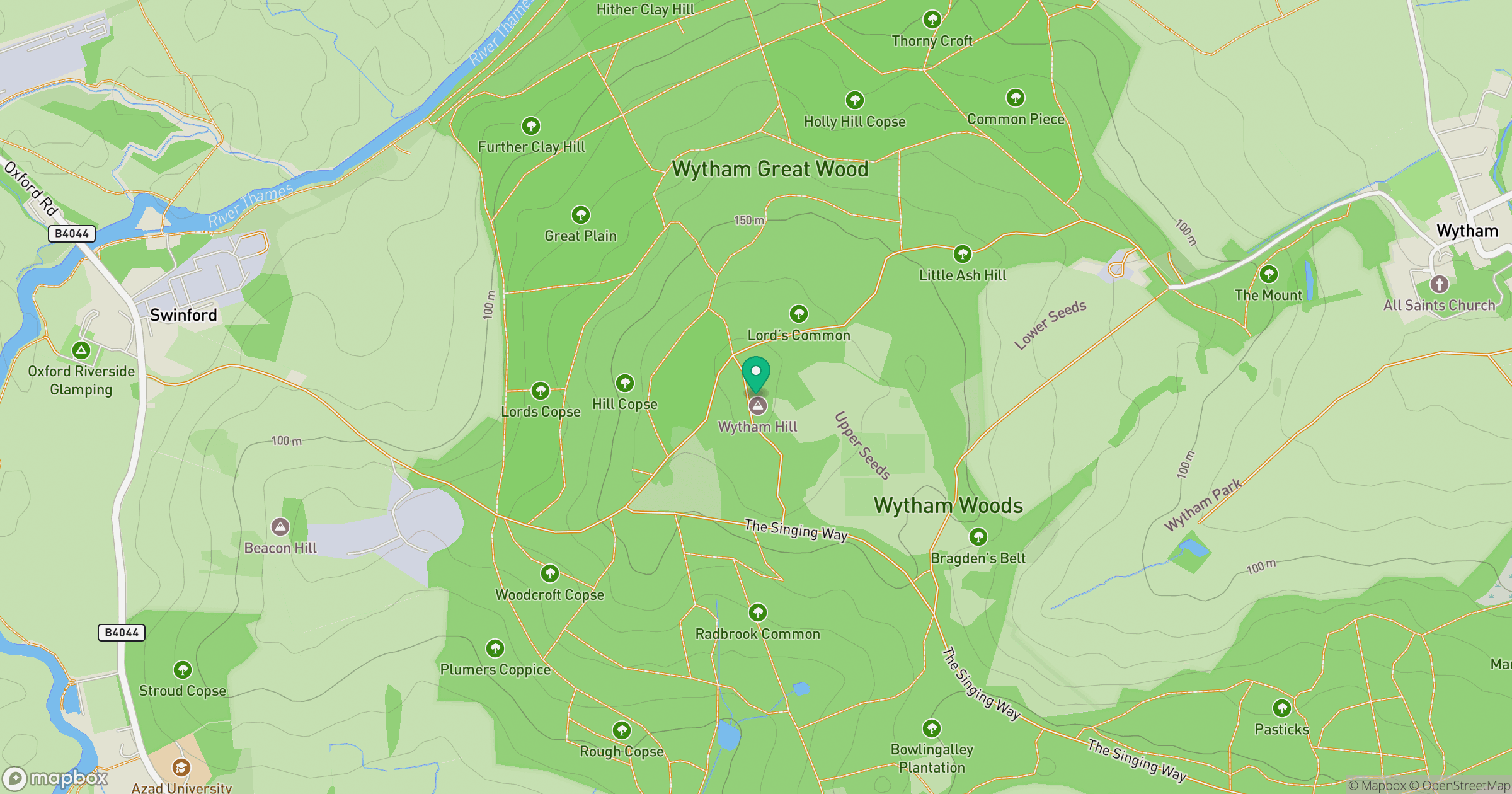
Grid reference: SP458082
View on OpenStreetMapOpens a map in a new tab, centred on the hill.
Nearby Hills
Worcestershire Beacon
425m
Leith Hill
294m
Titterstone Clee Hill
533m
Glastonbury Tor
158m
Ditchling Beacon
248m
No comments yet. Be the first.