

Wren's Nest
Good walks are even better shared.
SO9391 : Grassy clearing in Wren's Nest Nature Reserve, Dudley
Roger D Kidd Photo source
Overview
Wren's Nest
Wren’s Nest is a charming hill located in the West Midlands of the UK, known for its rich geological formations and delightful surroundings. Elevating to 220 meters, it presents the perfect spot for both casual walkers and seasoned hikers looking to enjoy a bite of nature while letting their spirits soar.
Geology
Wren's Nest is steeped in unique geological features thanks to its limestone origins, formed in seas that once covered the region millions of years ago. These formations offer not just a visual feast but also a fascinating insight into the Earth’s distant past. Exploring the rocky outcrops is akin to taking a time machine back to the Carboniferous period—minus the dinosaur encounters!
Routes
For those looking to explore, the Wren's Nest Circular Walk provides a delightful 6 km loop. The trek begins at the Wren’s Nest Visitor Centre, meandering through the striking limestone features of the area. While the path varies between grassy meadows and rocky slopes, it generally remains accessible for those of moderate fitness levels. Wear comfortable shoes—you don’t want to find yourself pondering existence while realizing you have a pebble in your boot!
Summit Features
Once you’ve reached the summit, you’ll be greeted by a trig point that stands proudly against the sky, a classic marker offering panoramic views of the surrounding countryside, including glimpses of the Malvern Hills on clear days. Besides, the ancient limestone formations nearby may have you feeling like a geological explorer!
Terrain
Expect a mix of limestone underfoot with grassy slopes transitioning into rocky outcrops. The terrain can be uneven, particularly after rainfall, so do tread carefully.
Views
The views from the summit are truly magnificent. A patchwork of rolling hills and lush greenery stretches out before you, while the sparkling Wyre Forest adds an enchanting flourish to the scenery. Early mornings or late afternoons in spring and autumn are the best times to capture these sights in their full glory—don’t forget your camera, or you’ll be left with a memory that’s only half preserved!
Hazards
As lovely as it is, Wren's Nest does have its quirks. The rocky terrain can be slippery when wet, and the loose stones may tempt you to perform unexpected acrobatic feats. Embrace caution; you want to return home with more than just a funny story!
Access
Access to Wren's Nest is relatively straightforward. The nearest parking is available at the Wren's Nest Visitor Centre. There are also regular bus services from Dudley town centre, ensuring that even those without a car can enjoy the beauty of the hill. Dudley is just a stone's throw away, adding convenience to your adventure!
Facilities
On your way to or from your hike, make sure to pop into the Wren's Nest Visitor Centre, where you can find toilets, educational resources, and, when the stars align, a café that serves a lovely assortment of snacks.
History
The name ‘Wren’s Nest’ reflects the local wildlife, specifically the small birds that flit about the ecosystem, making themselves at home in the surrounding nature. Beyond its name, this area has been marked as a Site of Special Scientific Interest due to its diverse geology and ecology.
In conclusion, Wren's Nest encapsulates a gem in the heart of the West Midlands, perfect for a day of outdoor fun or a peaceful retreat in nature’s embrace. So, whether you’re hiking for the views or just fancy a jaunt in the great outdoors, Wren’s Nest is waiting for you with open arms—just avoid the loose stones!
Explore routes near Wren's Nest
Walks starting near this hill. Open a route to check its map, distance and full itinerary.
Baggeridge Country Park: Bag Pool, Wishing Pools and woodland circuit
View route
Wombourne to Castlecroft: South Staffordshire Railway Walk
View route
Wednesfield Walk with Men Walking & Talking
View route
Quinton Walk with Men Walking & Talking
View route
Route planning notes
These notes describe possible approaches. Check a route's map and access information when planning your walk.
Wren's Nest Circular Walk
A delightful 6 km loop departing from the Wren’s Nest Visitor Centre, taking you around the prominent limestone features of the area.
Make a day of it, together
Find someone to share the walk with, or organise a day out along a route you like.
Photo Gallery
View all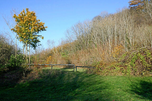 Photo could not load
SO9391 : Grassy clearing in Wren's Nest Nature Reserve, Dudley
Roger D Kidd
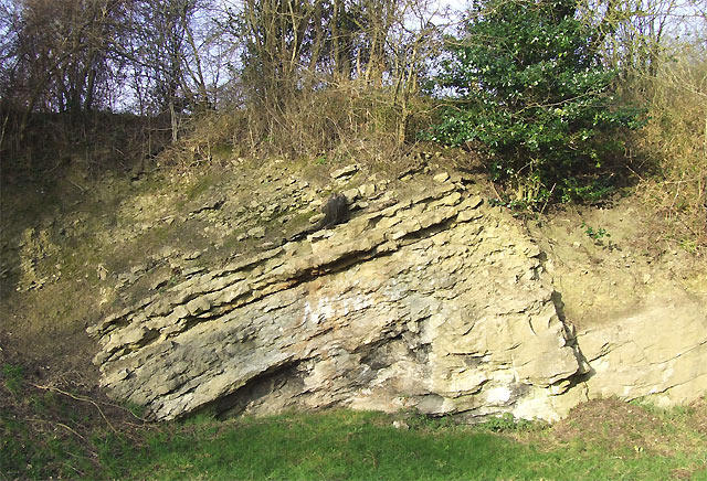 Photo could not load
SO9391 : Silurian (Wenlock) Limestone, Dudley, Worcestershire
Roger D Kidd
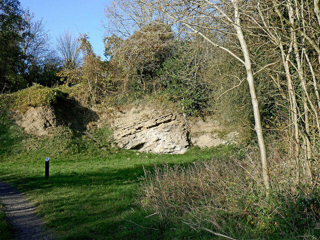 Photo could not load
SO9391 : Former quarry in Wren's Nest Nature Reserve, Dudley
Roger D Kidd
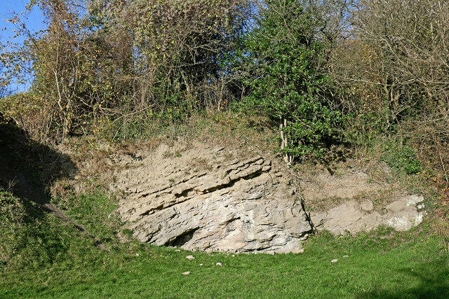 Photo could not load
SO9391 : Limestone exposure in Wren's Nest Nature Reserve near Dudley
Roger D Kidd
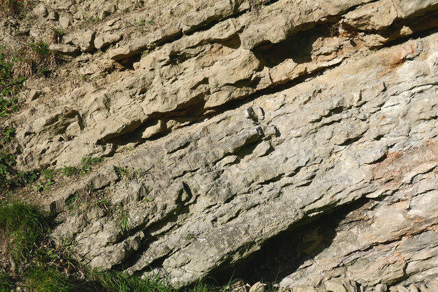 Photo could not load
SO9391 : Silurian Wenlock limestone strata near Dudley
Roger D Kidd
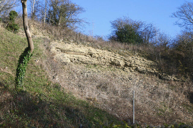 Photo could not load
SO9391 : Limestone exposure in Wren's Nest Nature Reserve, Dudley
Roger D Kidd
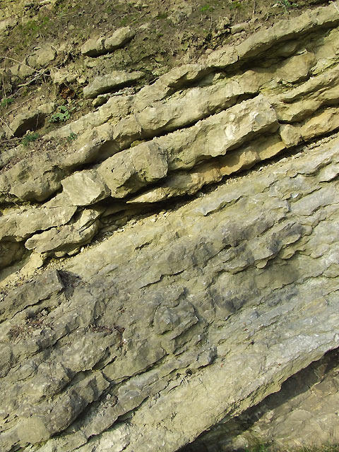 Photo could not load
SO9391 : Silurian Limestone (detail), Dudley, Worcestershire
Roger D Kidd
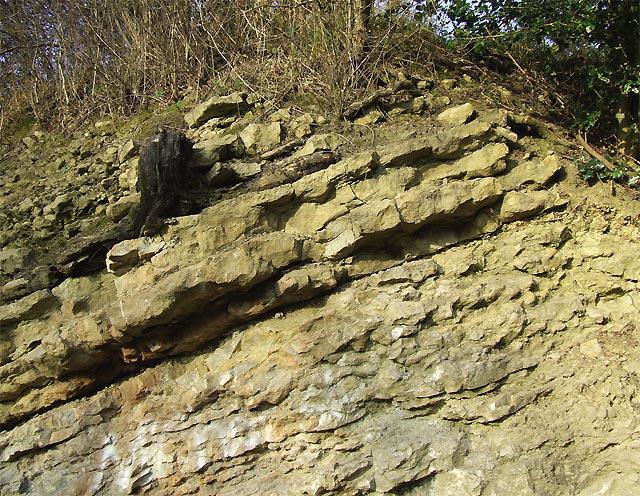 Photo could not load
SO9391 : Silurian Limestone (detail), Dudley, Worcestershire
Roger D Kidd
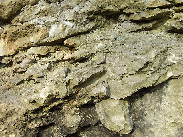 Photo could not load
SO9391 : Silurian Limestone (detail), Dudley, Worcestershire
Roger D Kidd
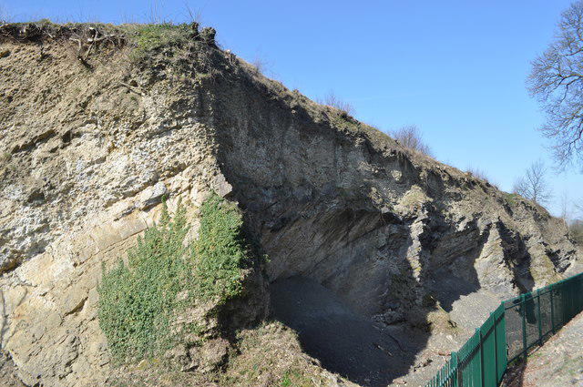
SO9391 : Wren's Nest - NNR
Ashley Dace
Hill facts and local notes
Classifications
Elevation
241m
791 ft
Prominence
40m
Coordinates
52.5229, -2.0953
SO936916
OS Map
139
Explorer: 219N 219S
At the Summit
The summit of Wren's Nest boasts a prominent trig point, offering fantastic views over the surrounding countryside. Nearby, you can find ancient limestone formations that date back millions of years.
Terrain & Geology
The area is primarily composed of limestone, which was formed in shallow tropical seas during the Carboniferous period. The unique rock formations lend themselves to a distinctive landscape characterised by exposed rock faces and steep inclines.
Views & Scenery
You can catch stunning views of the Wyre Forest and, on a clear day, the Malvern Hills in the distance.
History & Heritage
Name Origin
The name 'Wren's Nest' likely derives from the prevalence of wrens in the area, which find the limestone nooks and crannies to be prime real estate.
Historical Significance
The area is rich in geological history and has been designated as a Site of Special Scientific Interest (SSSI) due to its distinctive geological features and biodiversity.
Getting There & Facilities
Parking
Wren's Nest Visitor Centre car park provides ample space and easy access to the trails.
Public Transport
Regular bus services run from Dudley town centre, with the nearest bus stop being a short walk from the visitor centre.
Nearby Facilities
The Wren's Nest Visitor Centre offers educational resources, toilets, and on certain days, a café serving delightful treats. Just the right fuel for your adventures!
Safety Information
Known Hazards
- Uneven terrain with loose stones may pose a risk, particularly in wet conditions. Watch your step and don't fall for the local wildlife's charming looks!
General Safety Tips
- Check weather conditions before setting out
- Carry appropriate clothing and equipment
- Let someone know your planned route
- Take a map, compass, and GPS device
- Carry emergency supplies: food, water, first aid kit, torch
Hills
Some common questions about the hills answered
Are there group walks up Wren's Nest?
Many walkers use Walkmates to join or organise walks with others. You can check for group walks around Wren's Nest through the maps
Are there other walkers around Wren's Nest?
Activity varies by location and time, but Walkmates lets you see whether others have shared walks or shown interest in this area. Find other people through the walking friends search walking friends for Wren's Nest search or of course create your own walk for Wren's Nest
Can I organise a walk to Wren's Nest?
Yes. If there aren’t any walks listed already, you can create a walk and make it available for others to join.
If you're signed up to Walkmates, you can create a walk to Wren's Nest.
How do I find a walk up this hill?
There are often multiple ways to walk this hill, depending on experience and route preference. Walkmates helps you explore walks and routes that others have shared.
Can I suggest a new route up Wren's Nest?
Yes. You can suggest or create routes to share with others. Walkmates focuses on the social side of walking, so routes are used to help people organise walks and explore areas together, rather than as detailed navigation tools or route libraries.
Other uses really appreciate knowledgeable walkers sharing their routes. Share your favourite route to Wren's Nest here
The is an error or something incorrect about this hill. How do I let you know?
We always strive to keep the information on Walkmates as accurate as possible. If you find an error, please let us know through the contact form and we'll aim to correct it as quickly as possible
Community Discussion
Comments
Location
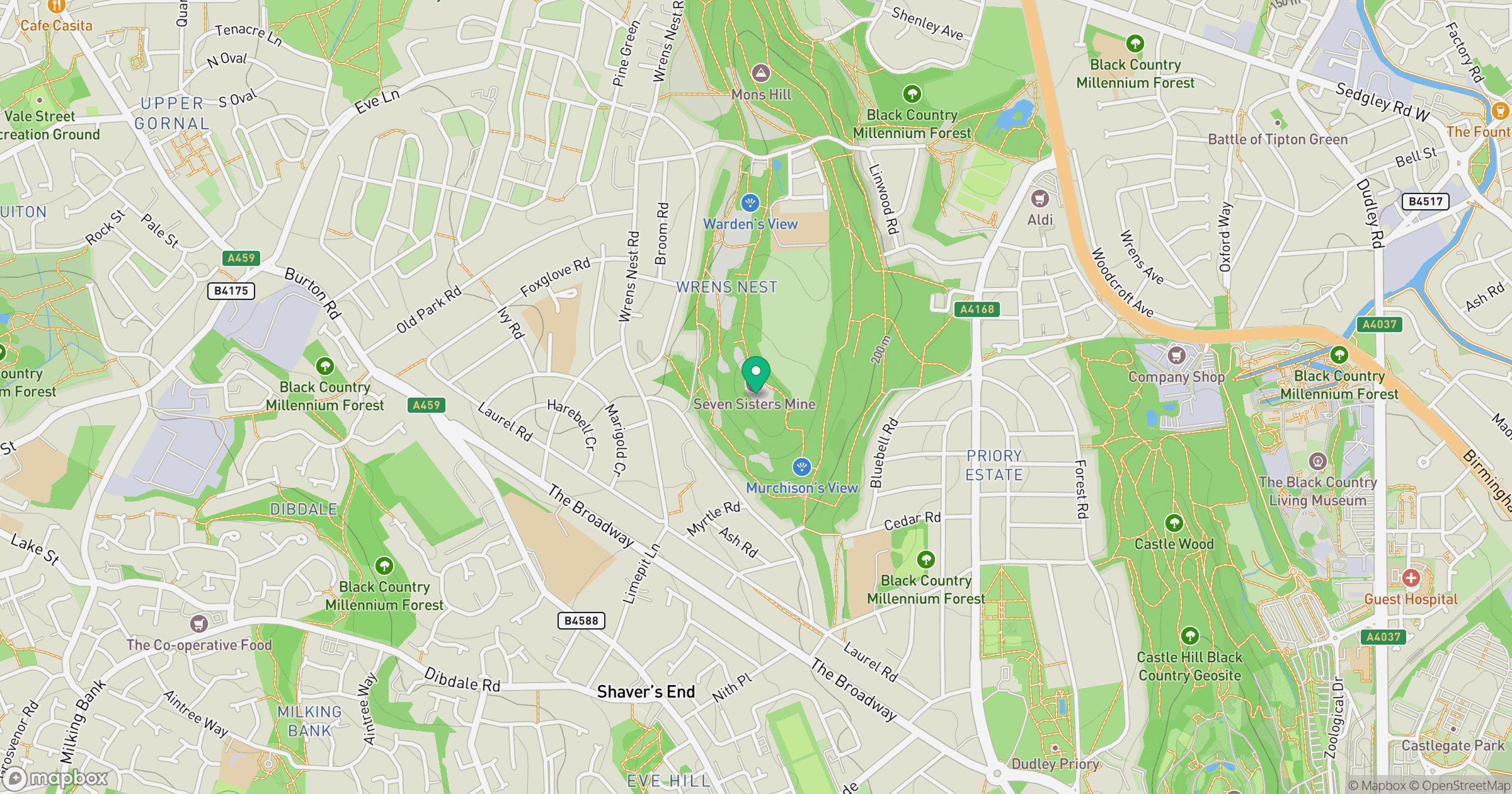
Grid reference: SO936916
View on OpenStreetMapOpens a map in a new tab, centred on the hill.
Nearby Hills

The Wrekin
407m
Worcestershire Beacon
425m
Titterstone Clee Hill
533m
The Roaches
505m
Long Mynd - Pole Bank
517m
No comments yet. Be the first.