

Wittenham Clumps
Good walks are even better shared.
SU5692 : The path to Wittenham Clumps
Marathon Photo source
Overview
Wittenham Clumps are two tree-crowned chalk hills above the Thames near Little Wittenham. The 123.4 m high point is on Round Hill; neighbouring Castle Hill carries the prominent hillfort earthworks. Earth Trust manages the surrounding grassland, woodland and farmland. Choose a short hilltop walk or a longer Dorchester circuit, checking current tree-work and access notices before using riverside paths.
Wittenham Clumps
Overview
Wittenham Clumps are two tree-crowned chalk hills above the Thames near Little Wittenham. The 123.4 m high point is on Round Hill; neighbouring Castle Hill carries the prominent hillfort earthworks. Earth Trust manages the surrounding grassland, woodland and farmland. Choose a short hilltop walk or a longer Dorchester circuit, checking current tree-work and access notices before using riverside paths.
Summit and views
The high point is ground by the fence on Round Hill at SU 56652 92732, 123.4 m above sea level. Castle Hill, about 400 m southeast at SU 56920 92461, is recorded as 1 m lower. Its hillfort is a separate feature. Follow open paths around the tree clumps and respect fenced areas; do not cross a barrier to seek the exact grid point. The open hilltops look across the Thames valley and the surrounding Oxfordshire and Berkshire countryside, with the North Wessex Downs and Chilterns on the wider skyline. Round Hill has a viewing plaque. Views depend on visibility and tree cover; the Didcot skyline has changed with demolition at the former power station.
Routes
Round Hill and Castle Hill: hilltop figure-of-eight
Start and finish at Wittenham Clumps car park on the lane off Sires Hill (OX10 8NB). Take the uphill path to Round Hill, the left-hand clump seen from the car park. Follow the open path around its wooded crown, then cross the saddle to Castle Hill. Continue around the outside of Castle Hill’s wooded top and its hillfort earthworks, then return through the saddle and down the car-park approach to your starting gate. Stay on the open paths and outside fenced tree enclosures; use gates and follow any local diversions. The climbs are short but can be steep and slippery, and cattle may be grazing. This hill-only outing does not include the woods or Thames riverside.
Dorchester circuit: unresolved riverside restriction
Riverside access is unresolved: Earth Trust’s 30 September 2026 notice reports a tree-safety closure without identifying the exact section or confirming reopening. Check with the land manager before setting out; this is the normal published itinerary, not a confirmed currently usable circuit. From Bridge End, Dorchester (OX10 7JT), take Wittenham Lane and the Dyke Hills path, cross the three bridges to St Peter’s Church, and climb Round Hill. Go clockwise around its crown, cross to Castle Hill and pass the Poem Tree stone outside the woods. Descend through the field-edge gates; take the right-hand gravel track through woodland, then left at the T-junction to Church Common. Return via St Peter’s and the same three bridges. On the far bank go left to the riverside, then right to Day’s Lock; cross the field to the farm-café path and return through Dorchester to Bridge End. North Wessex Downs gives 5 miles/8 km for that normal complete outing, with some sections retraced. Follow closure signs and turn back if blocked. That distance does not apply to a diversion or changed return.
Access and facilities
Little Wittenham is immediately below the hills; Dorchester-on-Thames is across the river. Didcot is the nearby town and rail gateway.
Use Wittenham Clumps car park on the lane off Sires Hill, OX10 8NB. Earth Trust lists it as free and open 24 hours; space can be busy, so keep lanes, gates and working access clear. Earth Trust Centre parking is separate, at OX14 4QZ, normally 9am–5pm Monday–Friday. In its 1 October 2026 update, the Trust said the new Sires Hill entrance was still awaiting approvals and centre visitors should continue via Little Wittenham and Hollow Way until it opens. Follow current signs rather than assuming the new entrance is available. The Dorchester circuit starts at Bridge End, OX10 7JT.
Didcot Parkway is the nearest railway station. Thames Travel 95 serves Long Wittenham, with a separate onward walk to the hills; Going Forward Buses advertises a Friday D1 service. The Dorchester circuit is another option from the Oxford–Wallingford bus corridor. Check current operators’ days, stops and return times; no bus stop at the Clumps car park is confirmed.
There are no toilets on the hilltops. Earth Trust lists the nearest toilets at its centre on weekdays, including accessible facilities; check opening arrangements. Its 1 October 2026 update planned a café pop-up from late October and the new café for January, so do not rely on either having opened. Bring water and refreshments. A defibrillator is installed at the Clumps car park. Dorchester has village services and toilets at Bridge End; check local opening times.
Terrain and safety
Open grassy hill slopes, earth and gravel paths, gates and hillfort steps, with short steep climbs and slippery ground after rain. Longer circuits add woodland tracks, rough floodplain paths, river bridges and village lanes. The Earth Trust Centre’s accessible facilities do not establish wheelchair access to the hilltops.
- Short steep slopes, uneven grass, muddy paths and hillfort steps can be slippery. Wear grippy footwear and supervise children near slopes, roads and deep water.
- Keep dogs on leads on the Clumps and in Little Wittenham Wood. Give cattle room, avoid separating cows and calves, and close gates. If cattle threaten you, release the dog rather than keep hold of its lead.
- Stay on open paths and obey fences, tree-safety notices and work-area barriers. A summit grid reference does not give permission to enter a closed tree enclosure.
- Earth Trust reported a Thames riverside path closed for dangerous-tree work on 30 September 2026. The exact section and reopening are not established here. Check its latest notices and signs before a woodland or river circuit; never bypass a closure.
- The Thames floodplain can flood after heavy rain. Do not enter floodwater or approach unsafe river edges. Bridges and return paths must remain usable for the whole outing.
- Earth Trust advises avoiding wooded areas in high winds over 30 mph because trees and branches can fall. Take care near working farm vehicles and construction traffic.
Wet weather can make the hill slopes and woodland paths muddy and slippery, and prolonged rain can flood the Thames-side sections. Frost or ice increases slipping risk, while shorter winter daylight leaves less time for the full return. Avoid woods in strong winds. Seasonal grazing and tree or construction work can change access; follow current Earth Trust notices and on-site signs. The September 2026 riverside closure has no verified reopening in the sources checked.
Geology
Round Hill and Castle Hill belong to the Sinodun Hills, an isolated outcrop of Cretaceous Lower Chalk separated from the main chalk uplands of the North Wessex Downs and Chilterns. The wider landscape also contains greensand and superficial flinty soils. Chalk bedrock, grass-covered slopes and wooded crowns shape the familiar outline; the hills should not be described simply as solid chalk and flint.
Names and history
“Clumps” refers to the groups of trees crowning Round Hill and Castle Hill. The pair is also known as the Sinodun Hills. Historical nicknames include the Berkshire Bubs and Mother Dunch’s Buttocks. Castle Hill has a late Bronze Age enclosure dating to about 1000 BC and larger Iron Age defences from about 700 BC. Its surviving ramparts and ditch form the scheduled Sinodun Hill camp. The surrounding landscape also contains prehistoric and Roman settlement evidence. Joseph Tubb carved a poem into a Castle Hill beech in 1844–45; the tree fell in 2012, but a commemorative stone records the poem. Paul Nash repeatedly depicted the Clumps.
Nearby landscape
Castle Hill’s scheduled hillfort lies southeast of Round Hill. Little Wittenham Wood, Church Common, St Peter’s Church and Day’s Lock are below the hills; Dorchester and Dyke Hills lie across the Thames. Brightwell Barrow is another distinct tree-crowned hill to the southeast. These features are not alternative names for the Round Hill high point.
Explore routes near Wittenham Clumps
Walks starting near this hill. Open a route to check its map, distance and full itinerary.
Shotover Country Park Circular
View route
Cowleaze Wood Halifax Crash Memorial Circuit
View route
Sonning Common Walk with Men Walking & Talking
View route
Reading Walk with Men Walking & Talking
View route
Route planning notes
These notes describe possible approaches. Check a route's map and access information when planning your walk.
Round Hill and Castle Hill: hilltop figure-of-eight
Start and finish at Wittenham Clumps car park on the lane off Sires Hill (OX10 8NB). Take the uphill path to Round Hill, the left-hand clump seen from the car park. Follow the open path around its wooded crown, then cross the saddle to Castle Hill. Continue around the outside of Castle Hill’s wooded top and its hillfort earthworks, then return through the saddle and down the car-park approach to your starting gate. Stay on the open paths and outside fenced tree enclosures; use gates and follow any local diversions. The climbs are short but can be steep and slippery, and cattle may be grazing. This hill-only outing does not include the woods or Thames riverside.
Dorchester circuit: unresolved riverside restriction
Riverside access is unresolved: Earth Trust’s 30 September 2026 notice reports a tree-safety closure without identifying the exact section or confirming reopening. Check with the land manager before setting out; this is the normal published itinerary, not a confirmed currently usable circuit. From Bridge End, Dorchester (OX10 7JT), take Wittenham Lane and the Dyke Hills path, cross the three bridges to St Peter’s Church, and climb Round Hill. Go clockwise around its crown, cross to Castle Hill and pass the Poem Tree stone outside the woods. Descend through the field-edge gates; take the right-hand gravel track through woodland, then left at the T-junction to Church Common. Return via St Peter’s and the same three bridges. On the far bank go left to the riverside, then right to Day’s Lock; cross the field to the farm-café path and return through Dorchester to Bridge End. North Wessex Downs gives 5 miles/8 km for that normal complete outing, with some sections retraced. Follow closure signs and turn back if blocked. That distance does not apply to a diversion or changed return.
Make a day of it, together
Find someone to share the walk with, or organise a day out along a route you like.
Photo Gallery
View all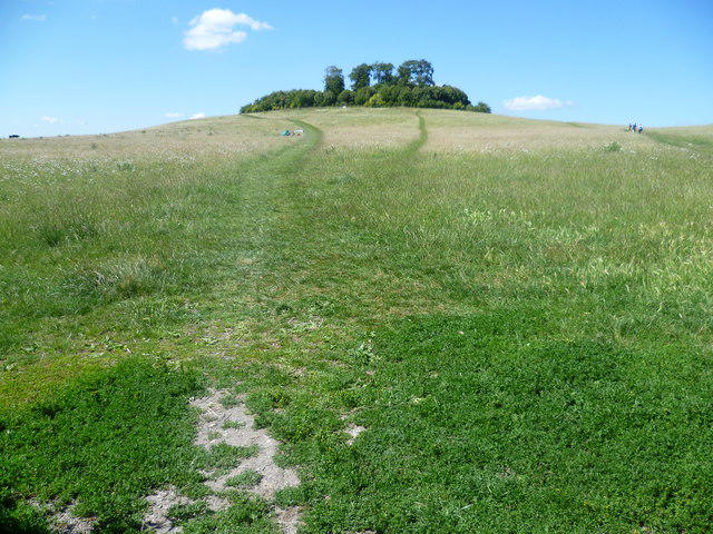 Photo could not load
SU5692 : The path to Wittenham Clumps
Marathon
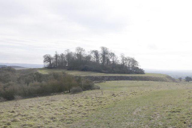 Photo could not load
SU5692 : Ditch around Castle Hill
Bill Nicholls
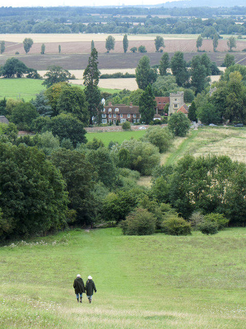 Photo could not load
SU5692 : Descent from Wittenham Clumps
Gareth James
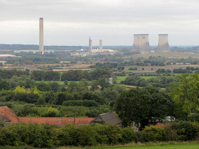 Photo could not load
SU5692 : View from Wittenham Clumps towards Didcot Power Station
Gareth James
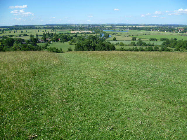 Photo could not load
SU5692 : View from Wittenham Clumps
Marathon
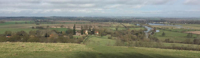 Photo could not load
SU5692 : Oxfordshire Panoramic
Bill Nicholls
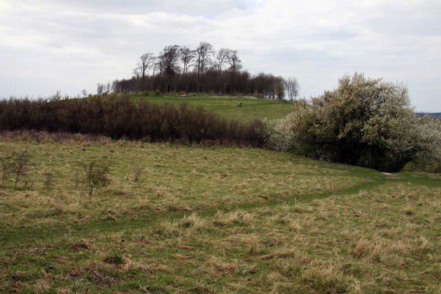 Photo could not load
SU5692 : Round Hill from Castle Hill
Steve Daniels
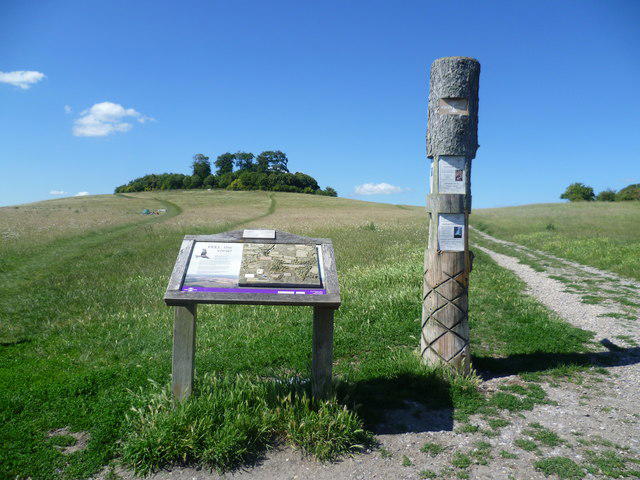 Photo could not load
SU5692 : The way to Wittenham Clumps
Marathon
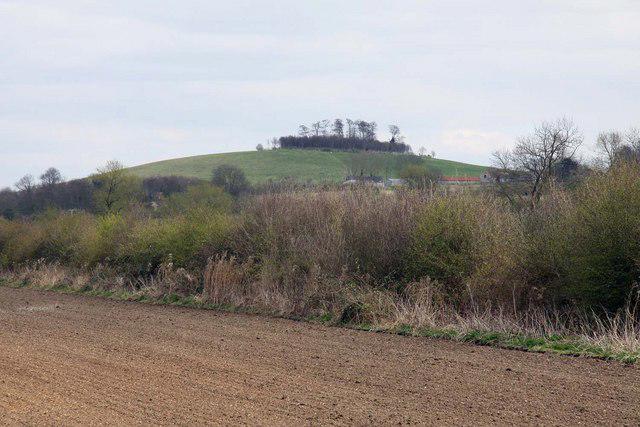 Photo could not load
SU5692 : Wittenham Clumps
Steve Daniels
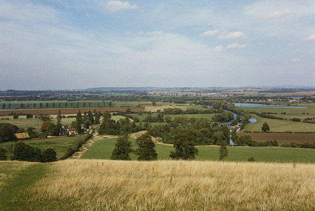
SU5692 : View north from Wittenham Clumps
Nigel Brown
Hill facts and local notes
Classifications
Elevation
123m
405 ft
Prominence
69m
Coordinates
51.6305, -1.1829
SU566927
OS Map
164 174
Explorer: 170E
At the Summit
The high point is ground by the fence on Round Hill at SU 56652 92732, 123.4 m above sea level. Castle Hill, about 400 m southeast at SU 56920 92461, is recorded as 1 m lower. Its hillfort is a separate feature. Follow open paths around the tree clumps and respect fenced areas; do not cross a barrier to seek the exact grid point.
Terrain & Geology
Round Hill and Castle Hill belong to the Sinodun Hills, an isolated outcrop of Cretaceous Lower Chalk separated from the main chalk uplands of the North Wessex Downs and Chilterns. The wider landscape also contains greensand and superficial flinty soils. Chalk bedrock, grass-covered slopes and wooded crowns shape the familiar outline; the hills should not be described simply as solid chalk and flint.
Views & Scenery
The open hilltops look across the Thames valley and the surrounding Oxfordshire and Berkshire countryside, with the North Wessex Downs and Chilterns on the wider skyline. Round Hill has a viewing plaque. Views depend on visibility and tree cover; the Didcot skyline has changed with demolition at the former power station.
History & Heritage
Name Origin
“Clumps” refers to the groups of trees crowning Round Hill and Castle Hill. The pair is also known as the Sinodun Hills. Historical nicknames include the Berkshire Bubs and Mother Dunch’s Buttocks.
Historical Significance
Castle Hill has a late Bronze Age enclosure dating to about 1000 BC and larger Iron Age defences from about 700 BC. Its surviving ramparts and ditch form the scheduled Sinodun Hill camp. The surrounding landscape also contains prehistoric and Roman settlement evidence. Joseph Tubb carved a poem into a Castle Hill beech in 1844–45; the tree fell in 2012, but a commemorative stone records the poem. Paul Nash repeatedly depicted the Clumps.
Getting There & Facilities
Parking
Use Wittenham Clumps car park on the lane off Sires Hill, OX10 8NB. Earth Trust lists it as free and open 24 hours; space can be busy, so keep lanes, gates and working access clear. Earth Trust Centre parking is separate, at OX14 4QZ, normally 9am–5pm Monday–Friday. In its 1 October 2026 update, the Trust said the new Sires Hill entrance was still awaiting approvals and centre visitors should continue via Little Wittenham and Hollow Way until it opens. Follow current signs rather than assuming the new entrance is available. The Dorchester circuit starts at Bridge End, OX10 7JT.
Public Transport
Didcot Parkway is the nearest railway station. Thames Travel 95 serves Long Wittenham, with a separate onward walk to the hills; Going Forward Buses advertises a Friday D1 service. The Dorchester circuit is another option from the Oxford–Wallingford bus corridor. Check current operators’ days, stops and return times; no bus stop at the Clumps car park is confirmed.
Nearby Facilities
There are no toilets on the hilltops. Earth Trust lists the nearest toilets at its centre on weekdays, including accessible facilities; check opening arrangements. Its 1 October 2026 update planned a café pop-up from late October and the new café for January, so do not rely on either having opened. Bring water and refreshments. A defibrillator is installed at the Clumps car park. Dorchester has village services and toilets at Bridge End; check local opening times.
Safety Information
Known Hazards
- Short steep slopes, uneven grass, muddy paths and hillfort steps can be slippery. Wear grippy footwear and supervise children near slopes, roads and deep water.
- Keep dogs on leads on the Clumps and in Little Wittenham Wood. Give cattle room, avoid separating cows and calves, and close gates. If cattle threaten you, release the dog rather than keep hold of its lead.
- Stay on open paths and obey fences, tree-safety notices and work-area barriers. A summit grid reference does not give permission to enter a closed tree enclosure.
- Earth Trust reported a Thames riverside path closed for dangerous-tree work on 30 September 2026. The exact section and reopening are not established here. Check its latest notices and signs before a woodland or river circuit; never bypass a closure.
- The Thames floodplain can flood after heavy rain. Do not enter floodwater or approach unsafe river edges. Bridges and return paths must remain usable for the whole outing.
- Earth Trust advises avoiding wooded areas in high winds over 30 mph because trees and branches can fall. Take care near working farm vehicles and construction traffic.
Seasonal Hazards
Wet weather can make the hill slopes and woodland paths muddy and slippery, and prolonged rain can flood the Thames-side sections. Frost or ice increases slipping risk, while shorter winter daylight leaves less time for the full return. Avoid woods in strong winds. Seasonal grazing and tree or construction work can change access; follow current Earth Trust notices and on-site signs. The September 2026 riverside closure has no verified reopening in the sources checked.
General Safety Tips
- Check weather conditions before setting out
- Carry appropriate clothing and equipment
- Let someone know your planned route
- Take a map, compass, and GPS device
- Carry emergency supplies: food, water, first aid kit, torch
Hills
Some common questions about the hills answered
Are there group walks up Wittenham Clumps?
Many walkers use Walkmates to join or organise walks with others. You can check for group walks around Wittenham Clumps through the maps
Are there other walkers around Wittenham Clumps?
Activity varies by location and time, but Walkmates lets you see whether others have shared walks or shown interest in this area. Find other people through the walking friends search walking friends for Wittenham Clumps search or of course create your own walk for Wittenham Clumps
Can I organise a walk to Wittenham Clumps?
Yes. If there aren’t any walks listed already, you can create a walk and make it available for others to join.
If you're signed up to Walkmates, you can create a walk to Wittenham Clumps.
How do I find a walk up this hill?
There are often multiple ways to walk this hill, depending on experience and route preference. Walkmates helps you explore walks and routes that others have shared.
Can I suggest a new route up Wittenham Clumps?
Yes. You can suggest or create routes to share with others. Walkmates focuses on the social side of walking, so routes are used to help people organise walks and explore areas together, rather than as detailed navigation tools or route libraries.
Other uses really appreciate knowledgeable walkers sharing their routes. Share your favourite route to Wittenham Clumps here
The is an error or something incorrect about this hill. How do I let you know?
We always strive to keep the information on Walkmates as accurate as possible. If you find an error, please let us know through the contact form and we'll aim to correct it as quickly as possible
Community Discussion
Comments
Location
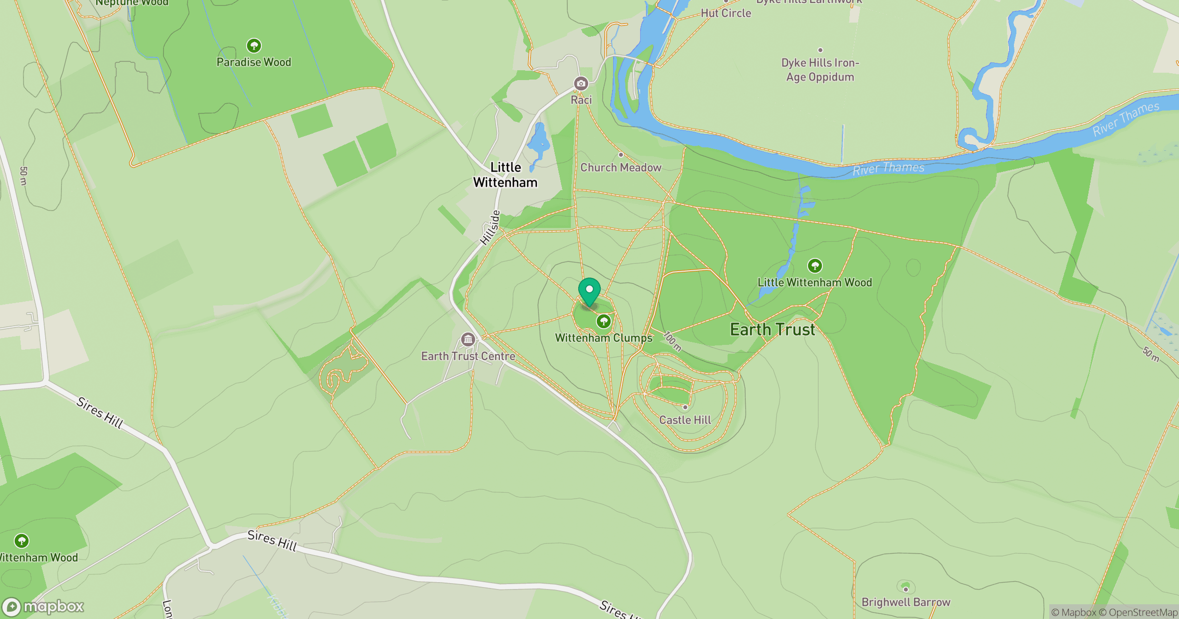
Grid reference: SU566927
View on OpenStreetMapOpens a map in a new tab, centred on the hill.
Nearby Hills
Leith Hill
294m
Worcestershire Beacon
425m
Ditchling Beacon
248m
Glastonbury Tor
158m
Titterstone Clee Hill
533m
No comments yet. Be the first.